Key West Fall Fishing Report: Transition Season Tactics
As the intense heat of summer begins to break, the waters surrounding Key West enter one of the most dynamic transition periods of the year. The shift in weather patterns triggers massive bait migrations, and the pelagic and reef species respond aggressively. Whether you are targeting the patch reefs, the deep wrecks, or the pristine backcountry flats, understanding the movement of water and bait is the key to unlocking the bite. This report breaks down the current conditions, top targets, and precise tactical approaches to maximize your success in the Conch Republic.
1. GO/NO-GO STATUS
Verdict: CAUTION - MONITOR WEATHER WINDOWS
During this transitional fall period, the primary concern for anglers is the potential for tropical weather systems and sudden barometric shifts. When the tropics are quiet, fishing conditions are absolutely spectacular, earning a solid "GO" rating. However, wind direction and velocity dictate where you can safely and effectively fish. Easterly trade winds can stack up waves against the Gulf Stream current, making offshore runs punishing for center consoles under thirty feet.
From the editor
Tired of fishing with strangers you can’t trust?
Nautrek is the first social network for serious anglers — verified partners, real trips, cost splitting and intel sharing without burning your spots. Private beta now open.
Water temperatures are slowly beginning to cool from their summer peaks, dropping into the low to mid-eighties. This slight temperature dip is enough to ignite the bite on the reefs. Always check the marine forecast before heading past the sea buoy, and ensure your VHF radio and safety gear are in prime working order. If the wind exceeds fifteen knots from the east, focus your efforts on the leeward sides of the islands or the protected backcountry basins.
2. SPECIES INTEL
Primary Targets: Mutton Snapper and Mahi-Mahi
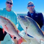
The reef and wreck bite is heavily dominated by Mutton Snapper right now. These hard-fighting bottom dwellers are congregating around deeper structure and are feeding heavily on the incoming bait. Offshore, the Mahi-Mahi (Dolphin) are pushing through along weed lines and floating debris. While you might not find the massive schools of schoolies typical of early summer, the fall run often yields much larger, solitary bull and cow Mahi.
Sleeper Pick: Tripletail
As floating debris accumulates from shifting currents and the first commercial trap buoys begin to dot the coastal waters, the Tripletail becomes the ultimate sleeper target. Most anglers blast right past these floating structures on their way to the blue water, completely missing these prehistoric-looking, delicious fish sunning themselves just inches below the surface.
Baitfish Report
The fall bait migration is in full swing. Massive schools of silver mullet are pushing down the coast, filtering through the lower Keys bridges. On the patch reefs, ballyhoo are showering in the shallows, fleeing from aggressive predators. Pilchards (scaled sardines) can be found schooling around nearshore markers and grass flats. Matching this forage is critical; ensure your live wells are blacked out with pilchards or that you have a healthy supply of fresh ballyhoo.
3. TACTICAL STRATEGY
Offshore and Reef Tactics (Mutton Snapper)
Where: Focus your efforts on the deeper wrecks and reef ledges south of Key West, specifically areas like Western Dry Rocks or the Vandenberg wreck. Look for structure in the 80 to 120-foot depth range where the current is steadily moving but not ripping so hard that holding bottom becomes impossible.
Bait and Rigging: Mutton Snapper have incredibly keen eyesight, making fluorocarbon leader mandatory. Use a long, 15 to 20-foot section of 40-pound fluorocarbon tied to a 5/0 inline circle hook. A knocker rig or a fish-finder rig with just enough lead to hold bottom is ideal. Live ballyhoo or large pinfish are the baits of choice. Hook the ballyhoo through the lips or the pinfish just behind the dorsal fin.
Pro Tip:When dropping for Muttons, do not immediately engage your reel when the weight hits the bottom. Let the bait flutter naturally in the current for a few seconds before coming tight. If you feel a bite, do not set the hook violently; simply reel down steadily until the circle hook finds the corner of the fish's mouth.
Flats and Backcountry (Bonefish and Permit)
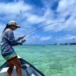
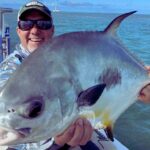
Where: The flats surrounding the Marquesas Keys and the oceanside edges of Sugarloaf Key are holding excellent numbers of bonefish and permit. Focus on the edges of turtle grass beds transitioning into sandy potholes in 2 to 4 feet of water.
Lure and Color: If you are throwing artificials, a 1/8 ounce tungsten skimmer jig in tan or pale pink is highly effective for bonefish. For permit, small crab imitations are essential. If fly fishing, a #4 Merkin Crab or a spawning shrimp pattern in tan/olive works wonders.
Timing: The last two hours of the incoming tide and the first hour of the outgoing tide provide the best feeding windows. The fish will use the rising water to access the shallower flats to root out crabs and shrimp.
Pro Tip:Keep the sun at your back whenever possible while poling the flats. Fall skies can sometimes be overcast, making polarization less effective. Rely on looking for nervous water, tailing fish, or mud boils rather than trying to spot the actual fish through the glare.
4. REGULATIONS SNAPSHOT
Always verify current Florida Fish and Wildlife Conservation Commission (FWC) regulations before keeping your catch, as rules are subject to emergency closures or seasonal shifts. Here is a quick reference for our primary targets in Monroe County:
Species
Minimum Size Limit
Daily Bag Limit
Special Notes
Mutton Snapper
18 inches (Total Length)
5 per harvester
Included in the 10-snapper aggregate bag limit.
Mahi-Mahi (Dolphin)
20 inches (Fork Length)
5 per person / 30 per vessel
Vessel limit does not apply to charter boats.
Tripletail
18 inches (Total Length)
2 per person
Hook and line gear only.
Bonefish / Permit
Catch and Release Only (Bonefish)
Special Permit Zone rules apply
Handle with extreme care; leave in water for photos.
5. REGIONAL ALTERNATIVE
If the offshore winds are howling and the reefs are blown out, do not cancel your trip. The Lower Keys backcountry offers a world-class backup plan. Head north out of Key West into the Gulf of Mexico side, focusing on the mangrove islands and channels behind Big Pine Key and Cudjoe Key.
Target: Mangrove Snapper, Jack Crevalle, and juvenile Tarpon.
Tactical Approach: Anchor up-current of deep mangrove shorelines or tidal channel intersections. Deploy a chum block heavily to draw the fish out from the roots. Free-line live pilchards or small chunks of fresh ballyhoo on a 1/4 ounce chartreuse jig head with 20-pound fluorocarbon leader. The mangrove snappers will rise in the water column to aggressively feed in the chum slick. This is light-tackle, high-action fishing that keeps rods bent and saves the day when the deep water is unfishable.
Pro Tip:When fishing heavy structure like mangrove roots, keep your drag locked down tight. The initial three seconds after the strike dictate whether you land the fish or get broken off in the barnacles.
Tight lines!
Editor's Choice: Must-Have Gear
FISHINGSIR Next-Gen Waterproof Chest Waders
★★★★★4.4 (7,370+ reviews)
2-Ply Tech: Upgraded nylon with 2.5x higher density than standard fabrics.
100% Waterproof: Lab-approved intrusion resistance with taped visible seams.
Ultra-Lightweight: Designed for all-day comfort while hunting or fishing.
As an Amazon Associate I earn from qualifying purchases. #ad
Loading forecast...
Live Fishing Conditions: Tides, Weather & Waves
Get real‑time tides, marine weather, swell and solunar activity for each spot so you know exactly when conditions line up for your best chance at a bite.
🎣
Key West
Loading coordinates...
🌤️
WEATHER CONDITIONS
--°F
--°C
Loading...
🌡️
Feels Like--°F--°C
💧
Humidity--%
💨
Wind-- mph-- km/h
🧭
Direction--
📊
Pressure-- inHg-- hPa
☀️
UV Index--
🌊
MARINE CONDITIONS
🌊Wave Height
-- ft
-- m
Loading...
🧭Wave Direction
--°
Loading...
⏱️Wave Period
-- s
Loading...
📈Tide Status
-- ft
-- m
Loading...
🌙
LUNAR & SOLUNAR
🌕
Loading...
Illumination: --%
Major Period--:-- - --:----:-- - --:--
Minor Period--:-- - --:----:-- - --:--
🌅Sunrise--:--
🌇Sunset--:--
📅
24-HOUR FORECAST
Loading fishing conditions...
Fishing Spots Map
🎣
Book a Fishing Charter near Key West Fishing Report Today 🎣
Local guides & charters. Verified captains, instant booking, best price guaranteed.
There was an error loading the map. Please try refreshing the page.
Info
Local Access & Facilities
Key West represents the absolute terminus of the Overseas Highway, but for the serious angler, it is merely the jumping-off point for some of the most diverse fishery complexes in the hemisphere. This is where the Atlantic Ocean meets the Gulf of Mexico, creating a dynamic biological intersection that supports everything from technical flats fishing to heavy offshore trolling. The atmosphere here shifts rapidly from the manicured, tourist-heavy streets of the historic district to the rugged, mangrove-lined solitude of the backcountry. While the nightlife is legendary, the dawn patrol crowd knows that the real magic happens when the sun breaks over the calm waters of the Florida Keys National Marine Sanctuary.
The fishery is defined by its massive protected zones, including the Great White Heron National Wildlife Refuge and the Key West National Wildlife Refuge. These areas offer a stark contrast to the open ocean, providing miles of shallow, clear water where sight fishing is the primary discipline. Seasoned skippers understand that this is not just a place to wet a line; it is a complex ecosystem protecting North America's only coral barrier reef and extensive seagrass beds. Whether you are targeting tailing permit on the flats or running deep for pelagics, success here requires an intimate understanding of the local tides and the unique logistical challenges of operating at the end of the road.
Access & Getting There
Reaching Key West requires patience, as the primary route is US Highway 1. Experienced captains know that the drive down the island chain is scenic but prone to significant bottlenecks, particularly on weekends or during high season. Once you arrive at the end of the line, the logistical focus shifts to getting your hull in the water. The primary public access point for trailered vessels is the Key West City Marina at Garrison Bight. This facility is the logistical heart of the local fleet, offering trailer parking and direct access to both the Atlantic and Gulf sides of the island.
💡 Captain's Tip: Launch Logistics
Traffic on US 1 can turn a short drive into a multi-hour ordeal. Plan your arrival and departure times to avoid the midday crush, especially if you are towing a wide-beam center console.
For those looking to explore the backcountry, specifically the Great White Heron National Wildlife Refuge, access is exclusively by boat. This vast wilderness area, located north of the primary Keys, is a labyrinth of tidal flats and mangrove islands. There are no roads leading into these refuges; you launch at Garrison Bight or other local ramps and run the open water to reach the fishing grounds. The distance to the refuge boundary is approximately 9.9 miles from the central access points, requiring a vessel capable of handling potential chop in the open basins while drafting shallow enough for the flats.
Parking in Key West is notoriously difficult, but there are strategic options for anglers towing trailers or needing long-term spots. UPP Global Parking on Simonton Street and 1707 White St Parking are reliable options, with the latter open 24 hours, accommodating the alpine start times required for serious fishing. Parking - Fort Street is another viable location, situated about 1.6 miles from the central district. Security is generally good, but standard precautions regarding gear left in truck beds should always be observed.
Key West Pre-Trip Checklist
Facilities & Amenities
The infrastructure in Key West is highly specialized to support a maritime economy. Unlike casual vacation spots, the facilities here cater to professional needs. For bait and tackle, 24/7 Sportfishing on Stock Island is a critical resource for captains pushing off the dock well before sunrise. Located about 3 miles from the city center, their round-the-clock operation ensures you can secure ice and bait regardless of your departure time. Closer to the main drag, Key West Angling on North Roosevelt Boulevard offers specialized gear, particularly for fly anglers targeting the flats.
The charter fleet here is world-class, with operators like Tailing Water Expeditions and All Water Charters specializing in the technical aspects of the fishery. These outfits are often booked months in advance, reflecting the high demand for local knowledge in navigating the complex backcountry channels. For those needing rod repairs or custom builds, Esky Rods on Duck Avenue has a reputation for high-quality craftsmanship. It is worth noting that while fuel is available at major marinas, the backcountry areas have absolutely no services; fuel management is critical when running deep into the refuges.
💡 Captain's Tip: Provisioning Strategy
24/7 Sportfishing on Stock Island is one of the few places you can rely on for bait at 4:00 AM. Stock up here before heading to the ramp, as on-water bait procurement can be hit-or-miss depending on the season.
Lodging options range from high-end resorts to angler-friendly trailer parks. Ocean Key Resort & Spa offers luxury accommodations right on the water, ideal for those who want proximity to the harbor and downtown amenities. For the traveling angler hauling a rig, Roy's Trailer Park on Maloney Avenue and Bluewater Key RV Resort provide essential infrastructure for boat owners. These locations are situated to allow relatively easy access to the launch ramps without navigating the tightest streets of the historic district.
Facility Name
Type
Key Features
Distance & Contact
24/7 Sportfishing
Bait & Tackle
Open 24 Hours, Live Bait, Ice
3.0 miles (305) 432-6339
Key West City Marina
Boat Launch
Trailer Parking, Deep Water Access
0.5 miles Garrison Bight
Key West Angling
Outfitter
Technical Gear, Fly Fishing Specialist
2.1 miles (305) 906-0301
UPP Global Parking
Parking
Open 24 Hours, Central Location
1.1 miles 1201 Simonton St
Southern Tide
Supply Shop
General Marine Supplies, Apparel
1.2 miles (305) 295-2522
Permits, Regulations & Fees
Fishing in these waters means operating within a complex overlay of protected zones. The Florida Keys National Marine Sanctuary encompasses the entire archipelago, enforcing strict regulations to protect the coral reef ecosystem. This includes prohibitions on anchoring on coral and requirements to use mooring buoys where available. The sanctuary protects more than 6,000 species of marine life and extensive historical shipwrecks. Anglers must be vigilant about "no-take" zones and Special Preservation Areas (SPAs) which are clearly marked on navigational charts but can catch the unprepared off guard.
The Great White Heron National Wildlife Refuge and Key West National Wildlife Refuge add another layer of protection. Established to save the great white heron from extinction, these refuges manage almost 200,000 acres of open water and islands. These are not just fishing grounds; they are critical nesting and resting areas for migratory birds and sea turtles. Special care must be taken to avoid disturbing wildlife on tidal flats, and speed restrictions are strictly enforced to protect manatees and turtles in the shallow seagrass beds.
💡 Captain's Tip: Know Your Zones
The transition between state waters, the National Marine Sanctuary, and Wildlife Refuges can happen within a few hundred yards. Ensure your GPS chart plotter is updated with the latest restricted zone boundaries to avoid hefty federal fines.
General fishing regulations are managed by the state fishing agency, but the federal overlay of the sanctuary and refuges takes precedence in specific areas. There are no specific entry permits required for recreational boating in the refuges, but commercial activities require distinct permitting. Always carry a current Florida saltwater fishing license and be prepared for on-water checks by both state wildlife officers and federal rangers who patrol these sensitive areas diligently.
Events & Seasonal Information
The rhythm of Key West is dictated by the seasons and the wind. Winter brings the strongest trade winds, which can make the open Atlantic crossings treacherous and confine smaller skiffs to the leeward sides of the mangroves. This is often when the backcountry shines, offering shelter and productive fishing for barracuda, sharks, and winter seatrout. As the winds subside in late spring, the migratory pelagics move closer to the reef, and the flats heat up with the arrival of tarpon.
While specific tournament dates shift annually, the summer months are traditionally the peak for big game activity. The calm waters allow for long runs to the offshore humps where tuna and marlin are targeted. However, summer also brings intense heat and the risk of afternoon thunderstorms. The smart money is on the water at first light to capitalize on the morning bite and off the water before the midday sun becomes oppressive. The Florida Keys Eco-Discovery Center offers a climate-controlled environment to learn about the ecosystem during the hottest part of the day or when weather grounds the fleet.
Contact Information & Resources
For official information regarding water access and regulations, the Florida Keys National Marine Sanctuary can be reached at (305) 809-4700. Their main office is located at 35 East Quay Road in Key West. For specific inquiries regarding the backcountry refuges, contact the National Key Deer Refuge headquarters (which administers the local refuges) at 305-872-2239 or via email at keydeer@fws.gov.
Safety in this region is paramount. The "backcountry" areas of the Great White Heron NWR are true wilderness zones with limited to no cellular reception. Anglers should file a float plan and carry VHF radios and satellite communication devices. For precise locations of boat ramps, live weather data, and real-time conditions, consult the live dashboard and interactive maps below.
Our spot reports combine data-driven forecasts with curated local information. The forecast is generated by our proprietary Fishing Score algorithm (0–100%), which analyzes real-time data from Open-Meteo API, validated against NOAA CO-OPS tide gauges and USGS water-monitoring stations. The model weights tide dynamics (35%), wave energy (25%), wind patterns (20%) and time of day (20%)—factors shown to influence fish feeding behavior through marine-biology research and decades of charter log data.
Access, facilities and services information for each fishing spot is sourced from official datasets such as Recreation.gov (RIDB), state park & wildlife agencies, and geospatial providers like Google Maps. These sections undergo scheduled re-validation every 3–6 months to ensure that boat ramps, park access, contact details and local services remain accurate.
Narrative sections (catches, seasonal behavior, local tips) are synthesized from these data sources and refined following the Fishing Reports Today editorial guidelines, combining bibliographic research from ichthyology and oceanography with expert angler experience. Our team reviews reports on a regular basis, while the forecast model itself updates every 6 hours for real-time accuracy.
⚠️ Important: Always verify current local regulations, access restrictions and weather conditions before fishing. These reports are intended as a planning aid, not a guarantee of catches or safety. When in doubt, contact local authorities or park managers listed on the page.
To provide the best experiences, we use technologies like cookies to store and/or access device information. Consenting to these technologies will allow us to process data such as browsing behavior or unique IDs on this site. Not consenting or withdrawing consent, may adversely affect certain features and functions.
Functional Always active
The technical storage or access is strictly necessary for the legitimate purpose of enabling the use of a specific service explicitly requested by the subscriber or user, or for the sole purpose of carrying out the transmission of a communication over an electronic communications network.
Preferences
The technical storage or access is necessary for the legitimate purpose of storing preferences that are not requested by the subscriber or user.
Statistics
The technical storage or access that is used exclusively for statistical purposes.The technical storage or access that is used exclusively for anonymous statistical purposes. Without a subpoena, voluntary compliance on the part of your Internet Service Provider, or additional records from a third party, information stored or retrieved for this purpose alone cannot usually be used to identify you.
Marketing & Affiliates
The technical storage or access is required to create user profiles to send advertising, or to track the user on a website or across several websites for similar marketing purposes, including affiliate tracking for products recommended in our reports.


Leave a Reply