
Stuart, Florida, sits at a prestigious geographical convergence that few other fisheries can claim. Located where the extensive St. Lucie River system meets the biodiverse Indian River Lagoon, and just a short run from the Atlantic Ocean, this location serves as the eastern gateway to the Okeechobee Waterway. For the serious angler, this means a unique ability to target freshwater bass, brackish snook and tarpon, and pelagic sailfish all within a relatively tight radius. The topography here is defined by the transition from inland canal systems to the mangrove-lined estuaries that define the Treasure Coast.
The atmosphere is distinct from the high-pressure tourism of Miami or the remote isolation of the Keys. This is a working fishery with a heavy emphasis on navigation and boat handling, largely due to the lock systems and the active waterways. The water conditions vary drastically from the tannic, fresh outflows of the canal to the crystal-clear incoming tides at the inlet. The bottom topography is a mix of dredged channels, natural riverbeds, and the nearshore reef systems that make this area famous for its winter sailfish run.
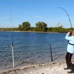
Anglers targeting this area are typically looking for a "Grand Slam" potential. The primary draws are the massive Snook that patrol the bridges and spillways, particularly around the St. Lucie Lock, and the Tarpon that roll in the estuary during seasonal shifts. However, the logistical hub of Stuart also supports heavy offshore vessels looking to utilize the inlet for deep-water access. Understanding the interplay between the canal releases and the lagoon's health is often the key to unlocking the bite in this complex ecosystem.
Access & Getting There
Reaching the primary access points in Stuart typically involves navigating the I-95 corridor. For those towing larger vessels, taking Exit 101 (Stuart/Indiantown) and following SR 76 West is the most direct route to the inland facilities. This route avoids some of the downtown congestion and leads directly to Locks Road, a critical artery for anglers launching at the canal system. Traffic on Federal Highway (US 1) can be heavy during mid-morning and late afternoon, so early departures are essential to avoid delays between the highway and the ramp.
The boat launch situation here caters to a mix of vessel sizes. The St. Lucie South facility is the premier launch point for the canal system. It is located approximately 6.3 miles from the city center and offers a robust infrastructure managed by the Corps of Engineers. The ramps here are designed to handle the traffic of the Okeechobee Waterway, but skippers should be mindful of the current generated by the locks. Opening and closing schedules can dictate water movement, making loading and unloading challenging during peak flow. For those staying closer to the salt, there are unnamed public ramps near latitude 27.19, though parking capacity can be a limiting factor on weekends.
💡 Captain's Tip: Lock Operations
When launching or transiting near the St. Lucie Lock, pay close attention to the lock operators. Currents can change rapidly during chamber cycles. Furthermore, this area is a known hotspot for manatees; idle speeds are strictly enforced and propeller vigilance is mandatory to avoid fines and wildlife strikes.
Parking strategies vary significantly depending on your launch time. For anglers utilizing the downtown or urban access points, the One8 Parking lot on 256 S Colorado Ave is a strategic asset because it operates 24 hours a day. This allows for true "dawn patrol" starts or overnight trips without the fear of being towed or locked in. Public Parking at 401 S Colorado Ave is another viable option, rated highly for accessibility. For those meeting crew or consolidating vehicles, the Sailfish Circle P+R on SE Dixie Hwy provides a safe staging area before heading to the water.
Weather contingencies in Stuart are dictated by the trade winds and the lock schedules. When the Easterly trades blow over 15 knots, the Indian River Lagoon can develop a steep, uncomfortable chop, making the protected waters of the St. Lucie Canal a preferred fallback. The canal system offers significant wind protection due to the surrounding vegetation and leeward banks. Conversely, during periods of heavy rain, the canal discharge can dirty the water quickly; in these conditions, pushing closer to the Jupiter Inlet or the ocean-side beaches often yields cleaner water and better visibility for sight fishing.
Stuart, FL Pre-Trip Checklist
Facilities & Amenities
The infrastructure in Stuart is tailored to the serious boater, with a mix of high-end marine services and practical, working-class tackle shops. You won't find a generic approach here; the local businesses are highly specialized. For bait and terminal tackle, Snook Nook Discount Bait & Tackle in Jensen Beach is an institution. Opening at 6:00 AM, it is perfectly timed for anglers heading out for the morning bite. They are known for reliable live bait and specific local knowledge on snook movements.
For specialized gear, particularly for fly anglers or those targeting light-tackle species, 772 Fly and Light Tackle Charters (located on NW Sunset Blvd) serves a dual purpose as a resource hub. If your expedition requires heavy modification or custom rod work, Leffler Custom Rods in nearby Jupiter is the go-to artisan shop. They are located about 19 miles south but are worth the drive for expert repairs or custom builds suited to the heavy drag pressures of offshore fishing.
| Facility Name | Type | Key Feature | Distance from Center |
|---|---|---|---|
| St. Lucie South | Campground/Marina | Cruiser Sites (Boat Camping) & 50 Amp Power | 6.3 miles |
| Indiantown Marina | Marina | Inland Lake Okeechobee Access | 18.4 miles |
| Snook Nook Bait & Tackle | Shop | Opens 6:00 AM Daily | 3.9 miles |
| One8 Parking | Parking | Open 24 Hours | 0.1 miles |
A critical piece of "negative knowledge" for captains planning a trip here involves fuel and ice logistics. While St. Lucie South offers excellent camping and docking, it is primarily a campground and lock facility. Do not expect full-service marina amenities like a high-speed fuel dock or extensive ship store provisioning at the campground itself. It is advisable to fuel up the vessel and the truck at the stations along SR 76 or US 1 before committing to the launch ramp. Similarly, while Indiantown Marina supports the inland side, it is a significant distance (18+ miles) from the Stuart city center, so planning your fuel stops is essential.
Lodging logistics in Stuart offer a rare opportunity for boat-based accommodation. St. Lucie South Campground features dedicated "cruiser sites" specifically designed for boat campers. These slips come equipped with 50-amp electric and water hookups, allowing you to sleep aboard your vessel in a protected slip right on the waterway. This is a massive advantage for multi-day trips, eliminating the need to haul out and trailer to a hotel every night. For those preferring land-based stays, standard RV and tent sites are available, often with riverfront views.
💡 Captain's Tip: Provisioning
Most local tackle shops open early, but for heavy provisioning, hit the Truck Court/Loading Zone area at Treasure Coast Square if you are towing a large rig. It offers ample turning radius for boat trailers that standard grocery store lots cannot accommodate.
Permits, Regulations & Fees
Fishing in the Stuart area requires strict adherence to both state and federal regulations, managed primarily by the State Fishing Agency and federal partners. The importance of these rules cannot be overstated, as this region hosts critical habitats for protected species. The Nathaniel P. Reed Hobe Sound National Wildlife Refuge is a primary example. This area protects the largest contiguous section of undeveloped beach in Southeastern Florida and is a vital nesting ground for sea turtles. Anglers fishing the surf or nearshore waters here must be hyper-aware of nesting seasons and avoid disturbing marked dunes or nests.
The Jupiter Inlet Lighthouse Outstanding Natural Area (ONA) represents another layer of regulatory complexity. As part of the National Conservation Lands, this 120-acre site at the confluence of the Loxahatchee River and the Indian River Lagoon is protected for its historical and natural resources. While boating and fishing are popular, specific zones may restrict anchoring to protect seagrass beds and submerged archaeological sites. The "Kapu" or sacred nature of these historical lands should be respected; avoid trespassing on the lighthouse grounds or disturbing the shoreline vegetation.
Permitting for the St. Lucie South campground and boat slips is handled through the Recreation.gov system. Reservations are highly recommended, especially during the winter season when "snowbird" traffic peaks. The campground enforces strict rules regarding equipment; for instance, boat slips have width restrictions, and slip #8 or #1 are recommended for wider vessels. Failing to book the correct slip size can result in being turned away at the dock. Additionally, standard Florida saltwater and freshwater fishing licenses are required depending on which side of the lock you are casting in.
Events & Seasonal Information
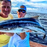
The rhythm of the Stuart fishery is dictated by the seasons and the flow of water. Winter brings the renowned sailfish run offshore, attracting high-caliber sportfishing fleets to the local marinas. During this time, the boat ramps and channels leading to the St. Lucie Inlet can be congested with tournament traffic. Conversely, the summer months shift the focus to the inshore game, with Snook breeding seasons regulating where and how you can fish. The summer also brings the heavy rains, which can trigger lock releases from Lake Okeechobee, drastically changing the salinity and water color in the St. Lucie River.
The Hobe Sound National Wildlife Refuge dictates a different kind of seasonal rhythm. Sea turtle nesting season (typically March through October) may limit night fishing access on specific beaches. It is crucial to check the refuge's specific calendar before planning a surf fishing expedition during these months. For boaters, the manatee migration in winter concentrates these mammals near warm water discharges and lock systems, necessitating slow speeds and added travel time to your spots.
💡 Captain's Tip: Wind & Tides
The best bite in the estuary often correlates with the incoming tide pushing clean ocean water into the lagoon. However, if the trade winds pick up from the East against an outgoing tide at the inlet, the standing waves can be hazardous for smaller skiffs. Plan your inlet transits accordingly.
Contact Information & Resources
For official information regarding lock operations, camping reservations, and water conditions, the St. Lucie South facility can be reached directly at 772-287-1382. They are the authority on lock schedules and slip availability. For inquiries regarding the Nathaniel P. Reed Hobe Sound National Wildlife Refuge, including beach access and conservation rules, contact the refuge headquarters at 772-546-6141 or via email at HobeSound@fws.gov. The Jupiter Inlet Lighthouse ONA is managed by the Bureau of Land Management and can be reached at 601-331-7407.
Safety in this region requires self-reliance. While tow boat services are available, the transition zones between freshwater canals and open ocean can create communication dead zones or delayed response times. Always file a float plan, especially when transiting the locks or heading offshore. For precise locations, real-time wind conditions, and detailed bathymetry of the nearby spots, consult the live dashboard and interactive maps below.


Leave a Reply