Currently, San Carlos Lake is under a strict CLOSED status for all fishing, boating, and shoreline recreational activities. A catastrophic environmental event driven by severe regional drought, intense early-summer heat, and mandatory downstream water releases from Coolidge Dam for agricultural irrigation has resulted in a complete ecosystem crash and a 100% fish kill. The extreme drawdown reduced the lake to less than two percent of its capacity, triggering massive oxygen depletion and localized toxic golden algae blooms.
Safety Advisory: Do not attempt to visit the shoreline or launch any watercraft. Decomposing fish along the receding shorelines have created severe biohazards and health risks. Furthermore, the retreating water has exposed vast, treacherous stretches of deep silt and unstable mudflats. Vehicles and pedestrians can easily become hopelessly trapped in this mud, and emergency recovery is both highly dangerous and exceptionally expensive. All anglers must pivot to regional alternatives until the San Carlos Recreation and Wildlife Department officially reopens the lake and initiates restocking programs.
🎣Nautrek
Private Beta
J
M
R
100+ anglers on the waitlist
The fishing network where your reputation matters.
Find trusted captains, join real trips with cost splitting, and build your Angler Rank. Your spots stay private — you decide who sees your intel.
Note: As a professional guide, I am providing the structural and biological blueprint of this fishery using our fallback structural analysis. The following intel reflects the historical and expected fishery profile for when water levels stabilize and the ecosystem is restored.
Species
Primary Forage
Optimal Structure
Peak Activity Window
Largemouth Bass
Threadfin Shad, Crawfish
Flooded Salt Cedar, Rocky Points
Dawn / Dusk
Flathead Catfish
Live Bluegill, Carp
Deep River Channels, Lava Beds
Nighttime (New Moon)
Black Crappie
Minnows, Small Shad
Submerged Timber, Drop-offs
Early Morning
Primary Target: Largemouth Bass
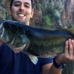
Historically, San Carlos Lake operates as a boom-or-bust factory for trophy Largemouth Bass. When the lake is viable, these bass are highly aggressive and heavily cover-oriented. Because the lake undergoes cyclical fill-and-drawdown phases, salt cedar (tamarisk) bushes aggressively colonize the dry lakebed. When water returns, this flooded brush creates a nutrient-rich, tangled jungle that bass use to ambush prey. The surviving genetics here are robust, with fish historically pushing past the 10-pound mark by gorging on trapped forage.
Sleeper Pick: Flathead Catfish
While the bass draw the tournament crowds, the undisputed apex predator of this desert reservoir is the Flathead Catfish. Most visiting anglers completely overlook them, but massive flatheads—frequently exceeding 50 pounds—dominate the deep holes and muddy channels of the old Gila River bed. They are incredibly resilient, nocturnal hunters that provide the ultimate heavy-tackle challenge for those willing to brave the desert night.
Baitfish Report
The primary forage base in this system consists of Threadfin Shad and desert crawfish. During the summer months, shad schools typically suspend over the main basin or push into the backs of major coves right at dawn. As water levels drop, these baitfish are forced out of the shallow brush and concentrated into the main river channels, creating feeding frenzies.
TACTICAL STRATEGY
Applying Fallback Bathymetry & Structure Analysis for Summer Conditions:
Where to Target
The 25-mile-long basin of San Carlos is relatively shallow and bowl-like, making the few existing drop-offs highly concentrated holding zones. Focus your efforts on the westernmost portion of the lake near Coolidge Dam, where maximum depths can reach up to 75 feet during full pool. Trace the subtle contour changes of the original Gila River channel.
North Shore: Work the submerged brush and rocky transitions at Mohave Point and New Government Corral. Target the 8-15 foot drop-offs where the mud flats transition into a harder bottom.
South Shore:Catfish Bay and the rocky points near Blue Cove are prime ambush structures. Look for the area known as The Lava Beds, where volcanic rock provides the only hard structure in an otherwise silty basin.
Lure Selection
For Largemouth Bass, you must penetrate the flooded salt cedar. Utilize a 1/2oz Tungsten Football Jig paired with a bulky craw trailer to maintain bottom contact in the brush. When fish are actively chasing shad along the river channel ledges, a deep-diving crankbait like a Strike King 6XD or a Rapala DT-15 is highly effective for triggering reaction strikes.
Color Patterns
Water clarity in San Carlos is notoriously poor, typically ranging from heavily stained to downright muddy due to wind-blown silt and agricultural runoff. You must maximize contrast. Opt for Black/Blue, Dark Green Pumpkin, or Firetiger patterns. Gold blades or aggressively loud rattles are essential to help fish locate your bait in the low-visibility water.
Bait & Rigging
For trophy Flathead Catfish, artificial lures are highly inefficient. You need live, vibrating meat. Use a heavy Carolina rig featuring a 2oz to 3oz no-roll sinker, a heavy-duty barrel swivel, and an 8/0 to 10/0 Gamakatsu circle hook. The ultimate bait is a live, hand-sized bluegill hooked just behind the dorsal fin to allow natural swimming action. Anchor your vessel near the steep, rocky banks flanking the dam face and cast right onto the channel ledge.
Timing
Summer desert heat pushes surface temperatures into the high 80s, driving fish deep and making mid-day fishing miserable and unproductive. The golden windows are the first hour of light at dawn, and nighttime fishing.
Pro Tip: Night fishing for catfish during a New Moon is historically the most successful approach. Without lunar illumination, flatheads feel secure leaving the deep channels to hunt on the 5-8 foot mud flats.
REGULATIONS SNAPSHOT
Jurisdiction: The lake is located on the San Carlos Apache Indian Reservation and is entirely governed by the Tribe. State of Arizona fishing licenses are not valid and do not apply here.
Permits Required: A tribal daily fishing permit and a yearly habitat stamp are strictly required for all non-members. These must be purchased in advance from the Recreation & Wildlife Department in Peridot or authorized vendors in Globe.
Bag & Size Limits: Because of the extreme cyclical drawdowns, harvest limits are historically generous to prevent waste during fish kills. Typical limits allow up to 10 Largemouth Bass and 25 Channel/Flathead Catfish per day, with no minimum size restrictions, though catch-and-release of trophy breeding females is strongly encouraged.
Boating: A specific tribal boating permit is required for any vessel launched on the water, including kayaks, canoes, and float tubes.
General Rules: Firearms are strictly prohibited on the reservation without specific tribal authorization. Always pack out your trash, as facilities are minimal and primitive.
Pro Tip: Crossing onto reservation land to fish without a specific tribal recreation permit is a violation of both tribal sovereignty and federal law. Always keep your physical permit in a waterproof lanyard on your person.
REGIONAL ALTERNATIVE
Talkalai Lake & Point of Pines
With San Carlos Lake completely unfishable, your best immediate backup is Talkalai Lake, located further north on the San Carlos Apache Reservation. This lake is meticulously managed, fully stocked, and fed by cooler, oxygenated waters from the San Carlos River, making it highly resistant to the severe drawdowns affecting the main reservoir.
Access & Permits: Accessible via well-maintained reservation roads. Your San Carlos Apache Tribal fishing permit is valid here, making it an easy pivot if you already purchased your passes.
Target Species: Largemouth Bass, Black Crappie, Channel Catfish, and holdover Rainbow Trout from the winter stocking program.
Tactical Approach: Focus your efforts on the northern inlet areas where the river feeds the lake. The cooler, oxygen-rich water concentrates active fish during the summer heat. Throw a 3/8oz spinnerbait with white and silver willow blades, burning it over submerged vegetation for aggressive Talkalai bass. For panfish and trout, a #2 Mepps Aglia inline spinner or a 1/16oz tungsten teardrop jig tipped with a live worm will keep your rod bent all morning.
Pro Tip: Because Talkalai is fed by the river, water temperatures are significantly cooler near the inlet. Position your boat at the mouth of the inflow and cast upstream to intercept feeding bass waiting for forage to be washed down.
If you are willing to drive further into the high country to escape the heat, Point of Pines Lake offers a stunning mountainous alternative. Located 50 miles off Highway 70, this remote, pine-blanketed lake provides excellent summer temperatures and aggressive trout fishing.
Tight lines!
Editor's Choice: Must-Have Gear
FISHINGSIR Next-Gen Waterproof Chest Waders
★★★★★4.4 (7,370+ reviews)
2-Ply Tech: Upgraded nylon with 2.5x higher density than standard fabrics.
100% Waterproof: Lab-approved intrusion resistance with taped visible seams.
Ultra-Lightweight: Designed for all-day comfort while hunting or fishing.
As an Amazon Associate I earn from qualifying purchases. #ad
Loading forecast...
Live Fishing Conditions: Tides, Weather & Waves
Get real‑time tides, marine weather, swell and solunar activity for each spot so you know exactly when conditions line up for your best chance at a bite.
🎣
San Carlos Lake
Loading coordinates...
🌤️
WEATHER CONDITIONS
--°F
--°C
Loading...
🌡️
Feels Like--°F--°C
💧
Humidity--%
💨
Wind-- mph-- km/h
🧭
Direction--
📊
Pressure-- inHg-- hPa
☀️
UV Index--
🌊
MARINE CONDITIONS
🌊Wave Height
-- ft
-- m
Loading...
🧭Wave Direction
--°
Loading...
⏱️Wave Period
-- s
Loading...
📈Tide Status
-- ft
-- m
Loading...
🌙
LUNAR & SOLUNAR
🌕
Loading...
Illumination: --%
Major Period--:-- - --:----:-- - --:--
Minor Period--:-- - --:----:-- - --:--
🌅Sunrise--:--
🌇Sunset--:--
📅
24-HOUR FORECAST
Loading fishing conditions...
Fishing Spots Map
🎣
Book a Fishing Charter near San Carlos Lake Fishing Report Today 🎣
Local guides & charters. Verified captains, instant booking, best price guaranteed.
There was an error loading the map. Please try refreshing the page.
Info
Local Access & Facilities
San Carlos Lake & Gila River Corridor: A Rugged Desert Fishery
The fishery surrounding San Carlos Lake and the feeding Gila River represents one of the most rugged, distinctively Sonoran angling experiences in the American Southwest. This is not a manicured urban reservoir with paved promenades; it is a raw, high-desert environment dominated by saguaro-studded hills, mesquite-willow riparian zones, and the imposing geology of the Galiuro Mountains. For the serious angler, this area offers a chance to target warm water species—specifically massive Flathead Catfish, Channel Catfish, and Largemouth Bass—in a setting that demands self-reliance and logistical preparation. The water here is the lifeblood of the desert, controlled by releases from the Coolidge Dam, creating a dynamic environment where water levels dictate accessibility and fish behavior.
The atmosphere is strictly "backcountry." The silence is heavy, broken only by the flow of the river or the call of desert avian species. While the main lake body is a vast expanse often affected by wind, the river access points upstream offer a more intimate, canyon-bound experience. This is a location for those who appreciate the solitude of the Arizona wilderness and are willing to navigate gravel roads and primitive launches to find unpressured water. The stark contrast between the arid red earth and the green ribbon of the river creates a visual backdrop that is as compelling as the fishing itself.
Prospective visitors must understand that this region is a patchwork of jurisdictions, primarily involving Bureau of Land Management (BLM) public lands and the sovereign territory of the San Carlos Apache Tribe. Navigating the physical landscape is challenging enough, but navigating the regulatory landscape is equally critical for a successful trip. Whether you are drifting the river sections in a canoe or setting up a primitive base camp for a week of catfish hunting, this guide breaks down the essential logistics required to fish this storied desert water.
💡 Captain's Tip: Flow Rate Awareness
River navigability below Coolidge Dam is entirely dependent on agricultural releases. The sweet spot for floating the Christmas to Winkelman stretch is between 300 and 600 cfs. Flows above 600 cfs turn the river dangerous with swift currents driving you into strainers and fences. Always check the USGS stream gauge before hitching the trailer.
Access & Getting There
Accessing the prime fishing grounds of the Gila River Recreation Area requires driving Arizona State Route 77, a scenic but remote highway connecting the towns of Winkelman and Globe. This is a two-lane road that winds through significant elevation changes and canyon geography. Traffic is generally light, but heavy mining trucks and RVs can create bottlenecks on the grades. From Phoenix, you are looking at a drive of approximately 100 miles to the southeast, while Tucson based anglers have a shorter 70-mile trek north. The isolation is a feature, not a bug, but it means that mechanical issues on the highway can result in long waits for assistance.
The launch realities here are starkly different from a standard marina experience. The primary access points managed by the BLM are the Shores Recreation Site (Milepost 141.4) and the Christmas Recreation Site (Milepost 144.6). These are not concrete ramps designed for 21-foot fiberglass bass boats. They are gravel-surfaced access points best suited for carrying down canoes, kayaks, inflatable rafts, or small aluminum tins. The Christmas Recreation Site features gravel driveways and unimproved campsites, but maneuvering space is tight. If you are towing a large rig, the turning radius at these sites can be unforgiving. The Shores site offers similar conditions; it is a launch for the adventurous, where your feet will likely get wet and your vehicle will get dusty.
Weather plays a critical role in physical access, particularly regarding the unpaved roads leading to areas like Turkey Creek. While SR 77 is paved, the spurs leading to the water are susceptible to washouts. During the summer monsoon season, flash floods are a genuine threat. A dry wash can become a raging torrent in minutes, cutting off exit routes. The Turkey Creek access road, partially maintained by Graham County, requires a high-clearance vehicle at minimum. During wet periods, 4x4 capability is mandatory. Even the gravel access at Shores and Christmas can become slick and treacherous after a heavy rain, making trailer extraction difficult for two-wheel-drive trucks.
Parking strategy is straightforward but limited. Both Christmas and Shores operate on a first-come, first-served basis. There are no assigned stalls or overflow lots. On peak weekends or during favorable flow releases, these small gravel lots can fill up by mid-morning. Security is non-existent; these are remote sites miles from the nearest town. Anglers should leave no valuables visible in the cab and ensure trailers are locked. For those venturing to Turkey Creek, the pull-outs are small, and vegetation often encroaches on the roadway, scratching the paint of wider vehicles. Large RVs and travel trailers are explicitly discouraged from attempting the Turkey Creek route due to overhanging tree limbs and narrow passages.
San Carlos Lake Pre-Trip Checklist
Facilities & Amenities
The infrastructure around the Gila River corridor is defined by what is absent rather than what is present. There are no on-water fuel docks, no fully stocked tackle emporiums at the ramp, and no marina restaurants. Anglers must adopt an expedition mindset. The nearest reliable hubs for supplies are Winkelman, Kearny, and Globe. Globe, roughly 25 miles north, serves as the primary logistical base, offering grocery stores, hardware supplies, and medical services at the Cobre Valley Community Hospital. Specialized tackle shops are scarce; experienced locals buy their heavy catfish terminal tackle and live bait in the major metro areas of Phoenix or Tucson before leaving the pavement.
Accommodations in the immediate vicinity are rustic. The Klondyke Horsehead Lodge, located approximately 24 miles from the core fishing zones, offers a bed and a roof for those who prefer not to camp. For RV users, the Palo Verde RV Park in Winkelman provides hookups and a more civilized base camp, though it is a drive to the launch points. The Fourmile Canyon Campground offers a middle ground: it is a developed BLM site with concrete picnic tables and fire rings, located near Klondyke. It is an excellent spot for hunters and anglers who want a dedicated campsite without the crowds of a commercial park, but it is still a significant drive from the water's edge at Christmas.
💡 Captain's Tip: The Water Void
There is absolutely no potable water available at the Turkey Creek site or the primitive river access points. The desert heat dehydrates anglers faster than they realize. The rule of thumb here is to carry one gallon of water per person, per day, plus extra for your vehicle radiator. Do not rely on filtering river water due to agricultural runoff upstream.
The table below outlines the specific facilities available at the primary access points to help you plan your load-out.
Facility Name
Type
Water Access
Camping
Key Restrictions
Christmas Rec Site
BLM Primitive
Gravel / Shore
Unimproved / Primitive
Not suitable for large RVs; tight maneuvering.
Shores Rec Site
BLM Primitive
Gravel / Shore
Unimproved / Primitive
Take-out point for floaters; limited parking.
Turkey Creek
Dispersed Area
Intermittent Creek
Primitive Pull-outs
4x4 Recommended; No water; No toilets.
Fourmile Canyon
Developed Camp
None (Dry Camp)
10 Developed Sites
Has toilets & trash; 32 miles from highway.
Permits, Regulations & Fees
Fishing this region requires navigating a complex overlay of state and tribal regulations. The Gila River Recreation Area sites managed by the BLM are generally fee-free for day use and primitive camping, a rarity in modern angling. However, the water itself often crosses boundaries. A valid Arizona Game and Fish Department license is the baseline requirement for all anglers. Because the river and lake interface with the San Carlos Apache Reservation, strict adherence to boundaries is required. Crossing onto reservation land without a specific tribal recreation permit is a violation of tribal sovereignty and federal law. These permits must be purchased in advance, often from vendors in Globe or Peridot.
The Needle's Eye Wilderness, located nearby, imposes strict federal wilderness regulations. This means no motorized vehicles and no mechanized transport (including bicycles or game carts) are permitted within the wilderness boundary. Anglers hiking into these remote canyon sections to fish isolated pools must do so on foot. Additionally, much of the surrounding land is Arizona State Trust Land. Unlike federal public land, State Trust land requires a recreational permit for entry, even just to cross it to reach a fishing hole. Respecting private property rights is also paramount; the Gila River corridor is a patchwork of public and private holdings. The "Kapu" (keep out/sacred) concept should be applied to any fenced area or private ranch land—do not trespass.
Protected zones include the Turkey Creek Cliff Dwellings and the Aravaipa Canyon Wilderness. These are culturally and ecologically sensitive areas. The cliff dwellings, remnants of the Salado culture from 1300 A.D., are protected federal resources. Anglers exploring Turkey Creek should treat these sites with reverence—look but do not touch, climb, or disturb. The Aravaipa Canyon requires a specialized permit system for entry due to its fragility, and anglers should not assume they can hike in from the Gila River side without proper authorization.
Events & Seasonal Information
The angling rhythm here is dictated by the sun and the dam. The prime season for floating the river sections is from May through October, coinciding with irrigation releases that keep the river navigable. However, this also coincides with the most brutal heat of the Sonoran summer. Experienced captains know that the "dawn patrol" is not just a preference but a safety necessity. Fishing activity peaks early in the morning and late in the evening. Mid-day temperatures often exceed 100°F, driving fish deep into the pools and anglers into heat exhaustion if unprepared.
Winter brings a different dynamic. The flows from Coolidge Dam are often curtailed, reducing the river to a series of pools. While this makes floating impossible, it concentrates fish in the deeper pockets. This is the time for bank fishing and hiking into the canyon bottoms. The Turkey Creek area is open year-round, but the creek flow is intermittent, depending entirely on winter snowfall and precipitation. Birding and wildlife viewing peak in the cooler months, with raptors and migratory species using the riparian corridor as a flyway.
💡 Captain's Tip: The Monsoon Factor
July and August bring the "Monsoon" season. Thunderstorms build rapidly in the afternoon. If you are in a narrow canyon like Turkey Creek or on the river, keep a constant eye on the sky upstream. Blue skies overhead do not mean safety; rain miles away can trigger a dangerous rise in water levels in minutes.
Contact Information & Resources
For the most current information on road conditions, fire restrictions, and facility status, direct communication with the managing agencies is essential. The Bureau of Land Management (BLM) Tucson Field Office manages the Gila River sites and can be reached at (520) 258-7200. For inquiries regarding Turkey Creek and Fourmile Canyon, contact the Safford Field Office at (928) 348-4400. In the event of an emergency, cell service is spotty to non-existent in the canyons; a satellite messenger is highly recommended. For medical emergencies, the nearest hospital is in Globe.
For precise locations, real-time weather data, and detailed maps of the river bends and access points, consult the interactive widgets and maps below.
Our spot reports combine data-driven forecasts with curated local information. The forecast is generated by our proprietary Fishing Score algorithm (0–100%), which analyzes real-time data from Open-Meteo API, validated against NOAA CO-OPS tide gauges and USGS water-monitoring stations. The model weights tide dynamics (35%), wave energy (25%), wind patterns (20%) and time of day (20%)—factors shown to influence fish feeding behavior through marine-biology research and decades of charter log data.
Access, facilities and services information for each fishing spot is sourced from official datasets such as Recreation.gov (RIDB), state park & wildlife agencies, and geospatial providers like Google Maps. These sections undergo scheduled re-validation every 3–6 months to ensure that boat ramps, park access, contact details and local services remain accurate.
Narrative sections (catches, seasonal behavior, local tips) are synthesized from these data sources and refined following the Fishing Reports Today editorial guidelines, combining bibliographic research from ichthyology and oceanography with expert angler experience. Our team reviews reports on a regular basis, while the forecast model itself updates every 6 hours for real-time accuracy.
⚠️ Important: Always verify current local regulations, access restrictions and weather conditions before fishing. These reports are intended as a planning aid, not a guarantee of catches or safety. When in doubt, contact local authorities or park managers listed on the page.
To provide the best experiences, we use technologies like cookies to store and/or access device information. Consenting to these technologies will allow us to process data such as browsing behavior or unique IDs on this site. Not consenting or withdrawing consent, may adversely affect certain features and functions.
Functional Always active
The technical storage or access is strictly necessary for the legitimate purpose of enabling the use of a specific service explicitly requested by the subscriber or user, or for the sole purpose of carrying out the transmission of a communication over an electronic communications network.
Preferences
The technical storage or access is necessary for the legitimate purpose of storing preferences that are not requested by the subscriber or user.
Statistics
The technical storage or access that is used exclusively for statistical purposes.The technical storage or access that is used exclusively for anonymous statistical purposes. Without a subpoena, voluntary compliance on the part of your Internet Service Provider, or additional records from a third party, information stored or retrieved for this purpose alone cannot usually be used to identify you.
Marketing & Affiliates
The technical storage or access is required to create user profiles to send advertising, or to track the user on a website or across several websites for similar marketing purposes, including affiliate tracking for products recommended in our reports.


Leave a Reply