Morse Lake (Morse Reservoir), Indiana Fishing Report Today 🎣
8 months ago · Updated 2 weeks ago
Morse Reservoir Fishing Report & Tactical Guide
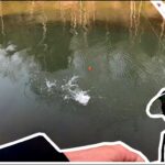
As spring transitions into its later stages, Morse Reservoir—a 1,500-acre impoundment in Hamilton County—presents both exceptional opportunities and unique challenges for the dedicated angler. Originally constructed for municipal water supply and flood control, this reservoir boasts a maximum depth of 75 feet and 35 miles of heavily developed shoreline. With water temperatures steadily climbing into the optimal feeding zones, the biological activity in the lake is reaching its seasonal peak. This report breaks down the current bathymetric patterns, forage movements, and tactical approaches required to succeed on one of Indiana's most popular tournament waters.
1. GO/NO-GO STATUS
Verdict: CAUTION
While the fishing is currently highly productive, anglers must exercise caution due to volatile spring weather patterns and increasing recreational boat traffic. Morse Reservoir features a distinct north-south orientation that acts as a natural wind tunnel. When stiff northerly or southerly fronts push through, the main lake basin can quickly develop a treacherous chop, making navigation difficult for smaller vessels.
🎣Nautrek
Private Beta
J
M
R
100+ anglers on the waitlist
The fishing network where your reputation matters.
Find trusted captains, join real trips with cost splitting, and build your Angler Rank. Your spots stay private — you decide who sees your intel.
Furthermore, spring runoff occasionally brings heavy debris into the northern feeder creeks. Water clarity is currently fluctuating; you will find stained, turbid water near the Cicero Creek inlet on the north end, while the southern basin near the dam remains relatively clear. Early morning launches are strongly advised to capitalize on low wind conditions and to beat the heavy recreational pontoon and jet-ski traffic that dominates the mid-day hours.
2. SPECIES INTEL
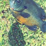
Primary Target: Largemouth Bass
Morse Reservoir is a premier tournament destination, and the largemouth bass are the undisputed main attraction. The fish are currently in a highly aggressive transitional phase. With the warming waters, large females are moving from their deep wintering holes along the historic creek channels and staging on secondary points and drop-offs in 8 to 12 feet of water. As the season progresses, they will push into the shallow flats and heavily structured dock areas to bed.
Secondary Target: Black and White Crappie
The crappie bite is exceptional right now. These panfish are tightly schooled and migrating toward shallower brush and vegetation. You will find them heavily concentrated under the extensive network of floating docks and near submerged timber in 8 to 15 feet of water. They provide high-volume catch rates for anglers willing to vertically jig with precision.
Sleeper Pick: Hybrid Striped Bass (Wiper)
While the majority of the fleet is beating the banks for largemouth, a healthy population of aggressive Wipers is actively hunting in the open water. These hybrids corral baitfish against wind-blown points or suspend over the deepest sections of the river channel. When the bass bite shuts down under heavy pressure, targeting suspended Wipers can completely salvage a tough outing.
Baitfish Report: Match the Hatch
Understanding the forage base is critical on Morse. American Gizzard Shad are the dominant baitfish, alongside juvenile bluegill and redear sunfish. The shad are currently schooling heavily near the mouths of feeder creeks, particularly around Hinkle Creek and the northern Cicero end. Predators are actively busting these schools in the early morning. To trigger strikes, your presentation must closely mimic the silver, white, and black profiles of the gizzard shad.
3. TACTICAL STRATEGY
To succeed on this heavily pressured lake, you must execute with the precision of a local guide. Generic casting will not yield tournament-winning bags here; success requires dissecting specific structures and understanding the daily feeding windows.
Where to Target
Begin your morning on the north end near the Town of Cicero. Focus your efforts on the distinct 8-to-12-foot drop-offs where the shallow flats transition into the main creek channel. As the sun rises and pushes the fish tighter to cover, transition to the shoreline. Approximately 95 percent of Morse Reservoir's shoreline is developed, making private docks the most prominent structural feature. Target the deepest docks situated near secondary points. Always maintain a respectful distance and avoid trespassing or snagging private property.
Lure Selection & Presentation
Your tackle box should be curated for specific depths and water clarities. Here is the optimal loadout for current conditions:
Deep Ledges: Broad-bill crankbaits (such as a Strike King 5XD or Rapala DT-10) in Gizzard Shad patterns for clear water, or chartreuse with a black back for stained northern creeks.
Dock Skipping: A 3/8-ounce tungsten jig paired with a green pumpkin craw trailer to perfectly mimic emerging crayfish.
Crappie Brush Piles: 1/16-ounce lead-head jigs tipped with chartreuse and white soft plastic tubes, fished vertically with minimal movement.
Pro Tip: When targeting crappie under floating docks, utilize the "shoot the dock" casting technique. Bow your rod and slingshot the tiny jig deep into the darkest shadows where the largest slab crappie are hiding from the sun and avian predators.
Bait Recommendations
If artificial lures are not producing, live bait is a highly effective fallback. Rig medium golden shiners or fathead minnows on a slip bobber setup. Set your bobber stop to suspend the bait exactly 12 to 18 inches above submerged brush piles in 10 feet of water. This presentation is deadly for both crappie and finicky largemouth bass.
Timing the Bite
The golden hour on Morse Reservoir is from first light until approximately 9:00 AM. During this window, the water is calm, the recreational traffic is non-existent, and the fish pull up to actively feed on shad. Once the sun penetrates the water column and the jet skis begin churning the main basin, the fish retreat to deep water or bury themselves deep under the docks, making the bite significantly tougher.
Pro Tip: Utilize your electronics to locate the thermocline and bait balls in the main river channel. If you mark suspended fish chasing bait in 20 feet of water, drop a heavy jigging spoon or blade bait to target the aggressive Wipers.
4. REGULATIONS SNAPSHOT
Enforcement on Morse Reservoir is strict, and all anglers must possess a valid Indiana Department of Natural Resources (DNR) fishing license. Be aware that Morse has site-specific regulations that differ from statewide limits to protect the fishery from heavy tournament pressure.
Species
Minimum Size Limit
Daily Bag Limit
Largemouth / Smallmouth Bass
15 inches (Site-Specific)
5 (singly or in aggregate)
Crappie (Black & White)
None
25
Hybrid Striped Bass (Wiper)
None
10 (Only 2 over 17 inches)
Channel Catfish
None
10
Note: Always verify seasonal closures, as certain coves may be temporarily restricted by the DNR during the spring spawn to protect bedding fish.
5. REGIONAL ALTERNATIVE
If Morse Reservoir is blown out by heavy winds, or if the boat ramps are simply too congested with weekend traffic, do not cancel your trip. Head south to Eagle Creek Reservoir in Indianapolis.
Eagle Creek is a fantastic backup plan that remains highly active during the spring transition. The reservoir features deeply protected coves and heavily timbered shorelines that shield anglers from harsh northerly winds. The Eagle Creek Park Marina offers excellent facilities and deep-water access.
While largemouth bass are present, the primary targets here shift to Walleye and Crappie. Eagle Creek receives heavy Walleye stocking from the DNR (up to 50,000 fingerlings annually). To target them, work the deep timber and main lake points with blade baits or drag nightcrawler harnesses along the bottom. For crappie, locate the submerged brush piles in 12 to 18 feet of water and deploy the same vertical tube-jigging techniques you would use at Morse.
Pro Tip: Eagle Creek is also a verified biological hot spot for Gizzard Shad. If the Walleye are finicky, switch to a silver lipless crankbait and burn it over the submerged points to trigger reaction strikes.
Tight lines!
Editor's Choice: Must-Have Gear
FISHINGSIR Next-Gen Waterproof Chest Waders
★★★★★4.4 (7,370+ reviews)
2-Ply Tech: Upgraded nylon with 2.5x higher density than standard fabrics.
100% Waterproof: Lab-approved intrusion resistance with taped visible seams.
Ultra-Lightweight: Designed for all-day comfort while hunting or fishing.
As an Amazon Associate I earn from qualifying purchases. #ad
Loading forecast...
Live Fishing Conditions: Tides, Weather & Waves
Get real‑time tides, marine weather, swell and solunar activity for each spot so you know exactly when conditions line up for your best chance at a bite.
🎣
Morse Lake (Morse Reservoir), Indiana
Loading coordinates...
🌤️
WEATHER CONDITIONS
--°F
--°C
Loading...
🌡️
Feels Like--°F--°C
💧
Humidity--%
💨
Wind-- mph-- km/h
🧭
Direction--
📊
Pressure-- inHg-- hPa
☀️
UV Index--
🌊
MARINE CONDITIONS
🌊Wave Height
-- ft
-- m
Loading...
🧭Wave Direction
--°
Loading...
⏱️Wave Period
-- s
Loading...
📈Tide Status
-- ft
-- m
Loading...
🌙
LUNAR & SOLUNAR
🌕
Loading...
Illumination: --%
Major Period--:-- - --:----:-- - --:--
Minor Period--:-- - --:----:-- - --:--
🌅Sunrise--:--
🌇Sunset--:--
📅
24-HOUR FORECAST
Loading fishing conditions...
Fishing Spots Map
🎣
Book a Fishing Charter near Morse Lake (Morse Reservoir), Indiana Fishing Report Today 🎣
Local guides & charters. Verified captains, instant booking, best price guaranteed.
There was an error loading the map. Please try refreshing the page.
Info
Local Access & Facilities
Tucked into the heart of central Indiana, Morse Lake—also known as Morse Reservoir—offers a highly structured, dynamic fishery that demands precision from serious anglers. Located in Noblesville, this sprawling body of water presents a classic Midwestern reservoir environment. The shoreline is highly developed, meaning the submerged topography is dotted with residential docks, retaining walls, and hidden creek channels that serve as prime ambush points for predatory fish. Seasoned skippers know that navigating these man-made structures is the key to unlocking the lake's true potential.
The atmosphere here shifts dramatically depending on the time of day and the season. During the quiet dawn hours, a glassy surface reflects the surrounding residential enclaves, offering a serene, focused environment for casting jigs under docks or working topwater lures along the retaining walls. However, as the sun rises, the vibe transforms into a bustling recreational hub. Expert anglers understand that fishing this reservoir requires a tactical approach, leveraging the early morning calm before the wakeboard boats and jet skis stir up the main channels.
For the tournament veteran or the seasoned local guide, the primary targets are typically largemouth bass and crappie, which cling to the abundant hard structures and drop-offs. The lake's layout forces anglers to be incredibly accurate with their presentations. Skipping baits deep under pontoon boats and private docks is a required skill here. Success on Morse Reservoir isn't just about having the right gear; it is about mastering the logistical rhythms of a shared-use waterway and knowing exactly when and where to deploy your arsenal.
Access & Getting There
Navigating to Morse Reservoir is generally straightforward via the major state routes feeding into Noblesville, but timing your drive is critical. Traffic flowing north from the Indianapolis metropolitan area can create significant bottlenecks, especially during weekday rush hours or busy summer holiday weekends. Seasoned captains towing heavy fiberglass bass rigs plan their approach long before the sun comes up to avoid the stop-and-go congestion on the two-lane roads leading closer to the water.
The boat launch reality on this lake requires a self-reliant mindset. There are three primary, unnamed access points located roughly 5.8 miles from the central lake coordinates. While these ramps do offer dedicated parking and accommodate standard boat trailers, they are incredibly bare-bones. Crucially, these ramps do not feature overhead lighting. If you are planning a dawn patrol launch—which is highly recommended to beat the recreational traffic—you must arrive fully prepared to back down the ramp in the dark.
💡 Captain's Tip: Dark Water Launches
Because the local boat ramps lack overhead lighting, seasoned skippers know to prep their rigs entirely in the staging area. Have your transom straps removed, drain plug installed, and headlamps equipped before you ever put your tires on the concrete. Speed is essential to keep the ramp clear.
Weather contingencies play a massive role in how you access and fish this reservoir. When the prevailing Midwestern winds pick up, the main basin can become surprisingly choppy. During high wind events, captains should look to launch and stay tucked into the narrower, wind-protected coves and creek arms. The lack of natural windbreaks on the main water means that boat control becomes a full-time job if you venture out of the leeward zones.
Parking your rig requires strategic thinking. While the ramps have trailer parking, spaces fill up rapidly by 5:00 AM during prime fishing seasons. If you are staging a massive tournament rig or meeting clients coming from the city, regional parking lots like the Monon Greenway (10.2 miles away) or the Cycle Gear lot (12.6 miles away) can serve as rendezvous points. Consolidate your gear into one vehicle before heading to the actual ramp to save valuable space.
Morse Lake (Morse Reservoir), Indiana Pre-Trip Checklist
Facilities & Amenities
The infrastructure immediately surrounding Morse Lake is heavily biased toward residential living rather than dedicated angling facilities. This means you must source your bait, tackle, and ice well before you arrive at the water's edge. Relying on finding last-minute gear at the ramp will leave you empty-handed. You must leverage the specialized shops located in the surrounding towns to ensure your livewells and tackle boxes are fully stocked.
For professional guidance and local intel, Two Forks Guide Service is the absolute heavy hitter in the area. Located just 5 miles from the lake in Noblesville, they operate 24 hours a day, making them an invaluable resource for night-fishing logistics or early morning tactical adjustments. If you are pushing further out, Indy Fly Guide Service sits 15.1 miles away in Anderson, offering specialized knowledge for anglers looking to target shallow-water species on the fly.
When it comes to tackle and live bait, you will need to stop on your way in. The Bobber Shop in McCordsville is roughly 15.2 miles away and opens at 8:00 AM, making it a solid stop for afternoon sessions. Red Dirt Bait LLC in Fortville is 15.5 miles out. If you are coming from downtown Indianapolis, the LBS Bait Shop is 24 miles south but stays open late, offering a crucial stop for night-before preparations.
Facility Name
Type
Distance
Specialty / Notes
Two Forks Guide Service
Charter / Guide
5.0 miles
Open 24 hours, elite local knowledge.
The Bobber Shop
Bait & Tackle
15.2 miles
Solid gear selection, opens at 8:00 AM.
Red Dirt Bait LLC
Bait & Tackle
15.5 miles
Specialized local baits, daytime hours.
Indy Fly Guide Service
Charter / Guide
15.1 miles
Fly fishing specialists based in Anderson.
Negative knowledge is critical here: the boat ramps have absolutely zero amenities. There are no fish cleaning stations, no showers, and no running water. Furthermore, the closest public restrooms are located between 1.1 miles and 3.4 miles away from the launch sites. Captains must brief their clients on this reality beforehand. You must bring heavy coolers packed with ice, as you will be transporting your catch whole to process back at home or at your campsite.
💡 Captain's Tip: The Ice Logistics
With zero fish cleaning stations or ice vendors at the lake access points, preparation is mandatory. Bring heavily insulated coolers packed with block ice. Bleed your catch immediately on the boat and bury them in the ice to preserve meat quality until you can process them off-site.
Lodging options cater to two distinct types of anglers: the rugged early riser and the luxury traveler. For the dawn patrol crowd, Deadcreek Camp is just 8 miles away, offering quick access to the ramps. Mud Creek Campgrounds, located 10.7 miles out, is open 24 hours, making it perfect for late-night arrivals. Conversely, if you want high-end comfort after a long day on the water, the historic Omni Severin Hotel in downtown Indianapolis is 23 miles away, offering a swimming pool and upscale dining.
Lodging Name
Style
Distance
Logistical Edge
Deadcreek Camp
Campground
8.0 miles
Closest proximity for early morning launches.
Mud Creek Campgrounds
Campground
10.7 miles
Open 24 hours, ideal for late arrivals.
Mystic Waters Campground
Campground
16.0 miles
Quiet retreat, open until 8:00 PM most days.
Omni Severin Hotel
Luxury Hotel
23.0 miles
Historic downtown comfort, pool, secure parking nearby.
Permits, Regulations & Fees
Fishing on Morse Lake falls under the strict jurisdiction of the State Fishing Agency. The regulations here are designed to maintain the delicate balance of the reservoir's bass and crappie populations amidst heavy recreational pressure. All anglers must possess a valid state fishing license, and captains are responsible for ensuring that every client on board has their paperwork in order before the first line hits the water.
While there are no specific, secondary permits required to launch at the local ramps, enforcement of standard size and bag limits is taken seriously. The lake's proximity to major population centers means it sees significant harvest pressure. Practicing catch-and-release for trophy-sized bass is highly encouraged by the local guiding community to preserve the genetic stock of the fishery. Always check the seasonal closures, as certain coves may be restricted during the spring spawn to protect bedding fish.
Cultural and local respect is paramount on a heavily developed lake like Morse Reservoir. The vast majority of the shoreline is private property. While casting under private docks is a standard and highly effective tactic, anglers must exercise extreme precision. Snagging a boat cover, damaging a retaining wall, or trespassing on a private dock is a quick way to draw the ire of local homeowners and law enforcement. Maintain a respectful distance and keep noise levels down during the early morning hours.
💡 Captain's Tip: Dock Etiquette
When picking apart the residential docks, boat control is everything. Keep your trolling motor on a low, quiet setting. If you snag a lure on a private dock or boat lift, break it off rather than climbing onto the property to retrieve it. Respecting the homeowners ensures continued access for the angling community.
Events & Seasonal Information
The rhythms of Morse Lake are dictated heavily by water temperatures and recreational boat traffic. Spring is arguably the most electric time for serious anglers. As the water warms, bass move out of the deep creek channels and push into the shallow, residential coves to spawn. This pre-spawn and spawn period offers the best opportunity to stick a true trophy fish, but it requires navigating the fluctuating water clarity caused by spring rains.
Summer on the reservoir is a logistical challenge. By 10:00 AM, the main lake becomes a washing machine of wakes from pleasure cruisers, jet skis, and pontoon boats. During these months, the expert angler shifts to a nocturnal schedule or strict dawn patrols. Fishing from 4:00 AM until 9:00 AM allows you to work the topwater bite in peace. Alternatively, night fishing with dark-colored spinnerbaits and jigs around lighted docks can yield massive strikes from heavily pressured fish.
As autumn sets in, the recreational traffic vanishes, and the lake returns to the anglers. The cooling water triggers aggressive feeding frenzies as fish push bait into the backs of the creeks. This is the time when local bass tournament circuits often schedule their final events. The water levels may drop during the late fall and winter, exposing hazards that were safely submerged during the summer, so captains must rely heavily on their electronics and updated charts to navigate safely.
Contact Information & Resources
Because the local access points lack on-site management, self-reliance is your best asset. The State Fishing Agency is the primary contact for any regulatory questions, license renewals, or reporting of violations. It is highly recommended to program the local Noblesville emergency dispatch numbers into your satellite phone or mobile device, as there is no harbor master to hail on the VHF radio if you experience engine failure or a medical emergency.
Always check the local weather and water conditions before hitching up your trailer. High winds can turn the main reservoir into a dangerous environment for smaller vessels, and the lack of shoreline refuges means you must be proactive about incoming storms. Ensure your vessel is equipped with all state-mandated safety gear, proper footwear for slippery ramp conditions, and adequate sun protection for long days on the water.
For precise ramp locations, live weather conditions, and routing to the nearest bait shops and staging areas, consult the interactive live dashboard and maps below.
🎣
Morse Lake (Morse Reservoir), Indiana
Noblesville • Indiana • 40.0880, -86.0592
🅿️
Parking
5
Lot 86
⭐ 5.022.7 mi
📍Blake St & West New York St, Lot 86, Indianapolis, IN 46202, USA
Our spot reports combine data-driven forecasts with curated local information. The forecast is generated by our proprietary Fishing Score algorithm (0–100%), which analyzes real-time data from Open-Meteo API, validated against NOAA CO-OPS tide gauges and USGS water-monitoring stations. The model weights tide dynamics (35%), wave energy (25%), wind patterns (20%) and time of day (20%)—factors shown to influence fish feeding behavior through marine-biology research and decades of charter log data.
Access, facilities and services information for each fishing spot is sourced from official datasets such as Recreation.gov (RIDB), state park & wildlife agencies, and geospatial providers like Google Maps. These sections undergo scheduled re-validation every 3–6 months to ensure that boat ramps, park access, contact details and local services remain accurate.
Narrative sections (catches, seasonal behavior, local tips) are synthesized from these data sources and refined following the Fishing Reports Today editorial guidelines, combining bibliographic research from ichthyology and oceanography with expert angler experience. Our team reviews reports on a regular basis, while the forecast model itself updates every 6 hours for real-time accuracy.
⚠️ Important: Always verify current local regulations, access restrictions and weather conditions before fishing. These reports are intended as a planning aid, not a guarantee of catches or safety. When in doubt, contact local authorities or park managers listed on the page.
To provide the best experiences, we use technologies like cookies to store and/or access device information. Consenting to these technologies will allow us to process data such as browsing behavior or unique IDs on this site. Not consenting or withdrawing consent, may adversely affect certain features and functions.
Functional Always active
The technical storage or access is strictly necessary for the legitimate purpose of enabling the use of a specific service explicitly requested by the subscriber or user, or for the sole purpose of carrying out the transmission of a communication over an electronic communications network.
Preferences
The technical storage or access is necessary for the legitimate purpose of storing preferences that are not requested by the subscriber or user.
Statistics
The technical storage or access that is used exclusively for statistical purposes.The technical storage or access that is used exclusively for anonymous statistical purposes. Without a subpoena, voluntary compliance on the part of your Internet Service Provider, or additional records from a third party, information stored or retrieved for this purpose alone cannot usually be used to identify you.
Marketing & Affiliates
The technical storage or access is required to create user profiles to send advertising, or to track the user on a website or across several websites for similar marketing purposes, including affiliate tracking for products recommended in our reports.


Leave a Reply