Summer fishing at Lees Ferry offers one of the most unique and productive angling experiences in the American Southwest. The current status is a resounding "GO," but it requires preparation for extreme environmental contrasts. While the desert air temperatures deep within Marble Canyon can easily soar well past the 100-degree mark by midday, the cold-water releases from the base of Glen Canyon Dam keep the river at a highly stable, trout-friendly 48 to 52 degrees Fahrenheit. This natural air conditioning effect keeps the trout actively feeding throughout the day, even when the terrestrial heat feels oppressive.
Safety Advisory & Weather Impact: Because this is a highly regulated tailwater, daily flow fluctuations dictated by regional power generation demands are your absolute biggest hazard. The river can rise or fall several feet in a matter of hours. Always check the Bureau of Reclamation's Glen Canyon Dam release schedule before your trip. If you are wading the walk-in section or anchoring your boat near a shallow gravel bar, pay constant attention to the water line on the shoreline rocks. Rising water can strand waders quickly. Furthermore, summer afternoons can bring sudden, localized monsoon gusts that funnel through the canyon walls. Secure your gear, wear ample sun protection, and hydrate constantly—the dry desert air will steal your moisture faster than you realize.
From the editor
Tired of fishing with strangers you can’t trust?
Nautrek is the first social network for serious anglers — verified partners, real trips, cost splitting and intel sharing without burning your spots. Private beta now open.
Primary Target: Rainbow Trout. The wild and semi-wild rainbows of Lees Ferry are the undisputed main attraction. These fish are incredibly well-conditioned and thick-shouldered, a direct result of the nutrient-rich tailwater environment. Right now, the rainbows are heavily concentrated along current seams, holding in deep runs, and waiting to ambush food funneled by the dam releases. Expect average catches in the 14 to 16-inch range, with plenty of 18 to 20-inch specimens lurking in the deeper slots.
Sleeper Pick: Brown Trout. While Lees Ferry is historically world-renowned for its rainbows, the brown trout population has been steadily increasing and establishing a foothold in recent years. Many visiting anglers completely overlook them by strictly nymphing small midges. If you want to target these aggressive predators, commit to throwing large, articulated streamers near undercut banks, large submerged boulders, and deep eddy tailouts.
Baitfish & Forage Report: The forage base here is massive in sheer volume but remarkably limited in diversity. You must match the hatch perfectly to succeed. The absolute staple of the Lees Ferry diet is the freshwater scud (shrimp). When dam releases drop, scuds often get stranded in the aquatic vegetation, perish, and turn a distinct orange or pink color. When the water rises again, these brightly colored morsels are washed back into the river, triggering aggressive feeding. Beyond scuds, aquatic worms (San Juan worms) and dense clusters of midges make up the rest of the underwater buffet. For topwater enthusiasts, the famous summer cicada hatch provides explosive dry fly action when these large terrestrial insects are blown into the river from the canyon walls.
TACTICAL STRATEGY
Where to Fish
Skip the fast, shallow riffles during the heat of the day and focus your efforts on the transition zones. The most productive holding water right now is located near 9-Mile Bar and the deep slots around Horseshoe Bend. Position your boat to drift the primary current seams where the shallow, sun-baked gravel bars drop off sharply into 8 to 12 feet of water. The trout will hold just inside the deeper, darker water, waiting for the current to deliver food. If you do not have a jet boat and are restricted to the walk-in area below the launch ramp, target the deep slots, back-eddies, and large boulders just upstream of the Paria River confluence. The first mile of walk-in access is highly productive if you fish it methodically.
Gear and Presentation
Fly Fishing: A 9-foot, 5-weight rod is the perfect tool for this river. A tandem nymph rig is virtually mandatory for consistent success. Lead with a size 14 Orange or Pink Scud pattern, trailing a size 18 to 20 Black Zebra Midge with silver wire ribbing dropped 15 to 18 inches below. Use a strike indicator set at 1.5 to 2 times the depth of the water, and mend your line constantly to ensure a drag-free drift. If you hear cicadas buzzing near the banks, tie on a size 8 Chubby Chernobyl and smack it hard onto the surface to trigger a reaction strike.
Spin Fishing: Use a medium-light 7-foot spinning rod paired with 4lb to 6lb fluorocarbon line. Drift a 1/8oz olive or black marabou jig right along the bottom. The key to spin-fishing success at Lees Ferry is keeping your lure bouncing along the riverbed for as long as possible, only reeling to pick up extra slack. Ensure your jig hooks are completely barbless.
Timing: The desert heat dictates your schedule. The most aggressive feeding windows are occurring during low-light periods from 6:00 AM to 10:00 AM, and again from 5:00 PM until dusk. Midday fishing requires deep, precise presentations and a lot of patience, as the overhead sun pushes the larger fish deeper into the water column.
Pro Tip:When the water levels begin to rapidly rise due to scheduled dam releases, immediately switch your lead fly to a San Juan Worm in a red or wine color. The rising water disrupts the riverbed and dislodges these aquatic worms from the muddy banks, creating a temporary, frantic feeding frenzy among the rainbows.
REGULATIONS SNAPSHOT
Lees Ferry is strictly managed as a trophy tailwater to preserve its world-class status. The specific regulated zone stretches from the base of Glen Canyon Dam downstream for roughly 15 miles to the Paria Riffle. Ignorance of the law is no excuse, so ensure your setup is fully compliant before making your first cast.
Regulation Category
Details (Glen Canyon Dam to Paria Riffle)
Gear Restrictions
Fishing is restricted to artificial flies and lures only. The use of natural bait, scented baits, or prepared baits is strictly prohibited. All hooks must be barbless.
Bag & Size Limits
Catch and release is highly encouraged to protect the resource. State regulations limit harvest to a maximum of 2 rainbow trout per day. Check the latest Arizona Game and Fish Department (AZGFD) proclamations for seasonal slot limits or emergency changes.
Species Protection
All native fish species, including the Flannelmouth Sucker and Bluehead Sucker, are fully protected and must be released immediately and unharmed if accidentally caught.
Pro Tip:Barbless hooks not only comply with local laws but also make releasing the vigorous, hard-fighting rainbows much safer for the fish and significantly easier for the angler. Keep a pair of hemostats clamped to your pack to quickly pinch down the barbs on any new flies or spinning lures straight out of the box.
REGIONAL ALTERNATIVE
If the wind is howling dangerously through Marble Canyon, or the dam release schedule makes wading completely unsafe, do not let it ruin your trip. Pack up your gear and head a short distance north across the border to Lake Powell (Wahweap Bay). This massive, stunning reservoir offers a completely different, yet highly productive, warm-water desert fishing experience.
Access Points: Wahweap Marina provides excellent, deep-water boat launching facilities. If you are fishing from the bank, there is ample shoreline access near the Stateline Ramp and along the rocky breakwaters.
Tactical Approach: For Striped Bass, keep a close eye on the horizon for diving birds and surface boils early in the morning. Throw topwater walking baits, like a Zara Spook in bone or chrome, directly into the feeding frenzy. Once the sun gets high and the topwater action dies, switch to vertically jigging 1/2oz to 3/4oz white heavy spoons in 40 to 60 feet of water near submerged canyon points. For Smallmouth Bass, methodically work the rocky shorelines, boulder fields, and submerged canyon walls with green pumpkin tube jigs, Ned rigs, or deep-diving crankbaits.
Pro Tip:Striped bass at Lake Powell travel in massive, highly competitive schools. If you hook up while vertical jigging a spoon, reel the fish halfway up and leave it in the water for an extra few seconds. The struggling fish will often trigger the rest of the school into a competitive feeding frenzy right beneath your boat, allowing your fishing partners to drop their lures down for an instant double or triple hookup!
Tight lines!
Editor's Choice: Must-Have Gear
FISHINGSIR Next-Gen Waterproof Chest Waders
★★★★★4.4 (7,370+ reviews)
2-Ply Tech: Upgraded nylon with 2.5x higher density than standard fabrics.
100% Waterproof: Lab-approved intrusion resistance with taped visible seams.
Ultra-Lightweight: Designed for all-day comfort while hunting or fishing.
As an Amazon Associate I earn from qualifying purchases. #ad
Loading forecast...
Live Fishing Conditions: Tides, Weather & Waves
Get real‑time tides, marine weather, swell and solunar activity for each spot so you know exactly when conditions line up for your best chance at a bite.
🎣
Lees Ferry
Loading coordinates...
🌤️
WEATHER CONDITIONS
--°F
--°C
Loading...
🌡️
Feels Like--°F--°C
💧
Humidity--%
💨
Wind-- mph-- km/h
🧭
Direction--
📊
Pressure-- inHg-- hPa
☀️
UV Index--
🌊
MARINE CONDITIONS
🌊Wave Height
-- ft
-- m
Loading...
🧭Wave Direction
--°
Loading...
⏱️Wave Period
-- s
Loading...
📈Tide Status
-- ft
-- m
Loading...
🌙
LUNAR & SOLUNAR
🌕
Loading...
Illumination: --%
Major Period--:-- - --:----:-- - --:--
Minor Period--:-- - --:----:-- - --:--
🌅Sunrise--:--
🌇Sunset--:--
📅
24-HOUR FORECAST
Loading fishing conditions...
Fishing Spots Map
🎣
Book a Fishing Charter near Lees Ferry Fishing Report Today 🎣
Local guides & charters. Verified captains, instant booking, best price guaranteed.
There was an error loading the map. Please try refreshing the page.
Info
Local Access & Facilities
Lees Ferry Pre-Trip Checklist
Local Access & Facilities
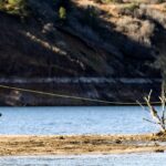
The stretch of the Colorado River known as Lees Ferry represents one of the most unique technical fisheries in the American Southwest. Situated immediately downstream of the massive Glen Canyon Dam, this 15-mile tailwater creates a clear, cold-water habitat that stands in stark contrast to the surrounding red sandstone of the Vermilion Cliffs. Unlike the warm water reservoirs nearby, this section acts as a giant limestone spring creek, offering seasoned anglers a shot at trophy rainbow trout in a setting that feels prehistoric.
The atmosphere here is deceptively rugged. While the launch ramp is paved and accessible, the canyon walls isolate you from the modern world the moment you motor upstream. The water maintains a constant, bone-chilling temperature year-round, demanding respect from even the most experienced boaters. This is a blue-ribbon fishery where precision drifting and reading subtle current seams are required to hook into the wild, hard-fighting trout that thrive in the nutrient-rich flows released from Lake Powell.
Accessing the upper reaches requires a jet boat or a specialized shallow-draft vessel, as the river is studded with gravel bars and hidden rocks. While drift boats are common, the upstream motor run is the standard approach for guides looking to reach the prime drifts near the dam. This is not a place for casual boating; it is a dedicated angling destination where the scenery rivals the fishing.
💡 Captain's Tip: Dam Release Rhythms
The river level here fluctuates significantly based on power generation schedules at Glen Canyon Dam. Experienced skippers check the release schedules daily; a gravel bar that is passable at 9:00 AM might be high and dry by 2:00 PM. Always anchor with enough slack to account for dropping water.
Access & Getting There
Reaching Lees Ferry requires a deliberate journey through the high desert. Most anglers base their operations out of Page, Arizona, which is approximately 42 miles away via US Highway 89 South and Highway 89A West. The drive is scenic but traverses remote territory. The critical turnoff is at Marble Canyon, just west of the historic Navajo Bridge. From there, a paved access road leads roughly 5 miles directly to the ferry area and boat ramps.
The primary launch facility is the Lees Ferry Boat Launch. This is the only public access point for powerboats to enter the 15-mile upstream stretch to the dam. The ramp is concrete, wide, and generally well-maintained by the National Park Service. However, it can become congested in the early morning with commercial river rafting expeditions rigging up for their journey downstream into the Grand Canyon. Patience is required during peak launch windows between 7:00 AM and 9:00 AM.
Parking at the launch area is ample for trailers, but security is basic. While incidents are rare, it is advisable to lock all gear and avoid leaving high-value electronics visible in the cab. For those without a boat, the shoreline around the launch and the walk-in area at Paria Beach offer productive wading, though the current can be deceptive. The road to the ramp is paved, but flash floods can deposit debris on the asphalt during the monsoon season (July–September).
💡 Captain's Tip: Weather Contingencies
The canyon acts as a wind tunnel. If the forecast calls for winds exceeding 20 mph, the drift becomes unmanageable and the ride back downstream can be wet and dangerous. Plan your run to be off the water before the afternoon thermal winds kick up, usually around 1:00 PM.
Facilities & Amenities
Infrastructure at Lees Ferry is purpose-built for the river runner and angler, but it is limited compared to the full-service marinas on Lake Powell. There is no fuel dock on the water. Anglers must fuel their vessels on the trailer at Marble Canyon (approx. 5 miles away) or in Page before driving in. Running out of gas upstream is a major logistical headache, as there is no cell service in the canyon to call for a tow.
For tackle and local intelligence, Lees Ferry Anglers Fly Shop in Marble Canyon is the undisputed hub. This shop specializes in the specific scuds, midges, and San Juan worms that work in this tailwater. They also offer guide services and up-to-date reports on water clarity. For kayak anglers or those needing general marine supplies, Lake Powell Paddleboards and Kayaks in Page is a reliable resource, though further away from the launch.
Lodging options are split between on-site camping and nearby motels. The Lees Ferry Campground offers 54 designated sites with modern comfort stations and potable water but lacks RV hookups. It is located just over a mile from the ramp, making it ideal for dawn patrol launches. For those requiring hard-sided accommodation, Marble Canyon offers lodges, while Page provides extensive hotel options and grocery stores.
Facility Name
Type
Distance & Details
Lees Ferry Anglers Fly Shop
Bait & Tackle
Located in Marble Canyon. The primary source for fly gear, licenses, and river reports.
Lees Ferry Campground
Lodging/Camping
1.1 miles from ramp. No hookups. RV dump station available. First-come, first-served.
Marble Canyon Lodge
Lodging/Gas
Approx 5 miles away. Nearest fuel station and restaurant.
Lake Powell Paddleboards
Shop/Rentals
Located in Page (8.1 miles). Kayak rentals and paddle gear.
💡 Captain's Tip: Ice and Provisions
There is no ice available at the boat ramp. The last reliable stop for ice, heavy groceries, and marine batteries is in Page. The store at Marble Canyon carries basics, but stock can be limited during peak season.
Permits, Regulations & Fees
Fishing Lees Ferry places you within the Glen Canyon National Recreation Area, managed by the National Park Service. An entrance fee is required for all vehicles entering the area. Anglers must possess a valid Arizona State Fishing License with a trout stamp. Because the river here is a shared border resource in the region, ensure you are compliant with Arizona regulations specifically, as the Utah border is just upstream.
Conservation is paramount in this blue-ribbon fishery. Barbless hooks are strongly recommended to protect the trout population, and specific size and bag limits apply. Always consult the current year's proclamation, as rules can shift to manage the health of the fishery. The use of live baitfish is generally prohibited to prevent the introduction of invasive species into the delicate tailwater ecosystem.
For those looking to camp upstream, regulations are strict. There are five designated primitive campsites along the 15-mile stretch between the dam and the ferry. These are accessible only by boat and operate on a first-come, first-served basis. You must use the provided toilets and fire pits; creating new fire rings or camping on non-designated beaches is a violation of federal regulations. Additionally, hiking into the adjacent Paria Canyon-Vermilion Cliffs Wilderness Area for overnight trips requires a specific permit from the BLM.
Events & Seasonal Information
The fishery at Lees Ferry is a year-round endeavor, but the rhythms change with the seasons. The summer months (June through August) can see air temperatures exceeding 100°F, making early morning and late evening the only viable times to be on the water. Conversely, the water temperature remains in the high 40s to low 50s regardless of the air temperature, creating a natural air conditioning effect on the river.
Spring (March to May) and Fall (October to November) are the peak seasons for angling. During these windows, the weather is mild, and the trout are active throughout the day. The cicada hatch in late spring is a legendary event that brings large trout to the surface, attracting fly fishermen from across the country. Winter fishing is productive but requires preparation for freezing air temperatures in the morning.
While there are no massive spectator tournaments held directly on this stretch of river due to its protected status, the area sees a steady influx of guides and serious anglers. The Colorado River flow rates are determined by the Bureau of Reclamation; anglers should be aware of "high flow experiments" (HFEs) where water releases are drastically increased to rebuild sandbars, which can temporarily render the river unfishable.
Contact Information & Resources
For the most current conditions regarding launch ramp status and camping availability, contact the Glen Canyon National Recreation Area headquarters. In the event of an emergency, cell service is non-existent in the canyon; reliable communication requires a satellite messenger or VHF radio. Emergency response times can be lengthy due to the remote nature of the river.
Glen Canyon National Recreation Area: (928) 608-6200
Our spot reports combine data-driven forecasts with curated local information. The forecast is generated by our proprietary Fishing Score algorithm (0–100%), which analyzes real-time data from Open-Meteo API, validated against NOAA CO-OPS tide gauges and USGS water-monitoring stations. The model weights tide dynamics (35%), wave energy (25%), wind patterns (20%) and time of day (20%)—factors shown to influence fish feeding behavior through marine-biology research and decades of charter log data.
Access, facilities and services information for each fishing spot is sourced from official datasets such as Recreation.gov (RIDB), state park & wildlife agencies, and geospatial providers like Google Maps. These sections undergo scheduled re-validation every 3–6 months to ensure that boat ramps, park access, contact details and local services remain accurate.
Narrative sections (catches, seasonal behavior, local tips) are synthesized from these data sources and refined following the Fishing Reports Today editorial guidelines, combining bibliographic research from ichthyology and oceanography with expert angler experience. Our team reviews reports on a regular basis, while the forecast model itself updates every 6 hours for real-time accuracy.
⚠️ Important: Always verify current local regulations, access restrictions and weather conditions before fishing. These reports are intended as a planning aid, not a guarantee of catches or safety. When in doubt, contact local authorities or park managers listed on the page.
To provide the best experiences, we use technologies like cookies to store and/or access device information. Consenting to these technologies will allow us to process data such as browsing behavior or unique IDs on this site. Not consenting or withdrawing consent, may adversely affect certain features and functions.
Functional Always active
The technical storage or access is strictly necessary for the legitimate purpose of enabling the use of a specific service explicitly requested by the subscriber or user, or for the sole purpose of carrying out the transmission of a communication over an electronic communications network.
Preferences
The technical storage or access is necessary for the legitimate purpose of storing preferences that are not requested by the subscriber or user.
Statistics
The technical storage or access that is used exclusively for statistical purposes.The technical storage or access that is used exclusively for anonymous statistical purposes. Without a subpoena, voluntary compliance on the part of your Internet Service Provider, or additional records from a third party, information stored or retrieved for this purpose alone cannot usually be used to identify you.
Marketing & Affiliates
The technical storage or access is required to create user profiles to send advertising, or to track the user on a website or across several websites for similar marketing purposes, including affiliate tracking for products recommended in our reports.


Leave a Reply