Panguitch Lake Fishing Report: Early Spring Transition
1. GO/NO-GO STATUS
VERDICT: CAUTION / TRANSITIONAL ICE
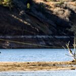
We are currently navigating a highly volatile shoulder season at an elevation of over 8,200 feet. Rapidly deteriorating ice conditions characterize the current state of the lake due to recent high-pressure warming trends. The main basin is opening up, and the rim ice where the frozen surface meets the shoreline is receding and rotting quickly. Water temperatures are hovering around a frigid 34 degrees Fahrenheit, meaning hypothermia is an immediate risk if you break through.
Safety Advisory: Mid-winter stability is gone. If you are attempting to fish the remaining hard water in sheltered bays, a spud bar is absolutely mandatory to test every single step. Waterproof boots and ice cleats are highly recommended due to slick, slushy surface conditions. If you spot dark patches or slush pools, avoid them entirely. The smartest play right now is transitioning to open-water shore casting near the inlets or the marina as the ice sheet recedes.
🎣Nautrek
Private Beta
J
M
R
100+ anglers on the waitlist
The fishing network where your reputation matters.
Find trusted captains, join real trips with cost splitting, and build your Angler Rank. Your spots stay private — you decide who sees your intel.
The high-altitude weather patterns play a crucial role in daily fish behavior. With daytime highs fluctuating and nighttime temperatures plummeting, the daily melt-and-freeze cycle creates a dynamic environment. On bluebird days with high barometric pressure, the fish tend to hold tighter to structure and require a slower, more methodical presentation. Conversely, when a low-pressure front approaches and cloud cover rolls in, the predators become willing to chase fast-moving hardware.
2. SPECIES INTEL
Based on recent biological ground truth data and on-the-water observations, the trout metabolism is beginning to shift as they prepare for the spring thaw.
Primary Target: Rainbow Trout
Rainbows, often affectionately called the eaters, are the most abundant and active species right now. You will find healthy stocker-class fish in the 12 to 16-inch range, alongside holdover footballs pushing 20 inches. Rather than hugging the deepest basins like they do in mid-winter, these fish are actively cruising transition zones and remaining weed lines to pack on calories.
Verified Cutthroat Presence
Recent citizen science biological data confirms that Rocky Mountain Cutthroat Trout are highly active in the regional watershed, with verified observations in nearby tributaries like the Kanarra Creek drainage. These native predators will begin staging near inlet flows as the spring melt accelerates.
Sleeper Pick: Tiger Trout
While most anglers are focused on the 10 to 15-foot depths, hybrid Tiger Trout are the ultimate shallow-water wolves. These aggressive predators often patrol the extreme shallows in 3 to 6 feet of water, utilizing the ice edge or shoreline structure to ambush prey. Pro Tip: Do not overlook the skinny water; a stealthy approach along the shoreline can yield the biggest catch of the day.
Baitfish Report
The primary forage driving the trophy bite consists of Utah Chubs and freshwater scuds. Larger Cutthroats and Tigers are aggressively hunting high-protein chub minnows, while the smaller Rainbows are grazing on scuds hidden in the decaying aquatic vegetation. Match the hatch by utilizing silver and blue profiles for chubs, or olive and black patterns to imitate scuds.
3. TACTICAL STRATEGY
Where to Deploy
Panguitch Lake features a diverse bathymetric profile that dictates fish movement during the shoulder season. The lake's northern shoreline features steeper contour lines, offering quick access to deep thermal refuges. In contrast, the southern and western shores present expansive, shallow flats that warm up faster under the midday sun. Focus your efforts on the North Shore boat ramp area near Wildlife Point, or the sheltered Marina bays. If you are shore casting into newly opened water lanes, target the 8 to 12-foot drop-offs where the shallow flats transition into the main basin. Fish the edges of the receding ice sheet, as trout will use the ice shelf as overhead cover to ambush baitfish being pushed into the open water.
Lure & Bait Selection
Hard Baits: A 1/4 ounce Kastmaster spoon in gold or silver/blue is highly effective for long casts into open water. If vertical jigging the remaining safe ice, a Rapala Jigging Rap (Size 5) in a natural chub pattern will trigger reaction strikes.
Finesse Jigs: For finicky fish, drop a 1/8 ounce tungsten teardrop jig in glow-white or chartreuse.
Bait & Rigging: Tipping your jigs with a small piece of sucker meat or a mealworm will drastically increase your hookup ratio. For shore anglers, floating a nightcrawler or garlic-scented PowerBait under a slip bobber just off the bottom remains a proven tactic.
Fly Fishing: For the long-rod enthusiasts, the ice-off period is a magical window. As the open water lanes expand, stripping streamers becomes incredibly effective. Utilize an intermediate sinking line to get your fly down into the strike zone. Black, olive, and brown leech patterns, or heavy bead-head Woolly Buggers, retrieved with erratic, jerky strips will imitate the struggling scuds and injured chubs perfectly.
Gear & Tackle Upgrades
When targeting the trophy-class Cutthroat and Tiger Trout, upgrading your fluorocarbon leader is non-negotiable. The crystalline waters of Panguitch Lake demand stealth, but the aggressive strikes from a 20-inch predator require strength. Run a mainline of 8-pound braided line joined to a 6-pound fluorocarbon leader via a Double Uni knot. This setup provides the sensitivity needed to detect light bites in 34-degree water while ensuring you have the abrasion resistance to navigate the jagged volcanic rock structures and remnant weed beds where the big fish lie in wait.
Timing the Bite
With frigid water temperatures, the early morning bite can be sluggish. Peak activity windows are occurring during the mid-day warming periods, particularly around early afternoon when the sun penetrates the shallows. Solunar data also points to a strong secondary bite window late in the evening. Pro Tip: Focus your heaviest casting efforts when the wind creates a slight chop on the open water, which breaks up the surface visibility and makes the trout less wary.
4. REGULATIONS SNAPSHOT
Panguitch Lake is managed as a premium trophy fishery, and strict adherence to the rules is required to maintain the exceptional quality of the Cutthroat and Tiger Trout populations.
Regulation Type
Rule Details
Daily Bag Limit
4 trout total (combined species).
Slot Limit
All Cutthroat and Tiger Trout between 15 and 22 inches MUST be immediately released.
Size Composition
Maximum of 2 Cutthroat or Tiger Trout under 15 inches; Maximum of 1 Cutthroat or Tiger Trout over 22 inches.
Rainbow Trout
No slot limit applies. Rainbows count toward the 4-fish total bag limit.
5. REGIONAL ALTERNATIVE
If you arrive at Panguitch Lake and find the transitional ice too dangerous to walk on, but too thick to cast through, do not force a bad situation. Pivot your trip eastward to save the day.
Backup Plan: Otter Creek Reservoir
Located roughly 45 minutes east of Panguitch, Otter Creek sits at a significantly lower elevation of 6,400 feet, meaning the ice comes off much earlier in the season. It generally offers wide-open water and highly accessible shore fishing during the early spring window.
Target Species: Rainbow Trout (abundant and aggressive).
Access Points: Tamarisk Point or the accessible shorelines near the main dam and campground.
Quick Tactic: Fan-cast silver casting spoons from the rocky points, or set up a bottom rig with a marshmallow and worm combo to float the bait just above the submerged vegetation.
Tight lines!
Editor's Choice: Must-Have Gear
FISHINGSIR Next-Gen Waterproof Chest Waders
★★★★★4.4 (7,370+ reviews)
2-Ply Tech: Upgraded nylon with 2.5x higher density than standard fabrics.
100% Waterproof: Lab-approved intrusion resistance with taped visible seams.
Ultra-Lightweight: Designed for all-day comfort while hunting or fishing.
As an Amazon Associate I earn from qualifying purchases. #ad
Loading forecast...
Live Fishing Conditions: Tides, Weather & Waves
Get real‑time tides, marine weather, swell and solunar activity for each spot so you know exactly when conditions line up for your best chance at a bite.
🎣
Panguitch Lake
Loading coordinates...
🌤️
WEATHER CONDITIONS
--°F
--°C
Loading...
🌡️
Feels Like--°F--°C
💧
Humidity--%
💨
Wind-- mph-- km/h
🧭
Direction--
📊
Pressure-- inHg-- hPa
☀️
UV Index--
🌊
MARINE CONDITIONS
🌊Wave Height
-- ft
-- m
Loading...
🧭Wave Direction
--°
Loading...
⏱️Wave Period
-- s
Loading...
📈Tide Status
-- ft
-- m
Loading...
🌙
LUNAR & SOLUNAR
🌕
Loading...
Illumination: --%
Major Period--:-- - --:----:-- - --:--
Minor Period--:-- - --:----:-- - --:--
🌅Sunrise--:--
🌇Sunset--:--
📅
24-HOUR FORECAST
Loading fishing conditions...
Fishing Spots Map
🎣
Book a Fishing Charter near Panguitch Lake Fishing Report Today 🎣
Local guides & charters. Verified captains, instant booking, best price guaranteed.
There was an error loading the map. Please try refreshing the page.
Info
Local Access & Facilities
The Alpine Trophy Fishery: Panguitch Lake
Situated high on the Colorado Plateau at a breathtaking elevation of 8,212 feet, Panguitch Lake is not merely a scenic stopover; it is a destination etched into the history of Utah angling. The name itself, derived from the Paiute language, translates literally to "Big Fish," a moniker that the water body continues to earn season after season. For the expert angler, this lake represents a unique hydrological environment where cool alpine waters fed by Blue Springs Creek, Clear Creek, and Ipson Creek create a thriving habitat for a diverse trout population. Unlike lower elevation reservoirs that suffer from summer thermal stress, Panguitch maintains the cool water columns necessary to support active feeding windows throughout the warmer months.
The atmosphere here is defined by the rugged beauty of the Dixie National Forest. The shoreline is framed by a dense canopy of ponderosa pines, creating a windbreak in certain coves while offering a classic mountain aesthetic. This is not a manicured urban fishery; it is a high-country experience where the air is thin, the water is crisp, and the bottom topography challenges even seasoned captains to read their sonar carefully. While the lake serves as the headwaters for Panguitch Creek, the primary draw remains the lake proper, where the potential for a "Trout Grand Slam"—landing Rainbow, Brook, Cutthroat, and Brown trout in a single session—draws serious sport fishermen from across the West.
Accessing this alpine gem requires navigating the high-altitude corridors of Southern Utah. Whether you are trailering a deep-V aluminum hull for trolling or packing light for a float tube session, understanding the logistical layout of the north and south shores is critical for a successful expedition. The infrastructure here is robust enough to handle heavy boat traffic but retains a rustic character that demands a degree of self-reliance, particularly regarding weather contingencies and supply management.
Access & Getting There
Reaching Panguitch Lake involves a scenic but steep drive, primarily utilizing Highway 143. For anglers approaching from the town of Panguitch, the commute is approximately 14 to 18 miles to the southwest. This route is generally well-maintained, but the significant elevation gain means vehicles towing heavy fiberglass boats should ensure their transmission coolers and braking systems are in top condition. The drive from Cedar City to the west is longer, roughly 55 miles, traversing through the spectacular geology near Cedar Breaks National Monument. This western approach offers stunning vistas but requires navigating winding mountain roads that can be slow-going with a trailer.
💡 Captain's Tip: High Altitude Trailering
At over 8,200 feet, naturally aspirated tow vehicles will lose significant horsepower. Allow extra time for the ascent up Highway 143, and monitor your transmission temperatures closely, especially during the summer heat. Downshifting early on the descent into the lake basin saves brakes for the boat ramp.
Boat Launch Logistics
The lake is serviced by two primary public boat ramps, strategically located to offer options depending on the prevailing winds. The North Shore Ramp, often associated with the Wildlife Point area, is a popular launch for larger vessels. It provides direct access to the deeper channels where large Browns often suspend. On the opposite side, the South Shore Ramp offers an alternative entry point. Experienced skippers know to assess the wind direction before committing to a ramp; strong afternoon winds can create significant chop, making retrieval difficult on the windward side. Both ramps are paved, but the water levels can fluctuate, so checking the end of the concrete during low water years is a prudent move before backing down.
Parking and Traffic Flow
Parking infrastructure around the lake is adequate but can reach capacity during peak salmonid runs. The Panguitch Lake North Campground features paved parking spurs, some accommodating rigs up to 40 feet, which is a luxury in high-alpine camping. Day-use parking at the ramps is available, but "dawn patrol" is the rule here; arriving after 8:00 AM on a summer Saturday often results in a long walk from the overflow areas. For those exploring the surrounding shorelines or tributaries, parking is available at nearby trailheads such as Golden Wall (17.5 miles away) and Thunder Mountain (17 miles away), though these are primarily used by hikers and OHV users.
Panguitch Lake Pre-Trip Checklist
Facilities & Amenities
The infrastructure at Panguitch Lake is designed to support multi-day fishing expeditions, though it lacks the full-service luxury of a commercial marina. The core of the overnight facilities is divided between the North and South shorelines, managed by the Dixie National Forest. Understanding the distinction between these facilities is vital for anglers traveling with RVs versus those looking for a primitive tent experience.
Campground Intelligence
The Panguitch Lake North Campground is the flagship facility for anglers requiring more robust amenities. It is the larger of the two, offering single and double campsites, as well as three group sites. Crucially for boat owners, the roads and parking spurs here are paved, reducing the dust and mud tracked into vessels. Amenities include flush toilets and drinking water. However, seasoned campers know the "negative knowledge" is just as important: there are no electrical, water, or sewer hookups at the sites. You must arrive with full freshwater tanks or fill them at the dump station located just east of the campground before setting up camp.
In contrast, the Panguitch Lake South Campground is strictly for tent camping and operates on a first-come, first-served basis. This area offers a quieter, more rustic experience but lacks the reservation security of the North side. For those preferring a river fishing experience, the White Bridge Campground is located approximately 3.9 miles away along Panguitch Creek. This site offers gravel spurs and a mix of shade structures, making it an excellent base camp for anglers targeting the moving water sections.
Facility Name
Type
Key Amenities
Max Vehicle Length
Boat Access
Panguitch Lake North
Campground
Flush Toilets, Paved Spurs, Dump Station
40 Feet
< 5 mins to ramp
Panguitch Lake South
Campground
Tent Only, Rustic
N/A (Tent)
On-site ramp
White Bridge
Campground
Vault/Flush Toilets, Creek Access
30-45 Feet
~6 miles to lake
Lodging and Supplies
For anglers who prefer a roof over their heads or need to resupply, the immediate area offers limited but essential services. Panguitch Lake townsite has accommodations, but for full hookups and resort-style amenities, many opt for Color Country Cabins and RV (approx. 14 miles away) or the Mammoth Creek RV Resort (approx. 8 miles away). The Dixie Forest RV Resort in Panguitch town serves as a reliable overflow option. It is critical to note that fuel docks are not standard features on the lake itself; captains should fuel their vessels on the highway in Panguitch or Cedar City before launching. A fish cleaning station is available near the public ramps, helping to keep campsites free of bear-attracting waste.
💡 Captain's Tip: Supply Chain Management
While basic supplies can be found locally, specialized tackle for deep-water trout trolling (like lead core line or specific downrigger weights) should be purchased in Cedar City or Panguitch town. The local general stores focus on bait and basic spinners.
Permits, Regulations & Fees
Fishing at Panguitch Lake is governed by the state fishing agency, and strict adherence to regulations is enforced to maintain the quality of this high-pressure fishery. The lake is famous for its "big fish," and slot limits or catch-and-release regulations may apply to specific species, particularly the native Cutthroat trout. Anglers must possess a valid Utah fishing license, which should be purchased online or at authorized dealers in Panguitch or Cedar City prior to arrival.
OHV and Access Restrictions
The area surrounding the lake is a hub for off-highway vehicle (OHV) usage, boasting access to the Markagunt OHV Trail System with over 300 miles of routes. However, within the campgrounds, strict rules apply. OHVs, including street-legal ATVs, are permitted for ingress and egress only. This means you may ride from your campsite directly to the trail or road, but "joyriding" within the campground loops is prohibited to preserve the peace for sleeping anglers. Furthermore, in the Panguitch Lake North Campground, all OHVs must be trailered; they cannot be ridden in or out of the facility, a regulation designed to reduce noise and dust.
Camping Fees and Reservations
The Dixie National Forest manages the campgrounds, and fees are required for overnight stays. Panguitch Lake North is reservable and highly recommended during the summer season when the cool mountain air draws crowds from the desert valleys. White Bridge is also reservable. Panguitch Lake South remains a non-reservable, first-come, first-served option, often filling up by Friday afternoon. A standard dump station fee may apply for those not camping within the paid facility.
Events & Seasonal Information
The rhythms of Panguitch Lake are dictated by its high altitude. The primary fishing season runs from late spring, after ice-out, through late autumn. Summer is the peak season, offering not just fishing but a respite from the heat. During July and August, the wildflower blooms at nearby Cedar Breaks National Monument (12-16 miles away) create a spectacular backdrop for the drive in. The lake is also a popular destination for ice fishing in the winter, though access depends heavily on snow plow schedules along Highway 143.
Daily Rhythms
Wind is the primary variable at 8,200 feet. The mornings are typically calm, offering the best conditions for fly anglers and small craft. By mid-morning, the thermal winds often kick up, creating chop that favors heavier trolling boats. Anglers targeting the shallow bays for cruising trout should plan their stalks for the first light. The lake does not host a high volume of professional tournaments compared to large reservoirs, but local derbies targeting Rainbow trout occur periodically.
Contact Information & Resources
For the most current information regarding campground status, ramp conditions, and fire restrictions, direct contact with the managing agencies is essential. The Dixie National Forest and the Cedar City Ranger District are the primary authorities for the land surrounding the lake.
Dixie National Forest / Cedar City Ranger District: 801-226-3564 or Help.Dixie.CedarCity@AmericanLL.com
Cedar Breaks National Monument: (435) 986-7120 (For nearby road conditions and park info)
Emergency Services: Dial 911. Note that cell service can be spotty in the deep canyons and heavy timber surrounding the lake.
Safety at this elevation is paramount. Weather can shift from sunny to hailing in under an hour. Always carry foul weather gear and be aware of the symptoms of altitude sickness if traveling rapidly from sea level. For precise boat ramp locations, real-time weather data, and nearby tackle shop locations, consult the live dashboard and interactive maps below.
Our spot reports combine data-driven forecasts with curated local information. The forecast is generated by our proprietary Fishing Score algorithm (0–100%), which analyzes real-time data from Open-Meteo API, validated against NOAA CO-OPS tide gauges and USGS water-monitoring stations. The model weights tide dynamics (35%), wave energy (25%), wind patterns (20%) and time of day (20%)—factors shown to influence fish feeding behavior through marine-biology research and decades of charter log data.
Access, facilities and services information for each fishing spot is sourced from official datasets such as Recreation.gov (RIDB), state park & wildlife agencies, and geospatial providers like Google Maps. These sections undergo scheduled re-validation every 3–6 months to ensure that boat ramps, park access, contact details and local services remain accurate.
Narrative sections (catches, seasonal behavior, local tips) are synthesized from these data sources and refined following the Fishing Reports Today editorial guidelines, combining bibliographic research from ichthyology and oceanography with expert angler experience. Our team reviews reports on a regular basis, while the forecast model itself updates every 6 hours for real-time accuracy.
⚠️ Important: Always verify current local regulations, access restrictions and weather conditions before fishing. These reports are intended as a planning aid, not a guarantee of catches or safety. When in doubt, contact local authorities or park managers listed on the page.
To provide the best experiences, we use technologies like cookies to store and/or access device information. Consenting to these technologies will allow us to process data such as browsing behavior or unique IDs on this site. Not consenting or withdrawing consent, may adversely affect certain features and functions.
Functional Always active
The technical storage or access is strictly necessary for the legitimate purpose of enabling the use of a specific service explicitly requested by the subscriber or user, or for the sole purpose of carrying out the transmission of a communication over an electronic communications network.
Preferences
The technical storage or access is necessary for the legitimate purpose of storing preferences that are not requested by the subscriber or user.
Statistics
The technical storage or access that is used exclusively for statistical purposes.The technical storage or access that is used exclusively for anonymous statistical purposes. Without a subpoena, voluntary compliance on the part of your Internet Service Provider, or additional records from a third party, information stored or retrieved for this purpose alone cannot usually be used to identify you.
Marketing & Affiliates
The technical storage or access is required to create user profiles to send advertising, or to track the user on a website or across several websites for similar marketing purposes, including affiliate tracking for products recommended in our reports.


Leave a Reply