Welcome to the comprehensive angler's guide for Lake Van Vliet, a premier 230-acre spring-fed waterbody nestled in Vilas County, Wisconsin. Known for its connection to the Presque Isle Chain—linking directly to Averill and Presque Isle Lakes—this relatively shallow system features a maximum depth of 20 feet and a mean depth of just 9 feet. Because it serves as the headwaters for the pristine Presque Isle River, subtle currents dictate both fish movement and structural integrity during the shifting seasons. The current transitional period requires anglers to pivot their strategies, focusing on specific habitats and species that remain active as the ecosystem awakens.
Go/No-Go Status
Verdict: CAUTION
Current seasonal shifts in the Northwoods demand extreme vigilance from all anglers. We are currently in a volatile transition period where structural integrity on the water is changing daily. The warming weather trends and increasing sun angles are rapidly altering surface conditions.
🎣Nautrek
Private Beta
J
M
R
100+ anglers on the waitlist
The fishing network where your reputation matters.
Find trusted captains, join real trips with cost splitting, and build your Angler Rank. Your spots stay private — you decide who sees your intel.
Safety Advisory: The shorelines are beginning to deteriorate, pulling away from the banks and creating hazardous entry and exit points. More importantly, the narrows connecting Lake Van Vliet to Presque Isle Lake and Averill Lake are experiencing increased current flow. This moving water erodes the surface from the bottom up, creating dangerously thin, honeycombed conditions even if the top layer appears solid. You must avoid these neck-down areas entirely.
Weather Impact: Fluctuating atmospheric pressure and mid-day warming are softening the access points. If you are venturing out, early morning is the only viable window while overnight freezing temperatures temporarily lock the surface. Pro Tip: Keep a lightweight spud bar and wearable safety picks on your person at all times during this transitional season, and strongly consider wearing a specialized buoyant float suit.
Species Intel
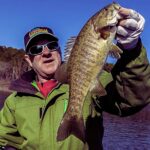
Primary Target: Bull Bluegill and Black Crappie
With the inland gamefish seasons closed to protect spawning populations, the spotlight shines brightly on Lake Van Vliet's robust panfish fishery. The bluegills and crappies are currently in a heavy feeding pattern, aggressively gorging to build energy reserves for their own upcoming spawn. Because the lake is relatively shallow, these fish do not have to travel far from their deep-water wintering holes to find the mid-depth vegetation where food is abundant.
Sleeper Pick: Yellow Perch
While most anglers are busy staring at suspended crappies, the jumbo yellow perch are quietly roaming the bottom transitions. They are heavily utilizing the mud-to-weed transition lines in 12 to 14 feet of water, vacuuming up aquatic insects. These perch are often overlooked but can provide some of the heaviest stringers of the day.
Baitfish Report
The primary forage right now consists of micro-invertebrates. Bloodworms, freshwater shrimp (scuds), and emerging insect larvae are the main course. There is very little minnow-chasing happening at this stage. To be successful, your presentation must meticulously match the size and profile of these tiny aquatic insects.
Tactical Strategy
Where to Deploy
Begin your systematic search at the south shore boat landing located off Crab Lake Road. From the public access, push directly toward the 6 to 10-foot weed flats that dominate the southern and eastern shorelines. Because Lake Van Vliet lacks deep-water sanctuary, these mid-depth flats constitute the primary holding zones. You are looking specifically for remaining stands of broadleaf cabbage. Pro Tip: Use an underwater camera to distinguish between living green weeds—which produce oxygen and attract the entire food chain—and decaying brown weeds, which actively deplete oxygen and repel fish.
Gear and Lure Selection
Leave the heavy gear at home. You need an ultra-light, noodle-tip rod paired with 2-pound test fluorocarbon line. The bite is incredibly subtle, often registering as a mere upward lift rather than a pull.
Tie on a 1/64-ounce or 1/32-ounce tungsten teardrop jig. Tungsten is non-negotiable for this application; its high density allows you to punch through slush or weed tops quickly while maintaining the micro-profile that finicky panfish demand. Given the slightly tannin-stained nature of these Vilas County waters, high-contrast colors are essential. Metallic gold, bright pink, or a glow-white and chartreuse combination will stand out perfectly against the darker bottom and vegetation.
Bait and Rigging
Tip your tungsten jig with a single live wax worm, hooking it delicately through the tail to maximize its natural wriggle. If you prefer artificial options, dark red micro-plastics that imitate bloodworms are incredibly effective. Pro Tip: Upsize your plastic tail rather than your jig weight to artificially slow the fall rate. A slow-falling, horizontal presentation mimics a dying scud perfectly and often triggers strikes from the largest, most educated bluegills in the school.
Timing the Bite
Focus your primary efforts on the late afternoon power hour. As the sun reaches its peak and begins to dip toward the horizon (roughly 4:00 PM until dusk), the shallow water warms by a fraction of a degree. This microscopic temperature bump triggers a massive spike in invertebrate activity, which in turn flips the feeding switch for crappies and bluegills.
Regulations Snapshot
Always verify with the local Wisconsin Department of Natural Resources postings at the boat ramp, as emergency rules can be enacted. However, here are the baseline spring regulations for the Presque Isle Chain, which includes Lake Van Vliet:
If the shoreline access at Lake Van Vliet is blown out, or if the wind and current make conditions unsafe or unfishable, do not force the issue. Instead, pack up and take the short drive to Oxbow Lake, located nearby within Vilas County.
Oxbow Lake is significantly smaller and features a highly convoluted, heavily wooded shoreline that provides excellent protection from prevailing winds. Because it lacks the river-flow dynamics of the Presque Isle Chain, its water column is much more stable during seasonal transitions. Access the water from the public launch and immediately target the steep, sunken timber drop-offs in 12 to 16 feet of water. Black crappies stack up heavily on this wood structure. Utilize the exact same tungsten and micro-plastic presentations, but rely on your electronics to locate the suspended schools holding tight to the submerged branches. Work your jig slowly down to the fish, stopping just above them to force them to rise and strike.
Tight lines!
Editor's Choice: Must-Have Gear
FISHINGSIR Next-Gen Waterproof Chest Waders
★★★★★4.4 (7,370+ reviews)
2-Ply Tech: Upgraded nylon with 2.5x higher density than standard fabrics.
100% Waterproof: Lab-approved intrusion resistance with taped visible seams.
Ultra-Lightweight: Designed for all-day comfort while hunting or fishing.
As an Amazon Associate I earn from qualifying purchases. #ad
Loading forecast...
Live Fishing Conditions: Tides, Weather & Waves
Get real‑time tides, marine weather, swell and solunar activity for each spot so you know exactly when conditions line up for your best chance at a bite.
🎣
Lake Van Vliet, Wisconsin
Loading coordinates...
🌤️
WEATHER CONDITIONS
--°F
--°C
Loading...
🌡️
Feels Like--°F--°C
💧
Humidity--%
💨
Wind-- mph-- km/h
🧭
Direction--
📊
Pressure-- inHg-- hPa
☀️
UV Index--
🌊
MARINE CONDITIONS
🌊Wave Height
-- ft
-- m
Loading...
🧭Wave Direction
--°
Loading...
⏱️Wave Period
-- s
Loading...
📈Tide Status
-- ft
-- m
Loading...
🌙
LUNAR & SOLUNAR
🌕
Loading...
Illumination: --%
Major Period--:-- - --:----:-- - --:--
Minor Period--:-- - --:----:-- - --:--
🌅Sunrise--:--
🌇Sunset--:--
📅
24-HOUR FORECAST
Loading fishing conditions...
Fishing Spots Map
🎣
Book a Fishing Charter near Lake Van Vliet, Wisconsin Fishing Report Today 🎣
Local guides & charters. Verified captains, instant booking, best price guaranteed.
There was an error loading the map. Please try refreshing the page.
Info
Local Access & Facilities
The Northwoods Experience at Lake Van Vliet
Situated in the heart of Wisconsin's renowned Presque Isle region, Lake Van Vliet offers the quintessential Northwoods angling experience. This is not a high-traffic urban reservoir; it is a glacial gem surrounded by the dense timber and serenity that defines Katinka Village. For the serious angler, the appeal here lies in the solitude and the structure. The topography of the surrounding area suggests a fishery that rewards patience and precision, far removed from the pressure of commercialized waters.
The atmosphere at Lake Van Vliet is defined by its remoteness. Anglers arriving here are greeted by the scent of pine and the distinct quiet that only comes with distance from major interstates. Unlike the manicured harbors of the Great Lakes, the water here feels intimate yet wild. It is a destination for those who prefer the sound of a drag screaming over the noise of jet skis. The shoreline is largely undeveloped compared to southern reservoirs, offering a backdrop that feels prehistoric in the early morning mist.
Targeting game fish in this region requires a mindset shift. The water clarity and structure in the Presque Isle chain typically demand lighter fluorocarbon leaders and a stealthy approach. Whether you are chasing the elusive top-water bite at dusk or working deep weed lines midday, the facility of the local geography dictates your strategy. This is a place where reading the water—and the weather—is just as important as the lure on your line.
💡 Captain's Tip: Digital Preparation is Mandatory
Cellular service in Katinka Village and the surrounding Presque Isle area can be spotty to non-existent. Download all bathymetric maps, weather apps, and the Recreation.gov mobile app before you leave the highway. You will need offline access to navigate and pay for amenities once you are on the water.
Access & Getting There
Reaching Lake Van Vliet requires navigating the winding county roads of Northern Wisconsin. The primary access routes through Katinka Village are scenic but require vigilance, particularly for those towing larger bay boats or fiberglass multi-species rigs. The roads are paved but narrow, with limited shoulders. Anglers should anticipate slower travel times than GPS estimates suggest, especially during the early morning hours when wildlife is active near the tarmac.
Boat launch facilities in the immediate vicinity are functional and designed for serious use. The primary Presque Isle Boat Landing is located approximately 2.1 miles from the central lake area. This facility offers trailer parking, which is a critical asset in a region where roadside parking is often impossible due to dense forestry. There is also a closer, unnamed launch point roughly 0.5 miles (2,882 feet) from the main fishing grounds. Seasoned skippers know to scout this closer ramp first; if the grade is steep or the water level is low, the Presque Isle landing serves as the reliable heavy-duty alternative.
Parking logistics here are generally manageable, but capacity is finite. The ramps are not designed for massive tournament fleets. Arriving before sunrise is not just a fishing strategy; it is a parking necessity on weekends. The White Sand Boat Landing offers parking further out (11.4 miles away), but for direct access, you rely on the immediate ramp lots. Ensure your trailer lights and bearings are in top condition, as the nearest major repair shop is a significant drive away in Woodruff or Mercer.
Weather plays a massive role in accessibility. The Northwoods are subject to rapid shifts in wind direction. A calm morning can turn into a chop that makes loading a boat solo difficult at exposed ramps. When the wind kicks up, the smaller, more secluded access points often offer better protection than the main landings. Always have a contingency plan for retrieval if the wind shifts to blow directly onto the ramp.
Lake Van Vliet, Wisconsin Pre-Trip Checklist
Facilities & Amenities
The infrastructure around Lake Van Vliet is characterized by rustic efficiency rather than luxury. You will not find expansive marinas with fuel docks and restaurants on the water. Instead, the area relies on specialized local businesses. The most critical logistical asset for anglers is Anglers Choice Guide Service, located a mere 1,485 feet from the water on W Van Vliet Rd. This proximity is a game-changer. Opening at 6:00 AM, it allows captains to grab live bait or replacement tackle without burning valuable fishing time driving into town.
Accommodations in the immediate area cater to the self-sufficient sportsman. Loew's Timber Lost Cottages is located just 4.2 miles away, offering a comfortable base of operations for multi-day trips. For those seeking a more resort-style experience, Pinehurst Resort is about 23 miles out, while Peninsula Pines Resort & Campground is roughly 22 miles away. The trade-off for staying closer to the water at places like Loew's is the ability to maximize time on the lake during the prime dawn and dusk windows.
It is vital to note the "negative knowledge"—what is missing. There is no on-water fuel service listed for the immediate lake area. Captains must ensure their tanks are topped off at gas stations in Presque Isle or Manitowish Waters before launching. Running out of fuel here means a long drift or a difficult solicitation for a tow. Additionally, while there are restrooms listed 7 to 10 miles away, immediate facilities at the smaller ramps may be primitive or non-existent. Plan accordingly.
💡 Captain's Tip: The Bait Shop Advantage
Anglers Choice Guide Service opens at 6:00 AM sharp. This is your best source for real-time intelligence. The staff here know the current bite better than any online report. Stop in not just for bait, but to ask about water clarity changes and recent hatch activity.
For those looking to camp, the options are rugged and require technological foresight. Moosehead Lake Camp (8 miles), Henry Lake Camp (9.6 miles), and Pomeroy Lake Camp (10.6 miles) are the primary camping facilities. These are not full-service RV parks with hookups; they are focused on nature and access. They operate on a first-come, first-served basis, which aligns with the spontaneous nature of many fishing trips, but the payment system is strictly digital.
Permits, Regulations & Fees
Fishing in this part of Wisconsin is governed by the State Fishing Agency. Compliance is not just a legal requirement but a cultural one; the local angling community is deeply protective of the fishery's health. Conservation officers patrol these waters, and ignorance of slot limits or bag limits is not an accepted excuse. Because Lake Van Vliet is part of a larger chain and ecosystem, specific regulations regarding bait transport and invasive species are strictly enforced to protect the water quality.
The camping fee structure at the nearby federal and state campgrounds (Moosehead, Henry, Pomeroy) utilizes a "Scan and Pay" system. This is a critical detail for trip planning. Visitors must physically arrive at the campground to claim a site, but payment is processed via a QR code and the Recreation.gov mobile app. Crucially, you must download this app and set up your account while you still have Wi-Fi or strong cellular data. Once you are at the campsite, signal may be too weak to download the app, leaving you unable to pay for your spot legally.
While there are no specific permit fees listed for the boat ramps themselves, it is standard practice in Wisconsin to display a valid boat registration and trailer plates. If you are accessing shore fishing spots, respect private property lines. The shoreline is a mix of public access and private holdings; utilize the designated access points to maintain good standing with the local landowners.
Events & Seasonal Information
The rhythm of Lake Van Vliet is dictated by the hard seasons of the North. The open-water season is relatively short, intense, and highly productive. Spring brings the post-spawn feed, where fish move into the shallows. Summer pushes the fish to deeper structures and weed edges, requiring better electronics and boat control. Fall is the trophy season, where seasoned anglers brave freezing temperatures for the chance at the heaviest fish of the year before the ice sets in.
While specific tournament schedules vary annually, the Presque Isle region is known for attracting serious sport fishermen. If you plan to visit during peak summer weekends, be aware that boat traffic increases significantly. However, the "dawn patrol" remains sacred; getting on the water before 6:00 AM usually guarantees you the prime spots before the recreational crowds emerge. The wind patterns generally pick up by mid-morning, so the first four hours of daylight are often the most fishable.
💡 Captain's Tip: Mid-Day Logistics
When the sun is high and the bite slows down, utilize the local guide services like Bobber Down or Rodbenders for networking. Even if you are fishing your own boat, observing where the local charter fleet concentrates their efforts can give you clues about the thermocline depth and baitfish movement.
Contact Information & Resources
Self-reliance is the rule of the road in Katinka Village. Emergency response times can be longer than in urban areas due to the rural road network. For immediate emergencies, standard 911 services apply, but always have a backup communication plan. For camping issues or specific land access questions, the managing agencies for Moosehead and Henry Lake camps are the primary points of contact, though they often operate remotely.
For the most current information on water levels and ramp conditions, local bait shops like Anglers Choice are your unofficial harbor masters. They have eyes on the water daily. Additionally, keeping the number for local towing or marine repair services in your phone is a wise precaution given the distance to major service centers like S&B Asphalt in Woodruff for trailer issues.
For precise locations of the boat ramps, detailed depth contours, and real-time weather conditions, consult the live dashboard and interactive maps below.
Our spot reports combine data-driven forecasts with curated local information. The forecast is generated by our proprietary Fishing Score algorithm (0–100%), which analyzes real-time data from Open-Meteo API, validated against NOAA CO-OPS tide gauges and USGS water-monitoring stations. The model weights tide dynamics (35%), wave energy (25%), wind patterns (20%) and time of day (20%)—factors shown to influence fish feeding behavior through marine-biology research and decades of charter log data.
Access, facilities and services information for each fishing spot is sourced from official datasets such as Recreation.gov (RIDB), state park & wildlife agencies, and geospatial providers like Google Maps. These sections undergo scheduled re-validation every 3–6 months to ensure that boat ramps, park access, contact details and local services remain accurate.
Narrative sections (catches, seasonal behavior, local tips) are synthesized from these data sources and refined following the Fishing Reports Today editorial guidelines, combining bibliographic research from ichthyology and oceanography with expert angler experience. Our team reviews reports on a regular basis, while the forecast model itself updates every 6 hours for real-time accuracy.
⚠️ Important: Always verify current local regulations, access restrictions and weather conditions before fishing. These reports are intended as a planning aid, not a guarantee of catches or safety. When in doubt, contact local authorities or park managers listed on the page.
To provide the best experiences, we use technologies like cookies to store and/or access device information. Consenting to these technologies will allow us to process data such as browsing behavior or unique IDs on this site. Not consenting or withdrawing consent, may adversely affect certain features and functions.
Functional Always active
The technical storage or access is strictly necessary for the legitimate purpose of enabling the use of a specific service explicitly requested by the subscriber or user, or for the sole purpose of carrying out the transmission of a communication over an electronic communications network.
Preferences
The technical storage or access is necessary for the legitimate purpose of storing preferences that are not requested by the subscriber or user.
Statistics
The technical storage or access that is used exclusively for statistical purposes.The technical storage or access that is used exclusively for anonymous statistical purposes. Without a subpoena, voluntary compliance on the part of your Internet Service Provider, or additional records from a third party, information stored or retrieved for this purpose alone cannot usually be used to identify you.
Marketing & Affiliates
The technical storage or access is required to create user profiles to send advertising, or to track the user on a website or across several websites for similar marketing purposes, including affiliate tracking for products recommended in our reports.


Leave a Reply