
Jupiter Pre-Trip Checklist
Local Access & Facilities
Jupiter, Florida, sits at a legendary convergence where the dark, tannin-stained waters of the Loxahatchee River meet the crystal-clear influx of the Atlantic Ocean. For the serious angler, this isn't just a picturesque coastal town; it is a tactical choke point on the Treasure Coast where inshore, nearshore, and offshore fisheries collide. The geography here is defined by the Jupiter Inlet, a dynamic gateway that demands respect, and the sprawling Indian River Lagoon system that offers miles of mangrove-lined backcountry. The atmosphere is a unique blend of high-end nautical luxury and rugged, historic Florida conservation land.
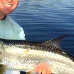
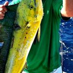
The area is dominated by the Jupiter Inlet Lighthouse Outstanding Natural Area (ONA), a 120-acre federally managed site that serves as both a historic beacon and a critical access point for watermen. Unlike the manicured concrete harbors found further south in Miami, Jupiter retains a connection to "Old Florida," with vast stretches of protected sand pine scrub and undeveloped beaches. The primary draw here varies by season, but the constant presence of the Gulf Stream just a few miles offshore makes this a premier launching ground for pelagic hunters, while the river system holds legendary Snook and Tarpon populations.
Navigating Jupiter requires an understanding of its dual nature: the urbanized corridors of Highway 1 and the protected sanctuaries managed by federal agencies. Whether you are trailering a skiff for a backcountry mission in the Hobe Sound National Wildlife Refuge or looking for a deep-water slip for a sportfisher, the logistics here are specific. The facilities range from primitive, nature-first access points to full-service marinas capable of handling heavy tournament traffic. Understanding where these two worlds meet is the key to a successful campaign in these waters.
💡 Captain's Tip: Tides Matter Here
The Jupiter Inlet is notorious for its swift currents. When fishing the confluence of the Loxahatchee and the ocean, seasoned skippers know that the outgoing tide can stack up steep waves against an incoming swell. Always time your passage and your bridge fishing sessions around the slack tides for safety and better predator positioning.
Access & Getting There
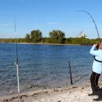
Accessing the prime fishing grounds of Jupiter revolves primarily around U.S. Highway 1 and State Road 707. For anglers towing vessels, the traffic flow on US-1 can be heavy, particularly during the winter season. The primary gateway to the historic fishing grounds near the inlet is via South Beach Road (S.R. 707). From Federal Highway 1, turning east onto South Beach Road leads directly toward Jupiter Island. This route is critical for accessing the Jupiter Inlet Lighthouse Outstanding Natural Area. The roads here are well-maintained, but the proximity to the inlet means salt spray and sand accumulation are constant factors on the pavement.
For those launching small craft or kayaks, the Jupiter Inlet Lighthouse ONA offers specific logistical realities. The site is located at the confluence of the Loxahatchee River and Indian River Lagoon, just 1.5 miles from the Atlantic. While there are hardened trails and boardwalks that facilitate shore access and gear transport, this is a protected natural area. You won't find acres of empty asphalt for trailer parking here; the focus is on low-impact usage. The terrain includes native Florida coastal habitats, so be prepared to carry gear over boardwalks rather than backing a truck right up to the water's edge in some sections.
Parking in Jupiter requires a strategic approach, especially for those with trailers. Via Valet, located on South Old Dixie Highway, is a known parking facility, but local intelligence suggests avoiding this spot if you are hauling a trailer. For the surf caster or pier angler, the parking lot at 1021-1027 Ocean Blvd is a strategic asset; it is open 24 hours a day, allowing for true "dawn patrol" missions or late-night shark fishing sessions without the fear of being towed. Another reliable lot is located at 901 FL-706. Always verify signage, as restrictions can change seasonally.
Weather plays a massive role in accessibility here. The area is exposed to the Atlantic trade winds. When the Easterly trades exceed 15 knots, the inlet can become treacherous, and shore casting becomes a battle against the wind. In these conditions, smart anglers retreat to the leeward side of the Hobe Sound National Wildlife Refuge or the protected waters of the St. Lucie Canal. The St. Lucie South facility, located inland on the Okeechobee Waterway, serves as an excellent fallback point or primary launch for freshwater and brackish excursions when the ocean is blown out.
💡 Captain's Tip: Trailer Strategy
Parking fills up fast in Jupiter, especially on weekends. While Via Valet is rated highly, it is not trailer-friendly. For extended trailer parking, consider the facilities further inland or ensure you arrive at public ramps well before sunrise to secure a spot that accommodates your rig's length.
Facilities & Amenities
Jupiter's infrastructure caters to a mix of heavy-tackle offshore anglers and technical inshore fly fishermen. The bait and tackle landscape is robust. The standout resource for the serious angler is Reel Floridian Fishing, located right on U.S. Route 1. Crucially, this shop operates 24 hours a day on many days (check current schedules), making it the absolute hub for buying live bait, ice, and terminal tackle before a pre-dawn launch. For those situated further inland or west, American Bait LLC in West Palm Beach opens at 6:30 AM and offers a reliable alternative for stocking up before heading to the coast.
When it comes to marine services and charters, the caliber of the local fleet is high. Reel Floridian Fishing also runs charters directly from the area, specializing in the local waters. For those looking for heavy offshore game, Stuart Big Game Fishing (located about 16 miles north in Stuart) is a regional heavyweight known for targeting sailfish and marlin. Reel Intense Fishing Charters out of Riviera Beach is another solid option for those willing to drive a few miles south. These operations are accustomed to serious clients and generally provide top-tier gear and local knowledge.
Accommodation for the traveling angler goes beyond standard hotels. The St. Lucie South Campground is a hidden gem for boat owners. It offers specific "Cruiser sites" designed for boat campers, along with standard RV sites equipped with 50-amp electric and water hookups. This allows you to keep your vessel right at the campground, which is situated on the St. Lucie Canal. For a more terrestrial but unique experience, Timberline Glamping Jupiter in Hobe Sound offers a comfortable base camp that bridges the gap between camping and a hotel stay. If you need standard tent camping, the Kitching Creek Campground is a reliable nearby option.
It is important to note what is missing to avoid logistical headaches. While the Jupiter Inlet Lighthouse ONA is a world-class natural site, it is not a commercial marina. Do not expect fuel docks, ice machines, or fish cleaning stations at the ONA itself. You must fuel up and ice up at commercial stations on Highway 1 before entering the natural area. Similarly, the Hobe Sound National Wildlife Refuge is a sanctuary; there are no commercial concessions inside the refuge. Bring every ounce of water, fuel, and bait you need for the day.
Key Facility Data
| Facility Name | Type | Key Features | Contact |
|---|---|---|---|
| St. Lucie South | Campground / Boat Access | Waterfront RV sites, Cruiser boat sites, 50-amp electric, boat slips, lock access. | 772-287-1382 |
| Jupiter Inlet Lighthouse ONA | Rec Area / Access | Hiking trails, shoreline access, historic site, kayak launch suitable. | 601-331-7407 |
| Hobe Sound NWR | Wildlife Refuge | Surf fishing, nature trails, undeveloped beach access. | 772-546-6141 |
| Indiantown Marina | Marina | Lake Okeechobee access, camping, water sports support. | (See Local Directory) |
Permits, Regulations & Fees
Fishing in the Jupiter area requires navigating a patchwork of federal and state jurisdictions. The primary regulatory body for fishing licenses and bag limits is the State Fishing Agency. However, because much of the prime access lies within federal lands like the Jupiter Inlet Lighthouse ONA (managed by the Bureau of Land Management) and the Nathaniel P. Reed Hobe Sound National Wildlife Refuge (managed by the U.S. Fish and Wildlife Service), additional rules apply. These overlays are not just bureaucratic; they exist to protect sensitive resources like the sand pine scrub communities and the sea turtle nesting grounds.
At the Hobe Sound National Wildlife Refuge, specific "Kapu" or restrictions are strictly enforced to protect the largest contiguous section of undeveloped beach in Southeastern Florida. This area is one of the most productive sea turtle nesting sites in the region. Consequently, night fishing from the beach may be restricted or heavily regulated during nesting season to prevent light pollution from disorienting hatchlings. Anglers must respect all signage regarding dune crossings; walking on the dunes destroys the vegetation that stabilizes the beach, leading to erosion that threatens the fishery itself.
The St. Lucie South area involves the U.S. Army Corps of Engineers, as it sits on the Okeechobee Waterway. If you are locking through the St. Lucie Lock, there are specific safety protocols and potential fees for commercial vessels, though recreational passage is generally facilitated smoothly. Boaters utilizing the mooring balls or slips at the campground (specifically sites like "Boat Site 03") must adhere to length restrictions—up to 40 feet for moorings and 45 feet for RV sites. Always verify the current fee structure for overnight mooring, as these federal recreation fees can change.
💡 Captain's Tip: Lock Safety
When transiting the St. Lucie Lock, have your fenders deployed and lines ready on both port and starboard sides before you enter the chamber. The lock operators control the show; follow their instructions explicitly to avoid damage to your vessel or fines.
Events & Seasonal Information
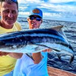
The rhythm of fishing in Jupiter is dictated by the seasons and the biological clock of the local fauna. The winter months bring the renowned sailfish migration, attracting tournament teams from across the globe to the "Sailfish Alley" just offshore. During this time, the inlet can be busy with high-end sportfishers heading out at dawn. Conversely, the summer months shift the focus to the beaches and the Snook spawn in the inlet. This is when the Hobe Sound National Wildlife Refuge becomes a critical habitat, and anglers must be hyper-aware of turtle nesting activity.
Daily timing is critical. The trade winds typically pick up by 10:00 AM, making the inlet rougher and sight-fishing on the flats more difficult. The "dawn patrol" is standard operating procedure here. Shops like Reel Floridian Fishing catering to the 24-hour crowd is a testament to the nocturnal and early-morning habits of the local pro community. If you are targeting the spillways or the inlet for Snook, the moving tide—specifically the outgoing tide flushing bait out of the Loxahatchee—is the prime window, regardless of the time of day.
Contact Information & Resources
For the most up-to-date information on access conditions, it is best to contact the managing agencies directly. The Jupiter Inlet Lighthouse Outstanding Natural Area can be reached at 601-331-7407 or via email at pdewitt@blm.gov. For inquiries regarding beach access and refuge rules, contact the Nathaniel P. Reed Hobe Sound National Wildlife Refuge at 772-546-6141 or HobeSound@fws.gov. Campers and boaters heading to the canal should call St. Lucie South at 772-287-1382.
Safety is paramount. The Jupiter Inlet is dynamic and can be dangerous. There is no substitute for real-time observation. In an emergency, standard marine VHF channels should be monitored, and local law enforcement on the water is active. For precise locations, real-time weather data, and detailed charts of the boat ramps and tackle shops mentioned, consult the live dashboard and interactive maps below.


Leave a Reply