
The Crossroads of the Keys
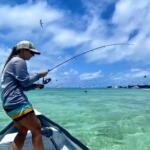
Islamorada sits at a distinct geographical pinch point in the Florida Keys, earning its reputation among serious anglers as a dual-threat fishery. To the south and east, the deep blue waters of the Atlantic Ocean offer access to the Gulf Stream, while to the north and west lies the shallow, grassy expanse of Florida Bay and the Everglades backcountry. This unique positioning allows captains to target sailfish in the morning and stalk bonefish or tarpon in the afternoon, all from the same slip. The atmosphere here is less about manicured resort life and more about the rugged utility of sportfishing; the scent of diesel and salt air is prevalent, and the local rhythm is dictated by the tide charts rather than happy hour.
For the traveling angler, the terrain is defined by the Overseas Highway, which bisects the islands. The water here is dynamic, ranging from the crystal-clear flats of the backcountry to the coral-studded reefs just a few miles offshore. While the visual beauty is undeniable, the logistical reality for boat owners can be challenging due to limited public infrastructure. Understanding the nuances of where to launch, where to park a trailer, and how to access the distinct bodies of water is essential for a successful campaign in these islands.
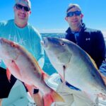
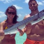
The primary game fish driving the local economy are highly seasonal and diverse. Offshore enthusiasts chase mahi-mahi and billfish, while the inshore crowd is strictly focused on the "big three" of the flats: tarpon, permit, and bonefish. Because this location serves as a gateway to the Everglades National Park boundaries, the biodiversity is immense, but so is the pressure on the fishery. Success here requires not just gear, but a strategic understanding of local access points and the often-complex navigational hazards of the shallows.
Access & Getting There
Reaching this fishery invariably involves traversing the Overseas Highway (US 1). While the drive is scenic, veteran captains know that traffic bottlenecks can be severe, particularly on weekends or during the high season. When towing a boat, patience is required, as passing lanes are infrequent. The highway is the main artery for all logistics, and most key facilities are located directly off this road. Navigating a heavy trailer into some of the tighter parking lots requires situational awareness, as the shoulder space is often non-existent.
Public launch facilities in the immediate vicinity are surprisingly scarce and present significant challenges for larger vessels. The primary data highlights a location at Upper Matecumbe Key - Blackwood Road, but it is flagged as a "Primitive Launch Site" and explicitly "Not Recommended." This is a critical detail for anyone towing a fiberglass boat; this site is likely suitable only for kayaks or very small skiffs, and attempting to launch a bay boat here could result in trailer damage or getting stuck. Serious boaters often have to rely on private marina ramps, such as the one listed at La Siesta Resort Bayside Marina. However, access here is not guaranteed; you must call ahead to confirm availability, as many resort ramps are restricted to guests or charge substantial fees.
💡 Captain's Tip: Trailer Warning
Avoid the Blackwood Road primitive launch if you are towing anything larger than a canoe. The "Not Recommended" status in local data usually implies soft sand, steep drops, or lack of turnaround space. Secure a launch slip at a private marina well in advance.
Weather plays a massive role in accessibility here. The islands are exposed to trade winds that can whip up the Florida Bay into a confused chop, making the crossing to the backcountry punishing for smaller skiffs. Conversely, an east wind can stack up swell on the Atlantic side, closing off the ocean inlets. When planning your launch, consider the wind direction relative to the island chain. The "Lee" side changes depending on the season, and having a flexible launch plan—or a boat capable of handling the run—is standard operating procedure for locals.
Parking for trailers is another logistical hurdle. Most dedicated parking areas, such as the Long Key State Park Parking Area (approximately 14.5 miles away) or the 97450 Overseas Highway Parking, do not explicitly guarantee overnight trailer storage. The BIRDSPOTS lot in Tavernier is roughly 11 miles away. Consequently, if you are not staying at a property with dedicated trailer parking, like the Bayfront RV Park, you must secure your rig's safety. Trailer theft is a known issue in the Keys; always use tongue locks and wheel boots if leaving your trailer unattended in a public lot.
Islamorada Pre-Trip Checklist
Facilities & Amenities
The infrastructure in this area caters heavily to the serious sportfishing community. Unlike general tourist destinations, the shops here understand the "dawn patrol" schedule. A standout resource is Tackle Center Charters, located just 1.6 miles from the center of the action. Crucially, this location is listed as open 24 hours. For captains needing fresh bait, leader material, or emergency terminal tackle at 4:00 AM, this is an invaluable asset. Similarly, Don't Touch The Bait in Key Largo (about 16 miles north) also operates on a 24-hour schedule, serving as a perfect pit stop for anglers driving down from the mainland.
The charter fleet here is world-class, with operators like Skins and Fins Charters located mere feet from the highway, and Florida Keys Fun Fishing within a two-mile radius. These are not just tourist rides; they are specialized operations. DirtyBoat Charters and Coastal Outfitters Sport Fishing Charters round out a roster of high-caliber options. When selecting a charter, note that specialization varies; some crews focus exclusively on the technical poling of the flats, while others are geared for heavy offshore trolling. The proximity of these fleets suggests a high availability of local knowledge, and visiting anglers can often pick up updated reports just by walking the docks in the late afternoon.
💡 Captain's Tip: The 24-Hour Advantage
With Tackle Center Charters open 24 hours, there is no excuse for hitting the water without fresh bait. However, prime live bait (crabs, shrimp) sells out fast during the tarpon run. Call ahead or stop in the night before to reserve your allotment.
Accommodation options listed in the data reflect the boat-centric culture. Bayfront RV Park and Sun Outdoors Islamorada are popular with anglers towing their own vessels, offering the critical advantage of on-site parking and hose-down facilities. For those seeking standard lodging, the Coconut Palm Inn in Tavernier offers a nearby alternative. It is worth noting that while fuel is generally available at major marinas, the data does not explicitly list a dedicated public fuel dock at the primitive ramps. Captains should plan to fuel up their vessels while on the trailer at highway gas stations to avoid the premium prices and limited hours of water-accessible pumps.
One notable facility mentioned in the regional data is the Guy Bradley Visitor Center (at Flamingo) and the Flamingo Campground. It is vital to understand the geography here: while listed in the dataset, Flamingo is physically located across Florida Bay, deep within Everglades National Park. It is roughly 24 miles away by boat or a massive detour by car. For an angler in Islamorada, Flamingo represents a destination to fish towards, not a convenient spot to buy ice before launching. It serves as the outpost for the backcountry, offering a marina store and fish cleaning station for those who make the long run across the bay.
Permits, Regulations & Fees
Fishing in these waters requires strict adherence to regulations managed by the State Fishing Agency. The region is heavily patrolled, and ignorance of the rules is not a valid defense. Because this spot sits on the border of state waters and the Everglades National Park, boundaries can be invisible but legally significant. If your drift takes you into Park waters (towards Flamingo), specific park regulations regarding gear types, bag limits, and boating safety gear apply. You may need a specific park pass or permit in addition to your standard state saltwater license.
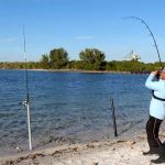
Conservation is a cultural pillar here. The area is famous for its catch-and-release ethic regarding bonefish and tarpon. Handling practices are scrutinized; keeping fish in the water for photos is the standard expectation. Additionally, there are specific protected zones and "no-motor" zones across the flats designed to protect the seagrass beds. Propeller scarring on the flats is a serious offense that carries heavy fines. If you are unfamiliar with the shallow water navigation channels, idle your engine or use a push pole.
While the primitive launch sites do not list specific fees, the private options like La Siesta will almost certainly charge for launch and parking. Always carry cash, as some smaller ramps or honor-box parking areas may not accept cards. The Long Key State Park area will also require an entrance fee for vehicle access. Budgeting for these daily logistical costs is part of the trip planning process.
Events & Seasonal Information
The fishing calendar here is driven by migration patterns. The most famous "event" is the annual tarpon migration, which typically peaks in late spring and early summer. During this window, the bridges and channels are lined with boats, and the competition for prime spots is fierce. Tournaments are a staple of the local culture, ranging from high-stakes billfish series offshore to technical fly-fishing invitationals in the backcountry. If you plan to visit during a major tournament, expect ramp traffic to be chaotic and accommodation to be fully booked months in advance.
Seasonally, the winter months bring the "cold" fronts (relative to Florida standards) which push fish into deeper channels or mud basins. This is when the wind becomes the primary factor for access. Summer offers the calmest seas, allowing smaller skiffs to venture further into the Atlantic or cross the bay to Flamingo with less risk. However, summer also brings the heat and afternoon thunderstorms that can form rapidly. The "dawn patrol" isn't just about fish activity; it's a safety measure to get off the open water before the midday storms build.
💡 Captain's Tip: Wind Awareness
In the winter, a hard north wind drains the water out of Florida Bay, making shallow flats impassable. Check the tide tables and the wind direction. A "low tide" on the chart can become a "dry ground" situation if the wind is pushing water out of the bay.
Contact Information & Resources
For official information regarding the backcountry and park waters, the Guy Bradley Visitor Center is the authority, reachable at (239) 695-2945. They can provide current updates on water levels and channel conditions within the Everglades boundaries. For camping reservations at Flamingo, the direct line is (855) 708-2207.
In terms of safety, self-reliance is key. Cellular service can be spotty once you push deep into the backcountry or head far offshore. A VHF radio is standard equipment for any boat leaving the dock. There are no dedicated "water rescue" amenities listed at the primitive ramps, so ensure your vessel is equipped with all Coast Guard-required safety gear. Local bait shops like JD Outdoor Adventures (305-735-4534) can often provide the most up-to-date, informal safety reports regarding floating debris or recent navigational hazards.
For precise locations, real-time wind conditions, and detailed interactive maps of the boat ramps and tackle shops mentioned, consult the live dashboard and widgets below.


Leave a Reply