0%

Driftwood River, Indiana Fishing Report Today 🎣

8 months ago Β· Updated 3 weeks ago

Driftwood River Fishing Report: Spring Tactics and Conditions

As a Senior Fishing Editor and Pro Guide who has spent countless hours dissecting the 16-mile stretch of the Driftwood River, I can confidently tell you that spring on this waterway is an angler's dream. Flowing from the confluence of the Big Blue River and Sugar Creek near Edinburgh down to the East Fork of the White River in Columbus, the Driftwood is a dynamic, free-flowing system. It winds through agricultural land and dense wooded corridors of silver maple and sycamore, offering some of the most diverse multi-species angling in central Indiana. Right now, the river ecosystem is waking up, water temperatures are in an optimal warming trend, and the bite is getting incredibly aggressive. Here is your comprehensive, professional-level guide to breaking down the Driftwood River this season.

1. GO/NO-GO STATUS

Verdict: GO - WITH CAUTION

Spring fishing on the Driftwood River is highly dependent on regional rainfall and agricultural runoff. Currently, the system is a GO, but anglers must exercise situational awareness. The river is prone to rapid stage fluctuations and muddy conditions following heavy spring showers. Before hitching the boat trailer or donning your waders, always check the USGS stream gauge near Edinburgh (USGS-03363000). If the water is rising rapidly, carrying heavy debris, or if the banks are slick with fresh river mud, stay off the main channel. When flows are stable or slowly dropping, the water clears to a beautiful emerald tint, creating perfect conditions for targeting aggressive, actively feeding fish.

🎣 Nautrek
Private Beta
J
M
R
100+ anglers on the waitlist

The fishing network where your reputation matters.

Find trusted captains, join real trips with cost splitting, and build your Angler Rank. Your spots stay private — you decide who sees your intel.

✓ Verified anglers ✓ Real trips ✓ Spot privacy
Join the Waitlist — Free →

No spam. First 500 get founder perks.

Nautrek App

2. SPECIES INTEL

  • Primary Target: Smallmouth Bass. The bronze bombers of the Driftwood are currently moving into their pre-spawn and spawning patterns. They are transitioning from their deep wintering pools to shallower gravel flats, aggressively feeding to pack on weight. This makes them the premier target for artificial lure enthusiasts looking for acrobatic fights in heavy current.
  • Sleeper Pick: Channel Catfish. Do not overlook the whiskered residents of this river. The Indiana DNR executed a massive statewide stocking initiative in the fall of 2024, introducing over 51,000 channel catfish into public waters, including fish raised at the nearby Driftwood State Fish Hatchery. Stocked at 8 to 10 inches, these fish have now grown into chunky, aggressive 14-to-18-inch eaters. They are highly active right now and provide fantastic action for anglers willing to soak bait.
  • Baitfish Report: The forage base is currently dominated by creek chubs, emerald shiners, and emerging crayfish. As the water warms, crayfish wake up and become the primary protein source for trophy smallmouth. Matching the hatch with crustacean profiles is the single most critical adjustment you can make this season.

3. TACTICAL STRATEGY

To successfully fish the Driftwood right now, you need to read the water and adapt to the current seams. Here is the exact playbook I use to put my clients on fish:

  • Where: Launch at the public access site near Camp Atterbury, located just west of US 31 and State Highway 252 on Camp Atterbury Road. Focus your efforts on the first three miles downstream. Target the outside river bends where the current has carved out 4-to-8-foot trenches. Look for root wads, undercut banks, and fallen sycamore trees. Smallmouth will hold in the eddy seams just out of the main current, waiting in ambush to intercept prey sweeping by.
  • Lure: For smallmouth, a 1/8 oz tungsten Ned Rig paired with a Z-Man TRD is unbeatable in this system. The buoyancy of the ElaZtech material keeps the bait standing up off the gravel, perfectly mimicking a defensive crayfish. If the water has a heavy spring stain, switch to a 3/8 oz chatterbait or a squarebill crankbait, such as a Strike King KVD 1.5, to create heavy vibration.
  • Color: In clear to slightly stained water, use Green Pumpkin, PB&J, or Molting Craw colors. If the water is muddy from agricultural runoff, switch immediately to Black/Blue or Firetiger to maximize the lure's silhouette and visibility.
  • Bait: For the sleeper channel catfish, set up your boat or wading position on the upstream side of deep pools or large log jams. Use fresh cut creek chubs, chicken livers, or nightcrawlers on a slip-sinker rig (Carolina rig) utilizing a 1-ounce egg sinker and a 3/0 circle hook. Cast into the current and let the scent trail wash down into the structure.
  • Timing: The golden hours are your best friend during the spring transition. Focus on the first two hours after dawn and the last two hours before dusk. During these low-light windows, big fish push up onto the shallow gravel bars to feed aggressively.

Pro Tip: When wading or floating the Driftwood, always cast upstream and retrieve your lure with the current. Natural forage gets swept downstream, and predators position themselves facing the current to intercept it. A lure moving against the current looks highly unnatural and will often be ignored by wary, educated smallmouth.

4. REGULATIONS SNAPSHOT

Familiarize yourself with the Indiana DNR regulations before hitting the water. The Driftwood River has specific, strict slot limits designed to protect breeding-size bass and ensure the long-term health of the fishery.

SpeciesSize LimitDaily Bag Limit
Black Bass (Smallmouth, Largemouth, Spotted)Slot Limit: No fish 12 to 15 inches may be kept. Only 2 fish over 15 inches allowed.5 (singly or in aggregate)
Channel CatfishNo more than one fish over 28 inches.10
Rock Bass & BluegillNo size limit.25 (Rock Bass) / Unlimited (Bluegill)

Pro Tip: The 12-to-15-inch slot limit on river smallmouth is crucial. These are the prime spawning fish that sustain the Driftwood's population. When you catch one in this slot, handle it with wet hands, avoid dragging it onto the dry gravel banks, and release it promptly to protect the slime coat.

5. REGIONAL ALTERNATIVE

If the Driftwood River is blown out, muddy, or unfishable due to heavy spring rains, do not cancel your fishing trip. Head just a few miles away to the Atterbury Fish and Wildlife Area. This state-managed property offers several excellent impoundments, including Pisgah Lake and Stone Arch Lake, which remain stable and fishable even when the river is flooding.

These lakes offer fantastic bank access and are loaded with largemouth bass, bluegill, and redear sunfish. Leave the heavy river gear in the truck and switch to a finesse approach. A weightless, wacky-rigged Senko skipped under overhanging brush, or a small 1/16 oz beetle spin worked along the emerging weed lines, will keep your rod bent all day. No special iSportsman permit is required for these specific lakes, but standard state bag and size limits apply. It is the perfect backup plan to salvage a weekend when the river conditions refuse to cooperate.

Tight lines!

Editor's Choice: Must-Have Gear

FISHINGSIR Next-Gen Waterproof Chest Waders

β˜…β˜…β˜…β˜…β˜… 4.4 (7,370+ reviews)
  • 2-Ply Tech: Upgraded nylon with 2.5x higher density than standard fabrics.
  • 100% Waterproof: Lab-approved intrusion resistance with taped visible seams.
  • Ultra-Lightweight: Designed for all-day comfort while hunting or fishing.
Check Availability on Amazon

βœ“ Amazon's Choice | 100+ bought last month

πŸ›’ Tactical Gear for this Spot

Bandit Walleye Deep

Mandatory for reaching deep schools in 35-50ft mud flats.

Check Price on Amazon #ad

As an Amazon Associate I earn from qualifying purchases. #ad

Loading forecast...

Live Fishing Conditions: Tides, Weather & Waves

Get real‑time tides, marine weather, swell and solunar activity for each spot so you know exactly when conditions line up for your best chance at a bite.

🎣

Driftwood River, Indiana

Loading coordinates...

🌀️

WEATHER CONDITIONS

Weather
-- Β°F
--Β°C

Loading...

🌑️
Feels Like --Β°F --Β°C
πŸ’§
Humidity --%
πŸ’¨
Wind -- mph -- km/h
🧭
Direction --
πŸ“Š
Pressure -- inHg -- hPa
β˜€οΈ
UV Index --
🌊

MARINE CONDITIONS

🌊 Wave Height
-- ft
-- m
Loading...
🧭 Wave Direction
--Β°
Loading...
⏱️ Wave Period
-- s
Loading...
πŸ“ˆ Tide Status
-- ft
-- m
Loading...
πŸŒ™

LUNAR & SOLUNAR

πŸŒ•

Loading...

Illumination: --%

Major Period --:-- - --:-- --:-- - --:--
Minor Period --:-- - --:-- --:-- - --:--
πŸŒ… Sunrise --:--
πŸŒ‡ Sunset --:--
πŸ“…

24-HOUR FORECAST

Loading fishing conditions...

Fishing Spots Map

🎣
Book a Fishing Charter near Driftwood River, Indiana Fishing Report Today 🎣

Local guides & charters. Verified captains, instant booking, best price guaranteed.

See Available Trips β†’

My location
Loading map...

Local Access & Facilities

The Driftwood River in Edinburgh, Indiana, presents a technical and rewarding challenge for the serious angler. Unlike the expansive reservoirs that dominate much of the state's fishing conversation, this river system requires a tactical approach, favoring those who understand current seams, structure, and the nuances of moving water. The atmosphere here is distinctly Midwesternβ€”a blend of agricultural backdrops and riparian woodlands that offer a sense of seclusion despite being relatively close to major thoroughfares like U.S. Highway 31.

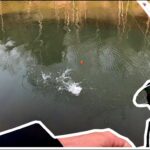
For the expert angler, the appeal of the Driftwood River lies in its accessibility paired with its lack of commercial pressure. This is not a manicured harbor environment with yacht clubs and fuel docks; it is a working river fishery where self-reliance is paramount. The water here demands respect, particularly after seasonal rains when flow rates change the navigable channels. Successful navigation requires reading the water rather than relying solely on charts.

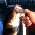
The primary draw for seasoned captains here is the opportunity to escape the "recreational fleet" found on larger lakes. While the specific game fish populations fluctuate with river health, the structure provided by fallen timber and cut banks creates classic ambush points for predatory species. This guide focuses on the logistical realities of accessing this fishery, ensuring your truck, trailer, and vessel are staged correctly for a successful day on the water.

Access & Getting There

Reaching the Driftwood River requires navigating the local road network around Edinburgh and Columbus. The primary artery for access is U.S. Highway 31, which runs parallel to much of the river system. Traffic on this route is generally manageable, though heavy transport trucks are common. Experienced haulers know to allow extra braking distance and anticipate slower speeds when passing through the light-controlled intersections in Edinburgh proper.

The river access infrastructure is functional but decidedly rustic. Data indicates three distinct boat launch locations within a 1.2-mile radius of the central river coordinate. Crucially, these ramps are un-named in standard datasets, suggesting they are likely state-managed or county easements rather than commercial marinas. All three identified launch points offer trailer parking, which is a critical asset for those towing skiffs or jet boats. However, the amenities profile for these ramps is stark: there are no restrooms, no showers, no lighting, and no fish cleaning stations.

πŸ’‘ Captain's Tip: Dark Launch Protocols

Since the local ramps lack overhead lighting, launching for the "dawn patrol" bite requires independent illumination. Ensure your trailer reverse lights are functioning and consider mounting auxiliary scene lights on your tow vehicle to safely navigate the ramp apron in the dark.

The ramp surfaces can be unpredictable. Without a designated harbor master or commercial oversight, silt accumulation and algae growth on the concrete are common issues. Anglers should inspect the waterline traction before backing down, especially during low water periods. Four-wheel drive is highly recommended, not just for traction, but for the low-range gearing control when pulling heavy loads up potentially steep or slick grades.

For those fishing from the bank, there are two specific shore access points identified suitable for families and foot anglers. These locations allow for a more casual approach, but the same safety rules apply regarding river currents and footing. Parking at these shore spots is generally available, but capacity is not guaranteed during peak spring or fall weekends.

Driftwood River, Indiana Pre-Trip Checklist

Facilities & Amenities

The infrastructure surrounding the Driftwood River is geared more toward local industry and travel than recreational tourism. This distinction is vital for the traveling angler to understand. You will not find a "Driftwood River Marina" with ice, live bait, and non-ethanol fuel on the water. All provisioning must be handled prior to arrival at the launch. The "Negative Knowledge" here is critical: there are no fuel docks. If your tank is low, you must divert to a roadside station before hitching your trailer.

However, the area does offer robust support for vehicles and trailers, largely due to its proximity to major transport routes. A standout facility for the serious boat owner is Andy Fleet Repair, located on N U.S. Hwy 31. This facility operates 24 hours a day, seven days a week. For a captain towing a rig long-distance, knowing there is a highly-rated (4.8 stars) repair shop capable of handling heavy equipment just 3.2 miles from the water is invaluable. Whether it is a blown bearing or an electrical issue on the trailer, this resource can save a trip.

For staging and rest, the Taylorsville Rest Areas (both Northbound and Southbound) are located approximately 5 to 6 miles from the river access points. These are excellent locations to pull over, check tie-downs, rigorous rig inspection, or simply wait out a passing storm without cluttering the smaller access roads. The Southbound Rest Area is slightly closer at 5.1 miles.

πŸ’‘ Captain's Tip: Staging Strategy

Use the Taylorsville Rest Area to perform your final boat prepβ€”installing electronics, removing covers, and organizing tackleβ€”before heading to the ramp. The ramps themselves have limited maneuvering space, and rigging up there can block access for other anglers.

Lodging options in the immediate vicinity are sparse, requiring anglers to look further afield toward Nashville, Indiana, or Seymour. The accommodation landscape consists primarily of campgrounds and retreat centers rather than angler-focused motels. Birdsong Barn and Happy Hollow Camp are highly rated but are located over 13 miles away. This distance means you must factor in at least 25-30 minutes of travel time in the morning to reach the launch by first light.

The table below details the key logistical facilities available to anglers in the region:

Facility NameTypeDistanceNotes for Anglers
Andy Fleet RepairRepair/Parking3.2 miOpen 24/7. Critical resource for trailer or truck breakdowns. Rated 4.8/5.
Taylorsville Rest Area (SB)Staging/Rest5.1 miGood for rig checks. Safe pull-off area for large boat trailers.
7400 N 250 W ParkingParking5.1 miBasic parking lot. No security or amenities noted.
Birdsong BarnLodging13.9 miTop-rated (5.0) accommodation, but requires travel time to launch.
eXplore Brown CountyLodging/Rec16.7 miAdventure camp style. Good for multi-day trips if camping.

Permits, Regulations & Fees

Fishing the Driftwood River falls under the jurisdiction of the State Fishing Agency (Indiana DNR). Compliance is not just a legal requirement but a contribution to the sustainability of the fishery. While specific permit costs are subject to annual changes, anglers should be prepared to present a valid Indiana fishing license upon request. Conservation officers patrol these accessible river points regularly.

The river flows through a mix of public and private lands. While the water itself is public, the riverbed and banks often belong to adjacent landowners. It is imperative to respect private property rights. Do not beach your vessel or traverse the bank above the high-water mark unless you are at a designated public access site. The "Kapu" or sacredness of the land here is legal rather than ancient, but the result is the same: trespassing can lead to lost access for everyone.

There are currently no specific environmental alerts listed for this location, and no special permits are flagged in the data beyond the standard state license. However, the boat ramps identified do not explicitly list fee structures. In many rural Indiana access points, launch fees are either non-existent or honor-system based. It is wise to carry small denominations of cash in the event a drop-box fee system is in place at the specific ramp you choose.

πŸ’‘ Captain's Tip: Carry Cash

Even if online data suggests free access, rural ramps often have unlisted maintenance fees collected via iron rangers (drop boxes). Keep a few five and one-dollar bills in your dry box to avoid a citation.

Events & Seasonal Information

The Driftwood River is a dynamic system heavily influenced by the Midwestern seasons. The water levels are the dictator of fishability here. Spring rains can turn the river into a turbid, debris-filled torrent unsafe for navigation. Conversely, late summer often brings low water conditions that may make certain ramps unusable for larger fiberglass boats. Aluminum hulls or jet drives are often the superior choice during the dry season.

While there are no major professional tournament circuits explicitly anchored to these specific un-named ramps, the local culture follows the rhythm of the warm-water bite. Early summer generally offers the most stable flows and active fish patterns. Anglers should monitor weather patterns in the watershed north of Edinburgh, as rain miles away can blow out the river clarity overnight.

Timing your day is also crucial regarding wind and heat. In the height of summer, the river valley can become stiflingly hot by midday. The "power hour" is often right at dawn or dusk. Furthermore, recreational trafficβ€”tubers and kayakersβ€”can increase significantly on weekends during the warmest months. Serious anglers often choose weekdays or inclement weather days to avoid the recreational flotilla.

Contact Information & Resources

For the most current information on river levels and regulations, reliance on official state resources is essential. The State Fishing Agency is the primary authority for all rule changes and bag limits. Since there is no on-site harbor master, safety is the responsibility of the captain. In an emergency, standard 911 services apply, but response times to remote river bends can be significant.

Cellular service near Edinburgh and along U.S. Hwy 31 is generally reliable, but signal strength can drop in the lower river valleys. It is advisable to file a float plan with a contact on land, detailing your launch point (e.g., the northern ramp at Lat 39.3605) and your expected take-out time. This simple step is the most effective safety measure for river anglers.

For precise locations of the boat ramps, real-time weather data, and detailed topographical context, consult the live dashboard and interactive maps below.

🎣

Driftwood River, Indiana

Edinburgh β€’ Indiana β€’ 39.3506, -85.9586
πŸ…ΏοΈ

Parking

5
Andy Fleet Repair
⭐ 4.8 3.2 mi
πŸ“ 11340 N U.S Hwy 31, Edinburgh, IN 46124, USA
πŸ•’
Monday: Open 24 hours
Tuesday: Open 24 hours
Wednesday: Open 24 hours
Thursday: Open 24 hours
Friday: Open 24 hours
Saturday: Open 24 hours
Sunday: Open 24 hours
πŸš— Get Directions
Five Star Paving
⭐ 4.4 24.8 mi
πŸ“ 1350 W Southport Rd suit 262, Indianapolis, IN 46217, USA
πŸ•’
Monday: 9:00β€―AM – 5:00β€―PM
Tuesday: 9:00β€―AM – 5:00β€―PM
Wednesday: 9:00β€―AM – 5:00β€―PM
Thursday: 9:00β€―AM – 5:00β€―PM
Friday: 9:00β€―AM – 6:00β€―PM
Saturday: Closed
Sunday: Closed
πŸš— Get Directions
7400 N 250 W Parking
⭐ 3.8 5.1 mi
πŸ“ 7400 N 250 W, Columbus, IN 47203, USA
πŸš— Get Directions
🏠

Lodging

4
Birdsong Barn
⭐ 5.0 13.9 mi
πŸ“ Hamblen Township, IN 47448, USA
πŸš— Get Directions
eXplore Brown County
⭐ 4.8 16.7 mi
πŸ“ 2620 Valley Branch Rd, Nashville, IN 47448, USA
πŸ•’
Monday: 10:00β€―AM – 5:00β€―PM
Tuesday: Closed
Wednesday: 10:00β€―AM – 5:00β€―PM
Thursday: 10:00β€―AM – 5:00β€―PM
Friday: 10:00β€―AM – 6:00β€―PM
Saturday: 9:00β€―AM – 6:00β€―PM
Sunday: 10:00β€―AM – 5:00β€―PM
πŸš— Get Directions
βš“

Boat Ramps

3
🚻

Restrooms

3
πŸ‘¨β€πŸ‘©β€πŸ‘§β€πŸ‘¦

Family Friendly

2
β™Ώ

Accessibility

β™Ώ

Wheelchair Access

Not Confirmed

πŸ•

Pets Allowed

Not Confirmed

⚠️ Some accessibility info not officially confirmed. Please verify with location directly.

πŸ“ Showing 18 facilities on map
🎣
Book a Fishing Charter near Driftwood River, Indiana Fishing Report Today 🎣

Local guides & charters. Verified captains, instant booking, best price guaranteed.

See Available Trips β†’

πŸ“Š

About Our Fishing Reports & Forecasts

Our spot reports combine data-driven forecasts with curated local information. The forecast is generated by our proprietary Fishing Score algorithm (0–100%), which analyzes real-time data from Open-Meteo API, validated against NOAA CO-OPS tide gauges and USGS water-monitoring stations. The model weights tide dynamics (35%), wave energy (25%), wind patterns (20%) and time of day (20%)β€”factors shown to influence fish feeding behavior through marine-biology research and decades of charter log data.

Access, facilities and services information for each fishing spot is sourced from official datasets such as Recreation.gov (RIDB), state park & wildlife agencies, and geospatial providers like Google Maps. These sections undergo scheduled re-validation every 3–6 months to ensure that boat ramps, park access, contact details and local services remain accurate.

Narrative sections (catches, seasonal behavior, local tips) are synthesized from these data sources and refined following the Fishing Reports Today editorial guidelines, combining bibliographic research from ichthyology and oceanography with expert angler experience. Our team reviews reports on a regular basis, while the forecast model itself updates every 6 hours for real-time accuracy.

⚠️ Important: Always verify current local regulations, access restrictions and weather conditions before fishing. These reports are intended as a planning aid, not a guarantee of catches or safety. When in doubt, contact local authorities or park managers listed on the page.

Learn more about our methodology & data sources β†’

Leave a Reply

Your email address will not be published. Required fields are marked *