As we navigate the late spring transition, anglers in the Chesterfield area face a tale of two fisheries. The Missouri River is currently experiencing volatile flow rates and elevated stages due to upstream runoff. Navigating the main river currents requires heavy caution, and bank fishing along the main channel is largely blown out or unsafe. However, this earns a confident GO for the protected urban and suburban impoundments tucked safely behind the Monarch-Chesterfield Levee.
Warming ambient temperatures have pushed the water in shallow, stagnant lakes into the upper 60s and low 70s. This thermal shift has triggered aggressive post-spawn feeding windows for predatory fish and pushed panfish into the extreme shallows for their spawning rituals. Wind conditions remain a factor, so utilizing the mature tree lines around local parks for cover will be essential for bite detection and casting accuracy.
From the editor
Tired of fishing with strangers you can’t trust?
Nautrek is the first social network for serious anglers — verified partners, real trips, cost splitting and intel sharing without burning your spots. Private beta now open.
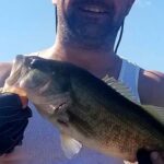
Primary Target: Largemouth Bass and Channel Catfish
Largemouth Bass are transitioning out of their spawning phase in our local lakes. These post-spawn bass are hungry but easily spooked by heavy angling pressure. Simultaneously, the Missouri Department of Conservation (MDC) maintains a robust urban stocking program, heavily planting Channel Catfish into St. Louis area waters from March through September. These catfish are highly active in the warming water and provide the most consistent bend in the rod for shore-bound anglers.
Sleeper Pick: Hybrid Sunfish and Bluegill
While the majority of local anglers are stubbornly grinding for a trophy bass, the panfish bite is absolutely explosive right now. Bluegill and MDC-stocked hybrid sunfish are aggressively defending their shallow-water beds. They offer non-stop action and are the perfect target if you want to ensure success, especially when fishing with younger or less experienced anglers.
Baitfish Report
The primary forage base in Chesterfield's urban lakes consists of juvenile sunfish, local crawfish, and small gizzard shad. With the water warming, crawfish are highly active around limestone rocks and concrete structures. Match your lure profiles to the two-to-three-inch mark to mimic this abundant, bite-sized forage.
TACTICAL STRATEGY
Where to Deploy: River's Edge Park
Your primary destination is River's Edge Park, a 188-acre passive park located quietly away from the retail hub of Chesterfield Valley. Access the lake via the crushed limestone trail. Bypass the highly pressured water immediately near the main park shelter and boating dock. Instead, hike the 1.6-mile loop toward the northwest corner where the trail branches off to the wooden boardwalks and mulched paths. Target the six-to-ten-foot depth transition zones where the mature tree canopy casts distinct shade lines over the water. Bass will use this shade to ambush prey as the sun rises.
Pro Tip:When fishing River's Edge, pay close attention to the submerged timber and brush near the boardwalks. Pitching your baits directly into the heaviest cover will yield strikes from fish that have retreated from the open-water pressure.
Lure and Bait Selection
Bass Lures: A 3/8oz tungsten finesse jig paired with a compact craw trailer. Alternatively, a Rapala Shadow Rap (Size 09) jerkbait worked erratically near the drop-offs.
Color: Green pumpkin or watermelon with red flake for plastics to perfectly mimic the local crawfish. If the water is stained from recent rains, switch to a black-and-blue jig for better silhouette visibility.
Catfish Bait: Fresh cut shad, raw shrimp, or nightcrawlers. Rig this on a classic slip-sinker setup: a 1/2oz egg sinker above a barrel swivel, an 18-inch fluorocarbon leader, and a 2/0 circle hook.
Panfish Rig: A 1/64oz tungsten teardrop jig tipped with a wax worm or a one-inch Berkley Gulp! Minnow, suspended 18 to 24 inches below a sensitive pencil float.
Timing the Bite
The bite is heavily dictated by light penetration. The golden windows are the first two hours of daylight and the final hour before sunset. During the midday heat, fish will hold tight to the bottom or retreat under the thickest available cover. If you must fish at noon, slow your retrieve down to a crawl.
Pro Tip:For Channel Catfish, the bite often peaks just as the sun dips below the tree line. Chumming is prohibited in many local waters, so rely on the scent of fresh, oily cut bait to draw them out of the deeper holes.
REGULATIONS SNAPSHOT
Always verify posted signage at the specific body of water, but here are the critical rules governing the St. Louis Urban Fishing Program and River's Edge Park:
Species
Daily Bag Limit
Length Limit
Black Bass (Largemouth)
2 (in most St. Louis urban lakes)
18-inch minimum
Channel Catfish
4
None
Crappie
15
None
All Other Species (Panfish)
10 combined
None
Site-Specific Rules for River's Edge Park: This is NOT a catch-and-release-only lake; standard state and urban harvesting rules apply. However, strict park rules prohibit fishing off the bridges, the use of trotlines or jug lines, and all motorized boats or watercraft. Wade fishing is also generally discouraged in these passive park environments.
REGIONAL ALTERNATIVE
August A. Busch Memorial Conservation Area
If River's Edge Park is too crowded or hosting a special event, your premier backup plan is just a short 15-minute drive across the Missouri River into St. Charles County. The August A. Busch Memorial Conservation Area is an angler's playground, featuring over 30 heavily managed lakes.
Target Species: Largemouth Bass and Black Crappie.
Tactical Approach: Because of the sheer number of lakes, you can always find a body of water that is shielded from the prevailing winds. If you are hunting trophy bass, head directly to Lake 33 or Lake 35, which are managed with strict 18-inch minimum length limits to promote top-tier growth. For fast action, target the brush piles in the mid-numbered lakes with 1/16oz marabou jigs in chartreuse and white. The bank access here is exceptional, with numerous fishing jetties and paved paths accommodating all mobility levels.
Pro Tip:Keep a secondary rod rigged with a topwater hollow-body frog when walking the banks at Busch Wildlife. Many of these lakes feature dense vegetation mats near the shoreline that hold explosive strike opportunities during the early morning hours.
Tight lines!
Editor's Choice: Must-Have Gear
FISHINGSIR Next-Gen Waterproof Chest Waders
★★★★★4.4 (7,370+ reviews)
2-Ply Tech: Upgraded nylon with 2.5x higher density than standard fabrics.
100% Waterproof: Lab-approved intrusion resistance with taped visible seams.
Ultra-Lightweight: Designed for all-day comfort while hunting or fishing.
As an Amazon Associate I earn from qualifying purchases. #ad
Loading forecast...
Live Fishing Conditions: Tides, Weather & Waves
Get real‑time tides, marine weather, swell and solunar activity for each spot so you know exactly when conditions line up for your best chance at a bite.
🎣
Chesterfield, MO
Loading coordinates...
🌤️
WEATHER CONDITIONS
--°F
--°C
Loading...
🌡️
Feels Like--°F--°C
💧
Humidity--%
💨
Wind-- mph-- km/h
🧭
Direction--
📊
Pressure-- inHg-- hPa
☀️
UV Index--
🌊
MARINE CONDITIONS
🌊Wave Height
-- ft
-- m
Loading...
🧭Wave Direction
--°
Loading...
⏱️Wave Period
-- s
Loading...
📈Tide Status
-- ft
-- m
Loading...
🌙
LUNAR & SOLUNAR
🌕
Loading...
Illumination: --%
Major Period--:-- - --:----:-- - --:--
Minor Period--:-- - --:----:-- - --:--
🌅Sunrise--:--
🌇Sunset--:--
📅
24-HOUR FORECAST
Loading fishing conditions...
Fishing Spots Map
🎣
Book a Fishing Charter near Chesterfield, MO Fishing Report Today 🎣
Local guides & charters. Verified captains, instant booking, best price guaranteed.
There was an error loading the map. Please try refreshing the page.
Info
Local Access & Facilities
The Confluence Gateway: Fishing Chesterfield and the River Bottoms
Situated on the western edge of St. Louis County, Chesterfield serves as a sophisticated logistical hub for anglers targeting the complex waterways of the Missouri and Mississippi River confluence. While the city itself offers manicured amenities, the surrounding fishery is defined by raw, powerful river dynamics and sprawling floodplain lakes. This is not a single harbor destination but rather a strategic launchpad for accessing the Two Rivers National Wildlife Refuge and the oxbow waters of Creve Coeur Lake. The atmosphere here shifts rapidly from the urban comfort of the St. Louis metro area to the rugged, muddy isolation of the river bottoms, where seasoned river rats hunt for trophy catfish and migratory waterfowl enthusiasts gather in the fall.
For the expert angler, this region presents a unique hydrological challenge. The water here is dictated by the pulse of the continent's two largest rivers. The bottom topography varies from the silt-laden channels of the Missouri to the shallow, weed-choked backwaters of the refuge system. Unlike the clear reservoirs of the Ozarks to the south, this is a fishery that rewards those who understand turbidity, current seams, and flood stages. The primary targets driving the local sportfishing scene include massive Blue and Flathead Catfish in the main river channels, while the backwater lakes hold populations of Crappie, Largemouth Bass, and Asian Carp that require specific tactical approaches.
The proximity to St. Louis means that while access is convenient, the best spots often require navigating a mix of heavy highway traffic and rural ferry crossings. The juxtaposition is stark: you might start your morning with coffee in a high-end Chesterfield cafe and end it covered in river mud on a levy road in Brussels, Illinois. Understanding the logistical nuances of this "urban refuge" environment is critical for maximizing time on the water and avoiding the pitfalls of seasonal flooding that frequently reshapes the local access points.
Access & Getting There
Reaching the prime fishing grounds from Chesterfield requires a strategic approach to navigation, as the area is bisected by major interstates and natural water barriers. The primary artery is Interstate 64 (US-40), which connects the urban core to the river valley. However, seasoned captains know that the "last mile" to the water is often the most complex. Traffic congestion on the bridges crossing the Missouri River can be severe during rush hours (7:00 AM to 9:00 AM and 4:00 PM to 6:00 PM). To maximize fishing time, plan your haul to avoid these windows, particularly if you are towing a wide beam trailer.
💡 Captain's Tip: The Ferry Factor
Accessing the heart of the Two Rivers National Wildlife Refuge often requires crossing the river via the Golden Eagle Ferry. Always carry at least $20 in small bills. The ferry charges approximately $5.00 per car each way, and credit card machines can be unreliable in the river bottoms due to spotty signal.
For boaters targeting the Two Rivers National Wildlife Refuge, the journey involves more than just highway driving. The refuge headquarters and prime boat access are located at the Calhoun Division, roughly 19 miles from the Chesterfield center. Reaching this area often requires utilizing the Brussels Ferry or the Golden Eagle Ferry. These ferry crossings are not merely transit; they are weather-dependent chokepoints. High winds exceeding 20 knots or extreme flood stages can shut down ferry operations, forcing a detour of nearly 60 miles. Always check the river stages before Hitching the trailer.
Launch facilities in the immediate area vary significantly in quality. The ramps at Creve Coeur Lake, located about 6 miles from the central hub, are paved and generally well-maintained, suitable for bass boats and recreational craft. However, these ramps can become slick with algae during the summer months. In contrast, access points within the federal refuge system may be more primitive. The "boat_access" points identified in the refuge often consist of gravel bars or improved dirt ramps that demand four-wheel drive, especially when river levels are receding and leaving behind deep, soft mud.
Parking requires vigilance. While the urban parking lots listed in local databases—such as The Parking Spot 3 or The Parking Spot East—are designed for airport travelers and are not suitable for boat trailers. Anglers must utilize the designated lots at the Creve Coeur ramps or the specific trailheads within the wildlife refuge. At the refuge access points, security is minimal. It is advisable to remove all valuables from the tow vehicle and use a high-quality coupler lock, as these remote lots are often out of sight from the main roads.
Chesterfield, MO Pre-Trip Checklist
Facilities & Amenities
The infrastructure surrounding Chesterfield supports a serious fishing habit, provided you know where to look. Unlike a dedicated coastal marina town, the amenities here are spread across the suburban landscape. For bait and tackle, the standout location is Bullseye Bait & Tackle, located approximately 11.7 miles away in O'Fallon. This shop is a critical resource for current river reports. They typically stock the heavy weights and live bait necessary for river current fishing, which big-box stores often neglect. Another reliable option, albeit further east (19 miles), is Broadway Sporting, known for servicing the needs of anglers targeting the confluence waters.
Facility Name
Type
Distance
Angler Relevance
Bullseye Bait & Tackle
Specialty Shop
11.7 miles
Primary source for live bait and river gear.
The Parking Spot 1 & 2
Parking
12.5 miles
Airport use only; avoid for trailer parking.
St. Louis Union Station Hotel
Lodging
20.1 miles
High-end historic lodging; ample space but urban setting.
Beaumont Scout Reservation
Lodging/Camp
11.0 miles
Rustic accommodation option near nature trails.
Fuel logistics are critical when fishing the refuge areas. There are no fuel docks on the water within the Two Rivers National Wildlife Refuge or at the Creve Coeur ramps. Anglers must fill their tanks and spare jerry cans at the highway stations in Chesterfield or St. Charles before heading into the floodplain. Running out of fuel in the main channel of the Mississippi River is a safety hazard due to commercial barge traffic; self-reliance is paramount.
For lodging, the area offers a spectrum of choices. Anglers looking for a "dawn patrol" advantage might consider the Beaumont Scout Reservation area or Blackberry Hollow (approx. 10 miles away) for a more rustic, outdoor-oriented stay. Conversely, those traveling with family or seeking luxury might opt for the St. Louis Union Station Hotel, Curio Collection by Hilton. While located 20 miles east in downtown St. Louis, it is a National Historic Landmark offering secure valet parking and a high level of comfort, though maneuvering a boat trailer in the downtown grid requires patience.
💡 Captain's Tip: Ice & Provisions
Once you cross the river via ferry into the Calhoun Division of the refuge, commercial services virtually disappear. There are no convenience stores near the boat ramps. Stock up on ice, water, and food in Chesterfield or Alton before committing to the crossing.
Permits, Regulations & Fees
Fishing the confluence requires navigating a web of state and federal regulations. Because the Two Rivers National Wildlife Refuge spans the border of Missouri and Illinois, jurisdictional boundaries can be confusing on the water. Anglers fishing the main river channels should possess licenses for both states or be extremely careful about which side of the channel buoy line they cast into. The refuge itself was established in 1958 primarily for migratory birds, meaning that certain areas may be seasonally closed to boating to protect resting waterfowl. It is the skipper's responsibility to consult the current refuge map for "No Entry" zones.
Cultural respect is also a legal requirement in this historic landscape. The Duncan Farm area within the Gilbert Lake Division contains an identified American Indian mound. This is a protected cultural resource. Federal law strictly prohibits the disturbance of these sites. Anglers landing on shorelines for lunch or bank fishing must respect these boundaries—digging for bait or disturbing soil in these zones is a federal offense. Similarly, the Ulysses S. Grant National Historic Site nearby enforces strict preservation rules regarding its grounds and historic structures.
Fee structures are generally modest but require cash. While the Two Rivers NWR does not currently list a specific entrance fee for fishing, the logistical costs of the ferries (approx. $5.00 one way) add up. State fishing licenses must be purchased in advance, as there are no kiosks at the remote launch sites. Conservation agents patrol these waters frequently, checking not only for licenses but also for compliance with invasive species protocols, particularly regarding the transport of live bait and bilge water to prevent the spread of Asian Carp.
Events & Seasonal Information
The rhythm of the fishery is dictated by the seasons of the river. Spring brings the high water. From March through May, the Mississippi and Missouri Rivers often swell beyond their banks, inundating the floodplain forests of the refuge. While this makes access difficult and often closes boat ramps, it triggers a feeding frenzy for catfish moving into the submerged timber. Anglers should monitor the "river stages" reported by the US Army Corps of Engineers; a rising river is generally dangerous with debris, while a falling river pulls fish out of the brush and into predictable channel ledges.
Summer settles into a hot, humid pattern where the bite shifts to early morning and late evening. This is prime time for the Creve Coeur Lake fishery, where recreational paddling traffic can become heavy by 10:00 AM. The "dawn patrol" launch is essential here to work the shorelines for bass before the sun pushes them deep. In the main rivers, summer is the season for heavy tackle, targeting giant Flatheads in the deep scour holes near bridge pilings and wing dikes.
Fall is perhaps the most visually spectacular season, as the hardwood forests of the Two Rivers Refuge turn gold and red. However, this season introduces a conflict of use: hunting. The refuge is a premier destination for waterfowl hunting. Anglers must be hyper-aware of hunting zones and seasons, typically starting in late October. It is courteous and safe to avoid setting up fishing drifts near duck blinds during active shooting hours.
💡 Captain's Tip: The Asian Carp Hazard
The confluence waters are heavily populated with invasive Silver Carp. These fish are sensitive to boat motor vibrations and will jump high out of the water when startled. When running on plane in the Illinois River or backwaters, keep your throttle steady and be prepared for flying fish. A full-face helmet or windshield is recommended for high-speed travel.
Contact Information & Resources
For the most current information regarding water levels, closures, and regulations, direct communication with the managing agencies is recommended. The Two Rivers National Wildlife Refuge headquarters can be reached at 618-883-2524 or via email at tworivers@fws.gov. They are the authority on ramp conditions within the refuge boundaries.
For orientation and historical context, the Ulysses S. Grant National Historic Site Visitor Center is located at 7400 Grant Road, St. Louis, MO, reachable at (314) 842-1867. While primarily a historical site, the rangers there can provide updated maps and regional orientation. For broader park information, the Gateway Arch National Park administration can be contacted at (314) 655-1600.
Safety on these big rivers is the responsibility of the captain. Cell service can be intermittent in the low-lying river bottoms. Always file a float plan with a reliable contact on land. For precise locations, live weather data, and real-time conditions, consult the live dashboard and interactive maps below.
Our spot reports combine data-driven forecasts with curated local information. The forecast is generated by our proprietary Fishing Score algorithm (0–100%), which analyzes real-time data from Open-Meteo API, validated against NOAA CO-OPS tide gauges and USGS water-monitoring stations. The model weights tide dynamics (35%), wave energy (25%), wind patterns (20%) and time of day (20%)—factors shown to influence fish feeding behavior through marine-biology research and decades of charter log data.
Access, facilities and services information for each fishing spot is sourced from official datasets such as Recreation.gov (RIDB), state park & wildlife agencies, and geospatial providers like Google Maps. These sections undergo scheduled re-validation every 3–6 months to ensure that boat ramps, park access, contact details and local services remain accurate.
Narrative sections (catches, seasonal behavior, local tips) are synthesized from these data sources and refined following the Fishing Reports Today editorial guidelines, combining bibliographic research from ichthyology and oceanography with expert angler experience. Our team reviews reports on a regular basis, while the forecast model itself updates every 6 hours for real-time accuracy.
⚠️ Important: Always verify current local regulations, access restrictions and weather conditions before fishing. These reports are intended as a planning aid, not a guarantee of catches or safety. When in doubt, contact local authorities or park managers listed on the page.
To provide the best experiences, we use technologies like cookies to store and/or access device information. Consenting to these technologies will allow us to process data such as browsing behavior or unique IDs on this site. Not consenting or withdrawing consent, may adversely affect certain features and functions.
Functional Always active
The technical storage or access is strictly necessary for the legitimate purpose of enabling the use of a specific service explicitly requested by the subscriber or user, or for the sole purpose of carrying out the transmission of a communication over an electronic communications network.
Preferences
The technical storage or access is necessary for the legitimate purpose of storing preferences that are not requested by the subscriber or user.
Statistics
The technical storage or access that is used exclusively for statistical purposes.The technical storage or access that is used exclusively for anonymous statistical purposes. Without a subpoena, voluntary compliance on the part of your Internet Service Provider, or additional records from a third party, information stored or retrieved for this purpose alone cannot usually be used to identify you.
Marketing & Affiliates
The technical storage or access is required to create user profiles to send advertising, or to track the user on a website or across several websites for similar marketing purposes, including affiliate tracking for products recommended in our reports.


Leave a Reply