As we push deeper into the fall season, fishing the high-elevation waters of the Absaroka-Beartooth Wilderness requires serious preparation. At this altitude, weather windows dictate your success. We are currently seeing dramatic temperature swings, with morning lows dipping near freezing and unpredictable afternoon wind shears. While there is no hard ice formation yet, frost on the trail and sudden snow squalls are immediate safety factors. Anglers should proceed with caution, ensuring they have cold-weather gear and are prepared for rapid barometric drops. The bite is excellent right now as fish feed aggressively before the winter freeze, making the trek highly rewarding for those who are prepared.
2. SPECIES INTEL
Primary Target: Yellowstone Cutthroat Trout
From the editor
Tired of fishing with strangers you can’t trust?
Nautrek is the first social network for serious anglers — verified partners, real trips, cost splitting and intel sharing without burning your spots. Private beta now open.
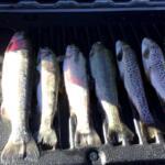
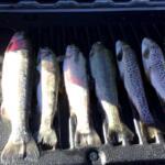
Based on the Montana Fish, Wildlife & Parks (FWP) historical stocking cycles of planting fingerlings every eight years, the current class of Yellowstone Cutthroat is well-established. We are seeing mature, aggressive fish in the 12 to 15-inch class. These fish are currently in hyper-phagia, actively gorging to build fat reserves for the impending ice-over.
Sleeper Pick: Cutbow Hybrids
While most anglers trek up here for the pure strain Cutthroats, the lake holds a healthy population of Cutthroat/Rainbow hybrids. These fish often out-compete the pure strains for larger forage and are known for their spectacular aerial acrobatics when hooked. They tend to hold slightly deeper than the cruising Cutthroats.
Baitfish & Forage Report
With the first hard frosts killing off the summer grasshoppers and terrestrial fall-ins, the forage base has shifted entirely sub-surface. The trout are currently keyed in on freshwater scuds, dark leeches, and late-season chironomid pupae emerging from the mud.
3. TACTICAL STRATEGY
Where to Target: Avoid the shallow, featureless shorelines. Focus your efforts on the northwestern drop-off where the lake transitions from 8 feet down to 20 feet. The submerged boulder fields near the primary inlet stream are currently acting as a dinner table for cruising trout waiting for nymphs to get washed in.
Lure & Fly Selection: For hardware anglers, a 1/8oz Panther Martin spinner or a 1/4oz Kastmaster is ideal for covering water. Fly anglers should be stripping size 8 or 10 Tungsten Beadhead Woolly Buggers.
Color Patterns: Stick to dark, natural tones. Black bodies with gold blades for spinners, and olive or black/marabou patterns for flies. The water clarity is currently gin-clear, so natural presentations will out-fish flashy, unnatural colors.
Bait & Rigging: If you prefer bait fishing (and where regulations permit), a simple nightcrawler rigged on a size 8 bait-holder hook, suspended 4 to 6 feet under a clear slip-bobber, is highly effective. Use a 4lb fluorocarbon leader to prevent spooking these line-shy mountain trout.
Timing: The traditional dawn bite is actually sluggish right now due to the freezing overnight temperatures. The optimal strike window has shifted to mid-day, specifically between 11:00 AM and 3:00 PM, when the sun warms the shallow shelves and stimulates insect activity.
Pro Tip:When stripping streamers or retrieving spinners, utilize a "pause and flutter" technique. The sudden stop mimics a dying baitfish and frequently triggers reaction strikes from following trout that are hesitant to commit.
4. REGULATIONS SNAPSHOT
Anglers must adhere to Montana's mountain lake regulations. The standard limit for trout in this district is generally 5 fish daily, but catch-and-release is strongly encouraged for the native Yellowstone Cutthroat to help preserve the genetic integrity and quality of this high-alpine fishery. Artificial lures and flies are recommended to reduce deep-hooking mortality. Always pack out your trash and discarded monofilament.
5. REGIONAL ALTERNATIVE
Backup Plan: East Rosebud Lake
If early snow blocks the trail to Lower Horseshoe Lake or the wind makes high-elevation casting impossible, drop down in elevation and head to East Rosebud Lake. Access is much easier via a well-maintained road, and you avoid the worst of the alpine weather systems. Target the inlet where East Rosebud Creek dumps into the lake using small bead-head nymphs or drifting salmon eggs. The lake holds a fantastic population of Brook Trout and Rainbows that remain highly active throughout the fall season.
Pro Tip:When fishing lower elevation lakes like East Rosebud after a cold front, downsize your tippet to 3x or 4x and use micro-jigs tipped with a wax worm under a sensitive strike indicator.
Tight lines!
Editor's Choice: Must-Have Gear
FISHINGSIR Next-Gen Waterproof Chest Waders
★★★★★4.4 (7,370+ reviews)
2-Ply Tech: Upgraded nylon with 2.5x higher density than standard fabrics.
100% Waterproof: Lab-approved intrusion resistance with taped visible seams.
Ultra-Lightweight: Designed for all-day comfort while hunting or fishing.
As an Amazon Associate I earn from qualifying purchases. #ad
Loading forecast...
Live Fishing Conditions: Tides, Weather & Waves
Get real‑time tides, marine weather, swell and solunar activity for each spot so you know exactly when conditions line up for your best chance at a bite.
🎣
Lower Horseshoe Lake
Loading coordinates...
🌤️
WEATHER CONDITIONS
--°F
--°C
Loading...
🌡️
Feels Like--°F--°C
💧
Humidity--%
💨
Wind-- mph-- km/h
🧭
Direction--
📊
Pressure-- inHg-- hPa
☀️
UV Index--
🌊
MARINE CONDITIONS
🌊Wave Height
-- ft
-- m
Loading...
🧭Wave Direction
--°
Loading...
⏱️Wave Period
-- s
Loading...
📈Tide Status
-- ft
-- m
Loading...
🌙
LUNAR & SOLUNAR
🌕
Loading...
Illumination: --%
Major Period--:-- - --:----:-- - --:--
Minor Period--:-- - --:----:-- - --:--
🌅Sunrise--:--
🌇Sunset--:--
📅
24-HOUR FORECAST
Loading fishing conditions...
Fishing Spots Map
🎣
Book a Fishing Charter near Lower Horseshoe Lake Fishing Report Today 🎣
Local guides & charters. Verified captains, instant booking, best price guaranteed.
There was an error loading the map. Please try refreshing the page.
Info
Local Access & Facilities
Angling in the High Country Pines
Situated in the dense ponderosa pines of Forest Lakes, Arizona, Lower Horseshoe Lake offers a distinct high-country fishing experience that contrasts sharply with the massive desert reservoirs found elsewhere in the state. This location is defined by its serene, alpine atmosphere and rugged accessibility, appealing to anglers who prefer solitude and scenery over concrete ramps and crowded marinas. The air here is thin and crisp, and the water reflects the towering timberline, creating a visual backdrop that is as rewarding as the catch itself.
The vibe at Lower Horseshoe is decidedly rustic and off-grid. Unlike manicured urban fisheries, this spot requires a degree of self-sufficiency and navigational awareness. It is a destination where the silence is usually only broken by the wind in the pines or the strike of a fish. The terrain is a mix of forest floor and rocky outcrops, demanding sturdy footwear and a willingness to explore the shoreline for the perfect casting window.
While the specific target species can vary by season, pros head here for the cold-water game fish typical of the Rim country. The lake's layout favors those who understand structure and depth changes in smaller water bodies. Whether you are fly-fishing from the bank or deploying light tackle from a small craft, the primary draw is the opportunity to fish in a calm, undisturbed environment far removed from the highway traffic.
Access & Getting There
Reaching Lower Horseshoe Lake requires navigating the network of forest roads branching off Highway 260. The primary artery for the final leg of the journey is Forest Road 237. Traffic on the highway can be heavy on Friday afternoons and Sunday evenings due to the weekend exodus from Phoenix, so plan your transit times accordingly. Once you leave the pavement, conditions shift; FR 237 is generally navigable, but recent rains can alter the surface quality significantly.
For those towing small trailers or carrying kayaks, the approach is more about staging than launching. There is no heavy-duty concrete boat ramp directly at the water's edge. Instead, access is facilitated via trailheads such as the 237 B Trailhead, located just past mile post 1 off FR 237. This area offers a solid staging location for parking and offloading gear. The Canyon Dr Access Trailhead also provides proximity to the area, sitting roughly 0.1 miles from the coordinate center, making it a viable option for hike-in anglers.
💡 Captain's Tip: Vehicle Clearance
While standard SUVs can typically handle Forest Road 237, conditions deteriorate rapidly after summer monsoons. If you are towing a small craft or carrying a heavy load, 4x4 capability is highly recommended to navigate mud or washouts near the 237 B Trailhead.
Parking is largely informal and centered around the designated trailheads. The 237 B Trailhead is specifically noted for having good parking capacity, which is critical during peak summer weekends when dispersed campers flock to the area. Anglers looking for paved, formal lots will find the nearest major infrastructure, like the Horton Springs Parking Lot, over 15 miles away, emphasizing the need to utilize the immediate dirt staging areas efficiently.
Weather plays a massive role in access here. The Mogollon Rim is notorious for afternoon thunderstorms in July and August. These storms can turn hard-packed dirt roads into slick mud traps in minutes. Furthermore, winter access is strictly dictated by snowpack; the roads often close seasonally, making this primarily a late spring through early autumn fishery.
Lower Horseshoe Lake Pre-Trip Checklist
Facilities & Amenities
The infrastructure around Lower Horseshoe Lake is designed for the outdoor enthusiast rather than the luxury traveler. There are no on-water marinas, fuel docks, or fish cleaning stations at the lake itself. Anglers must arrive with full fuel tanks and sufficient ice. The nearest reliable hub for supplies is Gilligan's Forest Lakes General Store, located about 2 miles away on AZ-260. This is the critical stop for last-minute bait, snacks, and local intelligence. They open at 7:00 AM, which is suitable for most morning runs, but true "dawn patrol" anglers should stock up the night before.
Lodging in the immediate vicinity caters to campers and RV owners. The Five Lakes RV Park is located less than 3 miles away, offering a comfortable base camp with full hookups. For those preferring a more primitive experience, the Fr 237 Camping Area provides dispersed camping options closer to the action. This site includes vault toilets located at the Willow Springs Loop Trailhead, but lacks running water or electricity.
💡 Captain's Tip: Supply Chain Management
There is no fuel or ice available at the water's edge. Top off your gas tank and fill your coolers at Gilligan's General Store on AZ-260 before turning onto the forest roads. Once you are at the lake, a round trip for forgotten supplies will cost you an hour of prime fishing time.
For anglers looking to stay nearby, the following table outlines the closest accommodation options relative to the fishing grounds:
Facility Name
Distance
Type
Rating
Five Lakes RV Park
2.9 miles
RV Park
5.0/5
Fr 171 Campground
4.5 miles
Campground
4.8/5
Boulders RV Park
13.9 miles
RV Park
4.9/5
Mountain Retreat RV Park
16.9 miles
RV Park
5.0/5
Permits, Regulations & Fees
Fishing activities at Lower Horseshoe Lake are under the jurisdiction of the State Fishing Agency. A valid Arizona state fishing license is mandatory for all anglers. While specific permit checks may be infrequent in remote areas, conservation officers patrol the Rim country regularly. The regulations here are in place to sustain the fishery in a fragile high-altitude ecosystem where fish growth rates can be slower due to cold water temperatures.
Because the immediate area includes dispersed camping zones like the Fr 237 Camping Area, strict "Leave No Trace" principles apply. There are no garbage services at the primitive access points; anglers are legally and ethically obligated to pack out all trash, including monofilament and bait containers. Respecting these rules ensures continued access to these dispersed sites.
Be aware of private property boundaries when accessing the water. While the forest lands are public, pockets of private cabins exist in the Forest Lakes Estates area. Always utilize designated public access points like the Canyon Dr Access Trailhead to avoid trespassing disputes. Accessibility data indicates that wheelchair access is available ("yes"), likely at the improved trailhead areas, though the shoreline terrain itself may vary.
Events & Seasonal Information
The rhythm of Lower Horseshoe Lake is dictated entirely by the seasons of the Mogollon Rim. The prime fishing window opens in late spring once the snowmelt has receded and the forest roads are unlocked. Summer offers the most consistent access, but it also brings the "monsoon season" pattern. Experienced locals know to be off the water or near shelter by early afternoon when lightning risks increase dramatically.
Fishing pressure tends to peak during holiday weekends (Memorial Day, July 4th, Labor Day) when the nearby campgrounds and RV parks are at capacity. To avoid the crowds, target mid-week mornings. The water is generally calmest at sunrise, before the thermal winds pick up through the canyons. Fall can be spectacular as the temperatures drop, triggering aggressive feeding behaviors before the winter freeze sets in.
💡 Captain's Tip: The Golden Hour
During summer months, the wind typically stays down until about 10:00 AM. Plan your launch or hike-in for first light to enjoy glass-calm water and active surface feeding before the breeze and the afternoon thunderheads roll in.
Contact Information & Resources
For official information regarding road closures and fire restrictions, anglers should consult the local Forest Service district office. In emergencies, be aware that cell service can be intermittent in the dips and valleys of the Rim. It is advisable to have a satellite communicator or reliable offline maps downloaded.
Gilligan's Forest Lakes General Store serves as an unofficial information hub; you can reach them at (928) 535-4716 for current road conditions or local bite reports. For camping inquiries at the nearby Fr 171 Campground, the contact number is (928) 333-4301. Always verify the status of Forest Road 237 before towing a trailer up the mountain.
For precise locations, trailheads, and real-time weather conditions, consult the live dashboard and interactive maps below.
Our spot reports combine data-driven forecasts with curated local information. The forecast is generated by our proprietary Fishing Score algorithm (0–100%), which analyzes real-time data from Open-Meteo API, validated against NOAA CO-OPS tide gauges and USGS water-monitoring stations. The model weights tide dynamics (35%), wave energy (25%), wind patterns (20%) and time of day (20%)—factors shown to influence fish feeding behavior through marine-biology research and decades of charter log data.
Access, facilities and services information for each fishing spot is sourced from official datasets such as Recreation.gov (RIDB), state park & wildlife agencies, and geospatial providers like Google Maps. These sections undergo scheduled re-validation every 3–6 months to ensure that boat ramps, park access, contact details and local services remain accurate.
Narrative sections (catches, seasonal behavior, local tips) are synthesized from these data sources and refined following the Fishing Reports Today editorial guidelines, combining bibliographic research from ichthyology and oceanography with expert angler experience. Our team reviews reports on a regular basis, while the forecast model itself updates every 6 hours for real-time accuracy.
⚠️ Important: Always verify current local regulations, access restrictions and weather conditions before fishing. These reports are intended as a planning aid, not a guarantee of catches or safety. When in doubt, contact local authorities or park managers listed on the page.
To provide the best experiences, we use technologies like cookies to store and/or access device information. Consenting to these technologies will allow us to process data such as browsing behavior or unique IDs on this site. Not consenting or withdrawing consent, may adversely affect certain features and functions.
Functional Always active
The technical storage or access is strictly necessary for the legitimate purpose of enabling the use of a specific service explicitly requested by the subscriber or user, or for the sole purpose of carrying out the transmission of a communication over an electronic communications network.
Preferences
The technical storage or access is necessary for the legitimate purpose of storing preferences that are not requested by the subscriber or user.
Statistics
The technical storage or access that is used exclusively for statistical purposes.The technical storage or access that is used exclusively for anonymous statistical purposes. Without a subpoena, voluntary compliance on the part of your Internet Service Provider, or additional records from a third party, information stored or retrieved for this purpose alone cannot usually be used to identify you.
Marketing & Affiliates
The technical storage or access is required to create user profiles to send advertising, or to track the user on a website or across several websites for similar marketing purposes, including affiliate tracking for products recommended in our reports.




Leave a Reply