Spring conditions on the Lake of the Ozarks are fully stabilized, making this a prime window of opportunity for anglers heading to the Camdenton area. Water temperatures have pushed into the mid-to-upper 60s across the main lake, with the backs of the coves reading slightly warmer in the late afternoon sun. These stable temperatures are triggering aggressive feeding and spawning behaviors across multiple species.
From a safety and navigation standpoint, the waterways are clear of winter hazards, but you must remain highly vigilant. As we push deeper into the spring season, recreational boat traffic—including large cruisers and wake boats—is steadily increasing. Anglers should exercise extreme caution when navigating the main channel during peak afternoon hours, as converging boat wakes can create unpredictable and turbulent conditions that can easily swamp a smaller vessel.
From the editor
Tired of fishing with strangers you can’t trust?
Nautrek is the first social network for serious anglers — verified partners, real trips, cost splitting and intel sharing without burning your spots. Private beta now open.
Weather impacts are currently dictating the bite. If you have a steady 10-15 mph wind blowing directly into a rocky point, that is your ultimate green light for an aggressive reaction bite. Conversely, if the lake is dead calm and flat, you will need to slow down your presentation and switch to finesse tactics. Always keep an eye out for floating debris in the Niangua Arm following heavy spring rain showers, as runoff from the tributaries can bring submerged logs into the navigation channels.
SPECIES INTEL
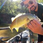
Primary Target: Largemouth and Spotted Bass
The black bass population is currently in a classic, multi-phase spring transition, which means you can fish to your strengths. A significant segment of the largemouth population is actively guarding fry around shallow cover and dock pilings, exhibiting highly territorial behavior. Meanwhile, the larger post-spawn females, along with the majority of the spotted bass (Kentucky bass), are beginning their migration out of the spawning pockets and toward deeper, main-lake structures. The bite is extremely aggressive right now, provided you are targeting the correct depth zones and matching the mood of the fish.
Sleeper Pick: White Bass
While the vast majority of tournament anglers are pounding the banks and flipping docks for largemouth, the white bass are schooling up in massive numbers in the river channels and major creek arms. They provide constant, rod-bending action and are completely overlooked by most visitors. Look for them pushing bait to the surface on overcast days, particularly near the Highway 54 bridge area and further up the tributaries towards Ha Ha Tonka.
Baitfish Report: Gizzard Shad, Bluegill, and Crawfish
The forage base is incredibly abundant and active right now. Gizzard shad are tightly schooled in the backs of pockets and along secondary points, providing a high-protein diet for schooling bass. Additionally, bluegill are moving into the shallows to begin their own spawning rituals, making them prime targets for big largemouth lingering near dock pilings. Do not ignore the crawfish, either. With the warming water, crawfish are highly active along the chunk rock banks and bluff transitions, making bottom-bouncing presentations highly effective.
Pro Tip:Listen closely when navigating into quiet coves at dawn. You can often hear bass busting shad schools on the surface before you can actually see them. Use your ears to locate the active feeding zones before dropping the trolling motor.
TACTICAL STRATEGY
Where: Focus your primary efforts on the Niangua Arm near Camdenton. Early in the day, target the deep-water dock complexes in Linn Creek, the Gravois Arm, and the backs of secondary coves. Look specifically for the darkest shade lines behind the docks where fry-guarding bass hide. As the sun gets high and the shallows heat up, transition your boat to 10-15 foot chunk rock points, underwater ledges, and bluff transitions near the main channel swings. The bass use these rocky transition zones as highways when moving from the shallows to their deep-water summer haunts.
Lure: For the shallow dock bite, utilize a 2.5-inch hollow-body popping frog. Skip it as far back into the dock slips as possible. When moving offshore to the rocky points, a 6-inch paddle tail swimbait is deadly for suspended fish. If they are pinned to the bottom, drag a 1/2-ounce structure jig or slow-roll a medium-diving crankbait that can dig into the 10-12 foot range.
Color: Success right now is all about matching the hatch. Use copperhead, green pumpkin, or natural bluegill patterns for your frogs and jigs to mimic the panfish and crawfish. For offshore swimbaits and crankbaits, albino pearl, translucent white, or silver shiner finishes perfectly replicate the local gizzard shad population.
Bait: If you prefer live bait fishing, rig a lively 3-inch to 4-inch gizzard shad hooked lightly through the nostrils. Use a 2/0 light-wire circle hook paired with a 1/4-ounce slip sinker and a 24-inch fluorocarbon leader. Drag this rig painstakingly slow along the secondary rocky points and gravel drop-offs, allowing the bait to swim naturally in the strike zone.
Timing: The golden hours are absolutely critical during this transition period. The topwater frog bite peaks from first light until approximately 9:00 AM. Once the sun penetrates the water column and the recreational boat traffic increases, the shallow bite dies quickly. Use the mid-day hours to focus on the offshore swimbait and jig bite on the main lake points.
Pro Tip:When skipping frogs under Camdenton's massive dock structures, aim for the black encapsulated floats rather than the white foam floats. The black floats absorb ambient heat from the sun and create darker, warmer ambush canopies, which consistently hold bigger, more aggressive fish during the spring season.
REGULATIONS SNAPSHOT
Conservation is key to maintaining this world-class fishery. Always verify with the Missouri Department of Conservation for real-time updates, but the current baseline regulations for the Lake of the Ozarks impoundment are as follows:
Target Species
Minimum Length Limit
Daily Bag Limit
Season Status
Largemouth Bass
15 inches
6 (in aggregate)
Open Year-Round
Smallmouth Bass
15 inches
6 (in aggregate)
Open Year-Round
Spotted (Kentucky) Bass
12 inches
6 (in aggregate)
Open Year-Round
White Bass
No minimum length
15 per day
Open Year-Round
Note: The daily limit of 6 black bass is an aggregate total. This means your daily catch can consist of any combination of largemouth, smallmouth, and spotted bass, so long as the total does not exceed 6 fish and all fish meet their respective minimum length requirements.
REGIONAL ALTERNATIVE
Harry S. Truman Reservoir Tailwaters
If heavy winds, severe weather fronts, or extreme recreational boat traffic make the main lake at Camdenton unfishable or unsafe, do not pack up and head home. Make the short drive northwest to the Truman Dam tailwaters located near Warsaw. This area offers highly protected access and phenomenal flow-driven fishing that is less impacted by lake traffic.
Instead of targeting largemouth bass, shift your focus to the Hybrid Striped Bass and White Bass that stack up heavily in the current seams below the dam. You can access the extensive public bank fishing areas or launch a smaller, more manageable vessel just below the restricted zone (pay close attention to the restricted zone buoys and signage). Cast 1/2-ounce to 3/4-ounce white bucktail jigs, or rig a chartreuse curly-tail grub on a heavy jig head. Throw your presentation right to the edge of the turbulent current breaks, let it sink, and allow the natural flow of the water to swing your bait through the strike zone. The strikes in this heavy current are violent, so ensure your drag is set properly.
Pro Tip:When fishing the Truman tailwaters, the bite is entirely dependent on the water generation schedule. Check the US Army Corps of Engineers generation schedule before making the drive. The fish feed most aggressively when the turbines are actively pushing water and creating strong current seams.
Tight lines!
Editor's Choice: Must-Have Gear
FISHINGSIR Next-Gen Waterproof Chest Waders
★★★★★4.4 (7,370+ reviews)
2-Ply Tech: Upgraded nylon with 2.5x higher density than standard fabrics.
100% Waterproof: Lab-approved intrusion resistance with taped visible seams.
Ultra-Lightweight: Designed for all-day comfort while hunting or fishing.
As an Amazon Associate I earn from qualifying purchases. #ad
Loading forecast...
Live Fishing Conditions: Tides, Weather & Waves
Get real‑time tides, marine weather, swell and solunar activity for each spot so you know exactly when conditions line up for your best chance at a bite.
🎣
Camdenton Bass
Loading coordinates...
🌤️
WEATHER CONDITIONS
--°F
--°C
Loading...
🌡️
Feels Like--°F--°C
💧
Humidity--%
💨
Wind-- mph-- km/h
🧭
Direction--
📊
Pressure-- inHg-- hPa
☀️
UV Index--
🌊
MARINE CONDITIONS
🌊Wave Height
-- ft
-- m
Loading...
🧭Wave Direction
--°
Loading...
⏱️Wave Period
-- s
Loading...
📈Tide Status
-- ft
-- m
Loading...
🌙
LUNAR & SOLUNAR
🌕
Loading...
Illumination: --%
Major Period--:-- - --:----:-- - --:--
Minor Period--:-- - --:----:-- - --:--
🌅Sunrise--:--
🌇Sunset--:--
📅
24-HOUR FORECAST
Loading fishing conditions...
Fishing Spots Map
🎣
Book a Fishing Charter near Camdenton Bass Fishing Report Today 🎣
Local guides & charters. Verified captains, instant booking, best price guaranteed.
There was an error loading the map. Please try refreshing the page.
Info
Local Access & Facilities
Camdenton, situated along the winding banks of the Lake of the Ozarks, represents a distinct chapter in Missouri bass fishing. This area is defined by its dramatic topography, where the rolling Ozark hills plunge directly into deep, structure-rich waters. Unlike the manicured, flat reservoirs found elsewhere in the Midwest, the fishery here is rugged and complex, demanding a captain's full attention regarding navigation and bottom composition. The water clarity often varies from stained in the river arms to clearer visibility near the main channel, creating a diverse playground for serious anglers.
The atmosphere in this sector of the lake is a blend of high-energy recreational boating and intense, focused angling. While the surface can be choppy with pleasure craft during the summer middays, the dawn and dusk hours reveal a serene, predatory environment ideal for working topwater lures over submerged timber. The primary draw for expert anglers here is undoubtedly the black bass population. Both Largemouth and Spotted Bass thrive in these waters, utilizing the thousands of private docks and rocky points as ambush cover. It is a fishery that rewards precision casting and high-end electronics.
For the traveling angler, Camdenton offers a strategic balance of accessibility and escape. It serves as a gateway to the Niangua Arm, a section of the lake renowned for its riverine characteristics and productive ledge fishing. Whether you are flipping jigs into heavy cover or cranking deep-diving plugs along channel swings, the local infrastructure supports heavy boat traffic and tournament-level logistics. Understanding the layout of the land, from trailer parking to bait acquisition, is the first step in unlocking the potential of this renowned bass haven.
Access & Getting There
Reaching the primary fishing grounds in Camdenton generally involves navigating via US-54, the main arterial road cutting through the region. Traffic flow on this highway can be deceptive; while generally moving well during the week, it becomes a significant bottleneck on Friday afternoons and Sunday mornings due to weekend vacationers towing vessels. Seasoned haulers know to time their arrival for early morning or late evening to avoid the "stop-and-go" grind on the hills leading into town. The terrain is hilly, so ensure your tow vehicle’s transmission and brakes are in top condition before tackling the grades around the lake.
Boat launch logistics in this area require a strategic approach. The data indicates multiple launch points in the immediate vicinity, though specific facility names are often colloquially known rather than officially signed. There is a launch point roughly 2.6 miles from the center of the spot, with others further out at 5.3 and 8.1 miles. When launching, particularly at public ramps, be prepared for steep grades. The water levels in the Lake of the Ozarks can fluctuate, making some ramps slick or shallow during winter drawdowns. It is imperative to inspect the ramp conditions before backing down, especially if you are hauling a heavy fiberglass bass boat or a deep-V multi-species hull.
💡 Captain's Tip: Trailer Security
Parking lots near public ramps in the Ozarks can fill up rapidly. For peace of mind and easier maneuvering, consider using the Truck Parking Club in Linn Creek. It offers 24-hour access and is designed specifically for larger rigs, avoiding the tight squeeze of crowded public lots.
Parking is a critical logistical component here. Main Gate Parking, located at 2465 N Business Rte 5, is a reliable option situated about 2.3 miles from the prime fishing coordinates. It holds a high rating, suggesting a level of safety and maintenance that professionals appreciate. For those fishing the quieter, more remote sections, the Brown Bend Public Access offers parking roughly 20.9 miles away. While further out, this location provides access to less pressured waters. Always ensure your vehicle and trailer are locked and devoid of valuables in plain sight, regardless of the lot's reputation.
Weather patterns in the Ozarks can dictate your access strategy. The steep hills surrounding the lake can channel wind, turning calm waters into a chop quickly. When the wind howls from the south or southwest, the main lake ramps can become difficult for solo launching. In these conditions, seeking out a ramp tucked into a leeward cove or utilizing the more protected access points in the river arms can save you from hull damage and frustration. The Dogwood Playground area offers shore access that is generally more protected, suitable for checking conditions before committing a vessel.
Camdenton Bass Pre-Trip Checklist
Facilities & Amenities
The local infrastructure in Camdenton is robust, catering heavily to the bass fishing community. The centerpiece for gear and local intelligence is Fitz Fishing Tackle & Supplies, located conveniently at 573 US-54. This shop is less than a mile from the central spot and is highly regarded by locals. However, captains planning a "dawn patrol" launch should note that Fitz Fishing Tackle opens at 8:00 AM throughout the week. This means you must secure your live bait, ice, and terminal tackle the afternoon before if you plan to be on the water at first light. Relying on a morning stop here will result in missing the prime morning bite.
For anglers who find themselves further afield or in need of alternatives, Bryants Osage Outdoors LLC in Laurie (15 miles away) and Weaver's Tackle Store in Lebanon (21 miles away) serve as excellent secondary options. Weaver's is particularly notable for staying open until 6:00 PM or 7:00 PM later in the week, providing a wider window for evening resupply. These shops are not just retail outlets; they are information hubs where you can glean the latest on water temperatures and clarity.
💡 Captain's Tip: Fuel Logistics
While there are marinas on the water, fuel prices at the dock are significantly higher than on land. Top off your boat on US-54 before launching. The gas stations along the highway are built to accommodate trailers, saving you maneuvering headaches and money.
The charter fleet in this region is exceptional, characterized by hard-working guides who understand the 24-hour nature of the fishery. Operators like Mike's Guide Service, Big Ed's Guide Service, and Casey Scanlon's Elite Lake of The Ozarks Guide Service are listed with 24-hour availability. This is a crucial indicator of the local fishing culture; night fishing for bass is a serious pursuit here, especially during the heat of summer. These guides are equipped for nocturnal operations, often utilizing black lights and specialized tactics that the average day-tripper might miss. If you are new to the lake, hiring one of these 24-hour capable guides for a night session can drastically shorten your learning curve.
Lodging options are plentiful and angler-friendly. Point Randall Resort in Lake Ozark is a standout, boasting a high rating and proximity to the water. For those towing campers or looking for a more rustic base camp, Spring Branch Park in Gravois Mills and King's Pointe Resort & RV Park in Sunrise Beach offer excellent facilities. Spring Branch Park is noted for being open 24 hours, facilitating late arrivals after a long haul. Most of these accommodations are accustomed to boaters, meaning finding a place to charge trolling motor batteries overnight is rarely an issue.
Facility Name
Type
Distance
Key Notes
Fitz Fishing Tackle
Bait & Tackle
0.5 mi
Opens 8 AM. Plan accordingly for early launches.
Truck Parking Club
Parking
3.2 mi
Open 24 Hours. Ideal for heavy trailers.
Mike's Guide Service
Charter
12.6 mi
24-Hour availability. Night fishing specialist.
Point Randall Resort
Lodging
14.3 mi
Highly rated resort near water.
Main Gate Parking
Parking
2.3 mi
Secure lot, 5-star rating.
Permits, Regulations & Fees
Fishing in the Camdenton area falls under the jurisdiction of the state fishing agency. Strict adherence to these regulations is not just a legal requirement but a cultural expectation among the local angling community. The bass fishery here is heavily pressured, and sustainable practices are vital to maintaining the quality of the sport. You must possess a valid Missouri fishing permit before wetting a line. These can typically be purchased online or at local vendors like Fitz Fishing Tackle, though electronic copies on your phone are generally accepted and more convenient.
Special attention should be paid to the specific regulations regarding black bass length and creel limits, which can vary by season and specific arm of the lake. The Brown Bend Public Access area, managed by the state, is a good reference point for checking posted signage regarding current rules. Conservation agents are active in this high-traffic area, and they frequently check livewells at boat ramps. Ignorance of slot limits or daily aggregate limits is not a valid defense.
In addition to state laws, anglers must respect the "rules of the road" regarding private property. The Lake of the Ozarks is lined with thousands of private docks. While fishing around these docks is legal and productive, casting into boat slips or stepping onto private floating structures is strictly prohibited and considered trespassing. This "Kapu" or forbidden behavior can lead to heated confrontations and legal trouble. Treat every dock as an extension of a homeowner's living room—fish the water, but touch nothing else.
Events & Seasonal Information
The rhythm of fishing in Camdenton is dictated by the seasons and the boat traffic. Summer brings the "pleasure boat" crowds, turning the main channel into a washing machine of wakes by 10:00 AM. Consequently, the serious fishing shifts to a nocturnal schedule or strict "dawn patrol" timing. The abundance of guides with 24-hour availability, such as Big Ed's Guide Service, highlights the popularity of beating the heat and the jet skis by fishing under the stars. During these summer months, night tournaments are common, and the lake comes alive with navigation lights.
Shoulder seasons, particularly spring and late autumn, offer a different dynamic. Traffic dies down, allowing anglers to explore main lake points and channel swings without constant rocking. This is often when the largest tournament sacks are weighed in. The Dogwood Playground area and other shore access points become more peaceful, offering families and shore-bound anglers a chance to fish without the noise of heavy combustion engines. Always monitor the wind forecast; the transition seasons can bring powerful storms that whip the lake into a dangerous frenzy.
💡 Captain's Tip: The 10 AM Rule
During peak season (Memorial Day to Labor Day), plan to be off the main lake or tucked deep into a no-wake cove by 10:00 AM. The wake turbulence from large cruisers makes precision boat control nearly impossible on the main channel after mid-morning.
Contact Information & Resources
For emergency situations, local law enforcement and the Missouri State Water Patrol maintain a strong presence on the water. However, cell service can be spotty in the deep coves and river arms. It is advisable to have a VHF radio on board monitoring channel 16. For non-emergency inquiries regarding specific ramp closures or water levels, the contacts associated with public access points like Brown Bend (573-346-2210) are valuable resources.
Self-reliance is key. Ensure your safety gear is up to date, and always file a float plan with someone on shore. While the amenities are plentiful, the water is vast and deep. For precise locations, real-time weather conditions, and detailed topographic maps of the spots mentioned, consult the live dashboard and interactive maps below.
Our spot reports combine data-driven forecasts with curated local information. The forecast is generated by our proprietary Fishing Score algorithm (0–100%), which analyzes real-time data from Open-Meteo API, validated against NOAA CO-OPS tide gauges and USGS water-monitoring stations. The model weights tide dynamics (35%), wave energy (25%), wind patterns (20%) and time of day (20%)—factors shown to influence fish feeding behavior through marine-biology research and decades of charter log data.
Access, facilities and services information for each fishing spot is sourced from official datasets such as Recreation.gov (RIDB), state park & wildlife agencies, and geospatial providers like Google Maps. These sections undergo scheduled re-validation every 3–6 months to ensure that boat ramps, park access, contact details and local services remain accurate.
Narrative sections (catches, seasonal behavior, local tips) are synthesized from these data sources and refined following the Fishing Reports Today editorial guidelines, combining bibliographic research from ichthyology and oceanography with expert angler experience. Our team reviews reports on a regular basis, while the forecast model itself updates every 6 hours for real-time accuracy.
⚠️ Important: Always verify current local regulations, access restrictions and weather conditions before fishing. These reports are intended as a planning aid, not a guarantee of catches or safety. When in doubt, contact local authorities or park managers listed on the page.
To provide the best experiences, we use technologies like cookies to store and/or access device information. Consenting to these technologies will allow us to process data such as browsing behavior or unique IDs on this site. Not consenting or withdrawing consent, may adversely affect certain features and functions.
Functional Always active
The technical storage or access is strictly necessary for the legitimate purpose of enabling the use of a specific service explicitly requested by the subscriber or user, or for the sole purpose of carrying out the transmission of a communication over an electronic communications network.
Preferences
The technical storage or access is necessary for the legitimate purpose of storing preferences that are not requested by the subscriber or user.
Statistics
The technical storage or access that is used exclusively for statistical purposes.The technical storage or access that is used exclusively for anonymous statistical purposes. Without a subpoena, voluntary compliance on the part of your Internet Service Provider, or additional records from a third party, information stored or retrieved for this purpose alone cannot usually be used to identify you.
Marketing & Affiliates
The technical storage or access is required to create user profiles to send advertising, or to track the user on a website or across several websites for similar marketing purposes, including affiliate tracking for products recommended in our reports.


Leave a Reply