


Access & Getting There
Getting your rig to the water requires navigating a mix of remote highways and strictly managed federal zones. For those hauling heavy fiberglass, the primary deep-water access is located 13.3 miles away at Davis Dam. The most common approach involves taking US 95 south from Las Vegas for about 30 miles, then cutting east on State Highway 164. Traffic is generally light in the early hours, but highway crosswinds can be treacherous for high-profile trailers. Plan your drive during the calmest parts of the morning.
The boat launch situation at Davis Dam Camp is highly functional but comes with specific operational quirks. Managed by the Mohave County Parks Department, the ramps are well-maintained and uniquely appointed to accommodate physically challenged anglers. However, maneuvering can get tight when the summer crowds arrive. There are also several unnamed, secondary boat launches located roughly 10 miles from the main Brown Creek spot. These are less developed, so a robust tow vehicle is highly recommended if you plan to explore off the beaten path.
Weather contingencies are a critical factor in this region. When the desert winds howl and whitecaps form on the open water, smart captains pivot to the protected shorelines. There are family-friendly shore access points located about 7 miles from the epicenter that offer excellent shelter during high-wind events. Always check the local wind forecasts before committing to a long run on the main lake. If the swell direction makes the main ramps dangerous, utilizing the leeward coves is your best backup plan.
Parking your rig requires strategic planning, especially if you are running a massive trailer. The Truck Parking Club is located 18.5 miles away and offers 24-hour access, making it the premier choice for oversized setups. If you need long-term storage, the Show Low Auto Boat RV Storage is closer at 13.3 miles, but their gates are locked on weekends. Note that the Home Depot parking lot is nearby, but it carries a dismal reputation among locals, so avoid leaving valuable gear there overnight.
💡 Captain's Tip: Dam Crossing Closure
Do not plan your driving route across the dam itself! As of April 2004, the roadway across Davis Dam is strictly closed to all vehicular traffic. You must use the surrounding highway bridges to cross the river. However, pedestrian and bicycle access is still permitted, making it an excellent scouting vantage point for current lines.
Brown Creek, AZ Pre-Trip Checklist
Facilities & Amenities
The local infrastructure around Brown Creek heavily favors the prepared angler. This is not a manicured resort area where tackle is available on every corner. The regional go-to shop is the Silver Creek General Store, located about 16.3 miles from the main fishing grounds. While they carry the essentials, there is a massive logistical hurdle: they do not open until 10:00 AM. If you are planning a dawn patrol for striped bass, you absolutely must purchase your bait, ice, and tackle the day prior.
Lodging in this sector ranges from completely off-grid to highly organized RV parks. For those who want to wake up in the wilderness, the Brown Creek Campground offers dispersed, primitive camping with zero amenities. It is rugged, quiet, and perfect for anglers who are entirely self-contained. If you need a bit more civilization, the White Mountain Recreation Camp is a highly rated facility just 3.3 miles away. For extended stays with full hookups, the Holiday Forest Mobile Home Park and Pine Flat RV Park offer excellent staging grounds roughly 9 miles away.
The Davis Dam Camp itself is a historical hub. Originally built to house the workers who constructed the dam, a few of the original buildings still stand today. The camp now features numerous campsites, RV hookups, and picnic areas. It serves as the primary base of operations for the local fleet. While there are no dedicated charter fleets listed directly in the creek area, the caliber of independent skippers launching from the county park is top-notch, heavily focused on big game river species.
Explicitly note the negative knowledge for this area: beyond the late-opening general store, there are very few immediate provisions near the dispersed trails. If you are hiking into the Lake Mountain Trailhead or the Land Of The Pioneers Trailhead for backcountry access, you must pack in all your own water and emergency supplies. The nearest major medical facility is the Summit Medical Center, located over 13 miles away. Self-reliance is not just a suggestion here; it is a vital necessity.
| Facility Name | Type | Distance | Key Detail |
|---|---|---|---|
| Silver Creek General Store | Bait & Tackle | 16.3 miles | Opens late at 10:00 AM. Buy gear prior day. |
| Brown Creek Campground | Accommodation | 0.0 miles | Dispersed, primitive camping. Fully off-grid. |
| Davis Dam Camp | Launch & RV | 13.3 miles | Accessible ramps, historic site, full hookups. |
| Truck Parking Club | Trailer Parking | 18.5 miles | Open 24 hours. Best for large rigs. |
| White Mountain Recreation Camp | Accommodation | 3.3 miles | Highly rated, close proximity to backcountry. |
Permits, Regulations & Fees
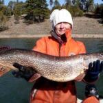
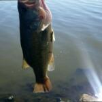
Fishing in this unique jurisdictional overlap requires strict adherence to local regulations. The waters here are primarily managed by the State Fishing Agency, and the rules are designed to protect the delicate balance between the native ecosystem and the introduced sport fish. Because you are dealing with a major waterway that borders different states and federal lands, holding the correct and current licensing is absolutely mandatory. Always check the official state sources for real-time size limits and seasonal closures regarding striped bass and rainbow trout.
The areas surrounding the Parker-Davis Project are highly sensitive federal zones managed by the Bureau of Reclamation. Security is tight around the critical infrastructure. Anglers must respect all posted signs, buoy lines, and restricted zones near the dam face. These barriers are not just for national security; they protect boaters from sudden, massive water releases that can swamp a vessel in seconds. Ignorance of the boundary lines carries heavy federal fines and immediate expulsion from the recreation area.
Cultural respect and environmental stewardship are equally important when utilizing the dispersed areas like Brown Creek. The nearby hiking paths, including the South Fork Trailhead and Upper Log Campground, traverse pristine wilderness. Anglers must practice strict Leave No Trace principles. Pack out all discarded line, bait containers, and trash. The historical significance of the dam workers' camps and the pristine nature of the high-desert creeks demand a high level of respect from visiting sportsmen.
💡 Captain's Tip: Border Waters Licensing
Because the Colorado River acts as a border between Arizona and Nevada near the dam, ensure your licensing covers the specific banks or waters you intend to fish. Reciprocal stamps are often required if you plan to cross the invisible state lines while trolling for stripers.
Events & Seasonal Information
The rhythms of this fishery are dictated entirely by seasonal weather patterns and scheduled water releases. During the peak summer months, the heat is absolutely punishing. Seasoned skippers know that the bite happens in the lowest light conditions. You must be on the water before dawn to capitalize on the striped bass feeding frenzies. As the sun crests and the desert bakes, the fish push deep, requiring heavy lead core lines or deep-dropping techniques to reach them.
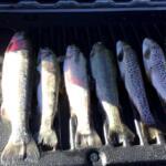
Winter brings a completely different dynamic to the Colorado River system and the surrounding creeks. The cooler temperatures make daytime fishing much more bearable, and this is typically when the rainbow trout action peaks. The state often stocks trout during the cooler months, which in turn fires up the massive, holdover striped bass that feed on them. Timing your trip around these stocking schedules is a closely guarded local secret that can result in trophy-class catches.
Daily timing is heavily influenced by the trade winds and thermals. Wind speeds typically increase dramatically by 10:00 AM, funneling through the canyons and whipping the main lake into a dangerous chop. If you are operating a smaller vessel, plan to have your fish in the box and be heading back to the Mohave County Parks Department ramps before the midday gales arrive. Always monitor the water release warnings, as sudden current shifts completely alter boat handling and drift speeds.
Contact Information & Resources
Safe and legal operation in this sector requires knowing who manages the land and water. The primary authority for the dam infrastructure is the Bureau of Reclamation, operating out of the Davis Dam Field Division in Bullhead City. For inquiries regarding the main boat ramps, RV hookups, and historic campsites, you should contact the Mohave County Parks Department. They maintain the day-use areas and can provide updates on ramp conditions following severe weather events.
Emergency self-reliance cannot be overstated. With many areas offering zero cell service, especially around the dispersed Brown Creek Campground, carrying a satellite communicator is highly recommended. The nearest major trauma center is the Summit Medical Center, which is over a 13-mile drive from the primary access points. Always file a float plan with a trusted contact before launching into the river system or hiking the backcountry trails.
For precise locations and real-time conditions, consult the live dashboard and maps below.


Leave a Reply