Quail Creek Reservoir Fishing Report: Fall Transition Tactics
GO/NO-GO STATUS
Verdict: GO
Current seasonal conditions at Quail Creek Reservoir are highly favorable for anglers. As we push through early fall, the intense summer heat of Southern Utah is finally beginning to break, leading to dropping surface temperatures that will trigger aggressive feeding windows. Water clarity remains excellent, with visibility often extending down to 8-10 feet. There are no ice conditions to worry about in this region at this time of year, but afternoon winds can pick up unexpectedly through the canyon. Small watercraft and kayakers should keep an eye on the wind forecast, particularly if venturing toward the main lake basin. Overall, the falling water temperatures make this a prime time to hit the water before the deep winter chill sets in.
SPECIES INTEL
Primary Target: Largemouth Bass
🎣Nautrek
Private Beta
J
M
R
100+ anglers on the waitlist
The fishing network where your reputation matters.
Find trusted captains, join real trips with cost splitting, and build your Angler Rank. Your spots stay private — you decide who sees your intel.
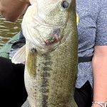
Largemouth bass are the undisputed heavyweight champions of Quail Creek, and the fall transition is one of the best times to target them. As the water cools, these bass begin moving from their deep summer haunts into shallower water to gorge on baitfish ahead of winter. You can expect to find them actively cruising weedlines and submerged brush.
While most anglers flock here for the bass, the Utah Division of Wildlife Resources (DWR) aggressively stocks catchable-sized rainbow trout in the cooler months. Many anglers completely overlook the trout bite in early fall, but as stocking trucks make their rounds and water temperatures drop, these fish provide consistent, rod-bending action, especially in the early mornings.
Baitfish Report
The primary forage base right now consists of redside shiners, juvenile bluegill, and crawfish. Bass are actively pushing schools of small baitfish toward the shorelines. Lure profiles that mimic a 2-to-3-inch struggling baitfish or a fleeing crawdad will get the most attention.
TACTICAL STRATEGY
Where to Look
Focus your efforts on the northern end of the reservoir where the incoming water provides slightly cooler temperatures and increased oxygen. Work the 8-15 foot drop-offs near the rocky points. Another highly productive zone is the submerged brush and flooded timber along the western shore. The bass will hold tight to this cover during the midday sun and push out to the edges to ambush prey early and late in the day.
Lure Selection
For largemouth bass, a drop-shot rig is incredibly effective right now. Use a 1/4-ounce tungsten cylinder weight paired with a 3-inch Megabass Hazedong Shad or a Z-Man Finesse TRD. If the fish are active and chasing, a medium-diving crankbait that hits the 7-12 foot depth range will trigger reaction strikes off the rocky points.
Color Patterns
Given the high water clarity, natural presentations are critical. Stick to Green Pumpkin, Watermelon Seed, or natural shad patterns for soft plastics. For crankbaits, ghost minnow or subtle crawfish patterns work best. Avoid overly bright or chartreuse colors unless a sudden rainstorm muddies the water.
Bait and Rigging
If you are targeting the stocked rainbow trout, a classic Carolina rig with a floating dough bait (like PowerBait in garlic or rainbow patterns) is highly effective. Rig it with a 1/8-ounce sliding egg sinker, a small swivel, and an 18-inch fluorocarbon leader (4-to-6 pound test) to keep the bait suspended just above the bottom grass.
Timing the Bite
The golden hours are your best friend right now. The first two hours after sunrise and the last hour before sunset offer the most aggressive feeding windows. During the midday bright sun, you will need to slow down your presentation and fish tight to structure or drop into deeper water (15-20 feet).
Pro Tip:When fishing the drop-shot rig in Quail Creek's clear water, lengthen your leader from the hook to the weight to about 18 inches. This keeps your bait slightly higher above the submerged vegetation and makes it more visible to cruising bass.
REGULATIONS SNAPSHOT
Before making your first cast, ensure you are compliant with current Utah DWR regulations for Quail Creek Reservoir:
Largemouth Bass: The daily limit is 6 fish, but only one (1) largemouth bass may be over 12 inches. This regulation is designed to protect the trophy-class breeding fish while allowing harvest of smaller bass.
Smallmouth Bass: There is NO LIMIT on smallmouth bass. In fact, catch-and-release is strictly prohibited for this species here. All smallmouth bass caught must be immediately killed to protect the largemouth fishery.
Trout: The general statewide limit of 4 trout applies.
Panfish (Bluegill/Crappie): Statewide general limits apply (typically 50 fish for panfish, but always verify current guidebook limits).
Pro Tip:Always double-check the official Utah Fishing Guidebook for emergency closures or seasonal updates, and remember that transporting live fish is strictly illegal in Utah.
REGIONAL ALTERNATIVE
If Quail Creek is blown out by heavy canyon winds or you simply want a change of scenery, Sand Hollow Reservoir is the premier backup location, located just a short drive to the south.
Why Sand Hollow?
Sand Hollow is a massive 1,300-acre reservoir famous for its red rock scenery and exceptional warm-water fishery. It boasts an incredibly dense population of largemouth bass and bluegill. The sheer size of the lake offers plenty of coves and wakeless zones to hide from the wind.
Tactical Approach for Sand Hollow
Target the submerged grass beds in 10-20 feet of water. A Texas-rigged Senko (green pumpkin or watermelon red flake) dragged slowly through the grass is a proven producer. For family-friendly action, target the rocky shorelines near the dam with a 1/16-ounce curly-tail jig tipped with a piece of nightcrawler to catch dozens of aggressive bluegill. Like Quail Creek, remember that any smallmouth bass caught here must be immediately killed.
Tight lines!
Editor's Choice: Must-Have Gear
FISHINGSIR Next-Gen Waterproof Chest Waders
★★★★★4.4 (7,370+ reviews)
2-Ply Tech: Upgraded nylon with 2.5x higher density than standard fabrics.
100% Waterproof: Lab-approved intrusion resistance with taped visible seams.
Ultra-Lightweight: Designed for all-day comfort while hunting or fishing.
As an Amazon Associate I earn from qualifying purchases. #ad
Loading forecast...
Live Fishing Conditions: Tides, Weather & Waves
Get real‑time tides, marine weather, swell and solunar activity for each spot so you know exactly when conditions line up for your best chance at a bite.
🎣
Quail Creek
Loading coordinates...
🌤️
WEATHER CONDITIONS
--°F
--°C
Loading...
🌡️
Feels Like--°F--°C
💧
Humidity--%
💨
Wind-- mph-- km/h
🧭
Direction--
📊
Pressure-- inHg-- hPa
☀️
UV Index--
🌊
MARINE CONDITIONS
🌊Wave Height
-- ft
-- m
Loading...
🧭Wave Direction
--°
Loading...
⏱️Wave Period
-- s
Loading...
📈Tide Status
-- ft
-- m
Loading...
🌙
LUNAR & SOLUNAR
🌕
Loading...
Illumination: --%
Major Period--:-- - --:----:-- - --:--
Minor Period--:-- - --:----:-- - --:--
🌅Sunrise--:--
🌇Sunset--:--
📅
24-HOUR FORECAST
Loading fishing conditions...
Fishing Spots Map
🎣
Book a Fishing Charter near Quail Creek Fishing Report Today 🎣
Local guides & charters. Verified captains, instant booking, best price guaranteed.
There was an error loading the map. Please try refreshing the page.
Info
Local Access & Facilities
Situated at the intersection of the rugged Texas Hill Country and the bustling urban sprawl of Austin, the Quail Creek area serves as a strategic logistical hub for anglers targeting the renowned Highland Lakes and the San Gabriel River system. While the immediate vicinity is defined by the limestone-rich geology of North Austin, seasoned captains recognize this location as the gateway to some of the state's most technical freshwater fisheries. The environment here is characterized by "karst" topography—a landscape of porous limestone that filters water to exceptional clarity, creating a visual hunting ground for game fish but demanding high-level presentation skills from the angler.
The atmosphere surrounding this fishery is a distinct blend of metropolitan convenience and raw, cedar-choked wilderness. To the north, the impounded waters of the San Gabriel River at Georgetown Lake offer a stark contrast to the manicured banks of Lady Bird Lake downtown. Here, the shoreline is rugged, lined with sharp limestone bluffs and dense juniper forests that seasoned locals refer to as "Cedar Breaks." This isn't just a place to wet a line; it is a technical arena where the bottom topography changes rapidly, and the water clarity often exceeds ten feet, requiring long casts and light fluorocarbon leaders.
For the expert angler, the primary draw here is a species mix that is somewhat unique for Central Texas. While Largemouth Bass are ubiquitous, the nearby reservoirs accessible from this hub are celebrated for a healthy population of Smallmouth Bass. The rocky structure and deep, clear water provide the ideal habitat for these bronze-backed fighters, attracting tournament pros looking to fill a mixed bag. Additionally, the presence of Hybrid Stripers and White Crappie allows for diverse seasonal strategies, making this a year-round destination for those who know how to read the seasonal movements of baitfish across the limestone ledges.
Access & Getting There
Navigating the access points around Quail Creek and the greater Austin area requires a strategic approach to traffic management. The I-35 corridor is the primary artery connecting anglers to the northern fisheries like Georgetown Lake, but it is notorious for heavy congestion. Seasoned skippers know that towing a boat through this sector between 7:00 AM and 9:00 AM on weekdays can result in significant delays. The preferred strategy is an early "dawn patrol" departure, aiming to hit the Cedar Breaks Park gates right as they open to secure prime trailer parking and beat the recreational traffic that swells by mid-morning.
For those launching at Georgetown Lake, the primary facility is located at Cedar Breaks Park, approximately 21 miles north of the Quail Creek center. This is a Corps of Engineers facility, meaning the infrastructure is robust, but the water levels can fluctuate significantly based on rainfall and municipal water use. The ramps here are generally wide and paved, designed to handle heavy bass boats and center consoles. However, during periods of low water, the end of the ramp can become slick with algae, and the drop-off to the lakebed can be steep. It is advisable to check current lake levels before hitching up, as a variance of just a few feet can alter the launch geometry significantly.
💡 Captain's Tip: Launch Ramp Traction
The limestone dust and algae common at Hill Country ramps like Cedar Breaks can make the concrete incredibly slick, especially during low water levels. Use 4-wheel drive when pulling out heavy fiberglass boats, and ensure your parking brake is fully engaged before stepping out of the truck.
Alternative access for the Colorado River system is available at the 360 Bridge Boat Landing (Pennybacker Bridge), located roughly 5.8 miles from the central hub. This ramp provides access to Lake Austin. While scenic, this is one of the busiest launch points in the state. Competitive anglers avoid this ramp on weekends after 10:00 AM due to the high volume of wakeboard boats and paddlers. If you are targeting the grass lines on Lake Austin, plan to launch in the dark. The parking lot here is tight, and maneuvering a 21-foot trailer requires patience and precision.
Weather plays a critical role in access decisions in this region. The open basins of the local reservoirs are susceptible to high winds, particularly when the spring southerlies kick up. Georgetown Lake lacks significant wind protection due to the surrounding savannah and low-lying scrub. When wind speeds exceed 15 knots, the main lake can develop a dangerous chop that makes boat control difficult for spot-locking on offshore structure. In these conditions, utilizing the leeward coves near the dam or shifting focus to the more riverine sections of the San Gabriel can save the day.
Quail Creek Pre-Trip Checklist
Facilities & Amenities
The infrastructure surrounding Quail Creek is highly developed, offering expert anglers access to specialized equipment and services that smaller rural fisheries lack. However, the urban density means that navigating these amenities with a trailer requires foresight. Unlike coastal fishing towns where every gas station sells marine fuel and ice, this is a metropolitan environment where selecting the right vendor matters.
For tackle and technical gear, Tackle Shack, ATX is the premier local outfitter, located just 3.6 miles from the center point. Unlike big-box stores, this shop is tuned into the local bite, stocking the specific colors of crankbaits and soft plastics that mimic the local forage in clear water. They are a reliable source for real-time intelligence on lake levels and bass patterns. For live bait, specifically minnows for crappie or hybrid striper fishing, anglers may need to travel further north to Sambass Market in Round Rock (11.3 miles), which caters more directly to the live-bait crowd.
💡 Captain's Tip: Urban Parking Hazards
Many "public parking" locations in Austin, such as the Central Parking garages listed in standard directories, have low clearance heights and tight turns incompatible with boat trailers. Do not attempt to enter urban garages with a vessel. Stick to surface lots or designated trailer parking at the ramps.
The local charter fleet is well-regarded, particularly for guides specializing in the use of forward-facing sonar and deep-water tactics. Operators like Torwick's Guiding Service and Hill Country Bass Coach have established reputations for dissecting the offshore structure that holds the biggest fish. These are not typically "tourist" trips but rather technical sessions suited for anglers looking to improve their electronics game or learn the nuances of the Highland Lakes.
Lodging logistics are critical for multi-day trips. While the AT&T Hotel and Conference Center offers high-end amenities, it is ill-suited for boat parking. For anglers towing rigs, the Austin East KOA Holiday (8 miles away) or the campsites directly at Cedar Breaks Park are far superior options. Staying at Cedar Breaks allows for immediate water access, maximizing fishing time during the prime dawn and dusk windows. The park offers 59 reservable campsites with electric hookups, suitable for charging trolling motor batteries overnight.
Facility Name
Type
Distance
Angler Notes
Tackle Shack, ATX
Gear & Tackle
3.6 mi
Pro-level selection; opens 10 AM (Tue) or 9 AM (Wed-Sun). Closed Mondays.
Sambass Market
Bait & Supplies
11.3 mi
Opens 6 AM daily. Reliable for live bait and early ice.
Austin East KOA
Lodging/RV
8.0 mi
Trailer-friendly; shore power available for charging.
Cycle Gear
Parts/Accessory
1.7 mi
Good for tie-downs, casual gear, or emergency trailer needs.
Permits, Regulations & Fees
Navigating the regulatory landscape here requires attention to both state laws and specific federal overlay zones. The primary fisheries are managed by the Texas Parks and Wildlife Department (TPWD), requiring a valid Texas freshwater fishing license for all anglers aged 17 and older. Enforcement is active, particularly on weekends, and game wardens frequently check live wells for compliance with length limits. Specifically, for Smallmouth Bass, regulations can vary by lake, so it is imperative to check the specific annual outlook for Georgetown Lake versus Lake Austin.
Beyond the standard state license, the Cedar Breaks Park facility operates under the jurisdiction of the U.S. Army Corps of Engineers. This means that access often requires an entry fee or a valid America the Beautiful pass. The park utilizes an automated gate system in some areas, and reservations for camping must be made in advance through the official recreation portals. Cancellations are strict; once a reservation date has begun, modifications are often impossible, so plan your trip dates with certainty.
A unique regulatory consideration in this area involves the Balcones Canyonlands National Wildlife Refuge. Located to the west, this refuge protects the habitat of the golden-cheeked warbler and black-capped vireo. While the refuge offers some hunting and hiking, it is primarily a conservation zone. Anglers exploring the upper reaches of tributaries or accessing remote creeks should be hyper-aware of refuge boundaries. Trespassing into nesting zones during the spring breeding season is a serious federal offense. Furthermore, the "karst" geology means that the aquifer is highly sensitive to pollution. Special care must be taken to prevent fuel spills or the introduction of invasive species like Zebra Mussels—clean, drain, and dry your boat before moving between bodies of water.
Events & Seasonal Information
The fishing calendar in the Austin area is dictated by the extreme heat of the Texas summer and the distinct spawn cycles of spring. The "pre-spawn" movement typically begins in late February or early March, when big females move from the deep limestone ledges into the shallows. This is the prime window for trophy hunters. During this period, boat traffic at ramps like 360 Bridge and Cedar Breaks intensifies significantly due to local bass club tournaments.
As summer sets in, with air temperatures often exceeding 100°F, the fishery shifts to a nocturnal rhythm. Expert anglers switch to night fishing to escape the heat and recreational boat traffic. The bite for Hybrid Stripers often ignites under the cover of darkness or during the first hour of daylight. During these months, the "dawn patrol" isn't just a preference; it's a safety necessity to avoid heat exhaustion. The trade winds usually pick up by 10:00 AM, providing some relief but also churning up the main lake basins.
💡 Captain's Tip: Summer Hydration & Heat
The limestone terrain reflects heat, creating on-water temperatures that feel significantly hotter than the forecast. When fishing Georgetown or Lake Austin in summer, carry double the water you think you need. The most productive fishing often occurs between 8:00 PM and 2:00 AM.
Fall brings a secondary peak in activity as shad migrate into the creeks, and schooling fish become common. This is often the most pleasant time to fish, with lower traffic and active wildlife. Winter fishing is technical and slow, often involving vertical jigging spoons or drop-shot rigs in 30+ feet of water, targeting suspended fish that have pulled back to the main river channels.
Contact Information & Resources
For the most current information on lake levels and ramp closures, direct contact with the managing agencies is essential. The Georgetown Lake Office (Corps of Engineers) can be reached at (512) 930-5253; they are the authority on flood control operations which can shut down boat ramps without warning. For issues regarding the wildlife refuge or specific conservation questions, the Balcones Canyonlands National Wildlife Refuge headquarters is available at 512-339-9432.
In the event of an on-water emergency, cell reception is generally good across the main lakes due to the proximity to Austin, but dead zones exist in the deep river canyons. Always file a float plan. For precise locations of the boat ramps, real-time wind conditions, and detailed bathymetry of the nearby reservoirs, consult the live dashboard and interactive maps below.
Our spot reports combine data-driven forecasts with curated local information. The forecast is generated by our proprietary Fishing Score algorithm (0–100%), which analyzes real-time data from Open-Meteo API, validated against NOAA CO-OPS tide gauges and USGS water-monitoring stations. The model weights tide dynamics (35%), wave energy (25%), wind patterns (20%) and time of day (20%)—factors shown to influence fish feeding behavior through marine-biology research and decades of charter log data.
Access, facilities and services information for each fishing spot is sourced from official datasets such as Recreation.gov (RIDB), state park & wildlife agencies, and geospatial providers like Google Maps. These sections undergo scheduled re-validation every 3–6 months to ensure that boat ramps, park access, contact details and local services remain accurate.
Narrative sections (catches, seasonal behavior, local tips) are synthesized from these data sources and refined following the Fishing Reports Today editorial guidelines, combining bibliographic research from ichthyology and oceanography with expert angler experience. Our team reviews reports on a regular basis, while the forecast model itself updates every 6 hours for real-time accuracy.
⚠️ Important: Always verify current local regulations, access restrictions and weather conditions before fishing. These reports are intended as a planning aid, not a guarantee of catches or safety. When in doubt, contact local authorities or park managers listed on the page.
To provide the best experiences, we use technologies like cookies to store and/or access device information. Consenting to these technologies will allow us to process data such as browsing behavior or unique IDs on this site. Not consenting or withdrawing consent, may adversely affect certain features and functions.
Functional Always active
The technical storage or access is strictly necessary for the legitimate purpose of enabling the use of a specific service explicitly requested by the subscriber or user, or for the sole purpose of carrying out the transmission of a communication over an electronic communications network.
Preferences
The technical storage or access is necessary for the legitimate purpose of storing preferences that are not requested by the subscriber or user.
Statistics
The technical storage or access that is used exclusively for statistical purposes.The technical storage or access that is used exclusively for anonymous statistical purposes. Without a subpoena, voluntary compliance on the part of your Internet Service Provider, or additional records from a third party, information stored or retrieved for this purpose alone cannot usually be used to identify you.
Marketing & Affiliates
The technical storage or access is required to create user profiles to send advertising, or to track the user on a website or across several websites for similar marketing purposes, including affiliate tracking for products recommended in our reports.




Leave a Reply