


Hudson Lake in New Carlisle, Indiana, presents a unique logistical profile for the serious angler. Situated strategically between the urban hubs of South Bend and the heavy-hitting fisheries of Michigan City, this location offers a distinct change of pace from the vast, often volatile waters of nearby Lake Michigan. For the expert angler, Hudson Lake serves as both a primary target for inland freshwater pursuits and a tactical base of operations for exploring the broader LaPorte County fishery. The atmosphere here is defined by a blend of rural Indiana tranquility and the rhythmic industrial hum of the South Shore Line, which runs directly adjacent to the water, creating a setting that is accessible yet feels removed from the high-pressure tournament scenes found at larger marinas.
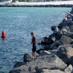
The fishery is characterized by its dual nature; it functions as a serene inland retreat while sitting in the shadow of the Indiana Dunes National Park ecosystem. Experienced captains navigating this region know that success here relies on understanding the interplay between local access points and the broader regional infrastructure. Unlike the manicured, full-service harbors found on the Great Lakes, Hudson Lake requires a more self-sufficient approach. The vibe is decidedly local, where knowledge of parking nuances and seasonal wind patterns is more valuable than a high-end GPS chart. This is a location for the angler who appreciates the "dawn patrol" solitude and doesn't mind hauling gear a few hundred yards to find the perfect launch point.
While the primary draw for many in this region is the salmon and trout run of the big lake, Hudson Lake offers a critical contingency for days when the "ocean-like" swells of Lake Michigan make offshore excursions dangerous or impossible. Understanding the facilities here—or more importantly, the lack thereof compared to major ports—is essential for a smooth trip. From the specific constraints of commuter rail parking to the location of the nearest heavy-duty trailer lots, the logistics of Hudson Lake demand a professional level of planning. The following guide breaks down the essential access, facility, and regulatory intelligence required to fish this water effectively.
Access & Getting There
Reaching Hudson Lake requires navigating the corridor between South Bend and Michigan City. The primary artery for most anglers will be U.S. Highway 20 or the scenic U.S. Highway 12 (Dunes Highway). Traffic flow in this region is generally moderate, but seasoned drivers know to account for shifts in volume during the summer tourist season when visitors flock to the Indiana Dunes. The approach to New Carlisle is straightforward, but the final mile to the water can be deceptive. The active South Shore Line commuter train tracks run parallel to the northern shore, and crossings can be potential bottlenecks. Anglers towing larger vessels should be particularly vigilant at rail crossings, ensuring their trailer clearance is sufficient for the grade.
The primary access point for this specific location is anchored by the Hudson Lake Station Parking South. Located approximately 1,000 feet from the water at 8311 E 700 N, this lot serves the commuter line but is frequently utilized by those accessing the lake area. It is critical to note that this is a mixed-use facility. Early morning arrivals—typical for serious anglers—will compete with daily commuters heading to Chicago or South Bend. The lot is paved and generally well-maintained, earning a high rating for accessibility, but it lacks specific "boat trailer" striping. If you are hauling a skiff or a bass boat, you must park strategically to avoid blocking commuter flow or getting boxed in by midday traffic.
💡 Captain's Tip: The Commuter Clock
The Hudson Lake Station parking lot fills up according to the train schedule. On weekdays, arrive before 6:00 AM to secure a spot that allows for easy trailer maneuvering. If you arrive mid-morning, you may find yourself navigating a tight maze of commuter vehicles.
For those requiring substantial space for heavy rigs or looking to rest before a long haul, the Truck Travel Center Parking Lot is located roughly 4.5 miles away in Rolling Prairie. This is an essential waypoint for captains towing large center consoles who need ample turning radius or a safe place to check bearings and tie-downs before navigating the narrower access roads closer to the lake. Additionally, for anglers looking to launch kayaks or smaller craft in the broader vicinity, the Glassman Park Kayak Launch is located approximately 10.9 miles away, and the Galien River Boat Launch is roughly 11.5 miles distant. These distances imply that Hudson Lake itself is best suited for car-toppers or shore access unless you have arranged specific private launch permissions, as public heavy-boat ramps are not immediately adjacent to the station lot.
Weather plays a significant role in access here, though differently than on the big lake. While you don't contend with 10-foot swells, the open nature of the surrounding farmland means wind can sweep across New Carlisle with surprising force. In winter and early spring, the lake effect snow bands from Lake Michigan can rapidly deteriorate road conditions on Highway 20. Always check the road status if towing in winter; the local "red dirt" roads and smaller access lanes can become treacherous mud pits during the thaw.
Hudson Lake Laporte County, IN Pre-Trip Checklist
Facilities & Amenities
Hudson Lake operates with a "bring what you need" philosophy. The immediate shoreline lacks the commercial density of a marina district. There are no fuel docks, pump-out stations, or full-service chandleries directly on the water. The expert angler knows to fuel up the vessel and the tow vehicle at the Truck Travel Center in Rolling Prairie (4.5 miles out) before committing to the final approach. Running out of fuel or ice here means a significant interruption to your fishing time.
For tackle and bait, the local infrastructure caters heavily to the Lake Michigan crowd, which works to the advantage of the Hudson Lake angler who wants professional-grade gear. Silver Bullet Sport Fishing in Bridgman, MI (approx. 14.6 miles away) is a top-tier resource for bait and local intelligence. They open at 6:00 AM, making them a viable stop for the dawn patrol. Another excellent resource is Mishawaka Lure & Tackle Co in Niles, MI (approx. 22 miles away). While these shops are not on the shoreline, their inventory is stocked for serious game fishing, far surpassing what one might find in a generic gas station.
💡 Captain's Tip: Bait Logistics
There is no live bait shop directly on the Hudson Lake shoreline. Purchase your minnows, crickets, or nightcrawlers at Silver Bullet Sport Fishing the evening before your trip or on your drive in. Once you are at the water, your options are zero.
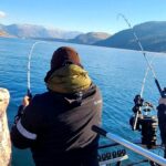
The charter fleet in the region is world-class, though primarily based out of Michigan City. Operators like Fire Drill Charters and Just 1 More Lake Michigan Charter Fishing run heavy-duty vessels targeting salmon and trout. For the visiting angler without a boat, booking a trip with these outfits (located roughly 16 to 19 miles away) is a great way to complement a shore-fishing trip to Hudson Lake. You can fish the inland water in the morning and head to the big lake for an afternoon charter, or vice versa.
Key Local Facilities Data
| Facility Name | Type | Distance | Notes |
|---|---|---|---|
| Hudson Lake Station Parking South | Parking | ~1,000 ft | Closest access; mixed commuter use. |
| Truck Travel Center | Parking/Fuel | 4.5 miles | Best for heavy rigs/fueling. |
| Silver Bullet Sport Fishing | Bait & Tackle | 14.6 miles | Opens 6 AM; pro-grade gear. |
| Republic Parking System | Public Lot | 11.4 miles | Located in South Bend; overflow option. |
Lodging in the immediate vicinity is sparse, leaning towards camping and retreats rather than chain hotels. Life Action Camp in Buchanan, MI (10.4 miles) and Redbud Trail Retreat (14.2 miles) offer rustic accommodations. For those towing campers, the Dunewood Campground (part of the National Park system) is a premier option, though it sits about 23.3 miles away. It features 66 campsites, including 54 drive-in sites, but be aware there are no electric or water hookups at the sites—this is dry camping for the self-sufficient. Showers and restrooms are available, making it a viable base camp for a multi-day expedition covering both Hudson Lake and the Dunes.
Permits, Regulations & Fees
Fishing Hudson Lake falls under the jurisdiction of the Indiana Department of Natural Resources (DNR). All anglers must possess a valid Indiana fishing license. Because of the proximity to the Michigan border (just a few miles north), it is crucial to know exactly where the state line sits. A Michigan license is not valid on Hudson Lake, and conservation officers patrol the area regularly due to the high volume of cross-border traffic. Always carry your license on your person; digital copies on a phone are generally accepted, but a paper backup in a waterproof bag is a professional standard.
While Hudson Lake is a state-managed fishery, its proximity to the Indiana Dunes National Park (approx. 20 miles north) means that anglers venturing toward the big lake or utilizing the Dunewood or Dunbar campgrounds must adhere to federal regulations. For instance, the Dunbar Group Site and Central Avenue Walk-in Sites have strict occupancy and vehicle limits (e.g., maximum 6 vehicles at Dunbar). If you are using these federal facilities as a base, ensure you have paid the requisite entrance fees (often managed via Recreation.gov) and display your pass clearly. The "America the Beautiful" pass is accepted at the National Park sites.
💡 Captain's Tip: The "Kapu" of the Rails
Local etiquette demands strict respect for the South Shore Line tracks. Never cross the tracks at unauthorized points to reach a fishing hole, and never park a trailer where the hitch overhangs the rail right-of-way. The railway police have zero tolerance for trespassing, and trains move faster and quieter than you expect.
Conservation is a major focus in this region. The Indiana Dunes area protects significant biodiversity, including rare bird species that frequent the wetlands. Anglers are expected to pack out all trash, particularly monofilament line, which poses a severe threat to waterfowl. The culture here is one of stewardship; local property owners along Hudson Lake are protective of their water quality and shoreline. Respect private docks and maintain a courteous distance when casting near residential shorelines.
Events & Seasonal Information
The angling rhythm at Hudson Lake is dictated by the distinct four-season climate of Northern Indiana. Spring is a dynamic time, with wildflowers blooming along the nearby Heron Rookery and fish moving into the shallows to spawn. This is often the best time for shore fishing as water temperatures rise. However, spring also brings mud and variable water levels, so footwear with good traction is non-negotiable.
Summer transforms the region into a bustling recreational hub. The "Lake Michigan summer sunsets" described in local guides paint the sky with vibrant hues, making evening fishing sessions particularly spectacular. However, the heat can drive fish deep by mid-morning. Experienced skippers know that the "bite window" in July and August is often from first light until 9:00 AM, after which recreational boating traffic and solar intensity shut down the surface action. The trade-off is the accessibility of the nearby Indiana Dunes beaches for a post-fishing cool down.
Fall is arguably the finest season for the serious angler. The maple trees surrounding the nearby Chellberg Farm burst into red and gold, creating a stunning backdrop. Fishing pressure drops significantly as the summer tourists depart. This is the time to target heavier fish feeding up for winter. Winter brings a hard freeze, and while ice fishing is a popular pastime in Indiana, one must verify ice thickness independently. The proximity to Lake Michigan can cause fluctuating temperatures that make ice stability unpredictable. Nearby, the Glenwood Dunes offer cross-country skiing, providing an alternative outdoor activity if the ice isn't safe.
Contact Information & Resources
For official information regarding the nearby National Park facilities, campgrounds, and federal regulations, contact the Indiana Dunes National Park directly. The fee collection office can be reached at 219-395-1882 or via email at INDUFeeCollection@nps.gov. For general park communications, use INDU_Communications@nps.gov.
In terms of safety, this is a semi-rural area. Emergency response times may be longer than in the city center. Ensure your cell phone is fully charged, as coverage can be spotty in the low-lying areas near the water. For precise locations of the parking lots, bait shops, and potential launch points mentioned in this guide, consult the live dashboard and interactive maps below.


Leave a Reply