Verdict: GO (WITH CAUTION FOR PENDING WEATHER SHIFT)
Current late-spring conditions are offering a prime, albeit brief, weather window for anglers looking to launch out of the Burns Waterway area. We are currently seeing highly manageable south winds at 5 to 10 knots, which is keeping our nearshore wave action at a very comfortable 1 foot or less. This makes for ideal boat control when finessing tight to the breakwalls. However, a significant meteorological pattern shift is looming on the horizon. Winds are forecasted to clock around to the northeast and eventually intensify from the north to 15 to 25 knots by mid-week. This northern fetch will quickly build waves up to 4 to 6 feet, with occasional 8-foot rollers, which will almost certainly trigger a Small Craft Advisory.
If you are heading out today or tomorrow morning, it is a definitive GO. Capitalize on the current calm conditions, but keep a marine radio active and plan to be off the big water before the northern blow arrives. Water temperatures are steadily warming near the Burns Waterway and industrial discharges, creating an excellent thermal draw. Ensure your vessel is equipped with all U.S. Coast Guard-approved safety gear, as Lake Michigan's late-spring water temperatures are still cold enough to make hypothermia a serious risk in the event of an emergency.
🎣Nautrek
Private Beta
J
M
R
100+ anglers on the waitlist
The fishing network where your reputation matters.
Find trusted captains, join real trips with cost splitting, and build your Angler Rank. Your spots stay private — you decide who sees your intel.
While the southern basin of Lake Michigan is internationally famous for its pelagic salmonids, the late-spring smallmouth bass fishery along the Indiana shoreline is nothing short of world-class. The bronzebacks have completed their transition into the shallows and are stacking up heavily along the rocky breakwalls, industrial rip-rap, and submerged boulder fields. Fish in the 2- to 4-pound class are standard daily catches right now, with legitimate 5-pounders making regular appearances for anglers who methodically dissect the structure. These fish are aggressive, feeding heavily to recover from the spawn and prepare for the summer months.
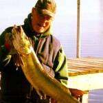
Sleeper Pick: Brown Trout and Rainbow Trout
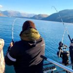
Most boaters are either making the 6- to 20-mile run offshore to chase migrating Coho Salmon in 70 to 200 feet of water, or they are pounding the rocks for bass. This leaves the nearshore trout fishery largely unpressured and highly lucrative. The Indiana Department of Natural Resources recently executed a massive spring trout stocking campaign, deploying nearly 52,000 fish statewide from the Curtis Creek Trout Rearing Station. Holdover fish and newly stocked 11-inch rainbows and browns are currently patrolling the color lines and warmer water discharges near the creek mouths. They are actively hunting in the upper water column and provide explosive nearshore action.
Baitfish Report
Understanding the forage base is critical, and it is currently split based on your exact target zone. Along the rocky breakwalls and nearshore reefs, Round Gobies are the absolute dominant forage. These invasive bottom-dwellers are the primary protein source for smallmouth bass. If your presentation doesn't mimic a scuttling goby, you are leaving fish on the table. Further off the breaks and near the river mouths, schools of alewives are present and are the primary target for the cruising trout and salmon. Match your presentations to these two distinct baitfish profiles for maximum success.
TACTICAL STRATEGY
Where to Deploy
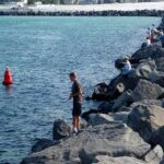
For smallmouth bass, launch at the Portage Marina (just off Indiana 249) and make the short run north via the Burns Waterway. Once you hit the main lake, you have two prime options. First, the small rocky breakwall protecting the creek mouth holds excellent numbers of fish. Second, make the short run east to the massive breakwall guarding the Port of Indiana. Crucial navigational note: Boaters cannot legally enter the Port to fish the inside waters, but the entire outer wall is open game. Focus your efforts specifically on the submerged secondary breakwater that runs parallel to the main outer wall. This invisible structure is the premier holding zone for trophy smallmouth.
If you are targeting trout, focus on the distinct color mudline where the Little Calumet River discharge meets the clearer waters of the main lake. Predators use this visual barrier to ambush baitfish pushed out by the current.
Lure Selection
For the smallmouth, finesse is the name of the game. Top producers include:
1/4-ounce Ned rigs paired with goby-imitating plastics
3/8-ounce football jigs dressed with compact creature baits
Heavy tube jigs dragged slowly and methodically across the rocks
If you are targeting the brown and rainbow trout near the discharge, cast a Rapala Husky Jerk (Size 10) or troll a 1/2-ounce metallic casting spoon through the top 10 feet of the water column.
Color Patterns
Water clarity is currently decent but can turn milky near the river discharges depending on recent rainfall. For your bass plastics, stick strictly to goby-imitating colors: green pumpkin, watermelon red, dark brown pepper, and anything with a hint of purple flake. For the trout hardware, metallic gold, firetiger, or silver/blue combinations are producing the necessary flash to draw strikes in the stained water.
Bait Recommendations
If you prefer utilizing live bait, rigging a lively jumbo leech or a soft-shell crayfish on a drop-shot rig is absolutely deadly for the smallmouth holding tight to the submerged boulders. Keep your weight in contact with the bottom, but ensure your hook is tied 12 to 18 inches above the weight to suspend the bait right in the fish's face and avoid constant snags in the jagged rip-rap.
Prime Timing
The first two hours of daylight are critical right now. The early morning bite offers the calmest wave conditions and the most aggressive feeding window before the sun gets high and the afternoon winds shift. Late evening, just before dusk, provides a secondary feeding window, particularly for the trout pushing shallow to chase alewives.
Pro Tip: When fishing the submerged secondary breakwater at the Port of Indiana, utilize your side-scan sonar to pinpoint irregular rock piles, gaps, or "blowouts" where the wall has deteriorated. Smallmouth use these subtle depth changes and structural anomalies as highly efficient ambush points.
Pro Tip: If the nearshore bite slows down, start zig-zagging to look for thermal breaks. Even a subtle one- or two-degree temperature variation near the Burns Waterway discharge will concentrate baitfish, and the predatory trout and bass will never be far behind.
REGULATIONS SNAPSHOT
Always verify with the latest Indiana DNR guidelines before hitting the water, but keep these critical regulations in mind for the Lake Michigan zone. Remember that if you travel 6 to 20 miles offshore, you may cross into Illinois or Michigan waters, which requires the appropriate out-of-state licensing.
Species
Minimum Size Limit
Daily Bag Limit
Special Notes
Smallmouth & Largemouth Bass
14 inches (Total Length)
3 fish (aggregate)
Specific to Lake Michigan waters. (Inland lakes differ).
Trout & Salmon
14 inches
5 fish (aggregate)
No more than 2 lake trout. Valid Indiana Trout/Salmon Stamp required.
Yellow Perch
None
15 fish
Excellent table fare if encountered near the structures.
REGIONAL ALTERNATIVE
If the impending north winds make the open waters of Burns Harbor and the Port of Indiana unsafe or unfishable, do not cancel your trip. Pack up your gear and make the short drive east to Michigan City to fish Trail Creek. The Michigan City pier and the adjoining marina basin offer substantial protection from rolling northern waves. You can safely access the handicap-accessible public fishing site located next to the DNR building.
Alternatively, push up into the lower stretches of Trail Creek itself. The creek provides excellent shelter from the wind and holds residual steelhead, brown trout, and staging coho salmon. Scale down your tackle significantly for this environment. Utilize medium-light spinning gear spooled with 6- to 8-pound fluorocarbon. Drift 1/8-ounce marabou jigs tipped with wax worms, or float fresh spawn sacs under a sensitive centerpin float to entice stream-dwelling trout holding in the deeper pools and behind current breaks. This is a highly productive backup plan that keeps you catching fish while staying safe from big lake swells.
Pro Tip: When fishing Trail Creek after a rain event, focus on the seams where muddy runoff meets the clearer main creek flow. Trout will sit in the clean water and dart into the muddy water to snatch displaced insects and bait.
Tight lines!
Editor's Choice: Must-Have Gear
FISHINGSIR Next-Gen Waterproof Chest Waders
★★★★★4.4 (7,370+ reviews)
2-Ply Tech: Upgraded nylon with 2.5x higher density than standard fabrics.
100% Waterproof: Lab-approved intrusion resistance with taped visible seams.
Ultra-Lightweight: Designed for all-day comfort while hunting or fishing.
As an Amazon Associate I earn from qualifying purchases. #ad
Loading forecast...
Live Fishing Conditions: Tides, Weather & Waves
Get real‑time tides, marine weather, swell and solunar activity for each spot so you know exactly when conditions line up for your best chance at a bite.
🎣
Burns Harbor
Loading coordinates...
🌤️
WEATHER CONDITIONS
--°F
--°C
Loading...
🌡️
Feels Like--°F--°C
💧
Humidity--%
💨
Wind-- mph-- km/h
🧭
Direction--
📊
Pressure-- inHg-- hPa
☀️
UV Index--
🌊
MARINE CONDITIONS
🌊Wave Height
-- ft
-- m
Loading...
🧭Wave Direction
--°
Loading...
⏱️Wave Period
-- s
Loading...
📈Tide Status
-- ft
-- m
Loading...
🌙
LUNAR & SOLUNAR
🌕
Loading...
Illumination: --%
Major Period--:-- - --:----:-- - --:--
Minor Period--:-- - --:----:-- - --:--
🌅Sunrise--:--
🌇Sunset--:--
📅
24-HOUR FORECAST
Loading fishing conditions...
Fishing Spots Map
🎣
Book a Fishing Charter near Burns Harbor Fishing Report Today 🎣
Local guides & charters. Verified captains, instant booking, best price guaranteed.
There was an error loading the map. Please try refreshing the page.
Info
Local Access & Facilities
Burns Harbor sits at a fascinating intersection where heavy industry meets the raw, natural power of Lake Michigan. For the serious angler, this location offers a unique juxtaposition: the rugged, man-made structures of the port providing structure for baitfish, flanked by the pristine, rolling topography of the Indiana Dunes National Park. This isn't just a steel town; it is a gateway to the southern basin’s productive waters, where the lake’s might has influenced the coastline for millennia. The bottom topography here is a mix of shifting sandbars and dredged channels, requiring a skipper who pays close attention to their depth sounder.
The atmosphere here is distinctly "working coast." While you will find the serenity of the dunes and the quiet woodlands nearby, the harbor itself is a hub of activity. It lacks the manicured polish of a resort town, offering instead a gritty, authentic maritime vibe that appeals to seasoned captains. The water here can turn treacherous quickly when the north winds howl down the length of the lake, shaping the very land and leaving a rich mosaic of habitats along the 15 miles of Indiana coast.
Anglers launching here are typically targeting the migratory heavyweights of the Great Lakes. The proximity to the Portage Public Marina and the nutrient-rich waters circulating around the industrial breakwalls creates a dynamic fishery. Whether you are trolling deep for salmon or working the shoreline structure, Burns Harbor serves as a strategic launchpad for those looking to avoid the heavier recreational traffic found further west toward Chicago.
Access & Getting There
Reaching Burns Harbor is a logistical exercise in navigating one of the Midwest's busiest transportation corridors. The primary arteries are Interstate 94 and the Indiana Toll Road (Interstate 80/90). For those hauling heavy fiberglass, U.S. Highway 12 and U.S. Highway 20 offer alternative routes that run parallel to the lakeshore. Traffic congestion here is a reality, particularly during the morning rush when steel haulers are active. Seasoned locals know to time their arrival well before the commuter wave hits, aiming to be at the ramp while the highways are still moving freely.
The boat launch situation requires a tactical approach. While Burns Harbor is the anchor point, the primary recreational access is often found at the nearby Public Marina in Portage, just over 2 miles away. For those with kayaks or lighter skiffs, the Deep River Water Trail at Riverview Park (approximately 6.7 miles out) offers a quieter entry point. If you are towing a large vessel, be mindful that the industrial nature of the area means roads are built for trucks, but turning radiuses in smaller lots can be tight.
💡 Captain's Tip: Trailer Logistics
If you are hauling a large rig, utilize the dedicated truck and RV parking facilities on Melton Road. Unlike standard lots, these areas are designed for heavy turning and offer 24-hour access, allowing you to stage your rig safely if you arrive the night before a dawn patrol.
Parking is generally robust but varies drastically by season. The West Beach parking lot is a massive facility with 596 spots, including 20 dedicated spaces for buses or RVs. However, do not let the capacity fool you; on holiday weekends and during peak summer runs, this lot can fill to capacity by mid-morning. The Northeast Parking Ramp and Parking Lot #0 are available but are located over 12 miles away, making them impractical for boaters. Stick to the lots closer to the water and arrive early.
Burns Harbor Pre-Trip Checklist
Facilities & Amenities
The infrastructure around Burns Harbor caters heavily to the functional needs of boaters and tradesmen. You won't find boutique tackle shops on every corner, but the ones that exist are dialed in for serious fishing. Slez's Bait and Tackle, located about 6.5 miles away in Lake Station, is the primary hub for live bait and local intelligence. Crucially, they open at 5:00 AM, accommodating the early-rising fleet. For those needing specialized gear or cannabis products, PUFF Cannabis New Buffalo Dispensary is in the region but is a significant drive (23+ miles) and likely not part of your immediate fishing logistics.
Fuel and provisions are readily available for big rigs. The Pilot Flying J locations on Melton Road offer truck and RV parking with 24-hour service, which is essential for captains needing to refuel tow vehicles or grab ice at odd hours. Note that while there are restrooms at West Beach and the Chellberg Farm picnic areas, these are often seasonal. From mid-May through mid-October, facilities are fully operational, but off-season anglers should plan accordingly as potable water may be shut off to prevent freezing.
💡 Captain's Tip: Amenities Check
Before hitching up, verify the operational status of the fish cleaning stations. While some local ramps have them, the industrial nature of Burns Harbor means you should be prepared to bring coolers and ice to transport your catch home for processing.
For those looking to charter a vessel rather than trailer their own, Brother Nature Charter Fishing operates directly out of the Public Marina in Portage, practically in the backyard of Burns Harbor. They are a top-tier option for getting on the fish without the hassle of navigation. Further east, Fire Drill Charters runs out of Michigan City, offering another reputable option for Great Lakes adventures.
Facility Name
Type
Distance
Notes
Slez's Bait and Tackle
Bait & Tackle
6.5 miles
Opens 5:00 AM; Rated 4.8/5
Brother Nature Charter Fishing
Charter
2.2 miles
Located at Public Marina, Portage
Pilot Flying J (Melton Rd)
Parking/Fuel
1.7 miles
24-hour Truck/RV Parking available
West Beach Picnic Shelter
Accommodation
4.0 miles
Picnic tables, seasonal restrooms
Indiana Dunes State Park Campground
Camping
4.6 miles
Electric hookups, showers, 24-hour access
Permits, Regulations & Fees
Navigating the regulatory waters here is just as important as navigating the lake. Fishing within the jurisdiction of the Indiana Dunes National Park and the surrounding state waters is managed by the State Fishing Agency. A valid Indiana fishing license is non-negotiable. Because this area borders state lines and includes federal waters, ensure you are cognizant of the specific boundaries to avoid inadvertent violations.
Access to the National Park areas, including West Beach and the boat access points, generally requires an entrance pass. The Indiana Dunes Visitor Center on Indiana State Road 49 is your checkpoint for permits, brochures, and current regulation updates. Be aware of cancellation policies for reserved facilities; the park enforces a $10.00 service fee for modifications or cancellations, and late cancellations can result in forfeiting the entire use fee.
Cultural and environmental respect is paramount here. The dunes are a fragile ecosystem containing sensitive areas like Pinhook Bog and Cowles Bog. These are National Natural Landmarks. "Kapu" or sacred laws might be a Hawaiian concept, but the principle applies to the local conservation ethos: tread lightly. Do not trample the dune grass, and strictly adhere to designated trails and water access points to preserve this landscape for future generations.
Events & Seasonal Information
The rhythm of Burns Harbor is dictated by the seasons of Lake Michigan. Spring is a time of awakening, splashing the river banks of the Heron Rookery with colorful wildflowers. This is often when nearshore anglers target coho salmon and trout cruising the shallows. As summer sets in, the lake calms, and the "picture-perfect picnic settings" at West Beach become popular. This is prime boating season, but it brings heavy recreational traffic.
Fall transforms the landscape as maple trees at Chellberg Farm burst into red and gold. For the angler, this signals the return of mature salmon to the tributaries and harbors. The weather can turn quickly during this transition, with the lake becoming violent with little warning. Winter brings a stark beauty; the "scenic canvas of virgin white snow" invites cross-country skiing in the Glenwood Dunes, but for the boater, it means icing conditions and limited access. Always check the Indiana Dunes Visitor Center calendar for specific ranger-led programs or festivals that might impact traffic flow.
💡 Captain's Tip: Wind Awareness
Lake Michigan's might has influenced this land for millennia. When the forecast calls for strong northerly winds, the swell at the harbor mouth can become dangerous. Always verify the wave period and height before leaving the dock, regardless of how calm it looks inside the breakwall.
Contact Information & Resources
For immediate logistical support and emergency information, the Indiana Dunes National Park communications office is your primary contact at (219) 395-1882. They can provide real-time updates on ramp closures and park conditions. For historical context or visits to the nearby Pullman National Historical Park, contact 773-928-7257.
Safety is your responsibility. The lake is unforgiving, and conditions change rapidly. Always file a float plan and ensure your safety gear is rated for offshore conditions. For precise locations, real-time wind data, and detailed charts of the nearby spots, consult the live dashboard and interactive maps below.
Our spot reports combine data-driven forecasts with curated local information. The forecast is generated by our proprietary Fishing Score algorithm (0–100%), which analyzes real-time data from Open-Meteo API, validated against NOAA CO-OPS tide gauges and USGS water-monitoring stations. The model weights tide dynamics (35%), wave energy (25%), wind patterns (20%) and time of day (20%)—factors shown to influence fish feeding behavior through marine-biology research and decades of charter log data.
Access, facilities and services information for each fishing spot is sourced from official datasets such as Recreation.gov (RIDB), state park & wildlife agencies, and geospatial providers like Google Maps. These sections undergo scheduled re-validation every 3–6 months to ensure that boat ramps, park access, contact details and local services remain accurate.
Narrative sections (catches, seasonal behavior, local tips) are synthesized from these data sources and refined following the Fishing Reports Today editorial guidelines, combining bibliographic research from ichthyology and oceanography with expert angler experience. Our team reviews reports on a regular basis, while the forecast model itself updates every 6 hours for real-time accuracy.
⚠️ Important: Always verify current local regulations, access restrictions and weather conditions before fishing. These reports are intended as a planning aid, not a guarantee of catches or safety. When in doubt, contact local authorities or park managers listed on the page.
To provide the best experiences, we use technologies like cookies to store and/or access device information. Consenting to these technologies will allow us to process data such as browsing behavior or unique IDs on this site. Not consenting or withdrawing consent, may adversely affect certain features and functions.
Functional Always active
The technical storage or access is strictly necessary for the legitimate purpose of enabling the use of a specific service explicitly requested by the subscriber or user, or for the sole purpose of carrying out the transmission of a communication over an electronic communications network.
Preferences
The technical storage or access is necessary for the legitimate purpose of storing preferences that are not requested by the subscriber or user.
Statistics
The technical storage or access that is used exclusively for statistical purposes.The technical storage or access that is used exclusively for anonymous statistical purposes. Without a subpoena, voluntary compliance on the part of your Internet Service Provider, or additional records from a third party, information stored or retrieved for this purpose alone cannot usually be used to identify you.
Marketing & Affiliates
The technical storage or access is required to create user profiles to send advertising, or to track the user on a website or across several websites for similar marketing purposes, including affiliate tracking for products recommended in our reports.


Leave a Reply