


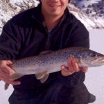
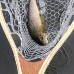
Nestled in the heart of the Cache Valley, Logan serves as a dual-threat gateway for serious anglers, offering immediate access to high-elevation river currents and productive flatwater reservoirs. The atmosphere here is defined by the dramatic transition from the pastoral valley floor to the rugged limestone cliffs of the Bear River Range. Anglers here trade the salt spray for the scent of maple, oak, and box elder forests that line the banks of the Logan River.
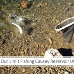
The fishery is diverse, splitting the fleet between fly purists chasing trout in the canyon and boaters targeting bass, perch, and bluegill in the impoundments. The crown jewel for boaters is Hyrum Reservoir, a 480-acre sheet of water that demands different tactics depending on the season. Whether you are drifting a dry fly through the riffles near Guinavah or trolling deep near the Hyrum Dam, the local topography dictates your strategy.
This region is not just a summer destination; it is a year-round fishery where the hardiest anglers brave the winter freeze for ice fishing opportunities. However, the prime window remains the heavy-use season from April through September, when the water levels are managed, and the aquatic life is most active. The following guide breaks down the logistical realities of fishing this northern Utah hub.
Access & Getting There
The primary artery for accessing this fishery is US-89, also known as the Logan Canyon National Scenic Byway. This route parallels the Logan River, offering numerous pull-outs and trailheads for shore anglers looking to wet a line in the moving water. Traffic can be heavy during the summer tourist season and autumn leaf-peeping windows, particularly on weekends. Experienced locals know to hit the canyon roads early to secure pull-out parking near prime holes.
For those trailing a boat, the primary destination is Hyrum State Park, located approximately 7.6 miles southwest of Logan. Access is straightforward via Highway U-165. The boat launch situation at Hyrum Reservoir is generally reliable with all-weather access, but captains should be aware that this is a multi-use reservoir. During peak summer months, the ramps can get congested with recreational water sports traffic by mid-morning.
💡 Captain's Tip: Launch Timing
Hyrum Reservoir is a hub for water skiing and wakeboarding in the summer. To target bass and trout effectively, seasoned skippers launch at first light and fish the dawn patrol window before the recreational fleet churns up the surface around 10:00 AM.
River access is facilitated by a network of campgrounds and trailheads. Spring Hollow, Guinavah, and Bridger campgrounds all offer direct access to the Logan River. While the roads within Spring Hollow and Guinavah are paved, anglers towing drift boats or small trailers should note that some parking spurs are gravel and can be tight. The Riverside Nature Trail and Crimson Trail provide excellent foot access for those willing to hike away from the pressured roadside spots.
Logan Utah Pre-Trip Checklist
Facilities & Amenities
Logan boasts a robust infrastructure for anglers, ranging from specialized fly shops to general outdoor outfitters. Rainy's Flies & Supplies, located just 1.2 miles from the center of the action, is the undisputed HQ for fly fishermen. This is the place to get local intelligence on hatch timings and river flows. For those fishing the reservoir, RoundRocks Flies in Hyrum offers proximity to the water, ensuring you can grab last-minute essentials without backtracking to the city.
For heavy-duty gear or late-night supplies, Bear River Outfitters in Willard operates 24 hours, a rare luxury for captains planning alpine starts or overnight trips. Note that while there are ample amenities in Logan and Hyrum, on-water fuel docks are not a standard feature at the smaller launch points. It is critical to fuel up your vessel at the stations along US-89 or in Hyrum City before committing to the launch ramp.
💡 Captain's Tip: Ice & Provisions
There is no ice available directly at the smaller river access points or primitive launches. Stock your coolers in Logan or Hyrum City. Kent's Optics and Classic + Titan in Tremonton serve as backup resource points if you are approaching from the west.
Lodging options cater to the "dawn patrol" mentality. Beaver Creek Lodge offers a comfortable base of operations for those fishing the upper canyon, while Camp Rendezvous provides a closer jump-off point for the southern approaches. For those hauling RVs, Hyrum State Park offers partial hookups, allowing you to keep the boat rigged and ready just yards from the water.
| Facility Name | Type | Key Amenities | Distance from Hub |
|---|---|---|---|
| Hyrum State Park | State Park / Marina | Boat Ramps, RV Hookups, Beach, Dump Station | 7.6 miles |
| Bridger Campground | River Camp | Vault Toilets, Picnic Tables, Fire Rings | 6.0 miles |
| Guinavah | River Camp | Amphitheater, Flush Toilets, Group Sites | 5.0 miles |
| Spring Hollow | River Camp | Paved Roads, Drinking Water, Trailheads | 4.0 miles |
Permits, Regulations & Fees
Fishing in this region is managed by the Utah Division of Parks and Recreation in conjunction with the Bureau of Reclamation for reservoir waters. Compliance is strictly enforced, particularly regarding invasive species inspections for boats entering Hyrum Reservoir. The "Why" behind these strict rules is the preservation of the delicate high-altitude ecosystems and the prevention of aquatic hitchhikers that could devastate the local trout and bass populations.
Reservations are highly recommended for all campgrounds, especially during the heavy use season from April to September. The Bridger, Spring Hollow, and Guinavah campgrounds operate on a reservation system with specific booking windows. Cancellation policies are rigid, often requiring 14 days' notice to avoid forfeiting fees. It is common for prime summer weekends to book out months in advance, so logistical planning is essential.
While there are no specific "Kapu" laws here, there is a strong local ethic regarding land stewardship. The Logan Canyon is a high-traffic corridor, and anglers are expected to pack out all trash and respect the private property boundaries that occasionally abut the river. Special attention should be paid to "refer to local signage" regarding size limits and possession limits, which can vary between the reservoir and the flowing river sections.
Events & Seasonal Information
The rhythm of the fishery is dictated by the seasons. Spring runoff can make the Logan River high and fast, challenging for wading but productive for drift fishing. As summer settles in, the river flow stabilizes, and the dry fly action peaks. In contrast, Hyrum Reservoir sees its heaviest pressure from April through September. This is when the bass bite is hottest, but also when recreational traffic is at its peak.
Autumn brings a spectacular transformation to the area. As the leaves on the maple and oak trees turn, the fishing pressure often drops, leaving the water open for serious anglers targeting brown trout moving to spawn. The Logan Canyon Scenic Byway becomes a destination in itself during this time, so expect heavier vehicle traffic on the roads, even if the water is quieter.
💡 Captain's Tip: The Autumn Window
Late September to mid-October offers the "Golden Window." The summer wakeboarders have racked their boats, the water temperature in Hyrum drops to a trout-friendly range, and the river fishing is technical and rewarding amidst the fall foliage.
Contact Information & Resources
For the most current conditions on water levels and campground status, direct communication with managing agencies is vital. The Logan Ranger District (435-755-3620) is the primary point of contact for river conditions and canyon campgrounds. For specific inquiries regarding boat launching and reservoir conditions, contact Hyrum State Park directly at 435-245-6866.
Safety in the canyon involves self-reliance. Cell service can be spotty in the deeper sections of Logan Canyon. Always file a float plan or tell a contact where you intend to fish. Be prepared for rapid weather changes; thunderstorms can roll over the Wellsville Mountains and into the canyon with little warning, dropping temperatures and visibility instantly.
For precise locations of boat ramps, tackle shops, and real-time weather conditions, consult the live dashboard and interactive maps below.


Leave a Reply