
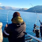
Willow Slough represents a quintessential Midwest backwater fishery, offering a rugged, quiet experience for anglers willing to navigate the borderlands between Illinois and Indiana. Situated near Hopkins Park, Illinois, this area is defined by its wetland characteristics, requiring a shift in tactics from open-water trolling to precision casting and shallow-water navigation. Unlike the manicured harbors of Lake Michigan to the north, this fishery is raw and unrefined, appealing to the self-reliant angler who appreciates solitude over amenities. The atmosphere here is thick with the quiet of the prairie and the marsh, where the water is often stained and the bottom composition varies from soft muck to submerged timber.
For the expert angler, the draw of Willow Slough is not just the fish, but the technical challenge of the environment. The hydrology here supports a variety of warm-water species typical of the region, thriving in the nutrient-rich, weedy waters. This is not a destination for heavy offshore vessels; it is the domain of johnboats, kayaks, and shallow-draft skiffs capable of maneuvering through tight channels and vegetation. The vibe is distinctly rural and agricultural, far removed from the urban sprawl, meaning that logistical planning is as critical as bait selection. Success here depends on understanding the lay of the land and the water levels, which can fluctuate significantly with seasonal rainfall.
Navigating this region requires an understanding that you are operating in a "boundary zone." With coordinates placing the heart of the action near the state line, anglers are often fishing waters that feel remote despite being within driving distance of major hubs. The lack of immediate commercial development on the water’s edge preserves the natural aesthetic but demands that captains arrive fully prepared. There are no fuel docks or full-service marinas waiting around the bend; this is a pack-in, pack-out fishery where your preparation on dry land dictates your range and endurance on the water.
💡 Captain's Tip: Mobile Logistics
Because amenities are spread out across a 15-to-20-mile radius, fuel up your vessel and tow vehicle before leaving the major highways (US-41 or I-57). Once you enter the Hopkins Park or wetland areas, fuel stations become scarce and often lack high-clearance canopies for larger center consoles.
Access & Getting There
Navigating the Road Network
Accessing the Willow Slough area generally involves navigating a grid of rural county roads that connect to larger arteries like US-41 to the east in Indiana or IL-1 and IL-114 to the west. For anglers towing trailers, the approach from Lake Village, Indiana via US-41 is often the most straightforward route for larger rigs, minimizing time spent on narrower backroads. Traffic in this agricultural belt is generally light, though farm equipment can cause slowdowns during planting and harvest seasons in spring and autumn. The roads surrounding Hopkins Park can be variable in quality; seasoned drivers know to watch for soft shoulders, especially after heavy rains which are common in the spring.Launch Ramp Realities
The data indicates that while the fishery is centered near Hopkins Park, the primary hard-surface boat ramps are located roughly 13 to 17 miles away from the central coordinate. This separation between the "spot" and the launch necessitates careful planning. You are likely launching into a feeder system or a nearby body of water and navigating toward the slough areas, or trailing to specific unimproved access points. The Forest Preserve access points in Lake Village and Schneider, Indiana are critical hubs. These ramps are functional but often lack the polished infrastructure of big-city marinas. Expect concrete pads that may be slick with algae or mud due to fluctuating water levels. During low-water periods in late summer, checking the end of the ramp with a push pole before backing down is a prudent move to avoid dropping a trailer wheel off the concrete.Parking Strategy and Security
Parking options in this region are categorized by their utility and distance. The Forest Preserve Parking Lot in Lake Village (approximately 14.4 miles away) and the lot in Schneider (approximately 14.6 miles away) are the primary staging grounds for boaters. These lots are rated highly for accessibility, but they are unattended. Security here is a matter of common sense: lock your vehicle and do not leave valuable electronics visible in the cab. For those looking for 24-hour access, the parking lot in Clifton, Illinois (roughly 16.2 miles south) offers round-the-clock availability, which is essential for anglers planning night fishing excursions for catfish or early dawn patrols.💡 Captain's Tip: Trailer Considerations
The rural lots near Schneider and Lake Village are spacious but can be unpaved or gravel. After heavy rains, 4WD is highly recommended for pulling heavier fiberglass boats out of the lots, as the ground can become soft.
Willow Slough Pre-Trip Checklist
Facilities & Amenities
Bait and Tackle Logistics
In this region, the bait shop is not just a store; it's the intelligence hub. However, you will not find a tackle shop directly on the shoreline of Willow Slough. You must procure supplies while en route. Elliotts Bait and Tackle in Kankakee, Illinois (approx. 19.8 miles away) is a staple for the area. Note their hours carefully: they open at 10:00 AM on Mondays, Thursdays, and Fridays, and are closed on Tuesdays. This is not a "dawn patrol" stop on weekdays, so buy your live bait the day before if you plan to launch at sunrise.For anglers approaching from the Indiana side, Realistic Bait LLC in Lowell, Indiana (approx. 24.9 miles away) offers more consistent daily hours, opening at 9:00 AM seven days a week. While neither shop opens at 4:00 AM, their ratings suggest high-quality live bait and reliable local intel. Sportsman's Den in Cedar Lake is another viable option, though further out. The key takeaway is that there is no "last chance" bait shop at the ramp; if you forget aerators or specific terminal tackle, you are looking at a 40-mile round trip to correct the mistake.Lodging and Base Camps
Accommodation near the fishery ranges from rustic to functional. The closest lodging option is KLos Ranch, located just 8.4 miles from the center of the fishing zone in Pembroke Township. This proximity makes it an excellent forward operating base for multi-day trips. For those who prefer to camp and stay close to the elements, Lake Alexander Campground in Momence, Illinois (approx. 13.5 miles away) provides a verified outdoor stay with a high rating. It positions you well for accessing the western approaches to the water. If you require standard hotel amenities, you will likely need to look further out toward the larger towns, but for the dedicated angler, these local spots offer the necessary proximity to maximize time on the water.Charter Availability
This area is primarily a DIY fishery. While there are highly rated charter operations in the broader region, such as Angry Pirate Fishing Charters (approx. 28.2 miles away in Cedar Lake) or Whitecap Outfitters LLC (approx. 47.3 miles away), they generally focus on the larger lakes or Lake Michigan fisheries. Do not expect to find a fleet of captains waiting at the Willow Slough launch. Anglers coming here should be self-sufficient captains capable of running their own vessels and finding their own fish.| Facility Type | Name | Distance | Key Notes |
|---|---|---|---|
| Bait Shop | Elliotts Bait and Tackle | 19.8 mi | Closed Tuesdays; Opens 10 AM Mon/Thu/Fri |
| Bait Shop | Realistic Bait LLC | 24.9 mi | Open Daily 9 AM - 6 PM |
| Lodging | KLos Ranch | 8.4 mi | Closest accommodation |
| Camping | Lake Alexander Campground | 13.5 mi | Good for trailers; Momence area |
| Parking | Clifton Parking Lot | 16.2 mi | Open 24 Hours |
Permits, Regulations & Fees
Jurisdictional Awareness
Fishing the Willow Slough area requires keen attention to state lines. The coordinates place the fishery squarely on the border of Illinois and Indiana. Regulations are managed by the respective State Fishing Agencies. It is imperative to carry the license for the state in which you are casting, or preferably both if you plan to explore the full extent of the interconnected waters. Conservation officers patrol these border waters, and claiming ignorance of the GPS line is rarely a successful defense.Protected Zones and Stewardship
Much of the surrounding land is designated as Forest Preserve or Fish and Wildlife Area (FWA). These designations are not just bureaucratic labels; they indicate sensitive wetland habitats that support waterfowl and migratory birds. "Kapu" or forbidden zones may not be marked with flashing lights but are often indicated by simple signage or buoys. Respecting no-wake zones is critical here, not just for legal reasons, but to prevent shoreline erosion in the soft, marshy banks that define the slough's structure.Events & Seasonal Information
Seasonal Rhythms
The fishing calendar here follows the classic Midwest rhythm. Spring brings high water and the pre-spawn movement, often the most productive time for shallow water angling. Summer sees the vegetation thicken, requiring weedless presentations and heavy braid to extract fish from cover. The "dog days" of summer often push the best bite windows to early morning or late evening.Weather Patterns
Wind is a major factor in this flat, open prairie landscape. Without significant terrain to block the flow, a 15-knot wind can chop up even relatively small bodies of water, making boat control difficult. The most stable weather patterns usually occur in early autumn, a favorite time for locals to target feeding fish before the winter freeze. While there are no major professional tournament circuits that focus exclusively on this specific slough, the surrounding region is active with local club tournaments, particularly on weekends.💡 Captain's Tip: Summer Heat Strategy
During July and August, the shallow nature of the slough means water temperatures can spike rapidly. Plan your trips for the first three hours of daylight. By 10:00 AM, the bite often shuts down as fish bury themselves deep in the heavy shade of the vegetation.
Contact Information & Resources
Emergency and Management
Because this area straddles jurisdictions, emergency response can come from either Illinois or Indiana agencies depending on your precise location. In an emergency, dial 911, but be prepared to provide specific landmarks or GPS coordinates, as "on the water near the slough" is too vague for dispatchers. For non-emergency issues regarding access or regulations, the Forest Preserve offices in Lake Village (contactable via the parking lot info at 219-992-3019) are a primary resource for current conditions on the Indiana side.Final Preparations
Self-reliance is the rule of the road here. Ensure your battery connections are tight, your spare tire is inflated, and your safety gear is accessible. This is a rewarding fishery for those who respect its remote nature and arrive prepared.For precise locations of the boat ramps, bait shops, and real-time weather conditions, consult the live dashboard and interactive maps below.


Leave a Reply