Wheeler Lake (Wheeler Reservoir), Alabama Fishing Report Today 🎣
10 months ago · Updated 3 weeks ago
Wheeler Lake Summer Fishing Report & Guide
As a Senior Fishing Editor and Pro Guide who spends countless hours dissecting the expansive waters of Wheeler Reservoir, I can confidently tell you that the summer patterns are fully established and delivering explosive action. Stretching 60 miles from Guntersville Dam down to Wheeler Dam, this Tennessee Valley Authority (TVA) powerhouse is currently showcasing exactly why it is one of Alabama's premier fisheries. The grass is topping out, the ledges are loaded, and the predators are feeding aggressively when the water moves. Whether you are hunting for a new personal best largemouth or looking to drag baits for a river monster, Wheeler has the habitat and the forage to make it happen.
1. GO/NO-GO STATUS
Verdict: GO - WITH NAVIGATIONAL CAUTION
Current summer conditions on Wheeler Lake are highly favorable for a phenomenal day on the water, but they require a vigilant captain at the helm. Surface water temperatures are holding in the upper 80s, driving fish into predictable warm-weather patterns. The TVA is actively managing water levels near the summer pool of approximately 556 feet, generating a steady, predictable current across the reservoir.
From the editor
Tired of fishing with strangers you can’t trust?
Nautrek is the first social network for serious anglers — verified partners, real trips, cost splitting and intel sharing without burning your spots. Private beta now open.
While the weather and water conditions are prime for heavy stringers, anglers must exercise standard navigational caution. The upper river sections, the Elk River arm, and the expansive shallow flats often conceal floating debris and submerged timber that can be hazardous to lower units. Proceed at idle speed when navigating outside of the marked river channels.
Pro Tip: Always check the daily TVA generation schedule before launching. Water releases dictate not only your safety but also the precise positioning and feeding mood of the fish. When the water is moving, the fish are feeding. If the current dies, you will need to downsize your line and finesse your presentations.
2. SPECIES INTEL
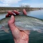
Primary Target: Largemouth and Smallmouth Bass
The famed black bass of the Tennessee River chain are the main event right now. Largemouth are aggressively feeding in the vast, stump-laden expanses of the Decatur Flats and heavily concentrated on secondary points and creek channel swings. Meanwhile, the robust smallmouth bass are stacking up in the lower reservoir, utilizing the oxygen-rich current near Wheeler Dam and the Elk River to ambush disoriented prey.
Sleeper Pick: Trophy Blue Catfish
While the bass boats crowd the creek mouths and flats, Wheeler Lake remains a world-class, silent sleeper catfish fishery. Let us not forget that this very reservoir produced a former world record 111-pound blue catfish. Summer is an exceptional time to target these bottom-dwelling leviathans as they stack up in deep holes and along the main river channel ledges. Wheeler Lake's diverse bathymetry, featuring deep river channels, submerged humps, and sharp drop-offs, provides the perfect sanctuary for massive blue and flathead catfish.
Baitfish Report
The primary forage base right now consists of threadfin shad, gizzard shad, bream (bluegill and sunfish), and crawfish. With the willow fly hatches occurring intermittently along the bluffs, you will also see opportunistic feeding near overhanging vegetation. Match your presentation to the dominant forage in your specific zone—shad profiles on the main river ledges and bream or frog imitations over the shallow grass.
3. TACTICAL STRATEGY
Where to Deploy
If you are targeting largemouth, head straight to the Decatur Flats. Focus your efforts on the matted milfoil and stump flats near the main river channel drop-offs. The grass is looking exceptionally healthy and is reaching the surface in many areas. Alternatively, parallel the steep rock walls and bluffs in the lower reservoir or near the Ingalls Harbor and Swan Creek areas for a mixed bag of largemouth and spotted bass.
For smallmouth, concentrate your efforts on the lower lake near Wheeler Dam and the mouth of the Elk River. Target the steep rocky bluffs, main-lake points, and the eddy water just off the main current. The smallmouth will sit just out of the heavy flow, waiting to dart into the current to grab passing forage.
Lure Selection
Topwater: SPRO Bronzeye Poppin' Frog 60 or a River2Sea Whopper Plopper 90 for drawing explosive surface strikes.
Jigs: 3/8 oz to 1/2 oz flipping jigs or swim jigs paired with a lively craw trailer.
Finesse: 1/4 oz shaky head rigs or Texas-rigged creature baits for meticulously picking apart submerged brush and rock piles.
Color Patterns
Water clarity is currently in great shape with a typical river stain. For topwater frogs and ploppers, stick to Bone or Albino to mimic the light bellies of dying shad or fleeing bait. For jigs and soft plastics, Green Pumpkin, Canterbury Craw, and dark greens are outperforming everything else by perfectly imitating the local crawfish population. If you are fishing the lower reservoir for smallmouth at night, switch to dark black and blue jigs to maximize silhouette visibility.
Bait Recommendations
If you are chasing Wheeler's monster blue catfish, leave the artificials behind. You need fresh, cut skipjack herring or large gizzard shad. Rig this on a heavy slip-sinker setup (essentially a supersized Carolina rig) with a 6/0 to 8/0 circle hook. Drift or drag these baits slowly in 25 to 35 feet of water along the main river channel drop-offs.
Pro Tip: When targeting trophy blue catfish, do not anchor blindly. Use your electronics to scan the ledges in 25 to 35 feet of water. Look for large, individual arches suspended just below massive bait balls. If you do not see the bait, do not drop your rigs.
Timing the Bite
The topwater frog bite on the Decatur Flats is highly dependent on low-light conditions; be on the water at first light and work the mats until the sun breaches the tree line. As the sun gets high, transition to punching the grass or dragging jigs on the ledges.
Pro Tip: Smallmouth in the lower reservoir are highly current-dependent. Time your bluff-wall fishing with the TVA's peak generation hours. When the turbines spin, the current positions the smallmouth predictably on the upstream side of rocky outcroppings.
4. REGULATIONS SNAPSHOT
Before hitting the water, ensure you are compliant with the current Alabama Department of Conservation and Natural Resources (ADCNR) regulations for Wheeler Reservoir. Always carry a valid Alabama fishing license and respect the resource.
Species
Daily Bag Limit
Size Restrictions
Black Bass (Largemouth, Smallmouth, Spotted)
10 (in aggregate)
No specific minimum size for the main lake, but check local tributary rules.
Crappie
30
9-inch minimum length.
Catfish (All species)
No limit under 34 inches
Only one (1) catfish over 34 inches allowed per person per day.
If Wheeler Lake experiences extreme weather, heavy debris flows from upstream storms, or an unfavorable TVA generation schedule, Lake Guntersville is your immediate fallback option. Located just one lock upstream, Guntersville is Alabama's largest lake and arguably the most famous bass fishery in the country.
Access: Launch at Ditto Landing (which sits conveniently between Wheeler and Guntersville) or head further up to the Goose Pond Colony Resort ramps.
Target Species: Trophy Largemouth Bass.
Tactical Approach: Guntersville is synonymous with grass fishing. If Wheeler is blown out, Guntersville's expansive eelgrass and hydrilla beds often act as a natural filter, keeping the water clearer. Tie on a 1-ounce tungsten weight, a stout 4/0 straight-shank flipping hook, and a compact creature bait to punch the thickest vegetation canopies you can find along the main river channel edges.
Tight lines!
Editor's Choice: Must-Have Gear
FISHINGSIR Next-Gen Waterproof Chest Waders
★★★★★4.4 (7,370+ reviews)
2-Ply Tech: Upgraded nylon with 2.5x higher density than standard fabrics.
100% Waterproof: Lab-approved intrusion resistance with taped visible seams.
Ultra-Lightweight: Designed for all-day comfort while hunting or fishing.
As an Amazon Associate I earn from qualifying purchases. #ad
Loading forecast...
Live Fishing Conditions: Tides, Weather & Waves
Get real‑time tides, marine weather, swell and solunar activity for each spot so you know exactly when conditions line up for your best chance at a bite.
🎣
Wheeler Lake (Wheeler Reservoir), Alabama
Loading coordinates...
🌤️
WEATHER CONDITIONS
--°F
--°C
Loading...
🌡️
Feels Like--°F--°C
💧
Humidity--%
💨
Wind-- mph-- km/h
🧭
Direction--
📊
Pressure-- inHg-- hPa
☀️
UV Index--
🌊
MARINE CONDITIONS
🌊Wave Height
-- ft
-- m
Loading...
🧭Wave Direction
--°
Loading...
⏱️Wave Period
-- s
Loading...
📈Tide Status
-- ft
-- m
Loading...
🌙
LUNAR & SOLUNAR
🌕
Loading...
Illumination: --%
Major Period--:-- - --:----:-- - --:--
Minor Period--:-- - --:----:-- - --:--
🌅Sunrise--:--
🌇Sunset--:--
📅
24-HOUR FORECAST
Loading fishing conditions...
Fishing Spots Map
🎣
Book a Fishing Charter near Wheeler Lake (Wheeler Reservoir), Alabama Fishing Report Today 🎣
Local guides & charters. Verified captains, instant booking, best price guaranteed.
There was an error loading the map. Please try refreshing the page.
Info
Local Access & Facilities
The Tennessee River Fishery: Power and History
The waters surrounding Wheeler Dam Village and the broader Wheeler Reservoir represent one of the most historically significant sections of the Tennessee River system. For experienced anglers, this area offers more than just open water; it presents a complex hydrological environment shaped by the limestone karst topography and the massive engineering of the Tennessee Valley Authority. The river here has carved a culture, once frustrating early settlers with its shoals and currents, but now providing a structured, power-generating fishery that attracts serious boaters and fly anglers alike.
The vibe here is distinctively functional and rugged. Unlike manicured resort lakes, this is a working river system where power generation dictates the flow and the bite. The shoreline is a mix of industrial history, protected heritage areas, and natural limestone features. The presence of the Muscle Shoals National Heritage Area underscores the deep connection between the water and local history, from Native American settlements to the modern era of hydroelectric power.
While the reservoir is vast, the specific focus for this guide centers on the strategic access points near the dam and the unique ecological zones nearby. Anglers targeting this section of the river must be versatile, ready to adapt to current generation schedules and the unique bottom structures created by the region's sinkholes and underground cave systems. Whether you are swinging flies for river species or launching heavy fiberglass for a long run, understanding the layout of the Shoals region is prerequisite for success.
Access & Getting There
Accessing the prime waters near the dam requires navigating the road networks around Florence and Muscle Shoals. The primary artery for approaching the southern side of the reservoir is State Route 20. Traffic in this region is generally moderate, but seasoned captains know that the rural routes, such as Gunwaleford Road (Lauderdale County Route 2), can be slower due to local agricultural traffic and narrow shoulders. When towing wide beams, exercise caution on the gravel connectors like Lauderdale County Route 223 if you are heading toward the refuge areas.
For boaters, the launch situation is defined by proximity to the dam. The Wheeler Dam Reservation Ramp is the closest access point, located just 1 mile from the central reference point. This ramp is strictly utilitarian; while it offers trailer parking, the data indicates a lack of lighting and restrooms, making it a "launch and go" facility. Similarly, the Joe Wheeler State Park Ramp offers excellent water access only 1.3 miles away. These ramps are designed for efficiency, not luxury, so preparation in the parking lot is essential before backing down.
💡 Captain's Tip: Launch Logistics
The local ramps near the dam (Wheeler Dam Reservation and Fisherman's Resort) are functional but austere. Data indicates no on-site restrooms or fish cleaning stations at these specific launch points. Handle all biological needs and gear prep at your lodging or in town before hitting the ramp.
Weather patterns here are dominated by the river valley's topography. Wind direction is critical; a strong wind opposing the river current can create steep, uncomfortable chop in the main channel, making boat control difficult for precision structure fishing. Parking at these launch sites is generally available, but during peak seasonal movements, the lots at Joe Wheeler State Park can fill with recreational traffic. The Fisherman's Resort Ramp provides a third option roughly 1.6 miles out, serving as a viable backup if the public launches are congested.
Wheeler Lake (Wheeler Reservoir), Alabama Pre-Trip Checklist
Facilities & Amenities
The infrastructure around Wheeler Lake is split between immediate riverside necessities and comprehensive outfitting in the nearby cities. For immediate bait and tackle needs, Big Kat Bait is the primary outpost, located approximately 7.8 miles from the water. This shop is the closest reliable source for live bait and essential terminal tackle. For more specialized gear, particularly if you require heavy repairs or specific electronics, you will need to drive into Florence or Muscle Shoals.
The city of Florence, roughly 16 miles from the dam area, serves as the logistics hub. Shops like Warehouse Tackle and Action Bait Co Inc offer a deeper inventory for serious anglers. Tennessee Rivers Tackle Co is another key resource for regional specificities. If you are looking for local knowledge on fly patterns or guided trips, Cox Flyfishing operates out of Florence and is the go-to authority for the fly angling community in this region.
Facility Name
Type
Distance
Captain's Notes
Big Kat Bait
Bait Shop
7.8 miles
Closest option for live bait and quick resupply.
Warehouse Tackle
Tackle Shop
16.3 miles
Located in Florence; extensive gear selection.
Emma Way RV Park
Lodging
4.0 miles
Nearest accommodation for trailer-boaters.
Wheeler Dam Ramp
Boat Launch
1.0 mile
Closest launch; no amenities (lights/restrooms).
Lodging logistics favor the mobile angler. Emma Way RV Park is strategically located just 4 miles from the fishing grounds, making it the ideal base camp for multi-day trips. For those seeking a more rustic experience or coming from the north, Platos Branch Farm RV Park is about 6.9 miles away. Anglers should note that fuel docks are not explicitly listed in the immediate ramp vicinity; topping off tow vehicles and vessels at highway stations along State Route 20 is highly recommended.
Permits, Regulations & Fees
Fishing in this region is governed by the State Fishing Agency, and strict adherence to state licensure is mandatory. Beyond standard creel limits, this area is ecologically sensitive due to the unique karst geology. The Key Cave National Wildlife Refuge, located approximately 23 miles from the dam village, represents a critical protected zone. This refuge was established to protect the federally endangered Alabama cavefish and the gray bat. The groundwater here is directly linked to the cave systems; therefore, pollution control and respecting restricted zones are not just legal requirements but ethical imperatives to prevent extinction.
💡 Captain's Tip: Protected Karst Waters
The limestone geography here means groundwater and surface water are intimately connected. Be hyper-aware of fuel spills or oil leaks, especially near the Key Cave NWR aquifer zones. The Alabama cavefish exists nowhere else on earth—your stewardship matters.
Access to the Muscle Shoals National Heritage Area is managed to preserve the cultural timeline of the Tennessee River. While fishing is a permitted activity in the broader region, specific areas around heritage sites may have restrictions to protect historical structures or archaeological resources. Always check the latest signage at the Wheeler Dam Reservation regarding restricted zones near the dam turbines and spillways, as these are strictly enforced by federal authorities for safety and security.
Events & Seasonal Information
The rhythm of Wheeler Lake is dictated by the seasons and the flow of the Tennessee River. Spring brings higher water levels and increased current, activating the baitfish along the channel ledges. This is often the most productive time for power fishing. Summer stabilizes the weather, but the heat pushes fish deeper or into the oxygenated water near the dam discharge. The Muscle Shoals area is steeped in music and river culture, often hosting festivals, but for the angler, the "event" is the daily generation schedule released by the TVA.
Tournament activity is common in this river system, ranging from local wildcat leagues to regional bass trails. While specific dates vary annually, the transition periods in late spring and early autumn usually see the highest density of competitive boats. Anglers looking to avoid the crowds should plan for mid-week trips or focus on the "dawn patrol" hours before the recreational fleet launches from Joe Wheeler State Park.
Contact Information & Resources
For official information regarding water levels, access status, and regulations, the Muscle Shoals National Heritage Area can be reached at (256) 765-5028. For specific inquiries regarding the wildlife refuge and protected species, contact the Key Cave National Wildlife Refuge office at 256-353-7243 or via email at wheeler@fws.gov. In the event of an emergency on the water, immediate contact with local emergency services is required, as cell reception can be spotty in the limestone valleys.
Self-reliance is key in this region. The distance between high-end marine services means you should carry necessary tools and spares. For precise locations of the boat ramps, the nearest bait shops, and real-time weather conditions, consult the live dashboard and interactive maps below.
Our spot reports combine data-driven forecasts with curated local information. The forecast is generated by our proprietary Fishing Score algorithm (0–100%), which analyzes real-time data from Open-Meteo API, validated against NOAA CO-OPS tide gauges and USGS water-monitoring stations. The model weights tide dynamics (35%), wave energy (25%), wind patterns (20%) and time of day (20%)—factors shown to influence fish feeding behavior through marine-biology research and decades of charter log data.
Access, facilities and services information for each fishing spot is sourced from official datasets such as Recreation.gov (RIDB), state park & wildlife agencies, and geospatial providers like Google Maps. These sections undergo scheduled re-validation every 3–6 months to ensure that boat ramps, park access, contact details and local services remain accurate.
Narrative sections (catches, seasonal behavior, local tips) are synthesized from these data sources and refined following the Fishing Reports Today editorial guidelines, combining bibliographic research from ichthyology and oceanography with expert angler experience. Our team reviews reports on a regular basis, while the forecast model itself updates every 6 hours for real-time accuracy.
⚠️ Important: Always verify current local regulations, access restrictions and weather conditions before fishing. These reports are intended as a planning aid, not a guarantee of catches or safety. When in doubt, contact local authorities or park managers listed on the page.
To provide the best experiences, we use technologies like cookies to store and/or access device information. Consenting to these technologies will allow us to process data such as browsing behavior or unique IDs on this site. Not consenting or withdrawing consent, may adversely affect certain features and functions.
Functional Always active
The technical storage or access is strictly necessary for the legitimate purpose of enabling the use of a specific service explicitly requested by the subscriber or user, or for the sole purpose of carrying out the transmission of a communication over an electronic communications network.
Preferences
The technical storage or access is necessary for the legitimate purpose of storing preferences that are not requested by the subscriber or user.
Statistics
The technical storage or access that is used exclusively for statistical purposes.The technical storage or access that is used exclusively for anonymous statistical purposes. Without a subpoena, voluntary compliance on the part of your Internet Service Provider, or additional records from a third party, information stored or retrieved for this purpose alone cannot usually be used to identify you.
Marketing & Affiliates
The technical storage or access is required to create user profiles to send advertising, or to track the user on a website or across several websites for similar marketing purposes, including affiliate tracking for products recommended in our reports.


Leave a Reply