0%

Port Glasgow Fishing Report Today 🎣

6 months ago · Updated 1 month ago

FISHING REPORT: Port Glasgow / Port Bay, NY

Late Ice & Creek Run Special | March 8, 2026

Region: Lake Ontario South Shore (Wayne County)
Water Body: Port Bay & Tributaries (Wolcott Creek)
Access Point: West Port Bay South Launch (via Port Glasgow Rd)

Editor's Note: This report covers the United States location at Port Glasgow, New York (Port Bay). If you are looking for the Canadian commercial port on Lake Erie, you are in the wrong jurisdiction—but you might want to stay here, because the perch bite is currently world-class.

1. GO/NO-GO STATUS

VERDICT: CAUTION - LATE ICE / OPEN WATER MIX

Safety Advisory: We are in the volatile "Late Ice" transition. While the main basin of Port Bay is holding 10-12 inches of ice, the shorelines are degrading rapidly due to recent rain and temperatures in the 40s. Access is the biggest hazard right now. If you can bridge the shoreline rot, the main ice is fishable, but ATVs/Sleds are NOT recommended this week. Stick to foot traffic and spud your way out.

🎣 Nautrek
Private Beta
J
M
R
100+ anglers on the waitlist

The fishing network where your reputation matters.

Find trusted captains, join real trips with cost splitting, and build your Angler Rank. Your spots stay private — you decide who sees your intel.

✓ Verified anglers ✓ Real trips ✓ Spot privacy
Join the Waitlist — Free →

No spam. First 500 get founder perks.

Nautrek App

Creek Status: GO. Tributaries (Wolcott Creek, Maxwell Creek) are open, flowing, and receiving fresh pushes of Steelhead.

2. SPECIES INTEL

Primary Target: Yellow Perch (Ice/Boat)

Status: High Activity

The "Jumbo" schools are staging for the spawn. They have moved out of the deepest basins and are scattering across the mud flats. The bite is aggressive but mobile—you must hole-hop to stay on them.

Size Class: 9" - 12" common, with 13"+ tankers mixing in.

Sleeper Pick: Steelhead (Tributaries)

Status: Peaking

While everyone is staring at their ice holes, the tributaries are seeing fresh chrome. The rain earlier this week raised water levels slightly, pulling fresh fish into Wolcott Creek and Maxwell Creek. These fish are aggressive and shallow.

Baitfish Report

Emerald Shiners are the primary forage right now. Perch are spitting up small, translucent fry. Match your profile to this—slender, silver/white presentations are outfishing bulky baits.

3. TACTICAL STRATEGY

The "Port Glasgow" Perch Pattern

  • Where: Launch from the DEC site on West Port Bay Rd. Head North towards the channel, but stop short of the open water. Focus on the 15-25 ft mud flats on the east side of the bay. Avoid the South end; it's too silty from runoff.
  • Structure: Look for "transition mud"—areas where the bottom hardness changes slightly on your sonar. Fish are hugging the bottom tight (bottom 6 inches).
  • Lure: 1/16oz Tungsten Jig in Wonderbread or Metallic Gold.

    Alternative: #2 Swedish Pimple (Hammered Silver) with the treble hook removed and replaced with a dropper chain and a single hook.
  • Bait: Spikes (Euro Larvae) are outproducing minnows 3-to-1. Load 3-4 spikes on the hook to create a "ball" of meat. If the bite slows, switch to a single Perch Eye.
  • Technique: Pound the jig into the mud to create a silt cloud, then lift it 6 inches and hold dead still. The big females are sluggish; they won't chase a erratic jig.

Creek Steelhead Tactics

  • Where: Wolcott Creek mouth and the first two riffles upstream from the bay.
  • Presentation: Float fishing is king here. Use a clear 4-6g float with a long fluorocarbon leader (6lb test).
  • Bait: Fresh Egg Sacs (Pink or Chartreuse mesh) tied roughly the size of a dime.

    Artificial: 3-inch Pink Plastic Worms wacky-rigged under a float.
  • Timing: First light (6:30 AM - 9:00 AM) is critical. Once the sun hits the clear water, the fish spook easily.

Pro Tip: The "Shoreline Bridge." Bring two 2x8 planks (6ft long) if you are ice fishing. The first 3 feet of water at the launch ramp might be open or slushy. The planks will get you onto the solid main ice safely. Do not skip this if you want to stay dry.

4. REGULATIONS SNAPSHOT

Jurisdiction: New York DEC (Zone: Lake Ontario / Tributaries)

SpeciesSeason StatusDaily LimitMin. Length
Yellow PerchOPEN (Year-round)50 fishNone
Steelhead/RainbowOPEN (Year-round)3 fish21" (Lake) / 15" (Tribs)
Northern PikeCLOSING SOON (Ends March 15)5 fish18"
WalleyeCLOSING SOON (Ends March 15)3 fish18"

Note: Tributary limit is 3 fish in combination (Steelhead/Brown), but only ONE can be a Rainbow/Steelhead.

5. REGIONAL ALTERNATIVE

Backup Plan: Sodus Bay (15 mins West)

If the ice at Port Bay is unsafe or the shoreline is impassable:

  • Location: Sodus Bay (Third Creek / LeRoy Island). Sodus is larger and holds ice longer than Port Bay.
  • Access: Park at the town launch or near the bait shops on the northeast side.
  • Target: Northern Pike. Large pike congregate near LeRoy Island weedlines (8-12ft) before the season closes on March 15.
  • Tactic: Large shiners on tip-ups set 2 feet off the bottom.

Tight lines!

Editor's Choice: Must-Have Gear

FISHINGSIR Next-Gen Waterproof Chest Waders

★★★★★ 4.4 (7,370+ reviews)
  • 2-Ply Tech: Upgraded nylon with 2.5x higher density than standard fabrics.
  • 100% Waterproof: Lab-approved intrusion resistance with taped visible seams.
  • Ultra-Lightweight: Designed for all-day comfort while hunting or fishing.
Check Availability on Amazon

✓ Amazon's Choice | 100+ bought last month

🛒 Tactical Gear for this Spot

Bandit Walleye Deep

Mandatory for reaching deep schools in 35-50ft mud flats.

Check Price on Amazon #ad

As an Amazon Associate I earn from qualifying purchases. #ad

Loading forecast...

Live Fishing Conditions: Tides, Weather & Waves

Get real‑time tides, marine weather, swell and solunar activity for each spot so you know exactly when conditions line up for your best chance at a bite.

🎣

Port Glasgow

Loading coordinates...

🌤️

WEATHER CONDITIONS

Weather
-- °F
--°C

Loading...

🌡️
Feels Like --°F --°C
💧
Humidity --%
💨
Wind -- mph -- km/h
🧭
Direction --
📊
Pressure -- inHg -- hPa
☀️
UV Index --
🌊

MARINE CONDITIONS

🌊 Wave Height
-- ft
-- m
Loading...
🧭 Wave Direction
--°
Loading...
⏱️ Wave Period
-- s
Loading...
📈 Tide Status
-- ft
-- m
Loading...
🌙

LUNAR & SOLUNAR

🌕

Loading...

Illumination: --%

Major Period --:-- - --:-- --:-- - --:--
Minor Period --:-- - --:-- --:-- - --:--
🌅 Sunrise --:--
🌇 Sunset --:--
📅

24-HOUR FORECAST

Loading fishing conditions...

Fishing Spots Map

My location
Loading map...

Local Access & Facilities

Port Glasgow offers a distinct angling experience defined by its industrial heritage and its strategic position on the southern bank of the River Clyde estuary. Unlike the pristine, manicured marinas found elsewhere, this fishery is characterized by deep channels, working water, and a rugged, historic atmosphere. Seasoned skippers appreciate this area for its direct access to the upper Firth of Clyde, where the water transitions from the brackish river flow to the salinity of the open sea. The bottom topography here is a mix of dredged shipping channels and natural mudflats, creating diverse holding grounds for both resident and migratory species.

The atmosphere is strictly utilitarian; this is a place for serious boat handling and technical fishing rather than leisure cruising. The backdrop is dominated by the remnants of the shipbuilding industry, providing structure that often holds fish but requires careful navigation. For the expert angler, the appeal lies in the challenge of the currents and the ability to intercept fish moving between the deep Atlantic and the inner river systems. While the shoreline offers access, the true potential of this fishery is unlocked by boat, allowing captains to work the edges of the navigation channels where the currents condense bait.

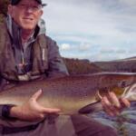
Primary targets in this region typically include robust groundfish and seasonal migratory runs that utilize the Clyde's nutrient-rich waters. The presence of nearby deep-water marinas and commercial traffic suggests a fishery that remains active year-round, though conditions can turn harsh quickly. Anglers arriving here should be prepared for a fishery that demands respect for the tides and an understanding of heavy maritime traffic regulations.

Access & Getting There

Reaching Port Glasgow requires navigating the busy arterial routes of the Greater Glasgow area. The primary approach is typically via the M8 and A8 highways, which parallel the southern coast of the Clyde. Traffic congestion is a significant factor here; the morning rush hour can severely impact travel times, so seasoned locals plan their "dawn patrol" launches to beat the commuter traffic that builds up around the airport and the Kingston Bridge. The final approach to the water takes you through urban and industrial zones where roads can be narrow, requiring heightened awareness when towing larger vessels.

For boat owners, the launch situation requires strategic planning. The data indicates a boat launch approximately 3,025 feet from the central spot, with additional ramps located 3.5 and 3.8 miles away. These facilities are often unmanned and may lack the polished infrastructure of a dedicated marina. It is critical to inspect the ramp conditions before backing down, particularly during low tide when algae buildup on the lower sections can create hazardous traction issues for tow vehicles. The proximity of the shipping channel means that wake from passing commercial vessels can surge up the ramps, so securing the boat immediately upon launching is mandatory.

💡 Captain's Tip: Trailer Management

When seeking parking or services, avoid "Car Blitz Car Valeting Service" if you are towing. Local intelligence specifically notes to avoid with trailers, likely due to tight turning radiuses or height restrictions that could trap a rig.

Parking logistics in this area are fragmented. While some launch sites may offer trailer parking, capacity is often limited. For anglers requiring long-term parking or overflow options, Kilpatrick Braes Car Park is located roughly 9.2 miles away and operates 24 hours a day. Similarly, Direct Parking offers 24-hour access about 10.6 miles from the fishing grounds. These locations are viable contingencies if the immediate waterside parking is at capacity. However, the distance necessitates having a support driver or a shuttle plan if you intend to leave a vehicle and trailer there while fishing out of Port Glasgow.

Weather contingencies are paramount in the Clyde estuary. The geography funnels wind, and a strong westerly breeze can oppose the outgoing tide to create steep, confused chop in the main channel. When the wind forecast exceeds 15 knots from the west or southwest, launching and retrieving can become difficult at exposed ramps. In such conditions, experienced captains often look for launch sites further down the coast that offer protection from the prevailing fetch, or they time their retrieval for slack water to minimize the surge at the ramp.

Port Glasgow Pre-Trip Checklist

Facilities & Amenities

The infrastructure surrounding Port Glasgow is functional rather than luxurious, catering to a mix of local residents and dedicated anglers. The area is well-served by specialized independent shops rather than big-box marine stores. For tackle and bait, Tickers Tackle in Helensburgh (4.9 miles away) is a primary resource. It opens at 9:00 AM, which may be late for the earliest launchers, but it serves as a reliable hub for local intelligence and terminal tackle. Another excellent option is JB's Nets in Alexandria (5.9 miles away), known for a 5-star rating and specific inventory for the region's fisheries.

One of the most valuable resources for the nocturnal angler or the late-returning boat is Skelmorlie Fishery. Located 8.6 miles from the spot, this facility operates from 8:00 AM until 11:00 PM, seven days a week. This extended operating window is rare and provides a crucial safety net for picking up fresh bait the night before a trip or replenishing supplies after a long day on the water. Conversely, anglers should be aware that fuel docks are not explicitly listed in the immediate ramp vicinity; it is standard practice to fuel vessels on the trailer at highway gas stations before entering the launch zones.

💡 Captain's Tip: Charter Strategy

For those looking to learn the local waters before taking their own helm, Clyde Charters operates out of Kip Marina, just 7.3 miles away. Their 5-star rating suggests they are the premier operation for heavy-tackle guidance in this sector of the Clyde.

The charter fleet in the wider region is robust, with operators stationed at key marinas to access the best grounds. Sea Clyde and Saltire Sailing are based out of Largs Yacht Haven, approximately 12.8 miles away. While this is a further drive, Largs offers full marina facilities, including heavy travel lifts and extensive chandleries, making it a critical logistical hub for major repairs or parts that cannot be sourced in Port Glasgow proper.

Key Facility Data

Facility NameTypeDistanceKey Features
Tickers TackleTackle Shop4.9 milesOpens 9 AM, High Rating (4.9)
Skelmorlie FisheryBait/Fishery8.6 milesOpen until 11:00 PM
Clyde ChartersCharter7.3 milesBased in Kip Marina
Kilpatrick BraesParking9.2 milesOpen 24 Hours
South Whittlieburn FarmLodging9.5 milesOpen 24 Hours, High Rating

For visiting anglers requiring accommodation, the options lean towards self-catering parks and farm stays that accommodate the erratic schedule of fishing trips. South Whittlieburn Farm (9.5 miles) and Auchengower Park (8.8 miles) are highly rated. Crucially, South Whittlieburn Farm is listed as open 24 hours, facilitating late check-ins for anglers arriving after an evening tide. Firth View Caravan Park in Millport is further out (16.3 miles) but offers a distinct island atmosphere for those willing to travel further.

Permits, Regulations & Fees

Fishing in the Clyde estuary and its tributaries is governed by a complex overlay of national marine regulations and local bylaws. Conservation is the driving force behind these rules, particularly regarding migratory species that pass through the Port Glasgow area to reach spawning grounds upriver. While the provided data indicates that fishing regulations are managed by the "State Fishing Agency," in this specific UK context, this refers to the local Scottish marine authorities and fishery boards. It is imperative to carry the correct permits, as enforcement patrols are common in these visible waterways.

There are no specific "fees required" flags for the boat ramps in the immediate dataset, but seasoned travelers know that "free" access often comes with time limits or residency restrictions not always posted online. Always carry local currency (pounds) for potential parking meters or honor boxes at smaller, less formalized access points. Furthermore, access to the shoreline for fishing is generally permissive in Scotland, but this does not extend to driving vehicles across private land or obstructing commercial harbor operations. Respect for "Kapu" (in the Hawaiian sense of sacred boundaries, or locally "Private" and "Keep Out" operational zones) is critical here; the industrial nature of Port Glasgow means many waterfront areas are active work sites where unauthorized entry is a safety violation.

💡 Captain's Tip: Safety & Zones

The shipping channel is active 24/7. Never anchor in the main channel. Keep a listening watch on the local VTS (Vessel Traffic Service) channel to stay aware of large commercial movements, as big ships cannot maneuver to avoid small fishing craft.

Events & Seasonal Information

The rhythm of the fishery at Port Glasgow is dictated by the seasonal movements of fish into the Clyde and the prevailing Atlantic weather systems. Winter brings shorter days and often challenging conditions, with strong winds funneled up the firth. However, these colder months can be productive for specific bottom-dwelling species. Summer offers long daylight hours—essential for the "after work" angler—allowing for trips that extend well past 9:00 PM while still having natural light.

The 24-hour access at parking locations like Kilpatrick Braes and Direct Parking supports night fishing operations, which are popular during the summer months when certain species move into the shallows under the cover of darkness. While no specific major tournaments are listed for this immediate spot, the presence of high-caliber charter fleets in nearby Largs and Kip Marina suggests a competitive scene further down the coast. Anglers should monitor local forums for club competitions that often launch from these larger marinas but fish the waters adjacent to Port Glasgow.

Contact Information & Resources

For safe and legal operations in these waters, self-reliance is key. There is no dedicated visitor center listed for the immediate spot, meaning anglers must rely on their own preparation. Ardentinny Forest (11.8 miles away) lists a contact number (0300 067 6600), which may serve as a resource for land-based access inquiries on the opposite bank. For maritime emergencies, the Coastguard is the primary point of contact.

Always file a float plan with a shore contact, as cell reception can be spotty in the shadow of the steep hills lining the firth. For precise locations of the boat ramps, real-time wind conditions, and detailed bathymetry of the shipping channels, consult the live dashboard and interactive maps below.

🎣

Port Glasgow

Port Glasgow • Scotland • 55.9346, -4.6896
🅿️

Parking

5
Green Hill Tyre & Exhaust Co
⭐ 4.9 11.3 mi
📍 19 Greenhill Rd, Paisley PA3 1RN, UK
🕒
Monday: 8:30 AM – 5:30 PM
Tuesday: 8:30 AM – 5:30 PM
Wednesday: 8:30 AM – 5:30 PM
Thursday: 8:30 AM – 5:30 PM
Friday: 8:30 AM – 5:30 PM
Saturday: 8:30 AM – 12:30 PM
Sunday: Closed
🚗 Get Directions
Car Blitz Car Valeting Service
⭐ 4.7 5.2 mi
📍 47 W King St, Helensburgh G84 8UL, UK
🕒
Monday: 9:00 AM – 4:00 PM
Tuesday: 9:00 AM – 4:00 PM
Wednesday: 9:00 AM – 4:00 PM
Thursday: 9:00 AM – 4:00 PM
Friday: 9:00 AM – 4:00 PM
Saturday: Closed
Sunday: Closed
🚗 Get Directions
Ardentinny Forest
⭐ 4.6 11.8 mi
📍 A815, Innellan, Dunoon PA23 8TS, UK
🕒
Monday: Open 24 hours
Tuesday: Open 24 hours
Wednesday: Open 24 hours
Thursday: Open 24 hours
Friday: Open 24 hours
Saturday: Open 24 hours
Sunday: Open 24 hours
🚗 Get Directions
Direct Parking
⭐ 4.5 10.6 mi
📍 55 West March Road, Paisley PA3 1BF, UK
🕒
Monday: Open 24 hours
Tuesday: Open 24 hours
Wednesday: Open 24 hours
Thursday: Open 24 hours
Friday: Open 24 hours
Saturday: Open 24 hours
Sunday: Open 24 hours
🚗 Get Directions
Kilpatrick Braes Car Park
⭐ 4.3 9.2 mi
📍 25 Mount Pleasant Dr, Old Kilpatrick, Glasgow G60 5LT, UK
🕒
Monday: Open 24 hours
Tuesday: Open 24 hours
Wednesday: Open 24 hours
Thursday: Open 24 hours
Friday: Open 24 hours
Saturday: Open 24 hours
Sunday: Open 24 hours
🚗 Get Directions
🐟

Bait & Tackle

5
Skelmorlie Fishery
⭐ 4.9 8.6 mi
📍 Beithglass Ave, Skelmorlie PA17 5ES, UK
🕒
Monday: 8:00 AM – 11:00 PM
Tuesday: 8:00 AM – 11:00 PM
Wednesday: 8:00 AM – 11:00 PM
Thursday: 8:00 AM – 11:00 PM
Friday: 8:00 AM – 11:00 PM
Saturday: 8:00 AM – 11:00 PM
Sunday: 8:00 AM – 11:00 PM
🚗 Get Directions
Tickers Tackle
⭐ 4.9 4.9 mi
📍 93 E Clyde St, Helensburgh G84 7PJ, UK
🕒
Monday: 9:00 AM – 5:00 PM
Tuesday: 9:00 AM – 5:00 PM
Wednesday: 9:00 AM – 5:00 PM
Thursday: 9:00 AM – 5:00 PM
Friday: 9:00 AM – 5:00 PM
Saturday: 9:00 AM – 5:00 PM
Sunday: Closed
🚗 Get Directions
Purdies
⭐ 4.9 9.2 mi
📍 112 Argyll St, Dunoon PA23 7NE, UK
🕒
Monday: 9:30 AM – 5:00 PM
Tuesday: 9:30 AM – 5:00 PM
Wednesday: 9:30 AM – 5:00 PM
Thursday: 9:30 AM – 5:00 PM
Friday: 9:30 AM – 5:00 PM
Saturday: 9:30 AM – 5:00 PM
Sunday: Closed
🚗 Get Directions
🚤

Fishing Charters

4
Clyde Charters
⭐ 5.0 7.3 mi
📍 Kip Marina, Inverkip, Greenock PA15 2UA, UK
🕒
Monday: 9:00 AM – 5:00 PM
Tuesday: 9:00 AM – 5:00 PM
Wednesday: 9:00 AM – 5:00 PM
Thursday: 9:00 AM – 5:00 PM
Friday: 9:00 AM – 5:00 PM
Saturday: Closed
Sunday: Closed
🚗 Get Directions
Sea Clyde
⭐ 5.0 12.8 mi
📍 Largs Yacht Haven, Irvine Rd, Largs KA30 8EZ, UK
🕒
Monday: Open 24 hours
Tuesday: Open 24 hours
Wednesday: Open 24 hours
Thursday: Open 24 hours
Friday: Open 24 hours
Saturday: Open 24 hours
Sunday: Open 24 hours
🚗 Get Directions
Saltire Sailing
⭐ 5.0 12.8 mi
📍 Saltire Sailing, Largs Yacht Haven, Largs KA30 8EZ, UK
🕒
Monday: Open 24 hours
Tuesday: Open 24 hours
Wednesday: Open 24 hours
Thursday: Open 24 hours
Friday: Open 24 hours
Saturday: Open 24 hours
Sunday: Open 24 hours
🚗 Get Directions
Seaforce Powerboats
⭐ 5.0 15.6 mi
📍 Seaforce Powerboats, Kelvin Harbour, 150 Pointhouse Pl, Glasgow G3 8RS, UK
🕒
Monday: 9:30 AM – 7:00 PM
Tuesday: 9:30 AM – 7:00 PM
Wednesday: 9:30 AM – 7:00 PM
Thursday: 9:30 AM – 7:00 PM
Friday: 9:30 AM – 7:00 PM
Saturday: 9:30 AM – 7:00 PM
Sunday: 9:30 AM – 7:00 PM
🚗 Get Directions
🏠

Lodging

4
Sallochy Bay
⭐ 4.8 13.7 mi
📍 Balfron, Glasgow G63 0JS, UK
🚗 Get Directions
South Whittlieburn Farm
⭐ 4.7 9.5 mi
📍 Brisbane Glen Road, Largs KA30 8SN, UK
🕒
Monday: Open 24 hours
Tuesday: Open 24 hours
Wednesday: Open 24 hours
Thursday: Open 24 hours
Friday: Open 24 hours
Saturday: Open 24 hours
Sunday: Open 24 hours
🚗 Get Directions
Auchengower Park
⭐ 4.7 8.8 mi
📍 Laurel Ln, Helensburgh G84 0NE, UK
🕒
Monday: 9:00 AM – 6:00 PM
Tuesday: 9:00 AM – 6:00 PM
Wednesday: 9:00 AM – 6:00 PM
Thursday: 9:00 AM – 6:00 PM
Friday: 9:00 AM – 6:00 PM
Saturday: 9:00 AM – 6:00 PM
Sunday: 9:00 AM – 6:00 PM
🚗 Get Directions

Boat Ramps

3
🚻

Restrooms

3
👨‍👩‍👧‍👦

Family Friendly

2

Accessibility

Wheelchair Access

Not Confirmed

🐕

Pets Allowed

Not Confirmed

⚠️ Some accessibility info not officially confirmed. Please verify with location directly.

📍 Showing 27 facilities on map

Nearby Spots

mi

📊

About Our Fishing Reports & Forecasts

Our spot reports combine data-driven forecasts with curated local information. The forecast is generated by our proprietary Fishing Score algorithm (0–100%), which analyzes real-time data from Open-Meteo API, validated against NOAA CO-OPS tide gauges and USGS water-monitoring stations. The model weights tide dynamics (35%), wave energy (25%), wind patterns (20%) and time of day (20%)—factors shown to influence fish feeding behavior through marine-biology research and decades of charter log data.

Access, facilities and services information for each fishing spot is sourced from official datasets such as Recreation.gov (RIDB), state park & wildlife agencies, and geospatial providers like Google Maps. These sections undergo scheduled re-validation every 3–6 months to ensure that boat ramps, park access, contact details and local services remain accurate.

Narrative sections (catches, seasonal behavior, local tips) are synthesized from these data sources and refined following the Fishing Reports Today editorial guidelines, combining bibliographic research from ichthyology and oceanography with expert angler experience. Our team reviews reports on a regular basis, while the forecast model itself updates every 6 hours for real-time accuracy.

⚠️ Important: Always verify current local regulations, access restrictions and weather conditions before fishing. These reports are intended as a planning aid, not a guarantee of catches or safety. When in doubt, contact local authorities or park managers listed on the page.

Learn more about our methodology & data sources

Leave a Reply

Your email address will not be published. Required fields are marked *