As a Senior Fishing Editor and veteran guide on Colorado's western slope, I have spent countless hours decoding the freestone puzzle that is the Fraser River. Flowing roughly 32 miles from the high elevations near Berthoud Pass down to its confluence with the Colorado River west of Granby, the Fraser is a quintessential Rocky Mountain trout stream. It offers a mix of meandering meadow reaches, dense willow-lined banks, and rugged canyon pocket water. This report delivers the critical, on-the-water intelligence you need to maximize your success during the summer season.
GO/NO-GO STATUS: CAUTION - EARLY MORNINGS ONLY
Verdict: CAUTION
Summer fishing on freestone rivers in this region requires vigilant attention to hydrology and water temperatures. While runoff conditions generally recede by mid-summer, yielding beautiful, clearing water, the primary threat shifts to thermal stress. Afternoon water temperatures on the Fraser and the nearby Colorado River can spike above the critical 65-degree Fahrenheit threshold. When water temperatures exceed this mark, dissolved oxygen plummets, and fighting a trout can easily become lethal for the fish. Consequently, your window of opportunity is strictly in the morning. Thunderstorms can also blow out the river with muddy runoff in the afternoons, further reinforcing the need for early starts.
From the editor
Tired of fishing with strangers you can’t trust?
Nautrek is the first social network for serious anglers — verified partners, real trips, cost splitting and intel sharing without burning your spots. Private beta now open.
Pro Tip: Carry a stream thermometer on your lanyard. Start fishing at first light and plan to be off the water by noon. If the water reads 65 degrees or higher, pack it up and head to a high-alpine lake.
SPECIES INTEL
Primary Target: Brown and Rainbow Trout
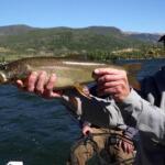
The main stem of the Fraser River boasts a robust population of wild Brown Trout and vibrantly colored Rainbow Trout. The Browns are the apex predators in these waters, often holding in the deeper, darker pools and undercut banks. They average 12 to 15 inches, but savvy anglers working the canyon sections can occasionally stick a predatory Brown pushing the 20-inch mark.
Sleeper Pick: Green Lineage Cutthroat Trout
While most anglers are hyper-focused on the Browns and Rainbows, the true gems of the Fraser watershed are the native Green Lineage Cutthroat Trout. Thanks to extensive conservation and barrier projects by Colorado Parks and Wildlife and Denver Water in headwater tributaries like Bobtail and Steelman creeks, these rare native fish are making a remarkable comeback. You will find them in the highest, coldest reaches of the drainage.
Baitfish & Forage Report
The Fraser is a bug factory. The summer forage base is dominated by aquatic macroinvertebrates. Expect to see heavy concentrations of Golden Stoneflies, varying species of Caddis (particularly in tan and olive), and Blue Winged Olives (BWOs). In the deeper tailouts, mottled sculpins dart among the cobble, providing a high-protein meal for aggressive, oversized Brown Trout.
TACTICAL STRATEGY
Where to Deploy
Skip the easily accessible bridge crossings and head to the Cozens Ranch Open Space between Winter Park and Fraser. Here, the river meanders through willow-choked meadows. Focus your efforts on the 3-to-5-foot deep outside bends and current seams. Later in the morning, as the sun gets high, target the oxygenated riffles and the plunge pools in the Fraser Canyon below Tabernash. The canyon requires a steep hike down to the water, which naturally filters out the casual crowds and leaves the prime holding water unpressured.
Lure & Fly Selection
Nymph rigs are your highest percentage play. Your box should be loaded with the following:
Heavy Nymphs: Size 10-14 Pat's Rubber Legs or TDJ Golden Stone to dredge the bottom.
Droppers: Size 18-20 Tungsten Flashback Pheasant Tail or Zebra Midge.
Dry Flies: Size 14 Elk Hair Caddis or Size 16 Parachute Adams for afternoon hatches.
Hardware: 1/8oz Panther Martin or Kastmaster spoon (single barbless hooks only).
Color Patterns
Match the naturals. Coffee, black, and dark brown are essential for your stonefly nymphs. For Caddis, stick to tan and olive bodies. If you are throwing streamers into the deep pools for large Browns, an olive or black articulated sculpin pattern will yield the best results in the tannin-stained summer water.
Bait & Rigging
CRITICAL WARNING: Organic bait (live worms, minnows, PowerBait, etc.) is strictly prohibited on the prime stretches of the Fraser River. You must use artificial flies and lures only. For fly anglers, a standard 9-foot 5-weight rod is perfect. Rig a 9-foot 4X or 5X tapered fluorocarbon leader for your nymphing setups to ensure invisibility in the clearing summer flows.
Timing the Bite
The golden window is from 5:30 AM to 11:00 AM. The trout are actively feeding in the shallower riffles during these low-light, cool-water periods. By midday, they will retreat to the deepest pools to seek thermal refuge and evade avian predators.
Pro Tip: Employ a Dry-Dropper rig in the meadow sections. Tie on a highly buoyant foam Chubby Chernobyl as your indicator fly, and drop a heavy tungsten nymph 24 to 36 inches below it. This allows you to fish the entire water column while keeping your rig out of the bottom-snagging moss.
REGULATIONS SNAPSHOT
Colorado Parks and Wildlife strictly manages the Fraser River to protect its wild trout populations. Always verify current regulations before casting, but here is the essential legal framework for the summer season:
River Section
Manner of Take
Bag & Possession Limits
Headwaters downstream to St. Louis Creek Confluence
Artificial flies and lures ONLY.
Catch and Release ONLY for Rainbow Trout. All Rainbows must be returned immediately.
St. Louis Creek Confluence downstream to Colorado River
Standard statewide regulations apply (check local postings).
Bag and possession limit for trout is two (2) fish.
REGIONAL ALTERNATIVE: Williams Fork Tailwater
If you arrive at the Fraser River and find it blown out by a localized summer thunderstorm or lingering runoff, do not pack it in. Your elite backup plan is the Williams Fork tailwater, located just a short drive away.
Because it is a tailwater flowing out of the Williams Fork Reservoir, the water releases are controlled, meaning it runs crystal clear and maintains stable, cold temperatures even when surrounding freestone rivers are unfishable. Ideal flows for this stretch are between 100 and 300 CFS. Access requires a roughly 1-mile hike from the parking area, which beautifully thins out the herd of casual anglers.
Expect highly technical fishing here. The trout are educated and the water is gin-clear. You will need to downsize your tippet to 6X fluorocarbon and lengthen your leader to 12 feet. Focus on micro-midges (sizes 20-24) and precise, drag-free drifts in the deep runs and pocket water lined with cottonwood trees.
Pro Tip: When fishing the Williams Fork tailwater, approach the banks with extreme stealth. The clear water means trout can see you from a mile away. Keep a low profile, utilize bankside vegetation for cover, and cast from your knees if necessary to avoid spooking the feeding lanes.
Tight lines!
Editor's Choice: Must-Have Gear
FISHINGSIR Next-Gen Waterproof Chest Waders
★★★★★4.4 (7,370+ reviews)
2-Ply Tech: Upgraded nylon with 2.5x higher density than standard fabrics.
100% Waterproof: Lab-approved intrusion resistance with taped visible seams.
Ultra-Lightweight: Designed for all-day comfort while hunting or fishing.
As an Amazon Associate I earn from qualifying purchases. #ad
Loading forecast...
Live Fishing Conditions: Tides, Weather & Waves
Get real‑time tides, marine weather, swell and solunar activity for each spot so you know exactly when conditions line up for your best chance at a bite.
🎣
Fraser River, Colorado
Loading coordinates...
🌤️
WEATHER CONDITIONS
--°F
--°C
Loading...
🌡️
Feels Like--°F--°C
💧
Humidity--%
💨
Wind-- mph-- km/h
🧭
Direction--
📊
Pressure-- inHg-- hPa
☀️
UV Index--
🌊
MARINE CONDITIONS
🌊Wave Height
-- ft
-- m
Loading...
🧭Wave Direction
--°
Loading...
⏱️Wave Period
-- s
Loading...
📈Tide Status
-- ft
-- m
Loading...
🌙
LUNAR & SOLUNAR
🌕
Loading...
Illumination: --%
Major Period--:-- - --:----:-- - --:--
Minor Period--:-- - --:----:-- - --:--
🌅Sunrise--:--
🌇Sunset--:--
📅
24-HOUR FORECAST
Loading fishing conditions...
Fishing Spots Map
🎣
Book a Fishing Charter near Fraser River, Colorado Fishing Report Today 🎣
Local guides & charters. Verified captains, instant booking, best price guaranteed.
There was an error loading the map. Please try refreshing the page.
Info
Local Access & Facilities
Nestled high in the rugged terrain of the Colorado Rockies, the Fraser River near Tabernash offers an alpine fishing experience that tests the mettle of even the most seasoned anglers. Slicing through high-altitude valleys at elevations exceeding 9,000 feet, this freestone river eventually merges with the legendary waters of the Colorado River. The atmosphere here is pure high-country wilderness, characterized by crisp mountain air, dense pine forests, and dramatic peaks that dictate both the weather and the water conditions.
While the river itself is a haven for technical fly anglers chasing wild trout, the surrounding area boasts massive impoundments that draw serious powerboat crews. Just a short drive north, the sprawling Lake Granby and the more intimate Willow Creek Reservoir serve as the primary arenas for heavy-hitting stillwater pursuits. These reservoirs are vital components of the Colorado-Big Thompson Project, featuring deep, cold waters that support thriving populations of predatory game fish.
The target species in this region demand diverse tactical approaches. River waders focus intensely on aggressive brown trout and acrobatic rainbow trout lurking in the undercut banks of the Fraser. Meanwhile, captains launching on the big lakes are hunting deep-water mackinaw (lake trout) and suspended schools of kokanee salmon. Whether you are stripping streamers in the current or downrigging heavy spoons over deep structure, this high-altitude fishery requires precise timing, specialized gear, and a deep respect for the elements.
Access & Getting There
Navigating to the prime fishing grounds around the Fraser River and its neighboring reservoirs requires traversing U.S. Highway 40. This main artery connects Winter Park through Tabernash and up toward Granby. Traffic can bottleneck during peak summer weekends and winter ski seasons, so early morning travel is always the tactical choice. For those towing heavy center consoles or deep-V aluminum boats, the mountain passes demand reliable towing vehicles and patience on the steep grades.
The boat launch reality varies significantly depending on your chosen body of water. Lake Granby, boasting 7,250 surface acres, is the main hub for the powerboat fleet. The lake features three primary boat-launch ramps, including the heavily utilized Sunset Point Boat Ramp and the Stillwater Boating Site. These ramps are wide and well-maintained, but trailer parking fills up rapidly by dawn during the peak summer salmon runs. For a quieter launch, Willow Creek Reservoir offers a single boat-launch facility accessing its 300 surface acres.
💡 Captain's Tip: Afternoon Lightning Protocol
Seasoned skippers know that high-altitude afternoon thunderstorms are practically guaranteed during the spring and summer months. These squalls produce dangerous lightning and sudden, violent winds. Plan your trips as "dawn patrols" and always aim to be off the water or securely moored by 1:00 PM to avoid the treacherous afternoon weather window.
Weather contingencies are absolutely critical when planning an expedition in this region. Both Lake Granby and Willow Creek Reservoir completely shut down their boating facilities during the winter due to severe ice and snow conditions. When the lakes freeze, the focus shifts entirely to hardwater ice fishing. During the open-water season, dominant alpine winds can whip the surface of Granby into a dangerous chop. If the winds exceed 15 knots, smaller vessels should seek the leeward coves or retreat to the sheltered, tree-lined shores of Willow Creek.
For shore anglers and wading guides, parking logistics require some strategic planning. The Cooper Creek Square Covered Parking in Winter Park is open 24 hours, making it an ideal staging area for early risers. Alternatively, the Fraser Station provides reliable parking closer to the river access points. Always secure your gear and maneuver trailers carefully, as mountain parking areas can feature tight turnarounds and uneven gravel surfaces.
Fraser River, Colorado Pre-Trip Checklist
Facilities & Amenities
The local infrastructure caters heavily to the rugged outdoor lifestyle, though specialized fishing amenities require knowing exactly where to look. Anglers will not find manicured urban marinas here; instead, the facilities are utilitarian and built to withstand harsh mountain winters. The region offers excellent support for fly fishermen and light-tackle anglers, but captains running larger vessels need to come prepared with their own mechanical contingencies.
Local tackle shops are the lifeblood of current intelligence. Granby Bait And Tackle is the undisputed go-to for the dawn patrol, opening its doors at 6:00 AM. This shop is essential for grabbing live bait and heavy trolling gear before hitting the big lakes. For the fly-fishing crowd, Simply Outdoors in Granby and Kirks Flyshop Grand Lake provide extensive selections of local patterns, leaders, and wading gear. If you need professional guidance, The Flyfisher Guide Service maintains a stellar reputation for putting clients on trophy fish.
Facility Name
Type
Distance
Early Access
Granby Bait And Tackle
Tackle Shop
9.2 miles
Opens 6:00 AM
Simply Outdoors
Bait & Tackle
9.2 miles
Opens 7:00 AM
Kirks Flyshop Grand Lake
Fly Shop
18.7 miles
Opens 7:00 AM
Cooper Creek Square
Covered Parking
5.0 miles
24 Hours
Negative knowledge is vital for avoiding logistical nightmares in this terrain. Note that there are no dedicated on-water fuel docks explicitly listed for these reservoirs; captains must fuel up their vessels and portable tanks at highway gas stations in Granby or Winter Park before launching. Furthermore, while the campgrounds have basic amenities, do not expect to find commercial ice machines at the boat ramps. Provision your coolers heavily before leaving town.
💡 Captain's Tip: Bear Country Logistics
You are operating in active black bear territory. While Idlewild Campground provides bear-resistant food storage lockers, the Midland Group Campground currently does not. Anglers camping at Midland must bring their own certified bear-proof containers or secure all food and scented bait inside locked, hard-sided vehicles at night.
Lodging logistics revolve heavily around the U.S. Forest Service campgrounds. Idlewild Campground is a prime basecamp, situated at 9,000 feet directly along the Fraser River. It offers 24 non-electric sites with tent pads and fire rings. For larger expeditions, the Midland Group Campground sits slightly higher at 9,500 feet and accommodates up to 36 people. Both locations provide immediate access to the river trail networks, allowing anglers to step out of their tents and cast into holding pools within minutes.
Permits, Regulations & Fees
Fishing in this pristine alpine environment is heavily regulated to protect the fragile cold-water ecosystems. The State Fishing Agency manages all local limits, gear restrictions, and seasonal closures. Purchasing a valid Colorado state fishing license is mandatory before wetting a line. These regulations are not just bureaucratic hurdles; they are essential conservation tools designed to maintain the delicate balance of wild trout populations and managed salmon fisheries in high-pressure waters.
Anglers must pay special attention to the protected zones surrounding the water infrastructure. Granby Dam and Willow Creek Dam are critical components of the Colorado-Big Thompson Project. Boaters must strictly observe all buoy markers and keep a safe, legal distance from the dam faces, pumping plants, and spillways. Intruding into these restricted operational zones is both highly dangerous and strictly penalized by federal and state authorities.
Cultural and environmental respect is paramount when traversing the surrounding lands. The nearby Vasquez Wilderness Area and the non-motorized trail networks of the Strawberry area demand a leave-no-trace ethic. Bicycles and motorized vehicles are strictly restricted to designated roads. Anglers hiking into remote river stretches must respect private property boundaries along the Fraser River, as public access easements can occasionally weave through private ranch lands. Always look for official signage to ensure you are wading on legal ground.
Events & Seasonal Information
The rhythms of this fishery are entirely dictated by the extreme seasonal shifts of the Rocky Mountains. Winter locks the lakes under feet of solid ice, transforming the region into a hardwater destination. However, the true magic happens during the "ice-out" period in late spring. As the ice recedes, massive mackinaw cruise the newly exposed shallows hunting for food, offering a brief but explosive window for boaters casting large swimbaits near the shorelines.
Summer brings the most consistent action and the heaviest boat traffic. The kokanee salmon schools suspend in the deep, cold thermoclines of Lake Granby, requiring downriggers to reach depths of 40 to 80 feet. Meanwhile, the Fraser River hits its prime during the summer hatches, though anglers must monitor water temperatures. If the late-summer sun pushes river temperatures too high, ethical anglers halt their river pursuits to avoid fatally stressing the catch-and-release trout.
Daily timing is everything at these altitudes. The optimal bite window almost always occurs between first light and 10:00 AM. By mid-morning, the alpine thermals begin to shift, often bringing stiff breezes that make fly casting difficult and boat control tedious. As mentioned previously, the looming threat of afternoon thunderstorms makes the midday hours a time for returning to the ramp, cleaning fish, and prepping gear for the next dawn patrol.
Contact Information & Resources
Managing the vast recreational resources of this area is a collaborative effort between multiple agencies. The U.S. Forest Service oversees the campgrounds and recreation areas, managing facilities like Idlewild and the boat launches at Willow Creek for the Bureau of Reclamation. The Kremmling Field Office is the primary contact for trail information and dispersed access in the Strawberry area. Always consult these agencies for the latest updates on fire bans, road closures, and ramp conditions.
Self-reliance is the rule of law when fishing at 9,500 feet. Emergency response times in the backcountry and out on the expansive waters of Lake Granby can be lengthy. Captains must ensure their VHF radios are functional, though mountainous terrain often limits line-of-sight transmission. Carrying a satellite messenger device, a comprehensive first aid kit, and redundant cold-weather survival gear is considered mandatory by local experts.
For precise locations, real-time weather conditions, and routing to the specific boat ramps and tackle shops mentioned above, consult the live dashboard and maps below.
Our spot reports combine data-driven forecasts with curated local information. The forecast is generated by our proprietary Fishing Score algorithm (0–100%), which analyzes real-time data from Open-Meteo API, validated against NOAA CO-OPS tide gauges and USGS water-monitoring stations. The model weights tide dynamics (35%), wave energy (25%), wind patterns (20%) and time of day (20%)—factors shown to influence fish feeding behavior through marine-biology research and decades of charter log data.
Access, facilities and services information for each fishing spot is sourced from official datasets such as Recreation.gov (RIDB), state park & wildlife agencies, and geospatial providers like Google Maps. These sections undergo scheduled re-validation every 3–6 months to ensure that boat ramps, park access, contact details and local services remain accurate.
Narrative sections (catches, seasonal behavior, local tips) are synthesized from these data sources and refined following the Fishing Reports Today editorial guidelines, combining bibliographic research from ichthyology and oceanography with expert angler experience. Our team reviews reports on a regular basis, while the forecast model itself updates every 6 hours for real-time accuracy.
⚠️ Important: Always verify current local regulations, access restrictions and weather conditions before fishing. These reports are intended as a planning aid, not a guarantee of catches or safety. When in doubt, contact local authorities or park managers listed on the page.
To provide the best experiences, we use technologies like cookies to store and/or access device information. Consenting to these technologies will allow us to process data such as browsing behavior or unique IDs on this site. Not consenting or withdrawing consent, may adversely affect certain features and functions.
Functional Always active
The technical storage or access is strictly necessary for the legitimate purpose of enabling the use of a specific service explicitly requested by the subscriber or user, or for the sole purpose of carrying out the transmission of a communication over an electronic communications network.
Preferences
The technical storage or access is necessary for the legitimate purpose of storing preferences that are not requested by the subscriber or user.
Statistics
The technical storage or access that is used exclusively for statistical purposes.The technical storage or access that is used exclusively for anonymous statistical purposes. Without a subpoena, voluntary compliance on the part of your Internet Service Provider, or additional records from a third party, information stored or retrieved for this purpose alone cannot usually be used to identify you.
Marketing & Affiliates
The technical storage or access is required to create user profiles to send advertising, or to track the user on a website or across several websites for similar marketing purposes, including affiliate tracking for products recommended in our reports.


Leave a Reply