

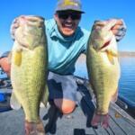
Situated at the southernmost tip of Texas, Brownsville serves as a strategic gateway between the Rio Grande delta and the famed Lower Laguna Madre. This is not a typical manicured marina destination; it is a rugged, subtropical frontier where the river meets the Gulf of Mexico. The fishery here is characterized by its diversity, offering access to shallow hypersaline flats teeming with Redfish and Speckled Trout, while also serving as a logistical launchpad for offshore excursions into the deep blue waters of the Gulf.
The atmosphere in Brownsville is distinctly border-town, blending rich cultural history with serious angling opportunities. Unlike the resort-heavy vibes of nearby South Padre Island, Brownsville offers a more utilitarian and historical base of operations. Anglers here are often targeting the extensive flats systems or preparing for long hauls to the jetties. The climate is semi-arid and subtropical, meaning heat management is just as important as gear selection.
For the expert angler, this location demands respect for geography. You are operating on an international border where waterways are shared, and navigation requires keen attention to detail. Whether you are launching a skiff to work the grassy flats of the refuge or trailing a center console for a run to the jetties, Brownsville provides the essential infrastructure to support serious campaigns in one of the most unique aquatic ecosystems in the United States.
💡 Captain's Tip: Border Awareness
You are fishing on an international boundary. When navigating near the mouth of the Rio Grande or southern channels, maintain clear awareness of your GPS position to avoid inadvertently crossing into Mexican territorial waters without proper permits.
Access & Getting There
Reaching Brownsville is generally a straightforward drive down Highway 77 or Highway 83, which serve as the primary arteries into the Rio Grande Valley. Traffic can become congested during weekday rush hours, particularly near the international bridges. For anglers towing boats, the surface streets are generally wide, but vigilance is required near the university district and downtown areas where pedestrian traffic is heavy.
The primary launching facility within the immediate vicinity is the Brownsville Event Center Public Boat Ramp, located approximately 4.2 miles from the city center. This ramp provides access to the local resacas and channels connecting to the main waterways. The ramps here are functional, though siltation can occasionally be an issue depending on recent rainfall and river levels. For those looking to access the Lower Laguna Madre directly, many pros choose to trailer their vessels roughly 20 miles east toward Port Isabel, where high-capacity ramps are more prevalent.
Weather is the dictating force in this region. The prevailing southeasterly trade winds can whip the shallow Laguna Madre into a heavy chop by mid-morning. When winds exceed 15 knots, launching from protected areas closer to the Laguna Atascosa National Wildlife Refuge or utilizing the leeward sides of the spoil islands is the standard operating procedure. During the winter months, "Blue Northers" can drop temperatures rapidly and drain water from the bay, making shallow water navigation treacherous for deep-draft vessels.
Parking requires a strategic approach. In the downtown and university areas, facilities like Lot R1 on West University Blvd offer rated parking, but they are geared more towards vehicle parking than boat trailers. At the boat ramps, trailer parking is available but unmonitored; seasoned locals advise stripping the boat of extensive electronics or loose gear if leaving the rig unattended for long periods. Note that some nearby parking data points, such as "Estacionamiento del auditorio," are located across the border in Matamoros; ensure you are navigating to lots on the U.S. side to avoid accidental border crossings.
Brownsville Pre-Trip Checklist
Facilities & Amenities
Brownsville serves as a supply hub, though specific marine amenities are often split between the city center and the coastal communities. For immediate tackle needs within the city, SWP Outdoors on East Elizabeth Street is the go-to specialist. Located just 0.3 miles from the central hub, they stock the specific lures and terminal tackle required for local waters. However, their opening time is 7:00 AM, which may be late for the dawn patrol crowd.
For heavy-duty provisioning, live bait, and offshore-grade equipment, the serious angler must look toward the coast. Gilbert's Bait & Tackle and Quik Stop are located in Port Isabel, roughly 21 miles away. Quik Stop opens at 5:30 AM, making it the superior choice for grabbing live shrimp or croaker before sunrise. Hook Line & Sinker in Harlingen (23.5 miles north) is another reputable outfitter for those coming in from that direction.
💡 Captain's Tip: Fuel Logistics
There are no dedicated fuel docks immediately adjacent to the inland Brownsville launch ramps. Top off your tanks at highway gas stations along Highway 48 or 77 before hitching up. If you need ethanol-free marine fuel, you will likely need to source it near the Port Isabel marinas.
The charter fleet servicing this area is world-class, primarily operating out of the nearby marinas in South Padre Island and Port Isabel. Operators like Salt Walker Sport Fishing Charters and South Padre Fishing Guide Service w/ Captain Lee are located about 24 miles east of Brownsville. These outfits are known for their versatility, capable of running shallow drafts for Redfish or heading offshore for Kingfish and Snapper. While they are not docked in Brownsville proper, they are the primary resource for guided trips in the region.
Lodging options in Brownsville cater to a mix of historical tourism and outdoor recreation. Winter Haven Resort, located 4.6 miles away on Old Port Isabel Road, is a solid option for anglers with RVs or those seeking a community atmosphere. For a more unique experience, Rocket Ranch near Boca Chica (13.9 miles) offers proximity to the coast and the SpaceX launch site, providing a rugged, distinctively Texan base camp. Rancho Los Tres Corrales in San Benito offers a more rural, quiet setting about 12 miles out.
| Facility Name | Type | Distance | Key Note |
|---|---|---|---|
| SWP Outdoors | Bait & Tackle | 0.3 mi | In-town hub; opens 7 AM. |
| Quik Stop | Bait Shop | 21.2 mi | Opens 5:30 AM; best for early bait. |
| Brownsville Event Center Ramp | Boat Launch | 4.2 mi | Primary inland launch point. |
| Winter Haven Resort | Lodging | 4.6 mi | RV friendly; good access to Hwy 48. |
Permits, Regulations & Fees
Fishing in this region is governed by Texas Parks & Wildlife regulations. A valid Texas saltwater fishing license with a saltwater stamp is mandatory for all anglers. The regulations here are strictly enforced due to the high volume of traffic and the ecological sensitivity of the Laguna Madre. Conservation is a priority, particularly regarding size limits on Spotted Seatrout and Red Drum.
A critical area for anglers to understand is the Laguna Atascosa National Wildlife Refuge. Located approximately 24.5 miles from Brownsville, this 120,000-acre refuge is a sanctuary for wintering waterfowl and the endangered ocelot. While fishing is a permitted activity within specific zones of the refuge, strict adherence to federal regulations is required. Boating zones are clearly marked to protect seagrass beds and wildlife habitats. Accessing the water through the refuge offers a pristine experience, but users must respect "No Wake" zones and restricted areas designed to minimize disturbance.
Cultural respect is also paramount. The region is rich in history, with sites like the Palo Alto Visitor Center (8 miles away) commemorating the Mexican-American War. When fishing near shorelines, particularly around private ranch lands or refuge boundaries, respect property lines and signage. The concept of stewardship is strong here; "pack it in, pack it out" is the expected norm to maintain the health of the estuary.
Events & Seasonal Information
The fishing rhythm in Brownsville is year-round, but distinct seasons dictate the strategy. Summer is the peak season for bay fishing, with warm water temperatures activating the aggressive feed of Redfish on the flats. This is also the time when the major fishing tournaments occur in neighboring Port Isabel, attracting competitive teams from across the Gulf Coast. If you are planning a trip during July or August, expect higher boat traffic and increased competition for prime spots.
Winter brings a different dynamic. As the temperatures drop, the Laguna Atascosa National Wildlife Refuge becomes a premier destination for birding, with thousands of migratory waterfowl arriving. For the angler, winter means targeting trophy Trout in deeper holes and channels where water temperatures are more stable. The "flounder run" in late autumn is another significant event, where anglers line the channels during the migration to the Gulf.
💡 Captain's Tip: The Wind Clock
In the Lower Laguna, the wind is your clock. Conditions are usually calmest at dawn. By 10:00 AM, the Southeast trade winds often pick up significantly. Plan your sight-fishing on the flats for early morning and move to protected coves or drift deeper water once the whitecaps form.
Contact Information & Resources
For official information regarding water access and conservation rules, the Laguna Atascosa National Wildlife Refuge can be reached at 956-748-3607. They can provide the most up-to-date information on ramp conditions within the refuge and any seasonal closures. For historical context and general area orientation, the Palo Alto Visitor Center is available at (956) 541-2785.
Safety is the individual skipper's responsibility. Ensure your VHF radio is functional, as cell service can be spotty in the remote stretches of the Laguna. In an emergency, the U.S. Coast Guard Station South Padre Island is the primary responder for water-based incidents. Always file a float plan, especially when venturing into the vast, unpopulated stretches of the lower bay.
For precise locations, real-time weather conditions, and detailed facility maps, consult the live dashboard and interactive widgets below.

Leave a Reply