Cherry Creek Reservoir, Colorado Fishing Report Today 🎣
9 months ago · Updated 2 weeks ago
GO/NO-GO STATUS
Verdict: GO
Spring is in full swing at Cherry Creek Reservoir, and the fishing conditions are prime. The water temperatures have climbed into the upper 50s to low 60s, triggering aggressive feeding patterns across multiple species. The ice is long gone, and the boat ramps are fully operational with Aquatic Nuisance Species (ANS) inspection stations running on their summer schedules. Anglers should be prepared for classic Front Range spring weather—start your days early to capitalize on calm waters, but keep a close eye on the western horizon for fast-moving afternoon thunderstorms. Wind can whip up quickly on this prairie reservoir, so boaters must remain vigilant.
Water clarity is currently sitting at a moderate stain due to recent spring runoff. This slight turbidity is actually ideal for predator fish, as it makes them less boat-shy and more willing to ambush prey. Barometric pressure swings are common this time of year; try to time your outings just ahead of an incoming low-pressure system when the fish feed most aggressively.
From the editor
Tired of fishing with strangers you can’t trust?
Nautrek is the first social network for serious anglers — verified partners, real trips, cost splitting and intel sharing without burning your spots. Private beta now open.
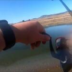
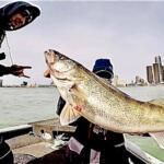
Late spring is arguably the best time of year to target Wipers (a hybrid cross between white bass and striped bass) on this body of water. They exhibit incredible hybrid vigor and are currently pushing baitfish into the shallows. Walleye are also high on the target list; they have fully recovered from their early spring spawn at the dam and are actively feeding to regain lost weight.
Sleeper Pick: Smallmouth Bass
While the walleye and wiper get all the glory, the smallmouth bass fishing can be spectacular right now. The rocky points and riprap sections are holding chunky bronze-backs that are aggressively defending their pre-spawn staging areas.
If you are fishing with family or looking for consistent action, the reservoir is heavily stocked with Rainbow Trout. They cruise the shoreline drop-offs and provide excellent sport. Additionally, as the water warms, Channel Catfish are beginning to wake up from their winter lethargy. They are actively scavenging the muddy bottoms in the shallower coves, offering a fantastic opportunity for anglers who prefer still-fishing with cut bait.
Baitfish Report: Gizzard Shad
The primary forage base driving the predator activity in Cherry Creek Reservoir is the gizzard shad. Shad are pelagic and are currently moving toward warming shorelines where plankton densities are highest. Match your presentations to juvenile shad—profiles in the three to four-inch range are getting hammered by nearly every predatory fish in the lake.
TACTICAL STRATEGY
Walleye Tactics
With the annual spawning closure at the dam lifted, walleyes have dispersed, but many are holding along the first major drop-offs. Focus your efforts near the East Boat Ramp and the submerged structural transitions dropping from 8 to 15 feet.
Where: Submerged drop-offs, rocky shorelines, and transition zones between mud and hard bottom.
Lure: Suspending jerkbaits like a Rapala Husky Jerk (Size 10) or a Smithwick Rattlin' Rogue.
Color: Glass Ghost or classic Silver/Black back to mimic the local shad population.
Bait: If the bite slows during the midday sun, switch to a bottom bouncer rigged with a Colorado blade and a live nightcrawler harness. Keep your trolling speed around 1.0 to 1.2 mph.
Timing: Low-light periods are critical. The last hour of daylight and the first hour after dark are when walleyes push shallow to feed on rocky shorelines.
Pro Tip:When casting jerkbaits for evening walleyes, use a painfully slow retrieve with long pauses. Most strikes will occur while the bait is suspended completely motionless in the water column.
Wiper Tactics
Wipers are pack hunters. Look for them near the wind-blown points and shallow bays where warm water is stacking up the plankton and shad.
Where: Wind-swept points, shallow bays, and open-water surface boils.
Lure: 1/2 oz Blue Fox spinners, or for fly anglers, Clouser Minnows and bucktail streamers on an 8-weight rod with a sink-tip line.
Color: Chartreuse and white, or blue and white.
Timing: Keep your eyes peeled for surface activity throughout the day. When wipers ambush a school of shad, the water will literally erupt. Have a topwater walking bait rigged and ready to fire into the boils instantly.
Largemouth and Smallmouth Bass Tactics
Target the south end of the reservoir where the water is generally quieter and receives less pressure. The submerged stumps and emerging weed beds in this zone are prime real estate for largemouth bass. For smallmouth bass, shift your focus to the riprap near the dam and the rocky points scattered throughout the main lake.
Where: South end stumps for largemouth; dam riprap for smallmouth.
Lure: 1/8 oz to 1/4 oz Ned rigs, tube jigs, or Texas-rigged creature baits.
Color: Green pumpkin or PB&J (peanut butter and jelly) to mimic the local crawfish population.
Pro Tip:Boat traffic can make the main lake points tough to fish by midday. Hit the prominent rocky structures at first light before the recreational boaters and jet skis arrive.
Shore Angling Strategy
Not fishing from a boat? Cherry Creek Reservoir offers fantastic bank fishing. The areas around the swim beach and the inlet are highly productive. When fishing from shore, a slip-bobber rig is your best friend. Set a live leech or a lively minnow just a foot off the bottom. This keeps your bait out of the snag-heavy rocks while presenting an easy meal to cruising walleyes and trout. Keep moving until you find active fish; sitting in one dead spot for hours is a common mistake.
REGULATIONS SNAPSHOT
Before hitting the water, ensure you are familiar with the specific regulations governed by Colorado Parks and Wildlife for Cherry Creek Reservoir. This is a heavily monitored fishery with strict size and bag limits designed to protect the resource.
Species
Size Limit
Bag & Possession Limit
Special Rules
Walleye
18-inch minimum
3 fish per day
Only 1 walleye over 21 inches allowed per day.
Largemouth & Smallmouth Bass
15-inch minimum
5 fish in aggregate
Must be 15 inches or longer to keep.
Trout (Rainbow/Brown)
No minimum size
4 fish per day
Standard statewide regulations apply.
Note: The annual spawning closure at the dam (where fishing is prohibited within 100 feet of the dam or spawning nets) runs from March 1 through April 15. This area is now fully open to anglers for the season. Underwater spearfishing is permitted but strictly prohibited within 100 feet of any marina, boat ramp, swim beach, or dam infrastructure.
REGIONAL ALTERNATIVE
If the wind is howling out of the west and making Cherry Creek Reservoir unfishable, or if the boat ramp lines are simply too long, head south to Chatfield Reservoir. Located just a short drive away at the edge of the foothills, Chatfield offers excellent backup options with similar species profiles and slightly more protection from the wind.
Access: The Plum Creek inlet on the south side of Chatfield is a fantastic spring hotspot. It offers more wind protection and warmer water temperatures than the main lake basin.
Target Species: Walleye, Smallmouth Bass, and Rainbow Trout.
Tactical Approach: Troll the submerged river channel edges with crankbaits or cast inline spinners near the inlet where moving water concentrates feeding trout and smallmouth bass. The shoreline near the swim beach is also an excellent evening spot for pitching jigs to cruising walleyes.
Pro Tip:When fishing the Plum Creek inlet at Chatfield, watch your sonar for sharp temperature breaks. Even a one- or two-degree increase in water temperature can hold massive concentrations of active fish during the spring season.
Tight lines!
Editor's Choice: Must-Have Gear
FISHINGSIR Next-Gen Waterproof Chest Waders
★★★★★4.4 (7,370+ reviews)
2-Ply Tech: Upgraded nylon with 2.5x higher density than standard fabrics.
100% Waterproof: Lab-approved intrusion resistance with taped visible seams.
Ultra-Lightweight: Designed for all-day comfort while hunting or fishing.
As an Amazon Associate I earn from qualifying purchases. #ad
Loading forecast...
Live Fishing Conditions: Tides, Weather & Waves
Get real‑time tides, marine weather, swell and solunar activity for each spot so you know exactly when conditions line up for your best chance at a bite.
🎣
Cherry Creek Reservoir, Colorado
Loading coordinates...
🌤️
WEATHER CONDITIONS
--°F
--°C
Loading...
🌡️
Feels Like--°F--°C
💧
Humidity--%
💨
Wind-- mph-- km/h
🧭
Direction--
📊
Pressure-- inHg-- hPa
☀️
UV Index--
🌊
MARINE CONDITIONS
🌊Wave Height
-- ft
-- m
Loading...
🧭Wave Direction
--°
Loading...
⏱️Wave Period
-- s
Loading...
📈Tide Status
-- ft
-- m
Loading...
🌙
LUNAR & SOLUNAR
🌕
Loading...
Illumination: --%
Major Period--:-- - --:----:-- - --:--
Minor Period--:-- - --:----:-- - --:--
🌅Sunrise--:--
🌇Sunset--:--
📅
24-HOUR FORECAST
Loading fishing conditions...
Fishing Spots Map
🎣
Book a Fishing Charter near Cherry Creek Reservoir, Colorado Fishing Report Today 🎣
Local guides & charters. Verified captains, instant booking, best price guaranteed.
There was an error loading the map. Please try refreshing the page.
Info
Local Access & Facilities
Cherry Creek Reservoir stands as a unique prairie oasis surrounded by the bustling urban landscape of the Denver metro area. Originally constructed to protect the region from the historic floodwaters of the South Platte River, this 880-acre impoundment has evolved into a high-traffic recreational hub that demands strategic planning for serious anglers. The juxtaposition of a skyline view against a rugged high-plains fishery creates an atmosphere that is both accessible and surprisingly wild.
For the seasoned captain, this water offers a year-round fishery that remains productive even when winter freezes over the shallows. While the park is famous for its multi-use recreational pressure—ranging from jet skis to sailboats—experienced anglers know that the subsurface topography holds significant potential for those willing to navigate the crowds. The environment is characterized by open water susceptible to sudden weather changes, requiring vigilance regarding wind and chop.
The primary draw here is the convenience of a legitimate fishery located minutes from the city center. Whether you are launching a fully rigged bass boat or patrolling the shoreline, the reservoir provides a quick escape without the need for a mountain expedition. However, because of its location on the southeast fringe of Denver, timing and local knowledge regarding access points are critical to maximizing time on the water.
Access & Getting There
Accessing the reservoir is straightforward but can be heavily influenced by urban traffic patterns. The primary route involves taking I-225 to Parker Road on the southeast edge of the city. While the highway infrastructure is robust, morning and evening rush hours can significantly delay travel time. Anglers towing trailers should remain in the right lanes on Parker Road to navigate the park entrance turns safely.
Once inside the park boundaries, boaters have two primary launch options: the East Boat Ramp and the West Boat Ramp. Both facilities are designed to handle significant volume, featuring paved lanes and trailer parking. However, the sheer popularity of the park means these lots can reach capacity rapidly during summer weekends. It is advisable to have a backup plan or arrive well before the mid-morning recreational rush.
💡 Captain's Tip: Trailer Strategy
The East and West boat ramps are the only viable options for launching trailered vessels. Avoid the "Jay's Valet" or generic city parking lots listed in GPS apps, as they cannot accommodate boat trailers and are miles from the water.
Weather on the high plains is a critical factor for access. The reservoir is exposed, and winds can whip up dangerous chop quickly. When the forecast calls for high winds, the West Boat Ramp may offer slightly more protection during launch depending on the wind direction, but the open water can become unnavigable for smaller craft. Shore anglers have dedicated access points, particularly suitable for families, located away from the heavy boat traffic of the main ramps.
Cherry Creek Reservoir, Colorado Pre-Trip Checklist
Facilities & Amenities
The infrastructure around Cherry Creek is developed, but anglers must distinguish between general park amenities and specific fishing resources. While the park offers restrooms and picnicking areas, specialized fishing support is found just outside the park boundaries. There are no fuel docks or fish cleaning stations explicitly listed at the ramps, so captains should arrive with full tanks and coolers prepped for transport.
For bait and tackle, Valley Country Fishing Tackle & Live Bait is the critical logistical hub, located just 1.5 miles from the water. This shop opens at 9:00 AM, which may be late for the dawn patrol, so stock up the day before. For fly fishermen targeting the shallows or nearby streams, Anglers All Denver and The Confluence Rod Company provide specialized gear, though they are located further into the city.
Facility Name
Type
Distance
Notes
Valley Country Fishing Tackle
Bait & Tackle
1.5 miles
Closest option; carries live bait.
Anglers All Denver
Fly Shop
8.5 miles
High-end fly gear and local expertise.
River Trekker Outfitters
Charter
9.7 miles
Local guiding services.
Fly Fish Colorado
Charter
9.3 miles
Specializes in fly fishing excursions.
Lodging for multi-day trips is convenient thanks to the on-site campgrounds. The Pioneer Loop and Gold Rush Loop offer campsites within the park, allowing anglers to sleep minutes from the launch ramp. This is a massive advantage for beating the gate traffic. For larger groups, the Ouray Group Site Campground is available. These sites are highly rated but require advance reservations due to the park's popularity.
💡 Captain's Tip: Missing Amenities
Note that the boat ramps do not have fish cleaning stations or dedicated lighting listed. Bring headlamps for early launches and plan to clean your catch at home.
Permits, Regulations & Fees
As a State Park and flood control project, strict adherence to regulations is enforced. Fishing in this area is managed by the State Fishing Agency, and valid Colorado fishing licenses are mandatory for all anglers. The park itself requires a daily or annual vehicle pass for entry, in addition to any boat registration fees. These fees contribute to the maintenance of the high-quality ramps and shoreline facilities.
The reservoir is a multi-use resource, and specific zones may be designated for swimming or wildlife protection, such as the wetlands near the inlet. Respecting these boundaries is not just a matter of legality but of preserving the delicate balance between high-impact recreation and wildlife habitat. The nearby Rocky Mountain Arsenal National Wildlife Refuge is a testament to the region's commitment to conservation; anglers should treat the reservoir with the same respect.
Aquatic Nuisance Species (ANS) inspections are a rigorous reality in Colorado. Expect mandatory boat inspections at the ramps before launching and upon exiting. This is to prevent the spread of invasive species like zebra mussels. Ensure your bilge is dry, plugs are pulled, and live wells are empty before arriving at the inspection station to avoid delays.
Events & Seasonal Information
The rhythm of Cherry Creek Reservoir is dictated by the seasons and the weekend crowds. Summer brings intense recreational pressure from water skiers and pleasure boaters. During these months, the "dawn patrol" strategy is essential; serious fishing is best done from safe light until about 10:00 AM when the recreational traffic peaks.
The park is open year-round, offering distinct opportunities in the colder months when the jet skis disappear. Ice fishing becomes a popular activity when conditions permit, changing the dynamic of the fishery entirely. Visitors should monitor local reports for ice thickness and safety, as the urban heat island effect can make ice conditions variable compared to mountain lakes.
💡 Captain's Tip: Wind Warning
Summer afternoons often bring violent thunderstorms and high winds coming off the foothills. Keep an eye on the western horizon and have an exit strategy if the sky turns dark.
Contact Information & Resources
For the most current information on water levels, boat ramp status, and park closures, direct contact with the managing agencies is recommended. The Cherry Creek State Park office manages daily operations and campground reservations. For broader environmental context, the U.S. Army Corps of Engineers oversees the dam and flood control aspects.
In the event of an emergency, standard 911 services apply, but having the park ranger station number saved is prudent. Self-reliance is key; while the park is urban, on-the-water assistance may not be immediate during off-peak hours. Always file a float plan with someone on shore, even for short trips.
For precise locations, real-time weather conditions, and detailed interactive maps of the boat ramps and bait shops mentioned, consult the live dashboard and widgets below.
🎣
Cherry Creek Reservoir, Colorado
Denver • Colorado • 39.6412, -104.8564
🅿️
Parking
5
Paradise Parking Lot
⭐ 5.014.6 mi
📍Parking lot, 1420 Garrison St #2, Lakewood, CO 80215, USA
Our spot reports combine data-driven forecasts with curated local information. The forecast is generated by our proprietary Fishing Score algorithm (0–100%), which analyzes real-time data from Open-Meteo API, validated against NOAA CO-OPS tide gauges and USGS water-monitoring stations. The model weights tide dynamics (35%), wave energy (25%), wind patterns (20%) and time of day (20%)—factors shown to influence fish feeding behavior through marine-biology research and decades of charter log data.
Access, facilities and services information for each fishing spot is sourced from official datasets such as Recreation.gov (RIDB), state park & wildlife agencies, and geospatial providers like Google Maps. These sections undergo scheduled re-validation every 3–6 months to ensure that boat ramps, park access, contact details and local services remain accurate.
Narrative sections (catches, seasonal behavior, local tips) are synthesized from these data sources and refined following the Fishing Reports Today editorial guidelines, combining bibliographic research from ichthyology and oceanography with expert angler experience. Our team reviews reports on a regular basis, while the forecast model itself updates every 6 hours for real-time accuracy.
⚠️ Important: Always verify current local regulations, access restrictions and weather conditions before fishing. These reports are intended as a planning aid, not a guarantee of catches or safety. When in doubt, contact local authorities or park managers listed on the page.
To provide the best experiences, we use technologies like cookies to store and/or access device information. Consenting to these technologies will allow us to process data such as browsing behavior or unique IDs on this site. Not consenting or withdrawing consent, may adversely affect certain features and functions.
Functional Always active
The technical storage or access is strictly necessary for the legitimate purpose of enabling the use of a specific service explicitly requested by the subscriber or user, or for the sole purpose of carrying out the transmission of a communication over an electronic communications network.
Preferences
The technical storage or access is necessary for the legitimate purpose of storing preferences that are not requested by the subscriber or user.
Statistics
The technical storage or access that is used exclusively for statistical purposes.The technical storage or access that is used exclusively for anonymous statistical purposes. Without a subpoena, voluntary compliance on the part of your Internet Service Provider, or additional records from a third party, information stored or retrieved for this purpose alone cannot usually be used to identify you.
Marketing & Affiliates
The technical storage or access is required to create user profiles to send advertising, or to track the user on a website or across several websites for similar marketing purposes, including affiliate tracking for products recommended in our reports.


Leave a Reply