Willow Slough Fishing Report Today 🎣
9 months ago · Updated 3 weeks ago

Willow Slough FWA: J.C. Murphey Lake Fishing Report
Go/No-Go Status
Verdict: GO
Conditions at Willow Slough Fish and Wildlife Area, specifically the 1,200-acre J.C. Murphey Lake, are prime for late spring and early summer angling. Following a massive multi-year lake renovation and drawdown that recently concluded, the water levels have fully recovered, and the newly established native aquatic vegetation is flourishing. Water temperatures are rapidly warming into the optimal feeding zones, shifting fish metabolism into high gear.
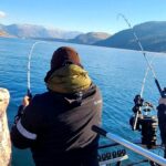
While the overall weather impact is highly favorable for fishing, anglers must exercise caution regarding the wind. J.C. Murphey Lake is exceptionally shallow, averaging just three feet in depth. This highly exposed topography means that even moderate breezes can whip up choppy conditions quickly, turning a calm morning into a challenging afternoon. Boaters should note that this is strictly an electric trolling motor-only lake. While gas outboard motors may remain physically attached to your transom, they cannot be operated under any circumstances. Furthermore, all watercraft must launch from the main headquarters ramps, and a U.S. Coast Guard-approved personal flotation device is legally required for every passenger onboard.

Species Intel
Primary Target: Bluegill and Redear Sunfish
The undisputed stars of J.C. Murphey Lake right now are the panfish. Thanks to an aggressive restocking effort by the Department of Natural Resources, which included over 600,000 fingerlings alongside mature broodstock saved during the drawdown, the bluegill and redear populations are thriving. Because of the newly enriched habitat and nutrient-dense waters, these fish are displaying explosive growth rates. Anglers are consistently tangling with thick-bodied bluegill in the 7-to-9-inch class, while the redear sunfish are pushing past the 11-inch mark. These aggressive feeders are currently moving from the deeper wintering channels toward the shallow flats to feed heavily and prepare for spawning.
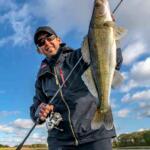
Sleeper Pick: Trophy Largemouth Bass
While panfish draw the numbers, the largemouth bass population is the true sleeper for trophy hunters. During the lake's renovation, biologists electro-fished and saved hundreds of mature bass, including over 200 specimens weighing between 5 and 7 pounds, transferring them to retention ponds before returning them to the refilled lake. With strict harvest limits in place, these apex predators are patrolling the newly established weedlines with minimal fishing pressure compared to other regional lakes.
Baitfish & Forage Report
The primary forage base currently consists of emerging aquatic insects, small native minnows, and young-of-the-year baitfish utilizing the newly flooded vegetation. Crawfish are also abundant around the newly stabilized shoreline riprap. Matching the hatch requires downsizing your presentation to mimic these small, erratic food sources or utilizing crawfish profiles when targeting bass.
Tactical Strategy
To maximize your success on J.C. Murphey Lake, precision and stealth are paramount. Forget wandering the open flats aimlessly; understanding the subtle bathymetry and the newly enhanced habitat is your key to unlocking this fishery.
Where to Target
Because the lake averages only three feet deep, you need to target the newly dredged in-lake ditch network. These channels drop down to 8-to-10 feet and act as aquatic superhighways for transitioning fish. Focus your efforts on the distinct drop-offs near Deer Island, Cypress Islands, and the area known as The Slot. As the midday sun warms the water, look for panfish and staging largemouth bass to slide up out of the deeper ditches onto the adjacent Sandy Knob Flats to forage in the emerging weedbeds. For those targeting catfish, the area known as Deep Hole provides a reliable holding zone during high-sun hours.
Pro Tip: Because J.C. Murphey Lake is exceptionally shallow, boat shadows and hull slap will easily spook fish in the clear, newly vegetated water. Use a stealthy approach, keep your trolling motor on a low, constant speed, and make long casts ahead of your drift to intercept undisturbed fish.
Lure & Bait Selection
- Panfish: Utilize a 1/8oz or 1/16oz tungsten teardrop jig suspended under a sensitive slip bobber. Tip the jig with a live wax worm or a small piece of nightcrawler.
- Largemouth Bass: Rig a weedless soft plastic stickbait, such as a green pumpkin Senko, or a shallow-running squarebill crankbait to work the edges of the new habitat structures. Topwater frogs are also becoming highly effective as the vegetation mats begin to form.
- Catfish: Carolina-rigged fresh cut bait, nightcrawlers, or commercial stink bait fished right on the bottom of the dredged channels will yield the best results.
Color Patterns
With the water clarity improving due to the new vegetation filtering the water column, natural color profiles are outperforming aggressively bright tones. For plastics and jigs, opt for green pumpkin, watermelon red flake, or natural shad patterns. If the wind stirs up the shallow silt and reduces visibility, switch to black-and-blue or chartreuse to provide a stronger, more visible silhouette.
Timing the Bite
Early morning excursions offer the calmest conditions and the most aggressive bite windows. The first two hours of daylight are crucial before the sun penetrates the shallow water column and pushes larger fish back into the safety of the dredged channels or the submerged habitat structures.
Pro Tip: Utilize your side-scan sonar to locate the 150+ new habitat enhancements placed by the DNR during the drawdown. These include wooden pallet structures and vertical stake beds. These isolated pieces of cover are absolute magnets for staging bass and crappie.
Regulations Snapshot
Always verify local postings at the Willow Slough headquarters, but here are the critical rules for J.C. Murphey Lake to keep you compliant and protect the fishery:
| Species | Size Limit | Daily Bag Limit |
|---|---|---|
| Largemouth Bass | 18-inch minimum | 2 fish per day |
| Bluegill, Redear, Crappie | No minimum size | 25 fish aggregate limit per day |
| Channel Catfish | No minimum size | Statewide standard applies |
Note: Swimming, wading, and the use of gas-powered motors are strictly prohibited. Shoreline fishing is restricted to the two designated earthen piers near the headquarters and the bank between them.
Regional Alternative: Kankakee River
If the wind is howling across the exposed flats of J.C. Murphey Lake making boat control impossible, pivot your plans north to the Kankakee River. The river's heavily wooded banks provide excellent windbreak protection, and the steady current keeps the fish active regardless of the barometric pressure drops that often accompany spring storm fronts.
Alternative Tactics
Access the river via the LaSalle Fish and Wildlife Area or various public access sites near the Indiana-Illinois state line. Target the deep outside bends, current seams, and eddy pools for smallmouth bass and walleye. A 1/4oz jig tipped with a lively fathead minnow or a medium-diving crankbait in a crawfish pattern will trigger strikes from fish holding behind laydowns and submerged boulders. The Kankakee also boasts a robust population of northern pike, so keep a wire leader handy if you plan on throwing flashy spinnerbaits near the backwater sloughs.
Pro Tip: When fishing the Kankakee River after a heavy rain, look for clear water tributaries emptying into the muddy main river. The distinct mudline created at these junctions is a prime ambush point for predatory fish waiting to ambush baitfish flushed out of the smaller creeks.
Tight lines!

FISHINGSIR Next-Gen Waterproof Chest Waders
- 2-Ply Tech: Upgraded nylon with 2.5x higher density than standard fabrics.
- 100% Waterproof: Lab-approved intrusion resistance with taped visible seams.
- Ultra-Lightweight: Designed for all-day comfort while hunting or fishing.
✓ Amazon's Choice | 100+ bought last month
Bandit Walleye Deep
Mandatory for reaching deep schools in 35-50ft mud flats.
Check Price on Amazon #adAs an Amazon Associate I earn from qualifying purchases. #ad
Live Fishing Conditions: Tides, Weather & Waves
Get real‑time tides, marine weather, swell and solunar activity for each spot so you know exactly when conditions line up for your best chance at a bite.
Willow Slough
Loading coordinates...
WEATHER CONDITIONS
Loading...
MARINE CONDITIONS
LUNAR & SOLUNAR
Loading...
Illumination: --%
24-HOUR FORECAST
Fishing Spots Map
Local guides & charters. Verified captains, instant booking, best price guaranteed.
Local Access & Facilities
Willow Slough
Parking
Bait & Tackle
Lodging
Boat Ramps
Restrooms
Family Friendly
Accessibility
Wheelchair Access
Not Confirmed
Pets Allowed
Not Confirmed
⚠️ Some accessibility info not officially confirmed. Please verify with location directly.
Local guides & charters. Verified captains, instant booking, best price guaranteed.
Nearby Spots


About Our Fishing Reports & Forecasts
Our spot reports combine data-driven forecasts with curated local information. The forecast is generated by our proprietary Fishing Score algorithm (0–100%), which analyzes real-time data from Open-Meteo API, validated against NOAA CO-OPS tide gauges and USGS water-monitoring stations. The model weights tide dynamics (35%), wave energy (25%), wind patterns (20%) and time of day (20%)—factors shown to influence fish feeding behavior through marine-biology research and decades of charter log data.
Access, facilities and services information for each fishing spot is sourced from official datasets such as Recreation.gov (RIDB), state park & wildlife agencies, and geospatial providers like Google Maps. These sections undergo scheduled re-validation every 3–6 months to ensure that boat ramps, park access, contact details and local services remain accurate.
Narrative sections (catches, seasonal behavior, local tips) are synthesized from these data sources and refined following the Fishing Reports Today editorial guidelines, combining bibliographic research from ichthyology and oceanography with expert angler experience. Our team reviews reports on a regular basis, while the forecast model itself updates every 6 hours for real-time accuracy.
⚠️ Important: Always verify current local regulations, access restrictions and weather conditions before fishing. These reports are intended as a planning aid, not a guarantee of catches or safety. When in doubt, contact local authorities or park managers listed on the page.
Leave a Reply