Cache La Poudre River: Fall Fishing Report & Tactical Guide
Welcome to the skinny water season on the Cache La Poudre River. As Colorado’s only federally designated Wild and Scenic River, the Poudre offers a masterclass in freestone trout fishing during the autumn months. The crowds have thinned, the cottonwoods have turned, and the trout are feeding with a sense of urgency before winter locks up the canyon. As a professional guide on these waters, I can tell you that fall fishing here is less about covering miles of water and more about surgical precision. The flows are low, the water is gin-clear, and the fish are holding in highly predictable, yet demanding, lies.
1. GO/NO-GO STATUS
Verdict: GO
Current conditions dictate a definitive "GO," but with the caveat that anglers must bring their technical A-game. We are currently experiencing classic low-flow autumn conditions. The water is running crystal clear, which means stealth is your greatest asset. Weather patterns are bringing cooler mornings with pleasant, mild afternoons. There is no ice to worry about in the lower and middle canyon, though you may encounter some morning frost on the banks in the upper reaches near Rustic. Wade with caution, not because of raging currents, but to avoid spooking the highly educated trout holding in the shallow tailouts.
Pro Tip:Leave the bright clothing at home. Wear muted earth tones to blend into the canyon walls and autumn foliage. If you can see the fish in this clear water, they have already seen you.
2. SPECIES INTEL
Primary Target: Wild Brown Trout
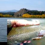
Brown trout are the undisputed kings of the Poudre during the fall. They are aggressive, putting on their vibrant autumn colors, and are beginning to exhibit pre-spawn behaviors. You will find them pushing into shallower riffles and holding aggressively on the seams of deeper pocket water.
Sleeper Pick: Cutbow Hybrids
While most anglers are laser-focused on the browns and stocked rainbows, the upper canyon holds beautiful Cutbow hybrids (Cutthroat/Rainbow crosses). These fish often hold in the softer, slower water off the main current and are incredibly willing to look up for a well-presented dry fly, even when a hatch isn't visible.
Baitfish & Forage Report
The large stoneflies and green drakes of summer are gone. The menu has transitioned strictly to micro-forage. The biomass is currently dominated by Blue-Winged Olives (BWOs) in sizes 20-22 and Midges in sizes 22-26. However, do not discount terrestrials just yet; on sunny afternoons, small foam ants and beetles blowing into the river from the canyon walls still trigger explosive surface eats.
3. TACTICAL STRATEGY
To succeed on the Poudre right now, you need to downsize everything—your flies, your tippet, and your indicators.
Where to Deploy
Skip the heavily trafficked picnic areas in the lower canyon. Head higher up Highway 14, focusing on the pocket water and fast riffles between the Big South trailhead and the town of Rustic. Look for structure: submerged boulders, deep slots between fast currents, and the foam lines created by small drops. The trout are heavily concentrated in any holding water that provides a mix of depth for safety and current for food delivery. Work the 3-to-5 foot deep plunge pools and the immediate drop-offs behind large mid-stream rocks.
Terrestrials: Foam Beetle (Size 16), Cinnamon Ant (Size 18).
Streamers: Micro-leeches and small Woolly Buggers (Size 10-12) in olive or black for the deeper pools.
Rigging & Tactics
The dry-dropper rig is the absolute best weapon in your arsenal right now. Tie on a highly visible but small terrestrial, like a foam beetle, and drop a tiny Zebra Midge or RS2 about 18 to 24 inches below it using 6X tippet. The low water demands long, fine leaders—opt for a 9-foot 5X or 6X tapered leader. If you are strictly nymphing, ditch the large plastic strike indicators. Use a small yarn indicator or a New Zealand strike indicator system to prevent heavy splashing that will send every fish in the pool darting for cover.
Pro Tip:When fishing the dry-dropper in tight pocket water, keep your rod tip high and minimize the amount of fly line on the water. High-sticking with just your leader in the current prevents micro-drag, which is the number one reason trout refuse a fly in the Poudre.
Timing the Bite
Leave the headlamp at home; there is no need to be on the water at dawn. The crisp fall nights drop the water temperature, making the fish sluggish early on. The magic window is between 11:00 AM and 3:00 PM. As the sun warms the canyon floor, the BWOs will begin to pop, and the trout will slide into feeding lanes to take advantage of the hatch.
4. REGULATIONS SNAPSHOT
The Cache La Poudre is heavily regulated to protect its wild trout populations, and the rules change depending on exactly which mile marker you are parked at. Always read the signage at the pull-offs.
Regulation Type
Details & Specifics
Gear Restrictions
Many sections, including Black Hollow Creek upstream to Big Bend Campground, are strictly Artificial Flies and Lures Only. No bait (worms, powerbait, eggs) is permitted in these zones.
Catch & Release
Several prime stretches are designated Catch and Release only for all trout species. All fish must be returned to the water immediately.
Spawning Advisory
With brown trout entering their spawn, watch your step. Avoid wading through shallow gravel beds (redds) where fish have laid eggs.
5. REGIONAL ALTERNATIVE
If the Poudre is running too low for your liking, or if weekend traffic along Highway 14 feels too crowded, your best fallback option is the Big Thompson River, located just a short drive south near Estes Park.
Focus on the catch-and-release tailwater section directly below Lake Estes. Because it is a tailwater, the flows are regulated and the water temperatures remain more consistent than the freestone Poudre. The Big Thompson is loaded with healthy rainbow and brown trout. The tactical approach is similar: 5X and 6X tippet, tiny midge patterns (Juju Baetis, Rainbow Warriors), and precise nymphing rigs. Access is incredibly easy along Highway 34, and the canyon scenery is equally stunning.
Tight lines!
🎣Nautrek
Beta testers wanted
The fishing network where your reputation matters.
Find trusted captains, join real trips with cost splitting, and build your Angler Rank. Your spots stay private — you decide who sees your intel.
Get real‑time tides, marine weather, swell and solunar activity for each spot so you know exactly when conditions line up for your best chance at a bite.
🎣
Cache La Poudre
Loading coordinates...
🌤️
WEATHER CONDITIONS
--°F
--°C
Loading...
🌡️
Feels Like--°F--°C
💧
Humidity--%
💨
Wind-- mph-- km/h
🧭
Direction--
📊
Pressure-- inHg-- hPa
☀️
UV Index--
🌊
MARINE CONDITIONS
🌊Wave Height
-- ft
-- m
Loading...
🧭Wave Direction
--°
Loading...
⏱️Wave Period
-- s
Loading...
📈Tide Status
-- ft
-- m
Loading...
🌙
LUNAR & SOLUNAR
🌕
Loading...
Illumination: --%
Major Period--:-- - --:----:-- - --:--
Minor Period--:-- - --:----:-- - --:--
🌅Sunrise--:--
🌇Sunset--:--
📅
24-HOUR FORECAST
Loading fishing conditions...
Fishing Spots Map
🎣
Book a Fishing Charter near Cache La Poudre Fishing Report Today 🎣
Local guides & charters. Verified captains, instant booking, best price guaranteed.
There was an error loading the map. Please try refreshing the page.
Info
Local Access & Facilities
The Cache la Poudre River corridor, pushing northwest from the plains of Laporte and Fort Collins, offers one of the most dynamic freshwater fisheries in Colorado. Designated as the state's first National Wild and Scenic River, the Poudre carves through steep mountains, dense Ponderosa pines, and shimmering aspen groves. For the seasoned angler, this region presents a rugged, high-altitude arena defined by fast-moving pocket water and deep, dark pools. The atmosphere here is wild and untamed, demanding technical wading skills and precise casting.
While the river itself is a haven for purists targeting brown, cutthroat, and rainbow trout, the surrounding watershed offers serious diversity. Just minutes away, the sprawling expanse of Horsetooth Reservoir provides a completely different theater of operations. This massive impoundment caters to the heavy-tackle and boat-based crowd, holding aggressive smallmouth bass, wiper, and deep-dwelling walleye. Whether you are throwing dry flies in a secluded canyon or trolling deep structure in the reservoir, the local topography dictates your tactical approach.
Expert anglers know that mastering the Laporte and Fort Collins area requires understanding the distinct rhythms of both moving and still water. The transition from the manicured, urban staging grounds of Fort Collins to the black lava-like rock formations of the upper canyon happens rapidly. Success here relies heavily on logistical preparation, knowing exactly where to launch, and understanding how the seasonal weather patterns impact the watershed.
Access & Getting There
Navigating to the prime fishing grounds requires a dual strategy depending on your target water. For river access, Highway 14 is your primary artery, winding directly along the Cache la Poudre North Park Scenic Byway. Traffic moving up the canyon can bottleneck during peak summer weekends, largely due to the influx of whitewater rafting outfitters. Seasoned skippers know to push up the canyon well before dawn to secure premium pull-offs near Ansel Watrous or Stove Prairie before the recreational crowds arrive.
If you are hauling a vessel to Horsetooth Reservoir, the logistics shift toward managing steep grades and busy ramps. The reservoir features seven distinct boat-launch ramps spread across its 6.5 miles of length. The ramps are generally wide and well-maintained, but they can become incredibly slick during periods of low water or after heavy rains. Trailer parking is widely available at the primary ramps, but these lots frequently reach capacity by early morning during the summer peak.
Weather contingencies are critical when planning your access strategy in this high-elevation environment. When high winds funnel through the foothills, the open waters of Horsetooth Reservoir can become dangerously choppy, making the leeward ramps near Inlet Bay your safest bet for launching. Conversely, if sudden canyon thunderstorms blow out the upper Poudre River, turning the water muddy, anglers often pivot to the reservoir or head south toward Flatiron Reservoir for clearer conditions.
💡 Captain's Tip: Navigating the Horsetooth Drawdown
Reclamation projects and dam modernizations occasionally lower the water levels at Horsetooth Reservoir significantly. Always check current reservoir levels before hauling a heavy boat up the grade, as low water can render some of the secondary boat ramps unusable for larger vessels.
For shore-based anglers hitting the lower river stretches, parking strategy is heavily reliant on designated access points. The Shields Street River Access provides excellent, well-maintained parking close to the urban boundary. Further up into the foothills, anglers must rely on tight, gravel pull-outs. Always ensure your vehicle is completely off the asphalt of Highway 14, as local law enforcement strictly monitors the canyon for traffic hazards.
Cache La Poudre Pre-Trip Checklist
Facilities & Amenities
The infrastructure supporting the Cache la Poudre fishery is heavily concentrated in Fort Collins, functioning as the ultimate basecamp before ascending into the canyon. The local tackle scene is highly specialized toward fly fishing. Mountain Fly Shop operates as the premier Orvis-authorized dealer, providing high-end gear and hyper-local intel on current hatches. Meanwhile, St. Peter's Fly Shop - South is a vital hub for tying materials and expert advice on traversing the upper canyon waters.
For those targeting the reservoir species with heavy conventional gear, the immediate canyon area lacks specialized big-tackle outfitters. Anglers looking for heavy-duty trolling gear or specialized walleye rigs often need to source their equipment before leaving the highway corridors. Vancestackle, located roughly 23.9 miles away in Berthoud, is a reliable option for conventional tackle if you are willing to make the drive prior to your dawn patrol.
Lodging logistics dictate how early you can hit the water. For those wanting to sleep right on the river, the Ansel Watrous and Stove Prairie campgrounds offer excellent access. These sites feature gravel driveways capable of handling trailers up to 40 feet, complete with tent pads and fire rings. However, negative knowledge is vital here: neither campground offers electrical hookups, and you must haul in your own drinking water or rely on the basic vault toilets provided.
💡 Captain's Tip: Urban Staging for Canyon Starts
If you prefer a comfortable bed over a tent, The Armstrong Hotel in Fort Collins operates 24 hours a day. It is perfectly positioned for a 4:00 AM departure, allowing you to grab coffee and hit the canyon access points before the sun hits the water.
Below is a breakdown of the critical facilities and staging areas utilized by local experts.
Facility Name
Type
Distance
Key Feature
Mountain Fly Shop
Tackle & Gear
6.7 miles
Orvis Authorized Dealer
St. Peter's Fly Shop
Tackle & Gear
11.3 miles
Premium Fly Materials
Ansel Watrous
Campground
9.9 miles
Direct River Access
Stove Prairie
Campground
12.2 miles
40-Foot Trailer Capacity
Shields Street
Parking
5.1 miles
Lower River Access
The Armstrong Hotel
Lodging
6.8 miles
24-Hour Operations
Permits, Regulations & Fees
Fishing the Cache la Poudre and surrounding reservoirs requires strict adherence to the rules set forth by the State Fishing Agency. The regulations here are not just bureaucratic red tape; they are essential for preserving the delicate balance of a high-altitude, Wild and Scenic watershed. The native cutthroat and brown trout populations face intense pressure during the summer, making catch-and-release practices and barbless hook regulations common in specific upper stretches of the canyon.
Accessing the Arapaho & Roosevelt National Forests requires an understanding of federal land use fees. While driving the scenic byway is free, parking at developed recreation sites, day-use areas, and campgrounds generally requires a daily vehicle pass or a valid annual National Parks and Federal Recreational Lands Pass. When utilizing the boat ramps at Horsetooth Reservoir, Larimer County requires specific daily or annual entrance and boat launch permits, which fund the maintenance of the marinas and parking lots.
If you plan to utilize the canyon campgrounds as your base of operations, reservations are strictly managed. Modifications or cancellations for sites like Ansel Watrous incur a $10.00 service fee, and late cancellations carry steeper penalties. The US Forest Service mandates that all equipment, including trailers and RVs, must fit entirely within the designated gravel driveways, which are strictly capped at lengths of 33 to 40 feet depending on the specific site.
💡 Captain's Tip: Firewood and Invasive Species
Never transport firewood from outside the immediate area due to the risk of introducing invasive beetles. Dead and downed wood can be gathered within the forest, or you can purchase approved bundles directly from the campground hosts at Stove Prairie.
Cultural and environmental respect is paramount in this region. The river corridor borders sensitive ecological zones and private property tracts. Anglers must be hyper-aware of high-water marks and property lines to avoid trespassing. Furthermore, the introduction of aquatic nuisance species is a severe threat; all vessels launching at Horsetooth Reservoir are subject to mandatory state boat inspections to prevent the spread of zebra and quagga mussels.
Events & Seasonal Information
The fishing rhythms in the Laporte area are entirely dictated by the dramatic seasonal shifts of the Rocky Mountains. Winter transforms the landscape, bringing heavy snow and thick ice. Facilities like Flatiron Reservoir close completely during the winter months due to inaccessible, ice-choked roads. During this time, the river flows drop significantly, and anglers must downsize their presentations, targeting deep, slow-moving pools where trout hold to conserve energy.
Spring runoff, typically peaking between late May and June, blows out the river with muddy, fast-moving water. This is when seasoned guides pivot their attention entirely to Horsetooth Reservoir. The rising water levels in the reservoir push smallmouth bass into the shallows to spawn, creating explosive early-season action along the rocky shorelines and submerged timber.
Summer is the peak season, but it brings intense logistical challenges. The Cache la Poudre River becomes a highway for commercial whitewater rafting operations. To fish successfully during July and August, the dawn patrol is mandatory. You must be on the water by first light and off the main runs by mid-morning when the rafts begin their descents. Similarly, afternoon thunderstorms roll over the canyon almost daily at 2:00 PM, making early starts critical for both success and safety.
Contact Information & Resources
Self-reliance is the rule when operating in the upper stretches of the canyon, as cell service disappears rapidly once you leave the plains. The primary managing agency for the forest lands is the Canyon Lakes District Office, co-located with the forest headquarters at 2150 Centre Avenue in Fort Collins. They are your best resource for current road closures, fire bans, and trail conditions.
For reservoir conditions, the Larimer County Parks Department manages Horsetooth Reservoir and Flatiron Reservoir. Always verify water levels and ramp statuses directly with the county before hauling a boat. In the event of an emergency on the river, local swift-water rescue teams are dispatched through the county sheriff, but response times in the deep canyon can be lengthy. Always wear appropriate footwear with felt or studded soles for the slick river rocks, and carry comprehensive first-aid and foul-weather gear.
For precise locations and real-time conditions, consult the live dashboard and maps below.
Our spot reports combine data-driven forecasts with curated local information. The forecast is generated by our proprietary Fishing Score algorithm (0–100%), which analyzes real-time data from Open-Meteo API, validated against NOAA CO-OPS tide gauges and USGS water-monitoring stations. The model weights tide dynamics (35%), wave energy (25%), wind patterns (20%) and time of day (20%)—factors shown to influence fish feeding behavior through marine-biology research and decades of charter log data.
Access, facilities and services information for each fishing spot is sourced from official datasets such as Recreation.gov (RIDB), state park & wildlife agencies, and geospatial providers like Google Maps. These sections undergo scheduled re-validation every 3–6 months to ensure that boat ramps, park access, contact details and local services remain accurate.
Narrative sections (catches, seasonal behavior, local tips) are synthesized from these data sources and refined following the Fishing Reports Today editorial guidelines, combining bibliographic research from ichthyology and oceanography with expert angler experience. Our team reviews reports on a regular basis, while the forecast model itself updates every 6 hours for real-time accuracy.
⚠️ Important: Always verify current local regulations, access restrictions and weather conditions before fishing. These reports are intended as a planning aid, not a guarantee of catches or safety. When in doubt, contact local authorities or park managers listed on the page.
To provide the best experiences, we use technologies like cookies to store and/or access device information. Consenting to these technologies will allow us to process data such as browsing behavior or unique IDs on this site. Not consenting or withdrawing consent, may adversely affect certain features and functions.
Functional Always active
The technical storage or access is strictly necessary for the legitimate purpose of enabling the use of a specific service explicitly requested by the subscriber or user, or for the sole purpose of carrying out the transmission of a communication over an electronic communications network.
Preferences
The technical storage or access is necessary for the legitimate purpose of storing preferences that are not requested by the subscriber or user.
Statistics
The technical storage or access that is used exclusively for statistical purposes.The technical storage or access that is used exclusively for anonymous statistical purposes. Without a subpoena, voluntary compliance on the part of your Internet Service Provider, or additional records from a third party, information stored or retrieved for this purpose alone cannot usually be used to identify you.
Marketing & Affiliates
The technical storage or access is required to create user profiles to send advertising, or to track the user on a website or across several websites for similar marketing purposes, including affiliate tracking for products recommended in our reports.


Leave a Reply