Western Basin (Sandusky, Ohio) Fishing Report Today 🎣
12 months ago · Updated 10 hours ago
Western Basin (Sandusky, Ohio) Fishing Report
Welcome to the premier breakdown of the Western Basin of Lake Erie out of Sandusky, Ohio. As the water temperatures begin their downward trend, the transition period triggers some of the most aggressive feeding windows of the year. This guide provides the tactical intelligence required to maximize your time on the water, whether you are targeting schooling panfish or chasing trophy predators.
1. GO/NO-GO STATUS
Verdict: CAUTION
The current seasonal transition brings highly variable weather patterns to the Western Basin. While the fishing is exceptional, safety dictates a cautious approach. Fall winds, particularly blows from the northeast, can stack waves rapidly in the shallow Western Basin, creating steep, dangerous swells. Always monitor marine forecasts closely before leaving the protected waters of Sandusky Bay. If winds exceed 15 knots from the North or Northeast, the main lake becomes treacherous for vessels under 21 feet. Water temperatures are dropping into the upper 60s, meaning survival times in the water are decreasing; ensure all safety gear is accessible and functional.
🎣Nautrek
Private Beta
J
M
R
100+ anglers on the waitlist
The fishing network where your reputation matters.
Find trusted captains, join real trips with cost splitting, and build your Angler Rank. Your spots stay private — you decide who sees your intel.
The fall perch bite is arguably the most reliable and rewarding fishery in the Sandusky area right now. As water temperatures cool, these fish are congregating in massive schools over soft mud bottoms to gorge before winter.
The resident walleye that stayed in the Western Basin are actively feeding, and the migratory fish from the Central Basin are beginning to push back west. They are following the massive bait balls moving toward the nearshore areas.
Sleeper Pick: Smallmouth Bass
Often overlooked by the walleye and perch crowds, the smallmouth bass fishing around the rocky structure of the Lake Erie Islands (just north of Sandusky) is world-class during the fall transition. They are heavily feeding on gobies and crayfish.
Baitfish Report
Emerald shiners and gizzard shad are the dominant forage right now. Massive schools of shad are moving toward the mouths of tributaries and into Sandusky Bay. Round gobies remain the primary forage for bottom-oriented predators near rocky reefs.
3. TACTICAL STRATEGY
Yellow Perch Tactics
Where: Focus your efforts in 25 to 32 feet of water. The mud flats northwest of the Cedar Point dumping grounds and the transitional edges south of Kelleys Island are holding massive schools. Look for the pack of boats, but rely on your sonar to find isolated, less-pressured schools nearby.
Lure/Rig: A standard two-hook or three-hook crappie/perch spreader rig. Use a 1/2 oz to 1 oz bell sinker depending on the current and wind drift.
Color: Gold or chartreuse blades on the spreader rigs tend to provide the necessary flash in the slightly stained waters of the Western Basin.
Bait: Live emerald shiners are non-negotiable. If local bait shops are out, golden shiners will work, but emeralds are the native forage. Hook them lightly through the lips to keep them lively.
Timing: The bite is highly dependent on light penetration. Mid-morning (8:00 AM to 11:00 AM) often yields the most aggressive feeding, especially on overcast days.
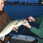
Pro Tip: Keep your bait precisely six to twelve inches off the bottom. If you are dragging in the mud, you will catch white perch and gobies. A tight line with slight vertical twitches will trigger the larger "jumbo" yellow perch.
Walleye Tactics
Where: The rock-to-mud transition zones off the Marblehead Peninsula and the shoals around Kelleys Island (15-24 feet of water). Fish are suspending slightly higher in the water column, often 10 to 15 feet down.
Lure: Trolling diving crankbaits is highly effective right now. Bandit Deep Walleye divers or Smithwick Perfect 10 Rogues are the top producers. For casters, 1/2 oz weight-forward spinners (like Erie Dearies) are still picking up fish.
Color: "Blue Chrome," "Pink Promise," or anything with a bright chartreuse/purple combination (often called "Discord" or "Barbie" patterns locally).
Speed: Trolling speeds should be dialed into 1.5 to 1.8 mph. As the water continues to cool, gradually reduce this speed.
Pro Tip: Pay close attention to your sonar's upper water column. Many anglers troll under the active fish in the fall. Run your crankbaits high, utilizing planer boards to get the lures away from the boat's shadow and engine noise.
Smallmouth Bass Tactics
Where: The rocky drop-offs around Kelleys Island and the Bass Islands. Focus on depths of 12 to 18 feet where chunk rock meets gravel.
Lure: Drop-shot rigs or dragging tube jigs. A 3.5-inch green pumpkin tube with a 3/8 oz internal jig head is a staple.
Color: Green pumpkin, watermelon red flake, or goby-imitating browns and blacks.
Pro Tip: Slow your presentation down. Drag the tube so it maintains constant contact with the rocky bottom, mimicking a scurrying goby. When you feel a tick, drop the rod tip slightly before setting the hook.
4. REGULATIONS SNAPSHOT
Note: Always verify with the current Ohio Department of Natural Resources (ODNR) fishing regulations, as emergency changes can occur.
Walleye: The daily bag limit is 6 fish per angler. The minimum size limit is 15 inches.
Yellow Perch: The daily bag limit in the Western Basin (Lake Erie Management Unit) is typically 30 fish per angler, with no minimum size limit.
Smallmouth/Largemouth Bass: The daily bag limit is 5 fish (singly or in combination). The minimum size limit is 14 inches.
5. REGIONAL ALTERNATIVE
If the main lake is rolling with 4-to-6 foot waves from a stiff northern blow, do not risk it. The perfect backup plan is retreating into the protected waters of Sandusky Bay.
Access: Launch at the Dempsey Fishing Access or the Shelby Street Public Boat Launch in downtown Sandusky.
Target Species: Largemouth Bass and Channel Catfish.
Tactical Approach: The bay offers excellent protection from north winds. Target the riprap shorelines, marina breakwalls, and the old bridge pilings with spinnerbaits (white/chartreuse) or squarebill crankbaits for aggressive largemouth bass. If you want a relaxing day, anchor up near the deeper channels of the bay (10-15 feet) and soak cut gizzard shad or raw shrimp on the bottom for massive channel catfish. The bay's water is typically much more stained than the main lake, so rely on scent and vibration.
Tight lines!
Editor's Choice: Must-Have Gear
FISHINGSIR Next-Gen Waterproof Chest Waders
★★★★★4.4 (7,370+ reviews)
2-Ply Tech: Upgraded nylon with 2.5x higher density than standard fabrics.
100% Waterproof: Lab-approved intrusion resistance with taped visible seams.
Ultra-Lightweight: Designed for all-day comfort while hunting or fishing.
As an Amazon Associate I earn from qualifying purchases. #ad
Loading forecast...
Live Fishing Conditions: Tides, Weather & Waves
Get real‑time tides, marine weather, swell and solunar activity for each spot so you know exactly when conditions line up for your best chance at a bite.
🎣
Western Basin (Sandusky, Ohio)
Loading coordinates...
🌤️
WEATHER CONDITIONS
--°F
--°C
Loading...
🌡️
Feels Like--°F--°C
💧
Humidity--%
💨
Wind-- mph-- km/h
🧭
Direction--
📊
Pressure-- inHg-- hPa
☀️
UV Index--
🌊
MARINE CONDITIONS
🌊Wave Height
-- ft
-- m
Loading...
🧭Wave Direction
--°
Loading...
⏱️Wave Period
-- s
Loading...
📈Tide Status
-- ft
-- m
Loading...
🌙
LUNAR & SOLUNAR
🌕
Loading...
Illumination: --%
Major Period--:-- - --:----:-- - --:--
Minor Period--:-- - --:----:-- - --:--
🌅Sunrise--:--
🌇Sunset--:--
📅
24-HOUR FORECAST
Loading fishing conditions...
Fishing Spots Map
🎣
Book a Fishing Charter near Western Basin (Sandusky, Ohio) Fishing Report Today 🎣
Local guides & charters. Verified captains, instant booking, best price guaranteed.
There was an error loading the map. Please try refreshing the page.
Info
Local Access & Facilities
The Western Basin of Lake Erie, anchored by the historic waterfront of Sandusky, Ohio, represents one of the most dynamic freshwater fisheries in the United States. This is not merely a lake; it is an inland sea with a distinct personality, characterized by its shallow depths, rapid weather changes, and a bottom topography rich with history. Experienced anglers know this area not just for the bite, but for the atmosphere. You are fishing in the shadow of the Perry's Victory & International Peace Memorial, a 352-foot Doric column that dominates the horizon, reminding every captain that these waters were once the stage for the pivotal Battle of Lake Erie in 1813.The vibe here shifts seamlessly from the rugged, industrial heritage of the mainland to the vacation-paced rhythm of the islands. While the roller coasters of Cedar Point scream in the distance, the serious work happens on the water. The basin features a mix of open water, rocky island shorelines, and protected estuaries like Old Woman Creek. This diversity attracts seasoned captains targeting the region's legendary game fish populations. Whether you are launching for a dawn patrol out of Sandusky or navigating the ferry lanes near South Bass Island, the Western Basin demands respect, preparation, and a solid understanding of local logistics.
Access & Getting There
Reaching the prime fishing grounds of the Western Basin requires navigating a mix of highway infrastructure and maritime logistics. For anglers trailing their own rigs, the primary approach is via the Ohio Turnpike (I-80/90). If traveling east, you will route through to US 250 north; if traveling west, the connection is via State Route 53. These highways feed into State Route 2, the coastal artery that connects the major harbors from Port Clinton to Sandusky. Traffic on SR 2 can be heavy during the summer tourist season, particularly on Friday afternoons and Sunday evenings, so plan your trailering schedule accordingly to avoid the bottlenecks near the Cedar Point causeway.
💡 Captain's Tip: Ferry Logistics for Boat Trailers
If you intend to fish from the islands with your own vessel, choose your ferry wisely. The Miller Boat Line out of Catawba Island is the primary carrier for vehicles and trailers. The Jet Express is passenger-oriented and docks in downtown Put-in-Bay, walking distance to the memorial but not designed for hauling heavy boat rigs.
Once in Sandusky, the launch reality is dictated by the ferry schedules and weather. The local ramps provide access to the bay, but captains must be vigilant regarding the Jet Express and commercial traffic. The ferries move fast and throw significant wakes; keep your head on a swivel when exiting the harbor. For those looking to launch directly into the island chain, access points on South Bass Island or Middle Bass Island are available, but require the aforementioned ferry transit. Note that private planes can also land at the Put-in-Bay Airport, which is open dawn to dusk, for anglers flying in to meet a charter.Weather is the single most critical factor for access in the Western Basin. Because this section of Lake Erie is the shallowest, it is notoriously prone to "kicking up" rapidly. A shift in wind direction can turn a calm chop into dangerous rollers in under an hour. When the wind blows from the northeast, the fetch across the lake builds significant swell that stacks up against the Sandusky shoreline. In these conditions, wise captains retreat to the protected waters of the bay or the leeward side of the islands. Always have a contingency plan; if the main lake is unfishable, the estuaries near Huron often remain accessible.Parking in Sandusky requires strategy, especially for those with trailers. The Jackson Street Parking Lot is a reliable option, rated highly for its accessibility and open 24 hours a day, making it ideal for alpine starts. There is also a garage at 158 W Market St, though vertical clearance must be checked for roof racks. For those heading to the islands without a boat, the ferry terminals have extensive parking, but they fill rapidly on summer weekends. Security is generally good, but standard precautions apply—lock your gear and park in well-lit areas like the Free Parking zones identified in the city center.
Western Basin (Sandusky, Ohio) Pre-Trip Checklist
Facilities & Amenities
The infrastructure in the Western Basin is robust, but it is spread out across several municipalities. You will not find every service on every corner, so knowing where to go saves valuable fishing time. For bait and tackle, the options are specialized and geographically distinct. Lakeside Fishing Equipment in Lakeside and Jeanett's Bait and Tackle in Port Clinton are staples for the region, opening early enough to service the morning fleet. However, if you are launching from Huron, Central Basin Bait, Tackle and Carryout is your primary resource. Note the distance: Jeanett's is over 11 miles from central Sandusky, so stocking up the night before is highly recommended to avoid burning daylight.The charter fleet here is world-class, with operators ranging from heavy trolling vessels to light tackle specialists. Eriesponsible Sportfishing is based directly in Sandusky, offering convenient access for those staying in the city. For those looking to depart closer to the islands, Eyehooker Lake Erie Fishing Charters and Champion Charters operate out of Lakeside Marblehead. These outfits are known for their deep local knowledge of the seasonal movements of fish between the islands and the mainland. They are accustomed to handling serious clients who want to focus on technique and results rather than just a boat ride.
💡 Captain's Tip: Fuel and Ice Gaps
While the marinas are excellent, on-water fuel can be more expensive and have shorter hours than highway stations. Experienced skippers fuel up their trailer boats at land-based stations on SR 2 or US 250 before hitting the ramp. Similarly, ensure your coolers are iced down before you reach the harbor, as dockside ice availability can be spotty during peak rushes.
Accommodations in the area cater well to the angling community. Bayfront Resort at Cross View is located less than half a mile from the water in Sandusky, minimizing the morning commute. For a more rustic or group-oriented stay, Kotts Camp in Lakeside Marblehead offers proximity to the peninsula's launch ramps. If you prefer a lodge atmosphere, the Farrell House Lodge provides a quiet retreat about 5 miles from the action. When booking, always ask about boat trailer parking availability, as many standard hotels in downtown Sandusky have tight lots not designed for 25-foot rigs.
Permits, Regulations & Fees
Fishing in the Western Basin is governed by the Ohio Department of Natural Resources (ODNR) Division of Wildlife. The regulations here are strictly enforced, not just for conservation, but because this is an international border water. You are often fishing within sight of Canadian waters. It is imperative to know exactly where the international boundary line sits on your GPS. Crossing into Canadian waters with live bait or without the proper Ontario license can result in significant fines and legal headaches. Stick to the US side unless you are fully permitted and declared for cross-border travel.There are specific protected zones that demand high situational awareness. The Old Woman Creek National Estuarine Research Reserve, located east of Huron, is a sensitive ecological area. It is one of only two such research reserves in the Great Lakes, featuring freshwater marshes and swamp forests. While it offers unique paddling and wildlife viewing, it is primarily a research facility. Access here is strictly managed to protect the barrier beach and estuarine waters. Anglers should utilize the designated visitor center to understand specific boundaries and restricted zones before casting near the mouth of the creek.
💡 Captain's Tip: Cultural Respect
The islands are not just fishing grounds; they are communities. When fishing near South Bass Island, respect the "no wake" zones and private docks. The local ethos values the history of the area—treat the waters around the Peace Memorial with the same respect you would a cemetery, as it is the final resting place for officers from the War of 1812.
Permit requirements are standard for Ohio waters, but always check for seasonal changes in bag limits, particularly for perch and walleye. The Visitor Center at Perry's Victory is an excellent place to get orientated, but they primarily handle park passes, not fishing licenses. Ensure your Ohio fishing license is purchased online or at a certified vendor like Jeanett's or Central Basin before you leave the dock. There is no grace period for fishing without a license in these heavily patrolled waters.
Events & Seasonal Information
The rhythm of the Western Basin is dictated by the seasons. The primary boating season runs from mid-May through mid-October, aligning with the operating hours of the Perry's Victory Visitor Center. This is when the water is most accessible, and the bait shops are running full schedules. Early season (May and June) often sees the most aggressive fishing action as water temperatures rise. As summer peaks, the bite often moves deeper or shifts to early morning and late evening windows to avoid the midday heat and recreational boat traffic.September is a particularly significant month in this region. The anniversary of the Battle of Lake Erie occurs on September 10th, often accompanied by historical reenactments, firing of carronades, and a heightened naval presence. While this adds to the atmosphere, it can also mean restricted zones around the harbor and increased patrol boat activity. Anglers should expect the waters around Put-in-Bay to be congested during this commemorative period.Daily timing is also crucial. The "Lake Erie chop" is a real phenomenon; the wind often picks up by 10:00 AM. Seasoned locals aim to be at their spot by sunrise and often plan to be heading back to the barn by early afternoon before the afternoon thunderstorms roll in. The visitor center at Old Woman Creek is open year-round, offering a good shore-based alternative for birding and observation if the main lake is blown out during the shoulder seasons.
Contact Information & Resources
For official information regarding park access and historical sites, contact Perry's Victory & International Peace Memorial at (419) 285-2184. For questions regarding the estuary and coastal access east of Huron, the Old Woman Creek National Estuarine Research Reserve can be reached at 419-433-4601.In an emergency on the water, hail the Harbor Master on VHF Channel 16. The Coast Guard maintains a strong presence in this sector due to the international border and high volume of ferry traffic. Self-reliance is key; ensure your radio is functional and your safety gear is up to date.For precise locations of boat ramps, real-time wind conditions, and the nearest tackle shops to your current position, consult the live dashboard and interactive maps below.
Our spot reports combine data-driven forecasts with curated local information. The forecast is generated by our proprietary Fishing Score algorithm (0–100%), which analyzes real-time data from Open-Meteo API, validated against NOAA CO-OPS tide gauges and USGS water-monitoring stations. The model weights tide dynamics (35%), wave energy (25%), wind patterns (20%) and time of day (20%)—factors shown to influence fish feeding behavior through marine-biology research and decades of charter log data.
Access, facilities and services information for each fishing spot is sourced from official datasets such as Recreation.gov (RIDB), state park & wildlife agencies, and geospatial providers like Google Maps. These sections undergo scheduled re-validation every 3–6 months to ensure that boat ramps, park access, contact details and local services remain accurate.
Narrative sections (catches, seasonal behavior, local tips) are synthesized from these data sources and refined following the Fishing Reports Today editorial guidelines, combining bibliographic research from ichthyology and oceanography with expert angler experience. Our team reviews reports on a regular basis, while the forecast model itself updates every 6 hours for real-time accuracy.
⚠️ Important: Always verify current local regulations, access restrictions and weather conditions before fishing. These reports are intended as a planning aid, not a guarantee of catches or safety. When in doubt, contact local authorities or park managers listed on the page.
To provide the best experiences, we use technologies like cookies to store and/or access device information. Consenting to these technologies will allow us to process data such as browsing behavior or unique IDs on this site. Not consenting or withdrawing consent, may adversely affect certain features and functions.
Functional Always active
The technical storage or access is strictly necessary for the legitimate purpose of enabling the use of a specific service explicitly requested by the subscriber or user, or for the sole purpose of carrying out the transmission of a communication over an electronic communications network.
Preferences
The technical storage or access is necessary for the legitimate purpose of storing preferences that are not requested by the subscriber or user.
Statistics
The technical storage or access that is used exclusively for statistical purposes.The technical storage or access that is used exclusively for anonymous statistical purposes. Without a subpoena, voluntary compliance on the part of your Internet Service Provider, or additional records from a third party, information stored or retrieved for this purpose alone cannot usually be used to identify you.
Marketing & Affiliates
The technical storage or access is required to create user profiles to send advertising, or to track the user on a website or across several websites for similar marketing purposes, including affiliate tracking for products recommended in our reports.


Leave a Reply