OFFICIAL FISHING REPORT: Dowling Park, Indiana & Greater Border Waters Date: Thursday, June 18, 2026 Reporting Editor/Pro Guide: Senior Fishing Editor Coverage Area: Dowling Park (Hammond, IN) & 50km Radius (Southern Lake Michigan, Chicagoland, NWI)
---
🌊 PRO GUIDE’S EXECUTIVE SUMMARY
Welcome to the mid-June transition, anglers. As water temperatures push into their summer patterns, our biological ground truth data—compiled from 117 verified citizen-science observations over the last 30 days—paints a crystal-clear picture of what's happening under the surface.
🎣Nautrek
Private Beta
J
M
R
100+ anglers on the waitlist
The fishing network where your reputation matters.
Find trusted captains, join real trips with cost splitting, and build your Angler Rank. Your spots stay private — you decide who sees your intel.
If you're fishing the Dowling Park area, the Hammond/East Chicago border waters, or pushing up into the South Side Chicago harbors, Panfish and Urban Carp are currently dominating the bite, while the Largemouth and Smallmouth Bass are settling into highly predictable early-summer feeding windows.
Here is your actionable intelligence to put more fish in the net this weekend.
---
📊 BIOLOGICAL GROUND TRUTH: SPECIES ACTIVITY & PATTERNS
**1. The Panfish Syndicate (Bluegill & Sunfish) - *Activity Level: FIRE Data Status: Bluegill are the #1 most active species right now (28 recent observations), heavily supported by Common, Green, and Greengill Sunfish. Recent Intel: Massive activity spikes reported just days ago (June 13-14) across local ponds, the South Side, and park lagoons. The Pattern: We are seeing the tail-end of the spawn and early post-spawn behavior. The big "bull" bluegills are aggressively defending shallow nests or staging just off the first weedline drop-offs. Pro Tactic: Downsize your presentation. A 1/64 oz tungsten jig tipped with a wax worm or a small piece of nightcrawler under a slip bobber is lethal right now. Focus on shaded overhangs and emerging lily pad edges.
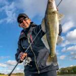
**2. The Bass Bite (Largemouth & Smallmouth) - *Activity Level: HIGH Data Status: Largemouth rank #4 (9 observations), with Smallmouth making a strong showing near harbor walls. Recent Intel: Verified Largemouth catches on June 15th (South Side, Homewood, Palos Hills). Smallmouth were actively busting bait on June 13th near structural choke points. The Pattern: Bass have fully recovered from the spawn and are strapping on the feedbag. Pro Tactic (Largemouth): Early morning topwater is turning on. Throw hollow-body frogs over the slop or walk-the-dog baits parallel to weedlines. As the sun gets high, switch to a weightless wacky-rigged Senko (Green Pumpkin) skipped under docks and overhangs. Pro Tactic (Smallmouth):Pay attention to species #10 on our list: the Round Goby.* Smallies are gorging on them around East Chicago and the Lake Michigan breakwalls. Throw goby-imitating bottom baits—specifically Ned rigs and dark-colored tube jigs—dragged slowly over rocks.
**3. European Carp (The Urban Tarpon) - *Activity Level: VERY HIGH Data Status: Ranked #2 overall (17 observations). The Pattern: Carp are cruising the shallows and mudflats across Cook County, East Chicago, and local Hammond/Dowling Park waterways. They offer the best pound-for-pound fight in the region right now.
Pro Tactic: Chum a targeted area with sweet corn. Use a hair rig loaded with 2-3 kernels of corn or a scopex-flavored boilie. Keep your drag relatively loose—these mid-June carp are making blistering runs.
**4. The Lingering Cold-Water Bite (Rainbow Trout) - *Activity Level: FADING Data Status: Ranked #8 (5 observations), but note that the last verified catch was June 3rd. The Pattern: As the surface temps have spiked over the last two weeks, the trout have pushed out to deeper, cooler thermal refuges (Michigan City offshore, deep harbor mouths). Pro Tactic: If you are still chasing trout, you need to be trolling spoons (like Moonshines or Silver Streaks) deep behind downriggers or heavy snap weights. Shoreline casting for trout is effectively over until the fall.
---
📍 HOTSPOT RADAR: WHERE TO DEPLOY THIS WEEKEND
Based on our 50km radius intelligence, here is where you should be burning your gas money:
Dowling Park / Hammond Local Ponds: Excellent for family fishing. Expect heavy Bluegill action and aggressive Green Sunfish. Bring ultra-light tackle and red worms. East Chicago / Lake Michigan Breakwalls: The Smallmouth/Goby connection is prime here. Rock Bass (#12 on our list) are also stacking up in these exact same rocky crevices. South Side Chicago / Jackson Park Lagoons: Verified hotspots for Largemouth Bass and Bullhead Catfish (recent catches confirmed June 13-15). Look for laydowns and fish tight to the wood.
Palos Hills / Lemont Corridors: Creek Chubs and Greengill Sunfish are highly active in the moving water and creek inlets. Great areas for wading with a fly rod or micro-jigs.
🎣 EDITOR'S PARTING ADVICE
The mid-June transition means the sun is beating down and water clarity is changing with algae blooms. Fish the low-light windows. Be on the water 30 minutes before sunrise or fish the last two hours of daylight into the evening. Not only will you beat the heat, but you'll intercept the heaviest feeding periods for both Bass and trophy Panfish.
Tight lines, watch your electronics, and please practice selective harvest—let those big breeder Bass and giant Bluegills swim to fight another day!
Editor's Choice: Must-Have Gear
FISHINGSIR Next-Gen Waterproof Chest Waders
★★★★★4.4 (7,370+ reviews)
2-Ply Tech: Upgraded nylon with 2.5x higher density than standard fabrics.
100% Waterproof: Lab-approved intrusion resistance with taped visible seams.
Ultra-Lightweight: Designed for all-day comfort while hunting or fishing.
As an Amazon Associate I earn from qualifying purchases. #ad
Loading forecast...
Live Fishing Conditions: Tides, Weather & Waves
Get real‑time tides, marine weather, swell and solunar activity for each spot so you know exactly when conditions line up for your best chance at a bite.
🎣
Dowling Park Indiana
Loading coordinates...
🌤️
WEATHER CONDITIONS
--°F
--°C
Loading...
🌡️
Feels Like--°F--°C
💧
Humidity--%
💨
Wind-- mph-- km/h
🧭
Direction--
📊
Pressure-- inHg-- hPa
☀️
UV Index--
🌊
MARINE CONDITIONS
🌊Wave Height
-- ft
-- m
Loading...
🧭Wave Direction
--°
Loading...
⏱️Wave Period
-- s
Loading...
📈Tide Status
-- ft
-- m
Loading...
🌙
LUNAR & SOLUNAR
🌕
Loading...
Illumination: --%
Major Period--:-- - --:----:-- - --:--
Minor Period--:-- - --:----:-- - --:--
🌅Sunrise--:--
🌇Sunset--:--
📅
24-HOUR FORECAST
Loading fishing conditions...
Fishing Spots Map
🎣
Book a Fishing Charter near Dowling Park Indiana Fishing Report Today 🎣
Local guides & charters. Verified captains, instant booking, best price guaranteed.
There was an error loading the map. Please try refreshing the page.
Info
Local Access & Facilities
Dowling Park Indiana Pre-Trip Checklist
Local Access & Facilities
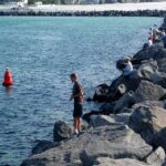
Situated in Hammond, Indiana, Dowling Park serves as a strategic terrestrial anchor for anglers targeting the southern basin of Lake Michigan. This area represents a unique convergence where the industrial might of the Rust Belt meets the ancient, wind-shaped topography of the Indiana Dunes National Park. For the experienced angler, this location offers a gateway to a fishery defined by its "rich mosaic of habitats," ranging from shifting sand shoals to the deep, cold waters of the lake.
The atmosphere here is distinctly functional and rugged. While the park itself provides a suburban green space, the surrounding fishery is influenced by the massive freshwater currents and the heavy maritime traffic of the nearby industrial harbors. Seasoned captains know that the southern shore can produce exceptional opportunities, but it requires navigating a landscape that is as much concrete and steel as it is dune grass and water. The primary draw here involves the seasonal movements of game fish patrolling the Indiana coastline, accessible via nearby ramps and shore points.
Unlike the manicured resort marinas found further north, the Hammond and Gary waterfronts demand a level of logistical self-reliance. The proximity to Pullman National Historical Park and the vast 15-mile stretch of the Indiana Dunes means that while the water is the main attraction, the surrounding land is steeped in a history of labor, industry, and conservation. Anglers launching here are fishing in the shadow of American industrial history.
💡 Captain's Tip: Wind Awareness
The southern shore of Lake Michigan is notoriously susceptible to north winds. Because the "fetch" runs the entire length of the lake, even moderate northerly breezes can stack up dangerous waves quickly against the Indiana shoals. Always check the marine forecast before towing to the ramp.
Access & Getting There
Reaching the fishing grounds near Dowling Park requires navigating the dense transportation web of the Chicago-Indiana border. The primary arterial routes include Interstate 94, the Indiana Toll Road (I-80/90), and U.S. Highway 12. For those towing heavy rigs, U.S. Highway 20 and Indiana State Road 49 provide critical surface street connections. Traffic in this corridor is notoriously heavy; seasoned locals know to time their transit to avoid the commuter bottlenecks that plague the Borman Expressway (I-80/94) during peak hours.
Official boat access is available through the Indiana Dunes National Park infrastructure, roughly 19 miles east, though closer municipal ramps exist within a 5 to 6-mile radius of Dowling Park. The launch facilities in this region vary from small municipal ramps to larger harbor accesses. When utilizing the National Park access points, be aware that these areas are multi-use, often shared with kayakers and beachgoers during the summer months. The ramps can be slick, and water levels fluctuate with the lake's cycles, so visual inspection of the end of the ramp is prudent before backing down.
Parking logistics require a strategic approach. While data indicates extensive parking facilities like 311 South Wacker Parking and Airways Parking, these are located over 20 miles away in Chicago and are not practical for local Hammond access. Anglers should prioritize parking at the designated boat launch areas or the nearby Indiana Dunes Visitor Center for orientation. Security at remote lots can be variable; ensure no valuables are left visible in the cab while you are out on the water.
💡 Captain's Tip: Trailer Traffic
The I-94 and I-80/90 corridors are major trucking routes. When towing a boat, stay in the right lanes and be prepared for sudden slowdowns near the Hammond/Gary exits. The "Dawn Patrol" launch time isn't just for fishing success; it's essential for avoiding the morning gridlock.
Facilities & Amenities
The infrastructure surrounding Dowling Park caters to a mix of serious outdoor enthusiasts and local residents. For bait and tackle, the standout option for early risers is Slez's Bait and Tackle in Lake Station, approximately 11 miles away. Crucially for the morning bite, they open at 5:00 AM daily, allowing captains to stock up on live bait and terminal tackle before the sun breaks the horizon. Other options like The Anglers Outlet and Bridgeport Bait And Tackle are reliable but located further afield (16-20 miles).
If you are looking to book a guided trip, the local fleet is anchored by operators who understand the nuances of the southern basin. Brother Nature Charter Fishing operates out of the Public Marina in Portage, roughly 14.9 miles from the park. They maintain a 5-star rating and offer 24-hour availability, catering to both early morning salmon runs and night fishing excursions. For those situated closer to the city, Storm Warning Chicago Fishing Charters provides access to the Illinois side of the fishery.
It is important to note a gap in immediate amenities: while there are extensive accommodations in the wider region, immediate "fisherman-friendly" lodging next to the ramps in Hammond is limited. Camping is available at the Dunbar Group Campsite or Nasaki Youth Camp Area, but these are located significantly to the east within the dunes area. Plan your fuel stops along the major highways (US-12 or US-20) before reaching the water, as dockside fuel availability can be inconsistent depending on the specific harbor you choose.
Facility Name
Type
Distance
Key Feature
Slez's Bait and Tackle
Bait Shop
11.3 mi
Opens 5:00 AM Daily
Brother Nature Charter Fishing
Charter
14.9 mi
Located in Portage, IN
West Beach Picnic Shelter
Accommodation
13.1 mi
Close to Dunes Access
Paul H. Douglas Center
Education/Facility
10.1 mi
Environmental Education
Permits, Regulations & Fees
Fishing waters around Dowling Park and the Indiana Dunes falls under the jurisdiction of the State Fishing Agency. Anglers must possess a valid Indiana fishing license and appropriate stamps for trout and salmon if targeting those species. Enforcement is active, particularly near the National Park boundaries and harbor mouths, to ensure conservation of the fishery.
Special attention must be paid when fishing near or accessing via Indiana Dunes National Park. While fishing is an allowed activity, specific zones may have restrictions to protect swimming beaches or sensitive dune habitats. The park spans 15 miles of coast and 16,000 acres; respecting the "Kapu" (restrictions) regarding dune preservation is critical. Walking on protected dune vegetation is strictly prohibited to prevent erosion of the landscape that has taken millennia to form.
Additionally, the Pullman National Historical Park nearby represents a protected cultural site. While primarily a historic district, visitors transit through these areas. Be mindful that regulations here focus on preserving the urban design and architecture of the planned industrial community. Always check local signage at the specific boat ramp you utilize, as municipal launch fees are common and often require cash or a specific local permit.
💡 Captain's Tip: Border Waters
You are fishing very close to the Indiana/Illinois state line. Ensure you know exactly where the boundary lies on your GPS, or carry licenses for both states if you plan to drift across the border, as marine patrols strictly enforce jurisdictional lines.
Events & Seasonal Information
The biological clock of this fishery is driven by the seasonal temperature shifts of Lake Michigan. In the summer, the action often moves offshore to deeper, cooler water, while shoulder seasons bring fish closer to the harbors and shorelines. The Paul H. Douglas Center for Environmental Education runs summer hours from 9:00 AM to 4:00 PM, signaling the peak visitor season. During winter, facilities often reduce hours or close on Mondays and Tuesdays.
While specific fishing tournaments vary by year, the region hosts various events centered around the natural heritage of the dunes, such as the "Art in the Park" series. For the angler, the most critical "events" are the seasonal migrations of baitfish which draw predators into the southern basin. The transition from the harsh winter winds to the calmer summer patterns dictates the accessibility of the lake from these southern ramps.
Contact Information & Resources
For the most current information regarding launch status, weather closures, and park access, direct contact with the managing agencies is recommended. Self-reliance is key, but knowing who to call in an emergency is vital.
Indiana Dunes National Park: (219) 395-1882
Pullman National Historical Park: (773) 928-7257
Paul H. Douglas Center: (219) 395-1824
Slez's Bait and Tackle: (219) 588-5929
Always wear appropriate footwear for slippery ramps and rocky shorelines, and use sun protection even on overcast days. For precise locations, real-time wind conditions, and detailed bathymetry, consult the live dashboard and interactive maps below.
Our spot reports combine data-driven forecasts with curated local information. The forecast is generated by our proprietary Fishing Score algorithm (0–100%), which analyzes real-time data from Open-Meteo API, validated against NOAA CO-OPS tide gauges and USGS water-monitoring stations. The model weights tide dynamics (35%), wave energy (25%), wind patterns (20%) and time of day (20%)—factors shown to influence fish feeding behavior through marine-biology research and decades of charter log data.
Access, facilities and services information for each fishing spot is sourced from official datasets such as Recreation.gov (RIDB), state park & wildlife agencies, and geospatial providers like Google Maps. These sections undergo scheduled re-validation every 3–6 months to ensure that boat ramps, park access, contact details and local services remain accurate.
Narrative sections (catches, seasonal behavior, local tips) are synthesized from these data sources and refined following the Fishing Reports Today editorial guidelines, combining bibliographic research from ichthyology and oceanography with expert angler experience. Our team reviews reports on a regular basis, while the forecast model itself updates every 6 hours for real-time accuracy.
⚠️ Important: Always verify current local regulations, access restrictions and weather conditions before fishing. These reports are intended as a planning aid, not a guarantee of catches or safety. When in doubt, contact local authorities or park managers listed on the page.
To provide the best experiences, we use technologies like cookies to store and/or access device information. Consenting to these technologies will allow us to process data such as browsing behavior or unique IDs on this site. Not consenting or withdrawing consent, may adversely affect certain features and functions.
Functional Always active
The technical storage or access is strictly necessary for the legitimate purpose of enabling the use of a specific service explicitly requested by the subscriber or user, or for the sole purpose of carrying out the transmission of a communication over an electronic communications network.
Preferences
The technical storage or access is necessary for the legitimate purpose of storing preferences that are not requested by the subscriber or user.
Statistics
The technical storage or access that is used exclusively for statistical purposes.The technical storage or access that is used exclusively for anonymous statistical purposes. Without a subpoena, voluntary compliance on the part of your Internet Service Provider, or additional records from a third party, information stored or retrieved for this purpose alone cannot usually be used to identify you.
Marketing & Affiliates
The technical storage or access is required to create user profiles to send advertising, or to track the user on a website or across several websites for similar marketing purposes, including affiliate tracking for products recommended in our reports.


Leave a Reply