Douglas Lake (Douglas Reservoir), Tennessee Fishing Report Today 🎣
10 months ago · Updated 2 days ago
GO/NO-GO STATUS
Verdict: CAUTION - ADJUST YOUR CLOCK
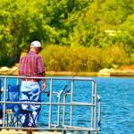
Welcome to the heart of summer on Douglas Lake. If you are planning a midday trip, you might want to rethink your strategy. Right now, the seasonal conditions dictate a "Caution" rating for daytime anglers, primarily due to extreme heat, heavy recreational boat traffic, and severe thermal stratification. The Tennessee Valley Authority (TVA) reservoir is currently sitting at summer pool, but the water temperatures are peaking, driving the dissolved oxygen levels down in the deepest basins.
Safety-wise, the lake is wide open and highly navigable, but the sheer volume of jet skis and wake boats by 10:00 AM makes main-lake fishing hazardous and frustrating. Weather impacts are typical for an East Tennessee summer: sweltering midday heat with the ever-present threat of pop-up afternoon thunderstorms. If you hear thunder echoing off the Smoky Mountain foothills, get off the water immediately. To find success and stay safe, you must become a creature of the night or an early bird. Dawn, dusk, and after-dark missions get a resounding "GO."
From the editor
Tired of fishing with strangers you can’t trust?
Nautrek is the first social network for serious anglers — verified partners, real trips, cost splitting and intel sharing without burning your spots. Private beta now open.
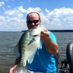
Douglas Lake is widely regarded as one of the premier bass and crappie fisheries in the nation, and even in the heat of summer, these two species remain the main event. The largemouth bass are currently locked into their offshore summer patterns, schooling up on deep ledges and channel swings to ambush bait. Crappie (both white and black) have abandoned the shallow spawning coves and are heavily concentrated around deep brush piles and vertical structures.
Sleeper Pick: Nighttime Flathead and Channel Catfish
While the bass boats are racing around scanning ledges, the savvy local anglers are quietly hauling in massive flathead and channel catfish after the sun goes down. Douglas Lake has a phenomenal, underutilized catfish population. As the water cools slightly at night, these whiskered predators move up from the deep river channels onto adjacent flats and rocky bluffs to hunt for decaying matter and live forage.
Baitfish Report
The primary forage base driving the ecosystem right now is gizzard shad, supplemented by threadfin shad and juvenile bluegill. The shad are currently schooling tightly and seeking thermal refuge near the main river current or hovering just above the thermocline (typically around the 15 to 20-foot mark). Matching the hatch means utilizing silver, white, and chartreuse profiles that mimic a distressed shad.
TACTICAL STRATEGY
Largemouth Bass: The Offshore Ledge Game
Forget beating the shallow banks right now; the summer doldrums require you to be best friends with your electronics. You need to target the main river channel transition banks, offshore ledges, and deep brush.
Where: Focus your efforts on the main channel swings near the Muddy Creek and McGuire Creek embayments. Look for rocky points that drop sharply into 15 to 25 feet of water. The grass flats mixed with submerged wood near the channel edges are also holding quality fish.
Lure: Start your morning with a topwater walking bait (like a Zara Spook in bone or clear) over the grass lines for the first hour of daylight. Once the sun breaches the trees, switch to a 3/4oz football jig (green pumpkin/orange) or a deep-diving crankbait (Strike King 6XD in Sexy Shad). For finesse situations, a 3/16oz shaky head with a 6-inch straight-tail worm (plum or Junebug) is deadly on the shade lines of bluff walls.
Timing: 4:30 AM to 8:30 AM, or night fishing under a full moon.
Pro Tip: When fishing deep-diving crankbaits on the ledges, make sure your bait is occasionally deflecting off the rocky bottom or submerged timber. That erratic deflection is exactly what triggers a reaction strike from a lethargic summer largemouth.
Crappie: Deep Brush and Bridge Pilings
The crappie bite requires precision. They are suspended in the water column, trying to find the perfect balance between comfortable water temperatures and adequate oxygen.
Where: Bridge pilings (especially the Highway 92 bridge area) and deep, man-made brush piles in 15 to 25 feet of water. You will often find them suspended around the 12 to 15-foot mark over deeper bottoms.
Bait & Lure: Tightlining live medium shiner minnows on a slip bobber rig is the most consistent producer. If you prefer artificials, utilize a 1/16oz or 1/32oz tungsten jig head paired with a small tube jig. Chartreuse, white, and electric blue are the top color choices for Douglas Lake's slightly stained summer water.
Timing: Night fishing under floating dock lights or submersible green LED lights is incredibly effective right now. The lights draw the plankton, which draw the shad, which bring in the slab crappie.
Pro Tip: Crappie feed upwards. Always position your bait or jig 1 to 2 feet above the school you mark on your sonar. If you drop it below them, they will not chase it.
Catfish: The Night Shift
Where: Steep rocky bluffs and the outside bends of the old French Broad River channel.
Bait: Fresh cut gizzard shad or chicken livers fished on a Carolina rig with a 2oz egg sinker and a 5/0 circle hook.
REGULATIONS SNAPSHOT
Before launching, ensure you are compliant with the Tennessee Wildlife Resources Agency (TWRA) regulations specific to Douglas Lake. Note: Regulations are subject to change; always verify with current TWRA guidelines.
Species
Daily Creel Limit
Size Restrictions
Largemouth / Smallmouth Bass
5 per day (combined)
June 1 - Sept 30: Only one bass may be 16 inches or longer.
Crappie (Black and White)
15 per day
10-inch minimum length limit.
Catfish (Channel, Blue, Flathead)
No limit under 34 inches
Only one catfish 34 inches or longer may be harvested per day.
Walleye / Sauger
5 per day (combined)
15-inch minimum for Walleye. Only one Sauger may be 16+ inches.
REGIONAL ALTERNATIVE
If Douglas Lake is too crowded with wakeboarders, or if the main lake is blown out by a severe summer thunderstorm, pack up and head approximately 45 minutes northeast to Cherokee Lake.
Cherokee Lake is another massive TVA reservoir on the Holston River system, but it generally fishes a bit cooler and deeper than Douglas. It is an exceptional alternative for targeting smallmouth bass and striped bass. Access the lake via the Panther Creek State Park ramp, which offers excellent facilities and immediate access to deep, clear water.
At Cherokee, the summer tactic shifts to targeting deep points and submerged islands. Drop-shotting small, natural-colored plastics (like a 4-inch goby or shad imitation) in 20 to 30 feet of water is highly effective for smallmouth. If you want to chase the stripers, look for surface boils early in the morning and throw heavy spoons or large topwater plugs into the feeding frenzy.
Tight lines!
Editor's Choice: Must-Have Gear
FISHINGSIR Next-Gen Waterproof Chest Waders
★★★★★4.4 (7,370+ reviews)
2-Ply Tech: Upgraded nylon with 2.5x higher density than standard fabrics.
100% Waterproof: Lab-approved intrusion resistance with taped visible seams.
Ultra-Lightweight: Designed for all-day comfort while hunting or fishing.
As an Amazon Associate I earn from qualifying purchases. #ad
Loading forecast...
Live Fishing Conditions: Tides, Weather & Waves
Get real‑time tides, marine weather, swell and solunar activity for each spot so you know exactly when conditions line up for your best chance at a bite.
🎣
Douglas Lake (Douglas Reservoir), Tennessee
Loading coordinates...
🌤️
WEATHER CONDITIONS
--°F
--°C
Loading...
🌡️
Feels Like--°F--°C
💧
Humidity--%
💨
Wind-- mph-- km/h
🧭
Direction--
📊
Pressure-- inHg-- hPa
☀️
UV Index--
🌊
MARINE CONDITIONS
🌊Wave Height
-- ft
-- m
Loading...
🧭Wave Direction
--°
Loading...
⏱️Wave Period
-- s
Loading...
📈Tide Status
-- ft
-- m
Loading...
🌙
LUNAR & SOLUNAR
🌕
Loading...
Illumination: --%
Major Period--:-- - --:----:-- - --:--
Minor Period--:-- - --:----:-- - --:--
🌅Sunrise--:--
🌇Sunset--:--
📅
24-HOUR FORECAST
Loading fishing conditions...
Fishing Spots Map
🎣
Book a Fishing Charter near Douglas Lake (Douglas Reservoir), Tennessee Fishing Report Today 🎣
Local guides & charters. Verified captains, instant booking, best price guaranteed.
There was an error loading the map. Please try refreshing the page.
Info
Local Access & Facilities
Situated strategically along the I-40 corridor midway between Nashville and Memphis, the fishery identified as Douglas Lake (Douglas Reservoir) in the Parkers Crossroads area offers a unique logistical profile for traveling anglers. Unlike the sprawling reservoirs of East Tennessee, the water accessible in this specific coordinate range presents a more intimate, tactical experience often overlooked by the masses speeding along the interstate. The atmosphere here is defined by the intersection of historical significance—anchored by the nearby Parker's Crossroads Battlefield—and the quiet, rural waters typical of West Tennessee's undulating landscape.
For the serious angler, this location serves as an excellent technical stopover or a dedicated quiet-water destination. The surrounding terrain is characterized by the rolling topography of the Tennessee River divide, offering waters that generally remain calmer than the massive mainstream impoundments. The vibe is decidedly low-pressure; you are less likely to fight for a spot here than at major tournament lakes, but the infrastructure requires a seasoned captain's eye to navigate effectively. Success here depends on understanding the localized access points and leveraging the unique amenities scattered around the Lexington and Parkers Crossroads hub.
While the name suggests a massive reservoir, the specific access coordinates place you in a network of waters closely tied to the Natchez Trace region. This area is prime for anglers targeting freshwater staples in a setting that demands self-reliance. The proximity to the interstate allows for rapid deployment, but once you exit the highway, the pace slows considerably. This guide breaks down the essential logistics, from navigating the 24-hour bait shops to securing trailer-safe parking in an area where history and angling intersect.
Access & Getting There
Reaching the primary access zones for this fishery is straightforward, largely due to the proximity of Interstate 40 and Tennessee Highway 22. The central logistical hub is Exit 108, which deposits you directly into the Parkers Crossroads area. For anglers towing heavy glass or aluminum rigs, this is a significant advantage; there are no winding mountain switchbacks to navigate, just wide, well-maintained arterial roads. However, traffic on I-40 can be heavy with freight transport, so seasoned haulers often plan their arrival for early morning or late evening to avoid the commercial congestion between Memphis and Nashville.
The data indicates multiple boat ramp candidates in the immediate vicinity, though they are primarily functional utility ramps rather than resort-style launches. The launch points identified near coordinates 35.66 and 35.71 suggest scattered access suitable for trailered vessels. Anglers should anticipate standard concrete ramps with varying degrees of steepness. Given the rural nature of these launch sites, it is critical to inspect the ramp for slick algae or mud accumulation before backing down, especially after heavy rains which are common in this region.
💡 Captain's Tip: Trailer Security
When launching at unnamed or rural ramps off Highway 22, always secure your vehicle and trailer thoroughly. While the area is generally quiet, remote ramps lack the surveillance of major marinas. Use a coupler lock and keep the cab clear of valuables.
For those fishing from the bank or launching kayaks, the Guy B. Amis Playground area provides a confirmed shore access point. This location is particularly suitable for quick scouting missions or light-tackle shoreline work. Additionally, the Parker's Crossroads Battlefield Visitor Center, located just 3 miles from the center of the fishing zone, serves as an excellent staging ground to gather bearings. While not a launch itself, the ample parking and staff knowledge regarding local road conditions make it a smart first stop for anyone unfamiliar with the backroads.
Parking for rigs requires strategic planning. While the ramps themselves have trailer parking, overflow can be an issue during peak weekends. The data highlights Pine Lake Boat Parking approximately 14.6 miles away, which is a dedicated facility rated highly by users. For those needing a secure place to drop a truck or trailer for an extended period, the Truck Parking Club on Highway 70 E offers 24-hour access and is designed to accommodate heavy equipment, ensuring you won't get boxed in by compact cars.
Douglas Lake (Douglas Reservoir), Tennessee Pre-Trip Checklist
Facilities & Amenities
The infrastructure surrounding this fishery is surprisingly robust for the traveling angler, specifically regarding bait and tackle availability. The standout facility is Casselberry Live Bait and Tackle, located roughly 7.9 miles from the primary coordinates. Crucially, this shop operates 24 hours a day, seven days a week. For the serious captain planning a "dawn patrol" launch or a late-night catfish grind, having round-the-clock access to live bait is a logistical game-changer that few fisheries can boast.
💡 Captain's Tip: The Midnight Resupply
Since Casselberry Live Bait and Tackle is open 24 hours, use this to your advantage to beat the morning rush. Pick up your minnows or nightcrawlers at 4:00 AM while other anglers are still waiting for shops to open at sunrise.
For specialized gear, specifically artificials, The Original Billy Phillips' Lures is located about 23 miles away in Jackson. While further out, this shop is a destination for regionally specific lures that big-box stores won't carry. If you are targeting specific predator fish that require precise color matching to the local forage, a detour here is worth the fuel. The table below details the key support facilities available to keep you on the water.
Facility Name
Type
Distance
Notes
Casselberry Live Bait and Tackle
Bait & Tackle
7.9 miles
Open 24 Hours. Critical resource for early starts.
The Original Billy Phillips' Lures
Tackle Specialist
23.1 miles
Specialized regional lures. Open 9am-6pm.
Truck Parking Club
Parking
18.1 miles
Open 24 Hours. Suitable for large trailers/rigs.
Pine Lake Boat Parking
Parking
14.6 miles
Dedicated boat parking area.
Accommodation options in the area cater well to the outdoor demographic. Camping At The Farm is located a mere 3.1 miles from the spot, offering a highly-rated, proximate base camp for multi-day trips. For those preferring a more standard RV hookup, Green Acres RV Park is even closer at 1.9 miles. This proximity allows anglers to maximize sleep and minimize transit time to the ramp. For a more immersive nature experience, the Natchez Trace Pin Oak Campground (Site 6) is about 10 miles out, placing you deeper into the state park environment.
It is important to note a key gap in the local amenities: there are no large-scale commercial marinas with fuel docks directly on the water listed in the immediate vicinity. Anglers must ensure their vessels are fueled up at gas stations along Highway 22 or near Exit 108 before launching. Do not expect to find pump-out stations or marine mechanics waiting at the ramp; self-reliance regarding engine maintenance and fuel capacity is mandatory here.
Permits, Regulations & Fees
Fishing activities in this region are under the jurisdiction of the State Fishing Agency. Anglers must possess a valid Tennessee state fishing license. Because this location sits near the intersection of various management zones, including state park waters and potential watershed authority lands, it is vital to carry your permit at all times. Wildlife officers in Tennessee are active, particularly around easily accessible ramps and state park boundaries.
A unique regulatory consideration for this specific area is its overlap with historical grounds. The Parker's Crossroads Battlefield is a site of significant cultural heritage. While fishing is the primary goal, anglers accessing water near park boundaries must respect "Kapu" (restricted) zones or areas designated for historical preservation. Metal detecting or disturbing the soil near the shoreline in designated battlefield areas is strictly prohibited and heavily fined. Treat the land with the same respect you treat the fishery.
💡 Captain's Tip: Boundary Awareness
This area contains a mix of private land, state park land, and historical preservation sites. Pay close attention to purple paint markings on trees, which legally signify "No Trespassing" in Tennessee, to avoid conflicts with local landowners.
Currently, the data indicates no specific environmental alerts, but standard conservation practices apply. There are no explicit permit fees listed for the boat ramps provided in the dataset, which suggests many may be public access points managed by the state or local municipality. However, always carry small bills in the event of a self-pay honor box at smaller, community-maintained ramps.
Events & Seasonal Information
The rhythm of this fishery is dictated by the distinct four-season climate of West Tennessee. Spring brings higher water levels and aggressive feeding in the shallows, while summer pushes fish into deeper structure, requiring good electronics to locate thermoclines. The area's connection to the Parker's Crossroads Battlefield means that historical anniversaries and reenactment events can swell the local population. During these events, usually held on specific weekends, traffic on Highway 22 and local dining establishments can become congested.
Weather patterns here can shift rapidly. The open nature of the terrain means wind can pick up quickly, turning a calm morning into a choppy afternoon. The most stable fishing windows are typically found in the early morning before the heat of the day generates thermal winds. Anglers should also be aware of the "Living History" events at the nearby visitor center, which are excellent side trips if the weather forces you off the water.
Contact Information & Resources
For the most current information regarding water access and local conditions, the Parker's Crossroads Battlefield Visitor Center is the most reliable "boots on the ground" contact. While their primary focus is history, their staff is knowledgeable about the immediate geography and road conditions leading to the water.
Emergency: 911 (Coordinate location with nearest mile marker on I-40 or Hwy 22)
Safety in this area is about preparation. Cell signal can be spotty in the low-lying areas near the water, so inform a contact of your float plan. For precise launch locations, real-time weather data, and detailed topographic maps of the water, consult the live dashboard and interactive widgets below.
Our spot reports combine data-driven forecasts with curated local information. The forecast is generated by our proprietary Fishing Score algorithm (0–100%), which analyzes real-time data from Open-Meteo API, validated against NOAA CO-OPS tide gauges and USGS water-monitoring stations. The model weights tide dynamics (35%), wave energy (25%), wind patterns (20%) and time of day (20%)—factors shown to influence fish feeding behavior through marine-biology research and decades of charter log data.
Access, facilities and services information for each fishing spot is sourced from official datasets such as Recreation.gov (RIDB), state park & wildlife agencies, and geospatial providers like Google Maps. These sections undergo scheduled re-validation every 3–6 months to ensure that boat ramps, park access, contact details and local services remain accurate.
Narrative sections (catches, seasonal behavior, local tips) are synthesized from these data sources and refined following the Fishing Reports Today editorial guidelines, combining bibliographic research from ichthyology and oceanography with expert angler experience. Our team reviews reports on a regular basis, while the forecast model itself updates every 6 hours for real-time accuracy.
⚠️ Important: Always verify current local regulations, access restrictions and weather conditions before fishing. These reports are intended as a planning aid, not a guarantee of catches or safety. When in doubt, contact local authorities or park managers listed on the page.
To provide the best experiences, we use technologies like cookies to store and/or access device information. Consenting to these technologies will allow us to process data such as browsing behavior or unique IDs on this site. Not consenting or withdrawing consent, may adversely affect certain features and functions.
Functional Always active
The technical storage or access is strictly necessary for the legitimate purpose of enabling the use of a specific service explicitly requested by the subscriber or user, or for the sole purpose of carrying out the transmission of a communication over an electronic communications network.
Preferences
The technical storage or access is necessary for the legitimate purpose of storing preferences that are not requested by the subscriber or user.
Statistics
The technical storage or access that is used exclusively for statistical purposes.The technical storage or access that is used exclusively for anonymous statistical purposes. Without a subpoena, voluntary compliance on the part of your Internet Service Provider, or additional records from a third party, information stored or retrieved for this purpose alone cannot usually be used to identify you.
Marketing & Affiliates
The technical storage or access is required to create user profiles to send advertising, or to track the user on a website or across several websites for similar marketing purposes, including affiliate tracking for products recommended in our reports.


Leave a Reply