
Situated in the rolling farmlands of central Indiana, Heritage Lake offers a distinct freshwater experience that contrasts sharply with the wilder, river-fed reservoirs nearby. This fishery is characterized by its residential shoreline and manicured coves, providing a calmer, more controlled environment compared to the rugged, timber-filled banks of the surrounding state recreation areas. For the seasoned angler, this location serves as a strategic base of operations, sitting centrally between the private waters of the lake itself and the public, expansive waters of Cecil M. Harden Lake and Cagles Mill Lake.
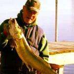
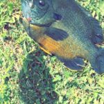
The atmosphere here shifts with the seasons, transitioning from a bustling summer boating community to a quiet, mist-covered retreat in the autumn. While the immediate vicinity of Coatesville maintains a quiet, rural pacing, the proximity to Indianapolis means access is straightforward, though services can be surprisingly sparse immediately at the water's edge. Anglers targeting this region are often chasing a mix of largemouth bass and panfish, navigating a landscape that requires a mobile strategy to hit the best bites across the tri-lake area.
Understanding the logistical layout is critical here. Unlike the massive public reservoirs with marinas on every corner, Heritage Lake and its neighbors require deliberate planning regarding fuel, bait, and launch timing. The following guide breaks down the essential access points, facility realities, and seasonal rhythms necessary for a successful campaign in this part of Indiana.
Access & Getting There
Reaching Heritage Lake and the surrounding fisheries involves navigating the rural grid of Putnam and Hendricks counties. The primary approach is typically via US 40, turning onto the local arteries that feed into Coatesville. Traffic in this agricultural belt is generally light, though slow-moving farm equipment can add time to the commute during planting and harvest seasons. For those towing larger vessels, the roads are paved and generally wide enough, but the final approaches to specific ramps can be winding.
The primary launch point for the main waterbody is the Heritage Lake Marina Slipway. Located just under 3,000 feet from the central reference point, this ramp offers the most direct access to the water. However, access realities here can be tight. It is a functional slipway, but during peak summer weekends, the maneuvering space for trailers can become congested early in the morning. Anglers looking for public water access often pivot to Cecil M. Harden Lake (also known as Raccoon Lake), located approximately 19 miles away. The drive involves heading northeast via US 40 to northbound IN 49, a route that is trailer-friendly and well-marked.
💡 Captain's Tip: Launch Logistics
The Heritage Lake Marina Slipway is convenient, but parking is finite. For a more rugged, public experience with ample room for 20+ foot center consoles, trailer your boat 19 miles west to the Raccoon State Recreation Area ramps at Cecil M. Harden Lake.
Parking infrastructure varies significantly depending on your specific target. In Coatesville, the Vandalia Trail parking lots (both the main lot and the horse trailer lot) are located about 3.7 miles from the water. These are excellent staging areas for kayakers or those meeting up with guides, rated highly for safety and accessibility. However, they are not boat launches. If you are headed to Cagles Mill Lake to the south, access is via I-70 to IN 243. This route is built for heavy traffic, and the facilities at the Corps of Engineers sites are designed to handle heavy recreational flow.
Weather plays a significant role in access availability, particularly regarding wind direction. The open waters of Cecil M. Harden Lake can chop up quickly when winds exceed 15 mph. In contrast, the coves of Heritage Lake often provide better lee. When heavy rains hit the region, the tailwater areas below the dams at both Cagles Mill and Cecil M. Harden can experience rapid rises in water levels, making shore access treacherous. Always verify the current discharge rates if you plan to fish the spillways.
Heritage Lake Indiana Pre-Trip Checklist
Facilities & Amenities
The local infrastructure around Heritage Lake is somewhat decentralized. Anglers must be prepared to travel for specific supplies, as the immediate shoreline does not support a high density of marine retail. There is a distinct lack of immediate "mom and pop" bait shops right at the ramp in Coatesville. This is a critical piece of negative knowledge: do not arrive at the Heritage Lake Marina Slipway expecting to buy live minnows or specialized crankbaits on site.
For serious tackle and live bait, the nearest reliable outlier is Thunderhawk Outdoors LLC in Brownsburg, roughly 19 miles to the east. This shop carries a reputation for solid inventory, but its distance means you must stock up before you leave the suburban edge of Indianapolis. Further out, Indy Bait & Tackle (24 miles away) serves as a secondary option. The gap in services necessitates a "bring it with you" mentality for terminal tackle and fresh bait.
💡 Captain's Tip: Fuel Strategy
There are no commercial fuel docks listed directly for the public access points at the smaller nearby recreational areas. Top off your tank in Plainfield or Brownsburg before hitting the rural roads to avoid burning fishing time searching for a gas station.
Lodging options in the immediate vicinity favor the camper and the RVer. Blackhawk 2 Campground in Cloverdale (17.8 miles away) and Running T Campground in Rockville (17.2 miles away) are the primary accommodations for anglers who want to stay close to the bite. These sites are well-regarded, with Blackhawk 2 holding a near-perfect rating. For those requiring hotel amenities, the Village of Deerfield in Plainfield offers a more conventional stay but requires a 30-minute commute to the boat ramps. BoeBerly RV Rentals in Crawfordsville is another resource for mobile anglers looking to set up a base camp at one of the State Recreation Areas.
Charter availability is specialized in this region. Sweet Creek Fly Guides, based out of Crawfordsville, services the area. This operation is notable for anglers looking to pursue species on the fly, a tactic that can be highly effective in the tailwaters and creeks feeding the larger reservoirs. The presence of a dedicated fly guide service suggests a fishery that rewards technical precision, particularly in the flowing waters connecting these lakes.
| Facility Name | Type | Distance | Notes |
|---|---|---|---|
| Heritage Lake Marina Slipway | Boat Launch | 0.5 miles | Primary access; check for private/public restrictions. |
| Vandalia Trail Parking | Parking | 3.7 miles | Horse trailer capable; good for kayak staging. |
| Thunderhawk Outdoors LLC | Bait & Tackle | 19.2 miles | Nearest full-service shop; located in Brownsburg. |
| Sweet Creek Fly Guides | Charter | 23.8 miles | Specialized fly fishing instruction and guiding. |
| Cecil M. Harden Lake | Rec Area | 18.9 miles | US Army Corps site; camping and heavy boat access. |
| Cagles Mill Lake | Rec Area | 19.8 miles | Access to Cataract Falls; deep water ramps. |
Permits, Regulations & Fees
Fishing in this region falls under the jurisdiction of the State Fishing Agency (Indiana Department of Natural Resources). Compliance is strictly enforced, particularly regarding boat registration and safety equipment. Because Cecil M. Harden Lake and Cagles Mill Lake are U.S. Army Corps of Engineers properties, federal regulations regarding alcohol and designated swimming areas also apply. Anglers should be particularly aware of the "State of Indiana Natural Area" designation around the dam and tailwaters of Cagles Mill Lake, where specific conservation rules may limit access or anchoring.
While Heritage Lake itself may have specific homeowners association rules regarding speed limits and wake zones, the public waters nearby are open to general state fishing licenses. There are no specific permit entrances listed for the boat ramps, but state park entrance fees often apply at Raccoon State Recreation Area and Cagles Mill during the peak season. These fees usually cover the vehicle and the boat trailer. It is advisable to carry cash for gate fees, as remote automated kiosks can be unreliable.
Cultural respect and conservation are paramount. The areas around Cataract Falls (accessible by boat from Cagles Mill Lake) are geologically significant. The control tower at Cagles Mill is a unique structure where the conduit was mined through solid rock; respecting the exclusion zones around these engineering marvels is not just a legal requirement but a safety necessity. Additionally, the shorelines are often shared with hikers and families, particularly near the Big Walnut Sports Park Playground and the local trailheads.
Events & Seasonal Information
The rhythm of fishing in Coatesville is heavily influenced by the seasons. The most significant regional event is the Parke County Covered Bridge Festival in October. While this is primarily a cultural festival, it draws massive crowds to the area, particularly around Rockville and Cecil M. Harden Lake. During this nine-day window, traffic on the rural roads can be gridlocked. However, for the angler, this coincides with vivid fall forest colors and often aggressive feeding patterns from bass fattening up for winter.
💡 Captain's Tip: The October Lull
During the Covered Bridge Festival in October, boat traffic on the water actually decreases as tourists flock to the bridges. If you can navigate the road traffic to the ramp, you will often find the lakes surprisingly quiet and the scenery spectacular.
Summer brings the recreational boating crowd, particularly on Heritage Lake and the main basins of the reservoirs. The "dawn patrol" strategy is essential from June through August; getting off the water by 11:00 AM allows you to avoid the wake boats and jet skis. Conversely, the tailwaters below the dams at Cagles Mill and Cecil M. Harden remain productive throughout the heat of the day due to the cooler water discharge.
Cataract Falls, the largest waterfall by volume in Indiana, is a dynamic feature that changes the fishing conditions at the headwaters of Cagles Mill Lake. After heavy spring rains, the flow can be intense, creating turbidity lines that predators use to ambush prey. In drier summer months, the flow recedes, and the pools below the falls become technical fisheries requiring lighter line and finesse presentations.
Contact Information & Resources
For the most current information on water levels and ramp status, direct contact with the managing agencies is recommended. The Cecil M. Harden Lake project office can be reached at (765) 344-1570. For conditions at Cagles Mill Lake and the falls, call (765) 795-4439. These lines are typically staffed during business hours and can provide vital updates on discharge rates and gate closures.
In case of emergency, cell reception can be spotty in the deep ravines near the dams. It is prudent to have a float plan filed with someone on shore. Local law enforcement and conservation officers patrol these waters regularly, but self-reliance regarding engine maintenance and safety gear is expected of all captains operating in these waters.
For precise locations, real-time weather conditions, and detailed interactive maps of the boat ramps and bait shops mentioned, consult the live dashboard and widgets below.


Leave a Reply