


Ashtabula River and Lake Erie Gateway
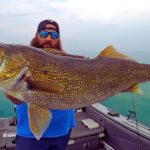
Ashtabula, Ohio, stands as a formidable gateway to the legendary central basin of Lake Erie, a fishery often cited in the conversation for the "Walleye Capital of the World." Unlike the shallower western basin, the waters off Ashtabula drop quickly into deeper structural zones, making this a favored launch point for serious anglers targeting trophy-class Walleye, Steelhead, and Yellow Perch. The atmosphere here is a blend of industrial history and dedicated sportfishing, where the Ashtabula River cuts a protected path through the city before emptying into the expansive, sometimes volatile, waters of the Great Lake. The harbor mouth is defined by its breakwalls, which not only offer shelter from the lake's notorious chop but also serve as prime structure for shore-bound anglers and small boaters during the shoulder seasons.
The strategic value of this location lies in its proximity to deep water. While western ports require long runs to find the thermocline in summer, skippers launching from Ashtabula often find themselves setting lines in productive water within minutes of clearing the harbor light. This efficiency makes it a magnet for charter captains and tournament pros who understand that time with lines in the water equates to cooler capacity. However, the logistical reality of fishing here requires preparation; the transition from the protected river to the open lake can be jarring when the wind shifts North or Northeast, turning the mouth into a washing machine of confused seas.
For the traveling angler, Ashtabula offers a distinct advantage in its river infrastructure. The lower river is navigable and lined with marinas, providing a safe haven when Lake Erie decides to show her teeth. This is not a manicured resort town but a working harbor where the focus is squarely on the catch. Whether you are trolling spoons for Walleye in July or casting spinners for Steelhead that run up the river in late autumn, the logistical footprint of this fishery demands respect and careful planning regarding fuel, bait, and launch timing.
💡 Captain's Tip: Border Patrol
You are fishing in a border zone. Several key amenities listed in this region, such as Gillette's Bait & Tackle, are located across the state line in Pennsylvania. If your trolling run takes you east of Conneaut, ensure you possess a valid Pennsylvania fishing license to avoid hefty fines from wildlife officers patrolling the state line.
Access & Getting There
Reaching the Ashtabula waterfront is generally a straightforward affair via Interstate 90 and Route 11, which feeds traffic directly toward the lake. The primary artery for anglers towing vessels is Lake Road (Route 531), which parallels the shoreline. While traffic is rarely gridlocked in the urban sense, summer weekends can see congestion around the lift bridge and harbor entrance as pleasure boaters and fishermen converge. Heavy haulers and seasoned captains know to time their arrival well before dawn to avoid the morning rush at the launch ramps, particularly during the peak of the Walleye run in June and July.
The primary public interface for launching trailer boats is Lakeshore Park, located approximately 1.8 miles from the central harbor area. This facility is the heartbeat of the local recreational fleet. The ramps here are generally well-maintained, but local knowledge suggests keeping a close eye on the wind forecast. Because the ramps face the lake, loading and unloading can become treacherous during strong northerly blows. In such conditions, the surge can wash over the concrete, making traction difficult for two-wheel-drive vehicles. Experienced locals will often opt for river-based marinas if the lake is kicking up, utilizing private lifts or ramps that offer protection behind the breakwall.
Parking strategies in Ashtabula require foresight. While Lakeshore Park offers dedicated trailer parking, it fills rapidly on tournament weekends and "chamber of commerce" weather days. For those utilizing the river access points near the historic lift bridge, parking can be tighter. There are several parking facilities identified in the surrounding region, such as the Neighbor Monthly Parking in Jefferson or the Western Reserve Greenway trailhead lots, but these are 8 to 15 miles inland and suitable only for staging or overflow, not for day-of launch parking. Security at the main harbor is generally good, with high foot traffic from the nearby entertainment district keeping eyes on the lot, but standard precautions of locking gear and removing electronics are mandatory.
💡 Captain's Tip: The North Wind Rule
Lake Erie is shallow and steep. If the forecast calls for winds from the North or Northeast exceeding 15 knots, the mouth of the Ashtabula River can become impassable for small craft due to stacking waves. Always check the marine forecast specifically for "Nearshore Waters Ashtabula to Conneaut" before hitching the trailer.
Ashtabula, Ohio Pre-Trip Checklist
Facilities & Amenities
The infrastructure in Ashtabula is robust for vessels but surprisingly spread out regarding consumables. The anchor for immediate vessel support is North Coast Marina & Campgrounds, located directly on the river (listed as just 79 feet from the central spot datum). This facility is a critical hub, offering transient docking and campground facilities that allow anglers to stay right next to their boats—a massive advantage for the "dawn patrol" crowd looking to beat the sunrise. Having lodging and launch facilities in one footprint eliminates the morning commute and trailer stress.
However, a critical piece of "negative knowledge" for visiting anglers is the scarcity of immediate, walk-in bait and tackle shops right at the water's edge in Ashtabula proper. The data indicates that the most highly-rated bait shops are located in neighboring towns. Conneaut Fuel Dock is roughly 13.6 miles to the east, and DB Marine & Outdoor Sports is over 16 miles to the west in Madison. Gillette's Bait & Tackle, a legendary 24-hour shop, is over 22 miles away in Linesville, PA. This means you cannot rely on buying nightcrawlers or minnows at the ramp five minutes before launch. You must procure your live bait and ice the night before or plan a detour to one of these regional outfitters on your drive in.
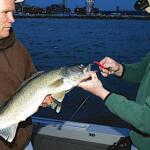
The charter fleet here is world-class, reflecting the quality of the fishery. Lost Tackle Charters LLC is the most centrally located operator, situated just 1.1 miles from the harbor core, making them the convenient choice for visitors staying downtown. For those willing to drive a few miles for specific captains, the fleet expands significantly toward Geneva (9+ miles west), home to Sweet Dreams Fishing Charters, DB Sport Fishing, and Hookin Hogs. These operations are accustomed to handling heavy coolers of Walleye and are equipped with the heavy-duty trolling gear required for Lake Erie's deep-water tactics.
Lodging and Support Facilities
| Facility Name | Type | Distance | Angler Notes |
|---|---|---|---|
| North Coast Marina | Camping/Marina | 0.0 mi | Prime location. Stay right on the river. Best for boat owners. |
| Little Lodges of Saybrook | Cabins | 4.2 mi | Good proximity for multi-day trips. quiet atmosphere. |
| HopeWood Shores | Lodging/Camp | 8.5 mi | Located in Conneaut, good backup if Ashtabula is full. |
| Polly Harper Inn | Inn | 13.7 mi | Located in Geneva. Better for those fishing the western sector. |
Permits, Regulations & Fees
Fishing the waters of Ashtabula falls under the jurisdiction of the Ohio Department of Natural Resources (ODNR). Compliance here is strictly enforced due to the high volume of out-of-state anglers and the commercial value of the fishery. A valid Ohio fishing license is mandatory for anyone 16 years of age or older. These can be purchased online or at regional vendors, though as noted in the facilities section, immediate waterside vendors may be scarce early in the morning, so digital purchase is recommended.
The most critical regulatory nuance for this specific location is the proximity to the Pennsylvania border. The aquatic state line is located just east of Conneaut. Anglers trolling specifically for Walleye often follow schools of fish that migrate east-west. It is remarkably easy to drift or troll across the state line without realizing it. Unless you possess a dual license, you must stop fishing immediately upon crossing into PA waters. GPS units with state line overlays are highly recommended for captains operating in this sector.
Special attention must be paid to bag limits, which can fluctuate annually based on Lake Erie hatch rates. Walleye limits are often generous, but size restrictions and daily possession limits are vigorously checked at the ramps. Additionally, aquatic invasive species (AIS) are a major concern. Boaters are legally required to drain all live wells and bilges before leaving the ramp area to prevent the spread of organisms to inland reservoirs. The "Clean, Drain, Dry" protocol is not just a suggestion; it is an expectation of the local maritime culture.
Events & Seasonal Information
The rhythm of the Ashtabula fishery is dictated by water temperature and migration patterns. The season kicks off in earnest in late spring as post-spawn Walleye begin to migrate from the western basin toward the deeper, cooler waters of the central basin off Ashtabula. This typically peaks from June through August, which is the busiest time for the local ramps and charters. During this window, the harbor is a hive of activity from 4:00 AM until sunset.
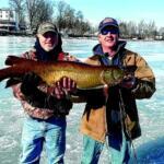
As summer fades into autumn, the focus shifts. The "Perch Jerk" begins as schools of Yellow Perch tighten up, offering high-volume fishing that is excellent for families and filling freezers. Simultaneously, the tributary anglers begin to watch the rain gauges. When the Ashtabula River rises and cools in late September and October, Steelhead Trout enter the system. This creates a secondary season where the focus moves from the open lake to the river mouth and upstream pools. This is a quieter time on the lake, but shore access points like G.O. Playground and the river banks become prime territory for waders.
Weather patterns heavily influence the daily bite. The prevailing winds are from the West/Southwest, which generally allows for fishable water near shore. However, the dreaded "Northeaster" is a season-killer, often shutting down the bite and muddying the water for days. Successful local captains know that after a big blow, it may take 48 hours for the water clarity to return to the "Walleye chop" green that produces the best catches.
💡 Captain's Tip: The 24-Hour Bait Solution
If you are arriving late at night for a dawn launch and forgot bait, drive the extra distance to Gillette's Bait & Tackle in Linesville, PA (approx. 22 miles). They are one of the few shops in the wider region listed with 24-hour operations, ensuring you don't hit the water empty-handed.
Contact Information & Resources
For emergency assistance on the water, the U.S. Coast Guard maintains a presence in the region, and they monitor VHF Channel 16. In non-emergency situations regarding marina services or camping availability, North Coast Marina can be reached at (440) 998-6272. For those needing last-minute gear or local intelligence on the bite, Lost Tackle Charters (330-383-2099) is a nearby resource that may offer guidance.
Anglers should always have a backup plan. If mechanical issues arise, DB Marine & Outdoor Sports (440-428-6591) in Madison is a rated service provider in the area. Self-reliance is key; ensure your radio is functioning and your safety flares are within date before clearing the breakwall.
For precise locations of the boat ramps, real-time wind conditions, and detailed directions to the amenities mentioned above, consult the interactive maps and live dashboards below.


Leave a Reply