Torch Lake Angling Outlook: Fall Transition Tactics
Go/No-Go Status
Verdict: GO
Current seasonal conditions make this a prime time to hit the water. As the blistering summer heat gives way to cooler autumn temperatures, the heavy recreational boat traffic that churns up this massive inland waterbody has largely dissipated. The infamous, razor-sharp thermoclines of this deep, ultra-clear glacial lake are beginning to shift, pushing baitfish into more predictable holding zones. Wind is your primary safety consideration right now; the sheer length and depth of this waterbody allow serious rollers to develop during strong north or south blows. Always check the marine forecast before launching. Water temperatures are dropping, meaning hypothermia is a growing risk if you take a spill. Ensure all safety gear and personal flotation devices are easily accessible. Ice is not a factor yet, making this an ideal open-water opportunity.
Species Intel
Primary Target: Yellow Perch
🎣Nautrek
Private Beta
J
M
R
100+ anglers on the waitlist
The fishing network where your reputation matters.
Find trusted captains, join real trips with cost splitting, and build your Angler Rank. Your spots stay private — you decide who sees your intel.
Autumn is undisputed jumbo perch season on this water. As the water cools, massive schools of yellow perch migrate from their deep summer haunts into more manageable depths to gorge before the winter freeze. The sheer numbers and size of the perch right now offer some of the most consistent, fast-paced action available.
Sleeper Pick: Atlantic Salmon
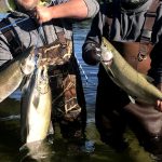
While many anglers focus strictly on lake trout or smallmouth bass, Atlantic salmon are the true wildcards this season. The Michigan Department of Natural Resources recently executed a massive stocking effort, planting 30,000 Atlantic salmon into the system. This emerging fishery is creating incredible opportunities for those willing to troll the open water basins. These acrobatic fish are highly aggressive and provide world-class fights on light tackle.
Baitfish Report
The primary forage base driving the bite right now consists of smelt, alewives, and emerald shiners. Because the water here is famously Caribbean-clear, predatory fish are highly visual feeders. Your presentations must perfectly mimic the slender, silvery profiles of these natural baitfish to trigger strikes.
Tactical Strategy
Where to Find Them
For yellow perch and walleye, focus your efforts heavily on the southern end of the lake, specifically near the mouth of the Torch River. This area features a diverse mix of bottom structure and bait-rich shallows that transition into deeper water. Target the primary drop-offs where the bottom falls from 12 to 20 feet. The perch will tightly school along these ledges. If you are chasing Atlantic salmon or lake trout, head to the deeper central basins. Look for thermal shears and bait balls on your sonar, typically suspended over 60 to 100 feet of water.
Lure and Bait Selection
When targeting perch, vertical jigging is highly effective. Utilize a 1/8oz tungsten tear drop jig or a Rapala Jigging Rap size #5. For the walleye holding in that same 12-20 foot zone, upsize your Jigging Rap to a #7. If you are trolling for Atlantic salmon, run silver streak spoons or slender crankbaits off downriggers and planer boards.
Color Patterns
Water clarity dictates everything on this fishery. Leave the bright chartreuse and hot pinks in the tackle box. You must rely on natural, muted colorways. Silver, blue, clear, and goby or smelt patterns are mandatory. Fluorocarbon leaders are not optional; they are an absolute necessity to prevent line-shy fish from turning away at the last second.
Bait and Rigging
For the live bait purists, a traditional slip sinker rig or a double-hook crappie rig tipped with lively emerald shiners is the ticket for jumbo perch. Keep your bait active and hovering just inches off the bottom. Do not let your bait drag in the mud. When targeting smallmouth bass in the southern shallows, a lively leech or a soft plastic goby imitation dragged slowly across the gravel will yield heavy strikes.
Timing the Bite
Because of the extreme water clarity, low-light periods are heavily favored. The first two hours of daylight and the last hour before sunset offer the most aggressive feeding windows. Midday bites require fishing deeper and sizing down your presentations.
Pro Tip:When targeting the 12-20 foot drop-offs at the south end, use your boat's spot-lock or anchor precisely on the edge of the break. Cast into the shallower water and slowly drag your jig or slip-sinker rig down the face of the drop-off. The fish are often facing shallow, waiting to ambush bait falling back into the depths.
Pro Tip:For Atlantic salmon, speed is your friend. Trolling speeds between 2.5 and 3.0 mph will trigger aggressive reaction strikes from these fast-swimming predators, whereas slower speeds give them too much time to inspect your lure in the crystal-clear water.
Regulations Snapshot
Recent updates to the Michigan DNR Fisheries Orders have clarified possession limits for this specific body of water. Under the newly enacted Fisheries Order 254, this waterbody is managed under Type E regulations.
Species
Key Regulations
Atlantic Salmon / Trout
Daily possession limit is combined 3 fish total (trout and salmon). Minimum size limits apply based on species.
Yellow Perch
Standard state daily possession limits apply. No minimum size, but ethical anglers release fish under 7 inches.
Walleye
15-inch minimum size limit. Daily possession limit of 5 fish.
Smallmouth Bass
14-inch minimum size limit. Daily possession limit of 5 fish (combined with largemouth).
Always consult the digital version of the DNR Hunt Fish app before launching, as regulations are subject to emergency changes.
Regional Alternative
If the wind is howling straight up the main lake and turning the deep basins into a washing machine, do not force a dangerous situation. Instead, trailer your rig and head to the connected waters of Lake Skegemog or Elk Lake.
Lake Skegemog offers far more vegetation, submerged timber, and shallower flats than its deeper, clearer neighbor. This makes it an absolute haven for northern pike, largemouth bass, and muskellunge. If you are forced off the main lake, launch at the Baggs Road access site on Skegemog. Tie on a large spinnerbait or a chatterbait in white or perch patterns, and aggressively work the deep weed edges and stump fields. The water here is slightly more stained, allowing you to use heavier tackle and more aggressive retrieval speeds. It is the perfect backup plan that often yields trophy-class fish when the primary water is unfishable.
Tight lines!
Editor's Choice: Must-Have Gear
FISHINGSIR Next-Gen Waterproof Chest Waders
★★★★★4.4 (7,370+ reviews)
2-Ply Tech: Upgraded nylon with 2.5x higher density than standard fabrics.
100% Waterproof: Lab-approved intrusion resistance with taped visible seams.
Ultra-Lightweight: Designed for all-day comfort while hunting or fishing.
As an Amazon Associate I earn from qualifying purchases. #ad
Loading forecast...
Live Fishing Conditions: Tides, Weather & Waves
Get real‑time tides, marine weather, swell and solunar activity for each spot so you know exactly when conditions line up for your best chance at a bite.
🎣
Torch Lake
Loading coordinates...
🌤️
WEATHER CONDITIONS
--°F
--°C
Loading...
🌡️
Feels Like--°F--°C
💧
Humidity--%
💨
Wind-- mph-- km/h
🧭
Direction--
📊
Pressure-- inHg-- hPa
☀️
UV Index--
🌊
MARINE CONDITIONS
🌊Wave Height
-- ft
-- m
Loading...
🧭Wave Direction
--°
Loading...
⏱️Wave Period
-- s
Loading...
📈Tide Status
-- ft
-- m
Loading...
🌙
LUNAR & SOLUNAR
🌕
Loading...
Illumination: --%
Major Period--:-- - --:----:-- - --:--
Minor Period--:-- - --:----:-- - --:--
🌅Sunrise--:--
🌇Sunset--:--
📅
24-HOUR FORECAST
Loading fishing conditions...
Fishing Spots Map
🎣
Book a Fishing Charter near Torch Lake Fishing Report Today 🎣
Local guides & charters. Verified captains, instant booking, best price guaranteed.
There was an error loading the map. Please try refreshing the page.
Info
Local Access & Facilities
Torch Lake represents a sophisticated freshwater fishery deep within the Clam River and Bellaire region of Michigan. While often celebrated for its recreational boating appeal, seasoned anglers know this water as a serious biological engine connected to the wider Jordan River watershed. The presence of the nearby Jordan River National Fish Hatchery underscores the ecological importance of this system, which serves as a rearing ground for massive populations of Lake Trout, Brook Trout, and Cisco.
The atmosphere here shifts from the bustle of summer recreational traffic to the quiet, rugged focus of the shoulder seasons. Unlike the manicured, concrete-heavy harbors found in larger metropolitan centers, the access points here feel closer to the wild, scenic nature of the Jordan River Valley. Anglers targeting this area are typically pursuing cold-water species that thrive in the deep, oxygenated structure provided by the lake's unique topography.
Success on Torch Lake requires preparation and an understanding of the local geography. The distance from major tackle hubs in Traverse City means self-reliance is key. This is not a "stop and grab bait at the dock" destination; it is a location that rewards the skipper who arrives with a well-planned loadout and a strategy for deep-water presentation.
Access & Getting There
Reaching the primary launch zones around Clam River and Bellaire generally involves navigating local arteries off US Hwy 131. Traffic is typically manageable, though summer weekends can see congestion from recreational haulers. The primary specific access point identified for boaters is the Dewitt Marina Boat Launch, located approximately 2.8 miles from the central coordinate. Data indicates that trailer parking is available here, a critical factor for captains hauling larger deep-V hulls.
In addition to the marina, there are unnamed public access points and shore entries scattered along the perimeter. While the sheer size of the water suggests a boat-dominant fishery, the "shore access" data points highlight opportunities for wading or casting, particularly suitable for family outings or quick evening sessions. When approaching via Vandermark Road, be aware that nearby parking lots, such as the Vandermark and Glacial Hills Trailhead lots, are geared toward hikers and may not accommodate boat trailers.
💡 Captain's Tip: Launch Logistics
The primary bait and tackle shops are over 20 miles away in Traverse City. Do not wait until you reach the ramp to check your live bait supply or terminal tackle; provisioning must happen before you leave the highway.
Weather patterns here are dictated by the large surface area of the lake and the surrounding valley. Winds can whip up significant chop quickly, making the leeward shore essential for comfortable fishing. In the winter months, the dynamic changes entirely; the area becomes a hub for snowmobiling and ice fishing, with the hatchery grounds themselves serving as a scenic winter destination.
Torch Lake Pre-Trip Checklist
Facilities & Amenities
The infrastructure directly surrounding the water is somewhat sparse regarding specialized fishing retail, requiring anglers to rely on the broader Traverse City hub for serious outfitting. There are no immediate "on-the-water" pro shops listed in the immediate vicinity of Clam River. For fly fishing enthusiasts, The Northern Angler Fly Shop and Outfitters is a top-tier resource, but it requires a drive of approximately 21 miles back toward the city.
Similarly, general provisioning for conventional gear is best handled at TC Bait & Tackle, located roughly 21 miles south. The charter fleet servicing this water often operates out of the Traverse City area as well, with reputable outfits like Showtime Xtreme Charters and Storm Hawk Sport Fishing Charters making the run or coordinating pickups. These operators are accustomed to the heavy gear required for Great Lakes style fishing.
💡 Captain's Tip: Fuel Management
With limited immediate marina services listed for fuel, ensure your tanks are topped off at highway stations before navigating the smaller access roads to the launch. Running dry here can mean a long wait for assistance.
For multi-day excursions, lodging options favor the outdoor enthusiast. The Rapid River Campground & Cabins and Pinney Bridge State Forest Campground offer proximity to the water for those towing campers. For a more developed stay, the Lake Leelanau RV Park provides high-rated amenities, though it sits further afield. The table below outlines the key logistics centers seasoned captains should program into their GPS.
Facility Name
Type
Distance
Notes
Dewitt Marina Boat Launch
Launch
2.8 miles
Primary water access; Trailer parking available.
Jordan River National Fish Hatchery
Facility
17 miles
Information site; Stocking source for Lake Trout.
The Northern Angler
Shop
21.7 miles
Fly shop; Opens 10:00 AM.
TC Bait & Tackle
Shop
21.1 miles
General tackle; Opens 8:00 AM.
Rapid River Campground
Lodging
13.7 miles
Open 24 hours; Cabins available.
Permits, Regulations & Fees
Fishing activities in this region are managed by the State Fishing Agency (Michigan DNR). Strict adherence to regulations is not just a legal requirement but a cultural necessity to protect the work being done at the Jordan River National Fish Hatchery. This facility has been stocking Lake Trout since 1965 and is integral to the rehabilitation of the Great Lakes fishery. Anglers should be hyper-aware of seasonal closures, particularly during spawning runs involving Brook Trout and Cisco.
While specific permit prices are not listed, a standard state fishing license is mandatory. The area does not currently show specific "permit required" flags for entry, but the hatchery grounds and certain state forest lands may have specific usage hours or vehicle restrictions. Always respect private property markers, as much of the shoreline is privately held.
The "Kapu" or sacredness of the land here translates to environmental stewardship. The Jordan River Valley is designated as wild and scenic; leaving trash or mishandling fish undermines the conservation efforts that keep this fishery productive. The hatchery offers interpretive programs and environmental education, providing a deep dive into why specific size limits and bag limits are enforced.
Events & Seasonal Information
The biological rhythm of Torch Lake is tied heavily to the stocking and spawning cycles managed by the nearby federal facilities. The hatchery grounds are a year-round attraction, offering hiking and pollinator garden tours in the summer, and snowmobile access for hot chocolate breaks in the winter. For the angler, this signals a fishery that remains active across seasons, provided you have the equipment to handle the freeze.
Summer is the peak window for open-water trolling and recreational boating. The best bite often occurs early in the morning before the recreational traffic disturbs the surface. Trade winds or local thermal breezes can pick up by mid-morning, making boat control more challenging on the open water. While no specific tournament dates are listed in the current data, the caliber of local charters suggests a strong culture of competitive sportfishing in the region.
💡 Captain's Tip: Seasonal Species
Visit the Jordan River National Fish Hatchery (approx. 17 miles away) to see the millions of Lake Trout and Brook Trout currently in production. Understanding the size and lifecycle of the stock there can give you valuable clues on what bait profiles to match on the lake.
Contact Information & Resources
For emergency situations or specific questions regarding water levels and stocking schedules, direct contact with the managing agencies is recommended. The Jordan River National Fish Hatchery can be reached at (231) 584-2461. They are a primary source of information regarding the ecological health of the watershed.
Safety is paramount on these deep inland waters. Cell service can be spotty in the valley depressions, so file a float plan before launching. For accommodations and campground availability, contact Rapid River Campground at (231) 886-8088. For precise locations, real-time weather data, and detailed bathymetry, consult the live dashboard and interactive maps below.
🎣
Torch Lake
Clam River • Michigan • 44.9782, -85.3044
🅿️
Parking
5
Tamarack Lot
⭐ 5.020.1 mi
📍1707-1731 E Front St, Traverse City, MI 49686, USA
Our spot reports combine data-driven forecasts with curated local information. The forecast is generated by our proprietary Fishing Score algorithm (0–100%), which analyzes real-time data from Open-Meteo API, validated against NOAA CO-OPS tide gauges and USGS water-monitoring stations. The model weights tide dynamics (35%), wave energy (25%), wind patterns (20%) and time of day (20%)—factors shown to influence fish feeding behavior through marine-biology research and decades of charter log data.
Access, facilities and services information for each fishing spot is sourced from official datasets such as Recreation.gov (RIDB), state park & wildlife agencies, and geospatial providers like Google Maps. These sections undergo scheduled re-validation every 3–6 months to ensure that boat ramps, park access, contact details and local services remain accurate.
Narrative sections (catches, seasonal behavior, local tips) are synthesized from these data sources and refined following the Fishing Reports Today editorial guidelines, combining bibliographic research from ichthyology and oceanography with expert angler experience. Our team reviews reports on a regular basis, while the forecast model itself updates every 6 hours for real-time accuracy.
⚠️ Important: Always verify current local regulations, access restrictions and weather conditions before fishing. These reports are intended as a planning aid, not a guarantee of catches or safety. When in doubt, contact local authorities or park managers listed on the page.
To provide the best experiences, we use technologies like cookies to store and/or access device information. Consenting to these technologies will allow us to process data such as browsing behavior or unique IDs on this site. Not consenting or withdrawing consent, may adversely affect certain features and functions.
Functional Always active
The technical storage or access is strictly necessary for the legitimate purpose of enabling the use of a specific service explicitly requested by the subscriber or user, or for the sole purpose of carrying out the transmission of a communication over an electronic communications network.
Preferences
The technical storage or access is necessary for the legitimate purpose of storing preferences that are not requested by the subscriber or user.
Statistics
The technical storage or access that is used exclusively for statistical purposes.The technical storage or access that is used exclusively for anonymous statistical purposes. Without a subpoena, voluntary compliance on the part of your Internet Service Provider, or additional records from a third party, information stored or retrieved for this purpose alone cannot usually be used to identify you.
Marketing & Affiliates
The technical storage or access is required to create user profiles to send advertising, or to track the user on a website or across several websites for similar marketing purposes, including affiliate tracking for products recommended in our reports.




Leave a Reply