0%

Presque Isle Lake, Wisconsin Fishing Report Today 🎣

8 months ago Β· Updated 2 days ago

GO/NO-GO STATUS

Verdict: GO

The transition into the late spring season has fully opened up Presque Isle Lake. The ice is a distant memory, and the sprawling 1,165-acre main basin is completely accessible to boat traffic. Water temperatures are steadily climbing into the mid-to-upper 50s, sparking aggressive feeding windows as fish recover from their spawning cycles. Because Presque Isle is a deep, oligotrophic glacial lake with a maximum depth of 103 feet, it warms noticeably slower than surrounding shallower waters in Vilas County.

Anglers should prepare for volatile spring weather patterns. Breezy conditions are common and should be welcomedβ€”wind is actually a blessing for breaking up the surface of this ultra-clear lake. Navigation is currently safe, but always exercise caution and respect the water when crossing the main basin during sustained high winds, as the fetch can whip up substantial rollers.

From the editor

Tired of fishing with strangers you can’t trust?

Nautrek is the first social network for serious anglers — verified partners, real trips, cost splitting and intel sharing without burning your spots. Private beta now open.

Join the Waitlist — Free → 100+ anglers on the list
Nautrek App

Pro Tip: Wind direction is your most valuable asset on clear-water lakes. Focus your efforts on wind-blown shorelines where wave action stirs up sediment and nutrients, drawing in baitfish and triggering the predatory instincts of actively feeding gamefish.

SPECIES INTEL

Primary Target: Walleye

Walleyes are the main draw right now, supported by a completely naturally reproducing population. Recent Department of Natural Resources netting and electrofishing surveys estimate a robust population of nearly two adult walleyes per acre, with over a third of those fish exceeding the 15-inch mark. We are firmly in the post-spawn phase. The fish have recovered from their reproductive rigors and are strapping on the feedbag, transitioning from deep wintering holes to newly emerging vegetation and rocky drop-offs.

Sleeper Pick: Smallmouth Bass

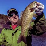
While the musky and walleye crowds dominate the boat ramps, Presque Isle is a top-tier, overlooked smallmouth bass factory. DNR surveys reveal a phenomenal size structure, with average fish running over 13 inches and true bronze trophies pushing the 20-inch mark. They are currently staging heavily in pre-spawn locations, soaking up the sun on shallow rock and gravel flats before making their beds.

Baitfish Report

The primary forage base in this system consists of yellow perch, ciscoes, and various native shiner species. With the water clarity frequently exceeding 15 feet, matching the hatch is non-negotiable. Lures and baits must closely mimic the natural silver, white, and subtle green/gold hues of the native baitfish to fool these visually oriented predators.

TACTICAL STRATEGY

Where to Look

Focus your search on the northern and northwestern bays, which absorb the most southern sun and hold the warmest water on the lake. The transition banks near the Wilderness Park boat landing off Bay View Road are prime real estate. Look for emerging cabbage weedlines and rocky drop-offs in the 8 to 14-foot depth range. The channel mouths connecting to Averill and Van Vliet lakes also create natural funnels that concentrate cruising predators, making them excellent ambush points to set up a drift.

Lure & Bait Selection

For walleyes, subtlety is key. Employ 1/8-ounce to 1/4-ounce lead-head jigs or tungsten tear drops. Suspending jerkbaits, such as a Rapala X-Rap Size 08 or a Husky Jerk, are incredibly effective when paused aggressively over transition zones. If you prefer live bait, rig a lively spot-tail shiner or a large fathead minnow on a slip-bobber setup. This allows you to keep the bait perfectly suspended just above the newly forming weed tops or rock piles without constantly snagging the bottom.

For smallmouth bass, dragging a finesse tube jig or a Ned rig slowly across the gravel flats in 5 to 10 feet of water will produce violent strikes from territorial fish.

Pro Tip: When using slip bobbers in crystal-clear water, downsize your fluorocarbon leader to 6-pound test and use a small, stealthy float. This allows you to detect the lightest bites without spooking line-shy walleyes.

Color Patterns

In the gin-clear waters of Presque Isle, natural colors reign supreme. Opt for translucent shiner patterns, natural perch finishes, or muted silvers and whites. Save the loud chartreuse and firetiger colors for days when a heavy "walleye chop" or overcast skies severely reduce underwater visibility.

Timing the Bite

Because of the exceptional water clarity, the midday bite can be notoriously tough under bluebird skies. Low-light periods are absolutely critical. Plan your trips to capitalize on the first two hours of daylight and the final hour before sunset. Night fishing with illuminated slip bobbers or slowly retrieved stickbaits is a highly productive, albeit underutilized, strategy for targeting the largest walleyes and muskies in the system.

REGULATIONS SNAPSHOT

Navigating the regulatory landscape for the Presque Isle Chain is essential, as specific rules apply that differ from statewide general regulations. Always verify with current DNR postings at the boat launch, but keep these key rules in mind for the current season:

SpeciesSeason StatusSize LimitDaily Bag Limit
WalleyeOpenNo minimum length (Only 1 fish over 14 inches allowed)3
Smallmouth & Largemouth BassCatch & Release Only (Harvest opens late June)N/A (Immediate release required)0
MuskellungeOpen40-inch minimum1
Panfish (Crappie, Perch, Bluegill)Open Year-RoundNo minimum length25

REGIONAL ALTERNATIVE

If sustained high winds make the large, deep basin of Presque Isle Lake unfishable or unsafe to navigate, pack up the truck and head south toward the Manitowish River or the tailwaters of the Rainbow Flowage on the Wisconsin River. These moving water systems offer sheltered, heavily forested shorelines that block the wind. Furthermore, river systems warm up much faster than deep glacial lakes, meaning the fish metabolism is often higher during cold fronts.

Pitch 1/8-ounce jigs tipped with fathead minnows or subtle paddle-tail plastics into current seams, slack-water eddies, and deep river bends. Drag them painfully slow along the bottom to entice staging walleyes and smallmouth bass looking for an easy meal out of the heavy current.

Pro Tip: When river fishing during a cold front, target the deepest holes adjacent to spawning flats. Fish will pull back into these deeper, slower sanctuaries to wait out the weather before pushing shallow again once the sun returns.

Tight lines!

Editor's Choice: Must-Have Gear

FISHINGSIR Next-Gen Waterproof Chest Waders

β˜…β˜…β˜…β˜…β˜… 4.4 (7,370+ reviews)
  • 2-Ply Tech: Upgraded nylon with 2.5x higher density than standard fabrics.
  • 100% Waterproof: Lab-approved intrusion resistance with taped visible seams.
  • Ultra-Lightweight: Designed for all-day comfort while hunting or fishing.
Check Availability on Amazon

βœ“ Amazon's Choice | 100+ bought last month

πŸ›’ Tactical Gear for this Spot

Bandit Walleye Deep

Mandatory for reaching deep schools in 35-50ft mud flats.

Check Price on Amazon #ad

As an Amazon Associate I earn from qualifying purchases. #ad

Loading forecast...

Live Fishing Conditions: Tides, Weather & Waves

Get real‑time tides, marine weather, swell and solunar activity for each spot so you know exactly when conditions line up for your best chance at a bite.

🎣

Presque Isle Lake, Wisconsin

Loading coordinates...

🌀️

WEATHER CONDITIONS

Weather
-- Β°F
--Β°C

Loading...

🌑️
Feels Like --Β°F --Β°C
πŸ’§
Humidity --%
πŸ’¨
Wind -- mph -- km/h
🧭
Direction --
πŸ“Š
Pressure -- inHg -- hPa
β˜€οΈ
UV Index --
🌊

MARINE CONDITIONS

🌊 Wave Height
-- ft
-- m
Loading...
🧭 Wave Direction
--Β°
Loading...
⏱️ Wave Period
-- s
Loading...
πŸ“ˆ Tide Status
-- ft
-- m
Loading...
πŸŒ™

LUNAR & SOLUNAR

πŸŒ•

Loading...

Illumination: --%

Major Period --:-- - --:-- --:-- - --:--
Minor Period --:-- - --:-- --:-- - --:--
πŸŒ… Sunrise --:--
πŸŒ‡ Sunset --:--
πŸ“…

24-HOUR FORECAST

Loading fishing conditions...

Fishing Spots Map

🎣
Book a Fishing Charter near Presque Isle Lake, Wisconsin Fishing Report Today 🎣

Local guides & charters. Verified captains, instant booking, best price guaranteed.

See Available Trips β†’

My location
Loading map...

Local Access & Facilities

Presque Isle Lake represents the quintessential Wisconsin Northwoods experience, tucked away near Katinka Village. This is not a fishery for the angler who expects manicured marinas and dockside dining at every turn. Instead, it offers a rugged, serene environment where the primary noise comes from the wind in the pines and the slap of water against the hull. For the expert angler, the appeal lies in this isolation. The lake geography suggests a quiet, darker water fishery typical of the region, demanding a strategic approach to navigation and location.

The atmosphere here is defined by its distance from major urban centers. Situated near the border of the Upper Peninsula, the vibe is distinctly rustic. Anglers traveling here are entering a zone where self-reliance is paramount. The shoreline is less developed than southern Wisconsin waters, providing a backdrop that feels wild and untouched. Whether you are targeting the submerged structure for walleye or casting the weed lines for muskellunge and pike, the setting demands respect and preparation. The water here is shared with loons and eagles rather than jet skis, making it a prime destination for serious captains seeking solitude.

Logistically, this location serves as a hub for a broader chain of opportunities, but it requires precise planning regarding resources. The infrastructure surrounding Presque Isle Lake is functional but minimal, designed for those who know how to handle a trailer and a boat in remote conditions. With specific boat landings located within a few miles of the central lake body, access is straightforward provided you have accounted for the lack of immediate amenities. This guide dissects the critical logistics, from the "Scan and Pay" camping systems to the reality of bait acquisition, ensuring your expedition is defined by catches rather than complications.

Access & Getting There

Reaching Presque Isle Lake requires navigating the smaller county roads of Vilas County. The primary access routes wind through heavy timber, and seasoned drivers know to be vigilant for deer and wildlife, especially during the dawn and dusk hours when the best bite occurs. The roads surrounding Katinka Village are generally well-maintained, but winter and early spring conditions can make them treacherous. Towing a heavy rig here demands patience; the "last mile" into the launch sites can be narrow.

πŸ’‘ Captain's Tip: The "Dark Territory" Prep

Cellular service in this region is notoriously spotty. Before leaving the main highway or your lodging, ensure you have downloaded offline maps and the Recreation.gov app. You will need the app for campsite payments, and you cannot rely on a signal at the ramp to download it.

Boat Launch Realities

For the captain launching a vessel, there are two primary insertion points to consider, both of which are functional but spartan. The closest facility is the Presque Isle Boat Landing, located approximately 1.1 miles from the lake's center. This is your primary target. The data indicates that while trailer parking is available, the amenities are non-existent. There are no restrooms, no showers, no lighting, and no fish cleaning stations. This means if you are pulling out after dark, you are doing so by the light of your truck's headlamps and your own tactical gear.

The secondary option is the Birch Lake Boat Launch, situated roughly 2.8 miles away. Like the main landing, this site offers parking for trailers but lacks all creature comforts. It serves as an excellent contingency if the main landing is crowded or if wind conditions make the Presque Isle ramp difficult to navigate. The lack of on-site lighting at both locations is a critical detail; seasoned anglers rig their trailers with backup lights or carry high-lumen floods to ensure safe recovery of the vessel during the pitch-black Northwoods nights.

Parking & Trailer Strategy

Parking in this region is generally surface-level and unpaved at the remote sites. While the boat landings themselves accommodate trailers, overflow parking is limited. For those meeting other anglers or dropping a vehicle, the M & N Trailhead is a reliable option, though it is located 15.8 miles away at 10643 County Rd N in Boulder Junction. Another option for regrouping before heading into the remote zone is the Park & Ride on Ramsay Rd in Bessemer, MI, roughly 20.9 miles out. Note that the White Sand Boat Landing parking area is 13.7 miles away; do not confuse this with the immediate access points for Presque Isle Lake.

Traffic at the ramps is rarely "highway congestion" heavy, but the limited number of slots means that on peak summer weekends, the early bird truly gets the worm. Arriving by 5:00 AM is standard procedure for the serious fleet. If you arrive late and the lot is full, maneuvering a large center console or a fiberglass walleye boat in these tight, wooded lots can be a challenge.

Presque Isle Lake, Wisconsin Pre-Trip Checklist

Facilities & Amenities

The infrastructure around Presque Isle Lake is characterized by a "bring it with you" philosophy. There are no marinas with fuel docks or well-stocked ship stores on the water. The nearest significant commercial support is miles away, making your pre-trip checklist vital. This is not a location where you can simply run to the dock for a forgotten bag of ice or a quart of oil.

Bait & Tackle Logistics

The most critical logistical hurdle for the angler is bait. The primary provider listed is The Swamp, located at 601 US-51 in Hurley, WI. While highly rated (5 stars), it is a significant haulβ€”approximately 24.2 miles from the water. The Swamp opens at 7:00 AM Tuesday through Saturday. This timing poses a conflict for the dawn patrol angler who wants lines in the water at first light. You must purchase your live baitβ€”minnows, leeches, or crawlersβ€”the afternoon before your trip. Do not plan on buying bait on the way to the ramp in the morning unless you plan to start late.

πŸ’‘ Captain's Tip: The 24-Mile Gap

With the nearest tackle shop over 20 miles away, mechanical redundancy is key. Carry spare props, hub kits, and two days' worth of bait. A simple forgotten item like a drain plug or a specific lure color becomes a 90-minute round-trip error here.

Local Charter Fleet

Despite the remote nature, the area supports a high-caliber network of guides, indicating the quality of the fishery. The most strategically located operation is Sunrise Guide Service, situated directly in Presque Isle, less than a mile from the water. Their proximity suggests intimate local knowledge of the daily patterns on the lake. For those looking for alternative expertise, Bobber Down Guide Service operates out of Mercer (15.8 miles away) and holds a 5-star rating. Rodbenders Guide Service and Last Resort Guide Service are based further out in Woodruff and Sayner respectively, but they service this region, bringing heavy-hitting experience to these waters.

Lodging & Accommodation

For anglers preferring a roof over their heads, Loew's Timber Lost Cottages is the premier local option, located just 6.5 miles away in Boulder Junction. This proximity allows for a reasonable wake-up time while still beating the sun to the ramp. For those willing to drive further, Pine Forest Lodge in Mercer (12 miles away) offers highly-rated accommodations. The Peninsula Pines Resort & Campground is another 5-star option, though it sits roughly 22.9 miles from the fishing grounds.

Campground Specifications

Camping is a primary accommodation style here, but it operates on a specific digital-first model. The following table details the nearby campgrounds managed under the RIDB system. Note that these are primitive experiences.

Campground NameDistanceTypeBooking Method
Henry Lake Camp7.4 milesStandard NonelectricFirst-come, Scan & Pay (App Required)
Moosehead Lake Camp8.5 milesStandard NonelectricFirst-come, Scan & Pay (App Required)
Pomeroy Lake Camp10.7 milesStandard NonelectricFirst-come, Scan & Pay (App Required)

Permits, Regulations & Fees

Navigating the regulatory landscape here is straightforward but strict. The fishery falls under the jurisdiction of the State Fishing Agency (Wisconsin DNR regulations apply). Because Presque Isle Lake is situated in a region with numerous lakes, it is vital to be aware of specific size limits and bag limits that may differ from the general statewide rules. Always consult the official state signage at the Presque Isle Boat Landing before making your first cast.

The "Scan and Pay" System

A unique aspect of the local facilities, particularly for the campgrounds at Henry Lake, Moosehead Lake, and Pomeroy Lake, is the mandatory use of digital payment in a low-tech environment. These sites operate on a first-come, first-served basis, but payment is processed via a QR code that links to the Recreation.gov mobile app. This is a critical pinch point for the unprepared. You are required to physically arrive at the campground to claim a site, but you must have the app pre-loaded on your phone to pay.

The system relies on the "Scan and Pay" feature. Since remote areas often have zero cellular service, the agency explicitly advises visitors to download the free Recreation.gov mobile app prior to arrival. If you arrive without the app and without service, you cannot legally pay for your site, risking fines or eviction. This digital requirement is part of a broader effort to modernize access while maintaining the unstaffed, remote nature of these facilities.

There are no indicated permit fees for the boat launch itself in the provided data, but "Trailer Parking" is noted as an amenity. Anglers should always carry small denominations of cash in case of unlisted iron ranger pay stations, which are common in Wisconsin state and county forests, even when digital options are present.

Events & Seasonal Information

The rhythm of Presque Isle Lake is dictated by the hard seasons of the North. The open water season is intense and relatively short. Spring brings the walleye opener, a period of high activity where the boat ramps at Presque Isle and Birch Lake will see their highest traffic. Summer settles into a stable pattern where early mornings and late evenings are the only times to beat the recreational traffic and the midday sun.

Operating Hours & Timing

Understanding the pulse of local commerce is essential for timing your trip. The Swamp bait shop operates Tuesday through Friday from 7:00 AM to 5:00 PM, and Saturday from 7:00 AM to 3:00 PM. They are closed on Sundays and Mondays. This closure on Sunday and Monday is a major logistical factor; if you are planning a long weekend trip starting Sunday, you must secure your bait on Saturday before 3:00 PM. S&B Asphalt, a parking or service location in Woodruff, follows a standard 9-5 schedule but is closed weekends.

πŸ’‘ Captain's Tip: The Sunday Gap

The local bait shop is closed Sundays and Mondays. If you are arriving for a Sunday launch, you must bring your bait with you from out of town. There is no "Plan B" locally for live bait on these days.

Contact Information & Resources

For emergency assistance or specific inquiries regarding campground status, the managing agencies operate remotely. In the event of an on-water emergency, cell service may be unavailable, so a VHF radio is a recommended piece of safety gear for any boat heading out onto these waters. The campgrounds (Henry, Moosehead, Pomeroy) do not have direct phone lines listed ("N/A"), reinforcing the need for self-reliance and the use of the Recreation.gov app for all administrative interactions.

For guiding services, direct contact is the best route to secure a spot on their calendar:

  • Sunrise Guide Service: (630) 728-9669
  • Bobber Down Guide Service: (715) 776-0140
  • Rodbenders Guide Service: (715) 605-2404
  • Loew's Timber Lost Cottages: (715) 385-2310

For precise locations of the boat ramps, detailed depth contours, and real-time weather conditions, consult the live dashboard and interactive maps below.

🎣

Presque Isle Lake, Wisconsin

Katinka Village β€’ Wisconsin β€’ 46.2240, -89.7814
πŸ…ΏοΈ

Parking

5
Fern Ridge Parking Area
⭐ 5.0 24.0 mi
πŸ“ 2005 Forest Ct, St Germain, WI 54558, USA
πŸš— Get Directions
S&B Asphalt
⭐ 4.9 22.9 mi
πŸ“ 126 US-51, Woodruff, WI 54568, USA
πŸ•’
Monday: 9:00β€―AM – 5:00β€―PM
Tuesday: 9:00β€―AM – 5:00β€―PM
Wednesday: 9:00β€―AM – 5:00β€―PM
Thursday: 9:00β€―AM – 5:00β€―PM
Friday: 9:00β€―AM – 5:00β€―PM
Saturday: Closed
Sunday: Closed
πŸš— Get Directions
M & N Trailhead
⭐ 4.8 15.8 mi
πŸ“ 10643 County Rd N, Boulder Junction, WI 54512, USA
πŸ•’
Monday: 6:00β€―AM – 9:00β€―PM
Tuesday: 6:00β€―AM – 9:00β€―PM
Wednesday: 6:00β€―AM – 9:00β€―PM
Thursday: 6:00β€―AM – 9:00β€―PM
Friday: 6:00β€―AM – 9:00β€―PM
Saturday: 6:00β€―AM – 9:00β€―PM
Sunday: 6:00β€―AM – 9:00β€―PM
πŸš— Get Directions
Park & Ride
⭐ 3.8 20.9 mi
πŸ“ Ramsay Rd, Bessemer, MI 49911, USA
πŸ•’
Monday: Open 24 hours
Tuesday: Open 24 hours
Wednesday: Open 24 hours
Thursday: Open 24 hours
Friday: Open 24 hours
Saturday: Open 24 hours
Sunday: Open 24 hours
πŸš— Get Directions
White Sand Boat Landing
13.7 mi
πŸ“ Boulder Junction, WI 54512, USA
πŸ•’
Monday: Open 24 hours
Tuesday: Open 24 hours
Wednesday: Open 24 hours
Thursday: Open 24 hours
Friday: Open 24 hours
Saturday: Open 24 hours
Sunday: Open 24 hours
πŸš— Get Directions
🐟

Bait & Tackle

1
The Swamp
⭐ 5.0 24.2 mi
πŸ“ 601 US-51, Hurley, WI 54534, USA
πŸ•’
Monday: Closed
Tuesday: 7:00β€―AM – 5:00β€―PM
Wednesday: 7:00β€―AM – 5:00β€―PM
Thursday: 7:00β€―AM – 5:00β€―PM
Friday: 7:00β€―AM – 5:00β€―PM
Saturday: 7:00β€―AM – 3:00β€―PM
Sunday: Closed
πŸš— Get Directions
🚀

Fishing Charters

4
Bobber Down Guide Service
⭐ 5.0 15.8 mi
πŸ“ 4816 Little Pike Rd, Mercer, WI 54547, USA
πŸ•’
Monday: 5:00β€―AM – 10:00β€―PM
Tuesday: 5:00β€―AM – 10:00β€―PM
Wednesday: 5:00β€―AM – 10:00β€―PM
Thursday: 5:00β€―AM – 10:00β€―PM
Friday: 5:00β€―AM – 10:00β€―PM
Saturday: 5:00β€―AM – 10:00β€―PM
Sunday: 5:00β€―AM – 10:00β€―PM
πŸš— Get Directions
Rodbenders Guide Service
⭐ 5.0 22.9 mi
πŸ“ 656 Elm Street, Woodruff, WI 54568, USA
πŸ•’
Monday: 6:00β€―AM – 9:00β€―PM
Tuesday: 6:00β€―AM – 9:00β€―PM
Wednesday: 6:00β€―AM – 9:00β€―PM
Thursday: 6:00β€―AM – 9:00β€―PM
Friday: 6:00β€―AM – 9:00β€―PM
Saturday: 6:00β€―AM – 9:00β€―PM
Sunday: 6:00β€―AM – 9:00β€―PM
πŸš— Get Directions
Last Resort Guide Service
⭐ 5.0 20.5 mi
πŸ“ 8772 Kurtzweil Rd, Sayner, WI 54560, USA
πŸ•’
Monday: 7:00β€―AM – 8:00β€―PM
Tuesday: 7:00β€―AM – 8:00β€―PM
Wednesday: 7:00β€―AM – 8:00β€―PM
Thursday: 7:00β€―AM – 8:00β€―PM
Friday: 7:00β€―AM – 8:00β€―PM
Saturday: 7:00β€―AM – 8:00β€―PM
Sunday: 7:00β€―AM – 8:00β€―PM
πŸš— Get Directions
Sunrise Guide Service
⭐ 5.0 0.9 mi
πŸ“ Rec Room, 7632 Sunrise Drive, Presque Isle, WI 54557, USA
πŸ•’
Monday: Open 24 hours
Tuesday: Open 24 hours
Wednesday: Open 24 hours
Thursday: Open 24 hours
Friday: Open 24 hours
Saturday: Open 24 hours
Sunday: Open 24 hours
πŸš— Get Directions
🏠

Lodging

4
βš“

Boat Ramps

3
🚻

Restrooms

3
πŸ‘¨β€πŸ‘©β€πŸ‘§β€πŸ‘¦

Family Friendly

2
β™Ώ

Accessibility

β™Ώ

Wheelchair Access

Not Confirmed

πŸ•

Pets Allowed

Not Confirmed

⚠️ Some accessibility info not officially confirmed. Please verify with location directly.

πŸ“ Showing 23 facilities on map
🎣
Book a Fishing Charter near Presque Isle Lake, Wisconsin Fishing Report Today 🎣

Local guides & charters. Verified captains, instant booking, best price guaranteed.

See Available Trips β†’

πŸ“Š

About Our Fishing Reports & Forecasts

Our spot reports combine data-driven forecasts with curated local information. The forecast is generated by our proprietary Fishing Score algorithm (0–100%), which analyzes real-time data from Open-Meteo API, validated against NOAA CO-OPS tide gauges and USGS water-monitoring stations. The model weights tide dynamics (35%), wave energy (25%), wind patterns (20%) and time of day (20%)β€”factors shown to influence fish feeding behavior through marine-biology research and decades of charter log data.

Access, facilities and services information for each fishing spot is sourced from official datasets such as Recreation.gov (RIDB), state park & wildlife agencies, and geospatial providers like Google Maps. These sections undergo scheduled re-validation every 3–6 months to ensure that boat ramps, park access, contact details and local services remain accurate.

Narrative sections (catches, seasonal behavior, local tips) are synthesized from these data sources and refined following the Fishing Reports Today editorial guidelines, combining bibliographic research from ichthyology and oceanography with expert angler experience. Our team reviews reports on a regular basis, while the forecast model itself updates every 6 hours for real-time accuracy.

⚠️ Important: Always verify current local regulations, access restrictions and weather conditions before fishing. These reports are intended as a planning aid, not a guarantee of catches or safety. When in doubt, contact local authorities or park managers listed on the page.

Learn more about our methodology & data sources β†’

Leave a Reply

Your email address will not be published. Required fields are marked *